|
Johnny Gruelle
John Barton Gruelle (December 24, 1880 – January 9, 1938) was an American artist, political cartoonist, children's book and comics author, illustrator, and storyteller. He is best known as the creator of Raggedy Ann and Raggedy Andy dolls and as the author/illustrator of dozens of books. He also created the Beloved Belindy doll. Gruelle also contributed cartoons and illustrations to at least ten newspapers, four major news syndicates, and more than a dozen national magazines. He was the son of Hoosier Group painter Richard Gruelle. Early life and education Gruelle was born in Arcola, Illinois, on December 24, 1880, to Alice (Benton) and Richard Buckner Gruelle. In 1882, when Gruelle was two years old, he moved with his parents to Indianapolis, Indiana, and settled in a home on Tacoma Avenue in what is the present-day Lockerbie Square Historic District. The Gruelles made Indianapolis their home for more than twenty-five years. John was exposed to art and literature at an early ... [...More Info...] [...Related Items...] OR: [Wikipedia] [Google] [Baidu] |
Arcola, Illinois
Arcola is a city in Douglas County, Illinois, United States. The population was 2,927 at the 2020 census. The city was founded in 1855, when the Illinois Central Railroad was built through the county. The railroad itself was responsible for surveying, platting and founding the town. History Arcola was the birthplace in 1880 of John Barton Gruelle, or "Johnny" Gruelle, who created Raggedy Ann and Raggedy Andy, the loveable American dolls and storybook characters. He used artistic skills learned from his painter father, Richard Buckner Gruelle, combined with his self-taught writing skills to create stories expressing regional values and aesthetic images. His artistic granddaughter, Joni Gruelle Wannamaker, manages the Raggedy Ann Museum in Arcola. A nationally known tourist attraction, Rockome Gardens, which featured large formal gardens, concrete fencing and architecture, and many Amish-influenced attractions was located just outside of Arcola. Rockome Gardens was built in 1937 ... [...More Info...] [...Related Items...] OR: [Wikipedia] [Google] [Baidu] |
Hoosier
Hoosier is the official demonym for the people of the U.S. state of Indiana. The origin of the term remains a matter of debate, but "Hoosier" was in general use by the 1840s, having been popularized by Richmond resident John Finley's 1833 poem "The Hoosier's Nest". Anyone born in Indiana or a resident at the time is considered to be a Hoosier. Indiana adopted the nickname "The Hoosier State" more than 150 years ago. "Hoosier" is used in the names of numerous Indiana-based businesses and organizations. "Hoosiers" is also the name of the Indiana University athletic teams. As there is no accepted embodiment of a Hoosier, the IU schools are represented through their letters and colors alone. In addition to universal acceptance by residents of Indiana, the term is also the official demonym according to the U.S. Government Publishing Office. Origin In addition to "The Hoosier's Nest", the term also appeared in the ''Indianapolis Journal'''s "Carrier's Address" on January 1, 1833. Ther ... [...More Info...] [...Related Items...] OR: [Wikipedia] [Google] [Baidu] |
Ashland, Oregon
Ashland is a city in Jackson County, Oregon, United States. It lies along Interstate 5 approximately 16 miles (26 km) north of the California border and near the south end of the Rogue Valley. The city's population was 21,360 at the 2020 census. The city is the home of Southern Oregon University (SOU) and the Oregon Shakespeare Festival (OSF). These are important to Ashland's economy, which also depends on restaurants, galleries, and retail stores that cater to tourists. Lithia Park along Ashland Creek, historic buildings, and a paved intercity bike trail provide additional visitor attractions. Ashland, originally called "Ashland Mills", was named after Ashland County, Ohio, the original home of founder Abel Helman, and secondarily for Ashland, Kentucky, where other founders had family connections. Ashland has a council-manager government assisted by citizen committees. Historically, its liberal politics have differed, often sharply, with much of the rest of southwest Oreg ... [...More Info...] [...Related Items...] OR: [Wikipedia] [Google] [Baidu] |
East Coast Of The United States
The East Coast of the United States, also known as the Eastern Seaboard, the Atlantic Coast, and the Atlantic Seaboard, is the coastline along which the Eastern United States meets the North Atlantic Ocean. The eastern seaboard contains the coastal states and areas east of the Appalachian Mountains that have shoreline on the Atlantic Ocean, namely, Maine, New Hampshire, Massachusetts, Rhode Island, Connecticut, New York, New Jersey, Delaware, Maryland, Virginia, North Carolina, South Carolina, Georgia, and Florida.General Reference Map , , 2003. Toponymy and composition T ...[...More Info...] [...Related Items...] OR: [Wikipedia] [Google] [Baidu] |
Wilton, Connecticut
Wilton is a town in Fairfield County, Connecticut, United States. As of the 2020 census, the town population was 18,503. In 2017, it was the sixth-wealthiest town per capita in Connecticut, the wealthiest U.S. state per capita. Officially recognized as a parish in 1726, Wilton today is a residential community with open lands, historic architecture such as the Round House, and many colonial homes. Many residents commute to nearby cities such as Stamford or New York City. Wilton is home to many global corporations such as ASML, Breitling SA, Cannondale Bicycle Corporation, Melissa & Doug, and formerly Deloitte. It is also home to AIG Financial Products, whose collapse played a pivotal role in the financial crisis of 2007–2008.Behind Insurer’s Crisis, Blind Eye to a Web of Risk ''< ... [...More Info...] [...Related Items...] OR: [Wikipedia] [Google] [Baidu] |
New Canaan, Connecticut
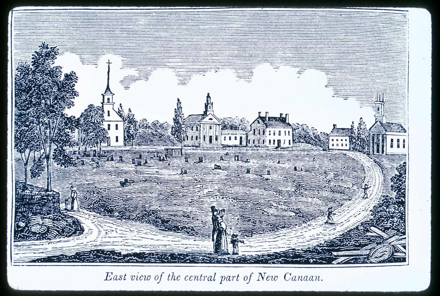
New Canaan () is a town in Fairfield County, Connecticut, United States. The population was 20,622 according to the 2020 census. About an hour from Manhattan by train, the town is considered part of Connecticut's Gold Coast. The town is bounded on the south by Darien, on west by Stamford, on the east by Wilton, on the southeast by Norwalk, and on the north by Lewisboro and Pound Ridge in Westchester County, New York. New Canaan is known for its architecture and public parks such as Waveny Park, and a town center with boutiques. Residents sing carols on God's Acre every Christmas Eve, a town tradition since 1916. Additionally, New Canaan is one of the wealthiest towns in the country, appearing in multiple rankings of the nation’s richest zip codes. It is also known for its public school system, which in 2018 was ranked as the top public school system in Connecticut, and in 2008 the third-best in the country. History In 1731, Connecticut's colonial legislature establish ... [...More Info...] [...Related Items...] OR: [Wikipedia] [Google] [Baidu] |
Silvermine, Connecticut
Silvermine is an unincorporated community in Fairfield County, Connecticut, United States that extends across three southwestern Connecticut towns: Norwalk, New Canaan and Wilton. The name "Silvermine" comes from old legends of a silver mine in the area, although no silver has ever been found. Silvermine was long an art colony and remains the home of the Silvermine Guild Arts Center. The Silvermine Tavern, an inn occupying several historic buildings, also remains in the neighborhood. Silver Hill Hospital is just beyond the northern end of the neighborhood, in New Canaan near the Wilton border. There are two community groups specific to Silvermine: The Silvermine Community Association and the Norwalk Association of Silvermine Homeowners (NASH). History The area has been settled since at least the late seventeenth century. In the eighteenth century, the Silvermine River was used for 12 or 13 mills in the neighborhood because it fell steeply enough for the water power to be profi ... [...More Info...] [...Related Items...] OR: [Wikipedia] [Google] [Baidu] |
Norwalk, Connecticut
, image_map = Fairfield County Connecticut incorporated and unincorporated areas Norwalk highlighted.svg , mapsize = 230px , map_caption = Location in Fairfield County, Connecticut, Fairfield County and Connecticut , coordinates = , pushpin_map = USA#Connecticut , pushpin_label_position = top , pushpin_label = Norwalk , pushpin_map_caption = Location in the United States and Connecticut , subdivision_type = Country , subdivision_name = , subdivision_type1 = U.S. state , subdivision_name1 = , subdivision_type2 = County (United States), County , subdivision_name2 = Fairfield County, Connecticut, Fairfield , subdivision_type3 = Councils of governments in Connecticut, Region , subdivision_name3 = Western Connecticut, Western CT , established_title = Settled , established_date = February 26, 1640 , established_title2 = Municipal corpor ... [...More Info...] [...Related Items...] OR: [Wikipedia] [Google] [Baidu] |
Ohio
Ohio () is a state in the Midwestern region of the United States. Of the fifty U.S. states, it is the 34th-largest by area, and with a population of nearly 11.8 million, is the seventh-most populous and tenth-most densely populated. The state's capital and largest city is Columbus, with the Columbus metro area, Greater Cincinnati, and Greater Cleveland being the largest metropolitan areas. Ohio is bordered by Lake Erie to the north, Pennsylvania to the east, West Virginia to the southeast, Kentucky to the southwest, Indiana to the west, and Michigan to the northwest. Ohio is historically known as the "Buckeye State" after its Ohio buckeye trees, and Ohioans are also known as "Buckeyes". Its state flag is the only non-rectangular flag of all the U.S. states. Ohio takes its name from the Ohio River, which in turn originated from the Seneca word ''ohiːyo'', meaning "good river", "great river", or "large creek". The state arose from the lands west of the Appalachian Mountai ... [...More Info...] [...Related Items...] OR: [Wikipedia] [Google] [Baidu] |
Cleveland
Cleveland ( ), officially the City of Cleveland, is a city in the U.S. state of Ohio and the county seat of Cuyahoga County. Located in the northeastern part of the state, it is situated along the southern shore of Lake Erie, across the U.S. maritime border with Canada, northeast of Cincinnati, northeast of Columbus, and approximately west of Pennsylvania. The largest city on Lake Erie and one of the major cities of the Great Lakes region, Cleveland ranks as the 54th-largest city in the U.S. with a 2020 population of 372,624. The city anchors both the Greater Cleveland metropolitan statistical area (MSA) and the larger Cleveland–Akron–Canton combined statistical area (CSA). The CSA is the most populous in Ohio and the 17th largest in the country, with a population of 3.63 million in 2020, while the MSA ranks as 34th largest at 2.09 million. Cleveland was founded in 1796 near the mouth of the Cuyahoga River by General Moses Cleaveland, after whom the city was named ... [...More Info...] [...Related Items...] OR: [Wikipedia] [Google] [Baidu] |
New York City
New York, often called New York City or NYC, is the List of United States cities by population, most populous city in the United States. With a 2020 population of 8,804,190 distributed over , New York City is also the List of United States cities by population density, most densely populated major city in the United States, and is more than twice as populous as second-place Los Angeles. New York City lies at the southern tip of New York (state), New York State, and constitutes the geographical and demographic center of both the Northeast megalopolis and the New York metropolitan area, the largest metropolitan area in the world by urban area, urban landmass. With over 20.1 million people in its metropolitan statistical area and 23.5 million in its combined statistical area as of 2020, New York is one of the world's most populous Megacity, megacities, and over 58 million people live within of the city. New York City is a global city, global Culture of New ... [...More Info...] [...Related Items...] OR: [Wikipedia] [Google] [Baidu] |


