|
Johannes Schöner Globe
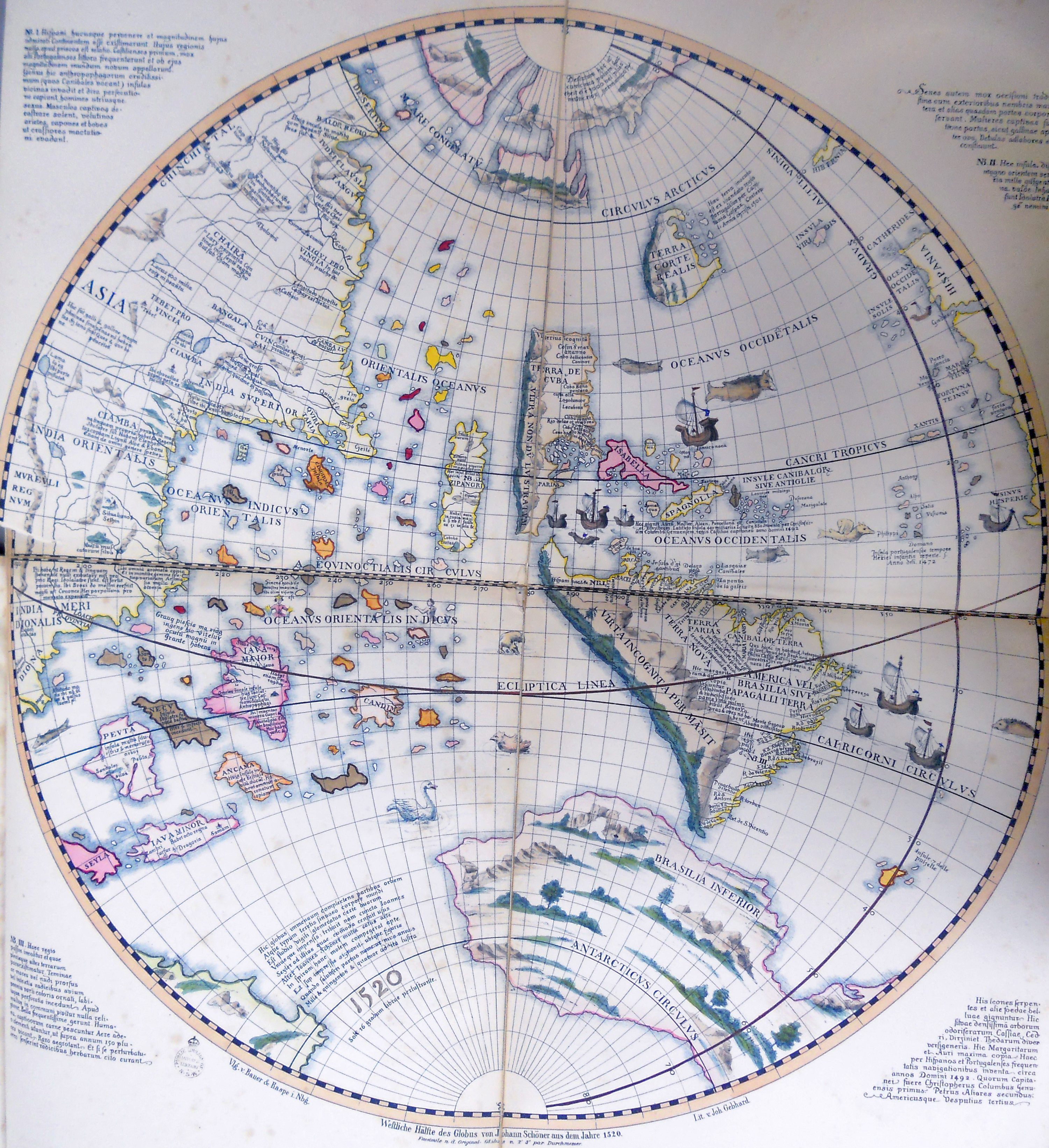
The Johannes Schöner globes are a series of globes made by Johannes Schöner (1477–1547), the first being made in 1515. Schöner's globes are some of the oldest still in existence. Some of them are said by some authors to show parts of the world that were not yet known to Europeans, such as the Magellan Strait and the Antarctic. Globes The Johannes Schöner Globe (1515), a printed globe, was made in 1515. Two exemplars survive, one at the Historisches Museum in Frankfurt and the other at the Herzogin Anna Amalia Bibliothek, at Weimar. There can be little doubt that Schöner was familiar with the globe made in Nuremberg by Martin Behaim in 1492. An inscription across the northern part of ''America'', says: “This part of the island has been discovered by order of the King of Castile”. This is matched by another inscription off ''America’s'' east coast: “The more southerly part of this island was discovered by order of the King of Portugal”; that is, America is called ... [...More Info...] [...Related Items...] OR: [Wikipedia] [Google] [Baidu] |
Globe
A globe is a spherical model of Earth, of some other celestial body, or of the celestial sphere. Globes serve purposes similar to maps, but unlike maps, they do not distort the surface that they portray except to scale it down. A model globe of Earth is called a terrestrial globe. A model globe of the celestial sphere is called a ''celestial globe''. A globe shows details of its subject. A terrestrial globe shows landmasses and water bodies. It might show nations and major cities and the network of latitude and longitude lines. Some have raised relief to show mountains and other large landforms. A celestial globe shows notable stars, and may also show positions of other prominent astronomical objects. Typically, it will also divide the celestial sphere into constellations. The word ''globe'' comes from the Latin word ''globus'', meaning "sphere". Globes have a long history. The first known mention of a globe is from Strabo, describing the Globe of Crates from about 150&nb ... [...More Info...] [...Related Items...] OR: [Wikipedia] [Google] [Baidu] |
Christopher Columbus
Christopher Columbus * lij, Cristoffa C(or)ombo * es, link=no, Cristóbal Colón * pt, Cristóvão Colombo * ca, Cristòfor (or ) * la, Christophorus Columbus. (; born between 25 August and 31 October 1451, died 20 May 1506) was an Italian explorer and navigator who completed Voyages of Christopher Columbus, four voyages across the Atlantic Ocean sponsored by the Catholic Monarchs of Spain, opening the way for the widespread European Age of Discovery, exploration and colonization of the Americas. His expeditions were the first known European contact with the Caribbean, Central America, and South America. The name ''Christopher Columbus'' is the anglicisation of the Latin . Scholars generally agree that Columbus was born in the Republic of Genoa and spoke a dialect of Ligurian (Romance language), Ligurian as his first language. He went to sea at a young age and travelled widely, as far north as the British Isles and as far south as what is now Ghana. He married Port ... [...More Info...] [...Related Items...] OR: [Wikipedia] [Google] [Baidu] |
Tierra Del Fuego
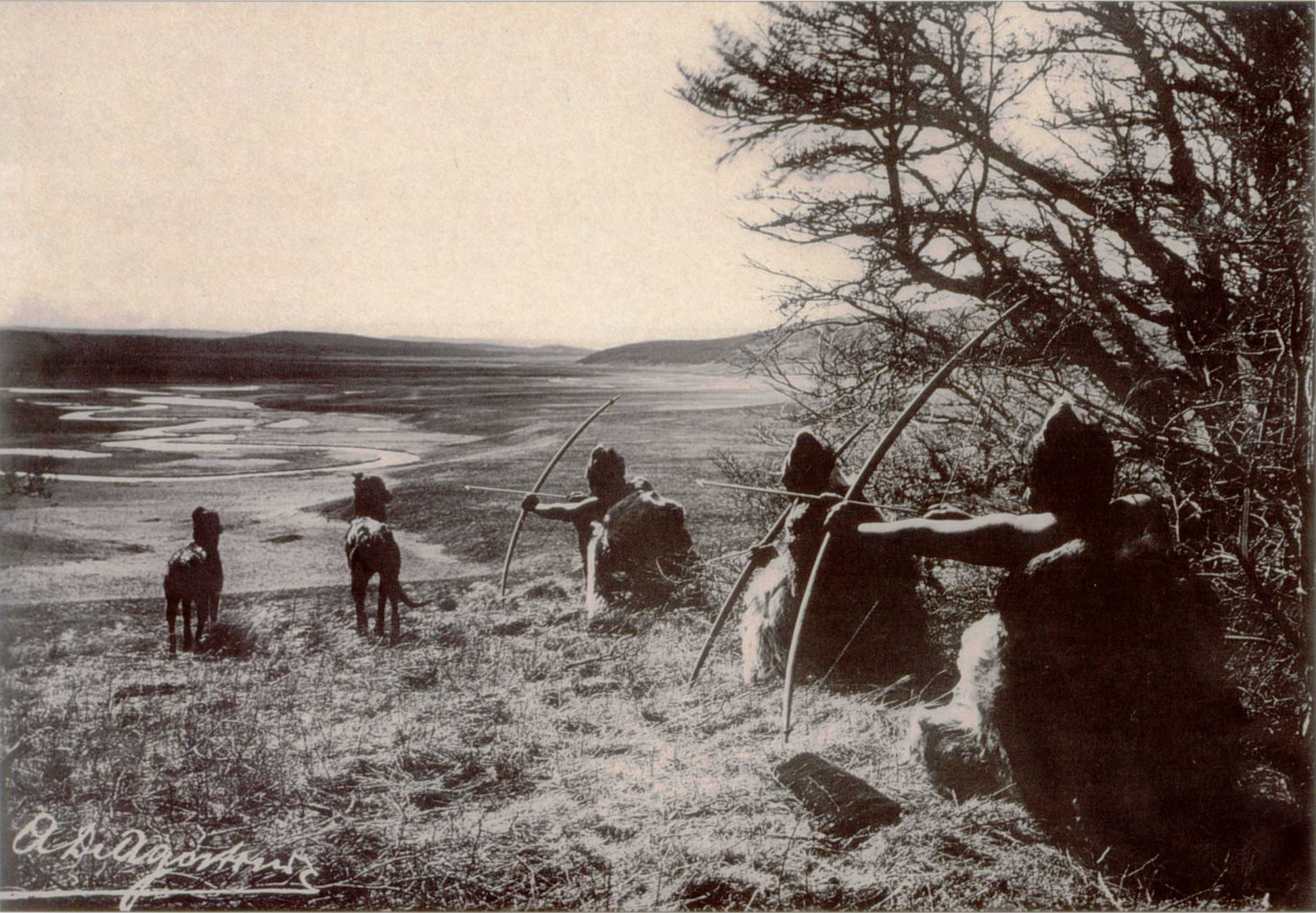
Tierra del Fuego (, ; Spanish for "Land of the Fire", rarely also Fireland in English) is an archipelago off the southernmost tip of the South American mainland, across the Strait of Magellan. The archipelago consists of the main island, Isla Grande de Tierra del Fuego, with an area of , and a group of many islands, including Cape Horn and Diego Ramírez Islands. Tierra del Fuego is divided between Chile and Argentina, with the latter controlling the eastern half of the main island and the former the western half plus the islands south of Beagle Channel and the southernmost islands. The southernmost extent of the archipelago is just north of latitude 56°S. The earliest known human settlement in Tierra del Fuego dates to approximately 8,000 BC. Europeans first explored the islands during Ferdinand Magellan's expedition of 1520. ''Tierra del Fuego'' and similar namings stem from sightings of the many bonfires that the natives built. Settlement by those of European descent and ... [...More Info...] [...Related Items...] OR: [Wikipedia] [Google] [Baidu] |
Moluccas
The Maluku Islands (; Indonesian: ''Kepulauan Maluku'') or the Moluccas () are an archipelago in the east of Indonesia. Tectonically they are located on the Halmahera Plate within the Molucca Sea Collision Zone. Geographically they are located east of Sulawesi, west of New Guinea, and north and east of Timor. Lying within Wallacea (mostly east of the biogeographical Weber Line), the Maluku Islands have been considered as a geographical and cultural intersection of Asia and Oceania. The islands were known as the Spice Islands because of the nutmeg, mace and cloves that were exclusively found there, the presence of which sparked colonial interest from Europe in the sixteenth century. The Maluku Islands formed a single province from Indonesian independence until 1999, when it was split into two provinces. A new province, North Maluku, incorporates the area between Morotai and Sula, with the arc of islands from Buru and Seram to Wetar remaining within the existing Maluku Province. ... [...More Info...] [...Related Items...] OR: [Wikipedia] [Google] [Baidu] |
Antipodes
In geography, the antipode () of any spot on Earth is the point on Earth's surface diametrically opposite to it. A pair of points ''antipodal'' () to each other are situated such that a straight line connecting the two would pass through Earth's center. Antipodal points are as far away from each other as possible. The North and South Poles are antipodes of each other. In the Northern Hemisphere, "the Antipodes" may refer to Australia and New Zealand, and Antipodeans to their inhabitants. Geographically, the antipodes of Britain and Ireland are in the Pacific Ocean, south of New Zealand. This gave rise to the name of the Antipodes Islands of New Zealand, which are close to the antipode of London. With the exception of a part of the Perth metropolitan area near Baldivis and Rockingham that is antipodal to Bermuda, the antipodes of Australia are in the North Atlantic Ocean, while parts of Spain, Portugal, France and Morocco are antipodal to New Zealand. Approximately 15% of ... [...More Info...] [...Related Items...] OR: [Wikipedia] [Google] [Baidu] |
Río De La Plata
The Río de la Plata (, "river of silver"), also called the River Plate or La Plata River in English, is the estuary formed by the confluence of the Uruguay River and the Paraná River at Punta Gorda. It empties into the Atlantic Ocean and forms a funnel-shaped indentation on the southeastern coastline of South America. Depending on the geographer, the Río de la Plata may be considered a river, an estuary, a gulf, or a marginal sea. If considered a river, it is the widest in the world, with a maximum width of . The river is about long and widens from about at its source to about at its mouth. It forms part of the border between Argentina and Uruguay. The name Río de la Plata is also used to refer to the populations along the estuary, especially the main port cities of Buenos Aires and Montevideo, where Ríoplatense Spanish is spoken and tango culture developed. The coasts of the river are the most densely-populated areas of Uruguay and Argentina. Geography The Río d ... [...More Info...] [...Related Items...] OR: [Wikipedia] [Google] [Baidu] |
Christopher De Haro
Cristóbal de Haro was a Castilian financier and merchant, famous for having provided funding for the Magellan-Elcano expedition. Born in Burgos, Haro was based in Lisbon since 1505. After 1513, he became upset with the Portuguese crown and returned to Castile, plotting with Portuguese exiles Ferdinand Magellan and Ruy Faleiro and with the Spanish minister Juan Rodríguez de Fonseca an expedition to the Spice Islands sailing westward. As a financier and representative of the Fuggers he provided a quarter of the financial backing to Magellan's 1519 voyage, which failed to conquer the Spice Islands but resulted in the first circumnavigation around the world by Juan Sebastián Elcano. Cristóbal's brother Diego de Haro headed a commercial firm based in Antwerp. A daughter of Diego, Frances, was married to Maximilianus of Transylvania (Maximilianus Transylvanus), who wrote the first account of Magellan's voyage, published in 1523. Transylvanus pointed out that Cristóbal de Ha ... [...More Info...] [...Related Items...] OR: [Wikipedia] [Google] [Baidu] |
Nicolaus Copernicus
Nicolaus Copernicus (; pl, Mikołaj Kopernik; gml, Niklas Koppernigk, german: Nikolaus Kopernikus; 19 February 1473 – 24 May 1543) was a Renaissance polymath, active as a mathematician, astronomer, and Catholic Church, Catholic canon (priest), canon, who formulated a mathematical model, model of Celestial spheres#Renaissance, the universe that placed heliocentrism, the Sun rather than Earth at its center. In all likelihood, Copernicus developed his model independently of Aristarchus of Samos, an ancient Greek astronomer who had formulated such a model some eighteen centuries earlier. The publication of Copernicus's model in his book ' (''On the Revolutions of the Celestial Spheres''), just before his death in 1543, was a major event in the history of science, triggering the Copernican Revolution and making a pioneering contribution to the Scientific Revolution. Copernicus was born and died in Royal Prussia, a region that had been part of the Kingdom of Poland (1385� ... [...More Info...] [...Related Items...] OR: [Wikipedia] [Google] [Baidu] |
Champa
Champa (Cham: ꨌꩌꨛꨩ; km, ចាម្ប៉ា; vi, Chiêm Thành or ) were a collection of independent Cham polities that extended across the coast of what is contemporary central and southern Vietnam from approximately the 2nd century AD until 1832, when it was annexed by the Vietnamese Empire under its emperor Minh Mạng. The kingdom was known variously as ''Nagaracampa'' ( sa, नगरचम्पः), ''Champa'' (ꨌꩌꨛꨩ) in modern Cham, and ''Châmpa'' () in the Khmer inscriptions, ''Chiêm Thành'' in Vietnamese and ''Zhànchéng'' (Mandarin: 占城) in Chinese records. The Kingdoms of Champa and the Chams contribute profound and direct impacts to the history of Vietnam, Southeast Asia, as well as their present day. Early Champa, evolved from local seafaring Austronesian Chamic Sa Huỳnh culture off the coast of modern-day Vietnam. The emergence of Champa at the late 2nd century AD shows testimony of early Southeast Asian statecrafting and crucial ... [...More Info...] [...Related Items...] OR: [Wikipedia] [Google] [Baidu] |
Java Major
La grande isle de Java ("the great island of Java") was, according to Marco Polo, the largest island in the world; his Java Minor was the actual island of Sumatra, which takes its name from the city of Samudera (now Lhokseumawe) situated on its northern coast. Earliest account Due to a scribal error in Book III of Marco Polo's travels treating of the route southward from Champa, where the name Java was substituted for Champa as the point of departure, Java Minor was located 1,300 miles to the south of Java Major, instead of from Champa, on or near an extension of the Terra Australis. As explained by Sir Henry Yule, the editor of an English edition of Marco Polo's travels: "Some geographers of the 16th century, following the old editions which carried the travellers south-east of Java to the land of ''Boeach'' (or Locac), introduced in their maps a continent in that situation". Jean Alfonse's cosmography Java Minor was identified as an island (the present Island of Java) by ... [...More Info...] [...Related Items...] OR: [Wikipedia] [Google] [Baidu] |


