|
Jaun Pass
Jaun Pass (German: ''Jaunpass'', French: ''col de Bellegarde'') is a high mountain pass (el. 1509 m.) in the Swiss Alps linking Charmey and Jaun in the canton of Fribourg with Reidenbach (part of the municipality of Boltigen) in the canton of Bern. The pass itself is located within the canton of Berne. The pass road was completed in 1878. See also * List of highest paved roads in Europe * List of mountain passes *List of the highest Swiss passes This is a list of the highest road passes in Switzerland. It includes passes in the Alps and the Jura Mountains that are over above sea level. All the listed passes are crossed by paved roads. These are popular with drivers, bikers and cyclists ... References External links Profile on climbbybike.com with tourist information, webcam [...More Info...] [...Related Items...] OR: [Wikipedia] [Google] [Baidu] |
Swisstopo
Swisstopo is the official name for the Swiss Federal Office of Topography (in German language, German: ''Bundesamt für Landestopografie''; French language, French: ''Office fédéral de topographie''; Italian language, Italian: ''Ufficio federale di topografia''; Romansh language, Romansh: ''Uffizi federal da topografia''), Switzerland's national mapping agency. The current name was made official in 2002. It had been in use as the domain name for the institute's homepage, swisstopo.ch, since 1997. Maps The main class of products produced by Swisstopo are topographical maps on seven different Scale (map), scales. Swiss maps have been praised for their accuracy and quality. Regular maps * 1:25.000. This is the most detailed map, useful for many purposes. Those are popular with tourists, especially for famous areas like Zermatt and St. Moritz. These maps cost CHF 13.50 each (2004). 208 maps on this scale are published at regular intervals. The first map published on this scale ... [...More Info...] [...Related Items...] OR: [Wikipedia] [Google] [Baidu] |
Mountain Passes Of The Alps
A mountain is an elevated portion of the Earth's crust, generally with steep sides that show significant exposed bedrock. Although definitions vary, a mountain may differ from a plateau in having a limited summit area, and is usually higher than a hill, typically rising at least 300 metres (1,000 feet) above the surrounding land. A few mountains are isolated summits, but most occur in mountain ranges. Mountains are formed through tectonic forces, erosion, or volcanism, which act on time scales of up to tens of millions of years. Once mountain building ceases, mountains are slowly leveled through the action of weathering, through slumping and other forms of mass wasting, as well as through erosion by rivers and glaciers. High elevations on mountains produce colder climates than at sea level at similar latitude. These colder climates strongly affect the ecosystems of mountains: different elevations have different plants and animals. Because of the less hospitable terrain and ... [...More Info...] [...Related Items...] OR: [Wikipedia] [Google] [Baidu] |
Mountain Passes Of Switzerland
A mountain is an elevated portion of the Earth's crust, generally with steep sides that show significant exposed bedrock. Although definitions vary, a mountain may differ from a plateau in having a limited summit area, and is usually higher than a hill, typically rising at least 300 metres (1,000 feet) above the surrounding land. A few mountains are isolated summits, but most occur in mountain ranges. Mountains are formed through tectonic forces, erosion, or volcanism, which act on time scales of up to tens of millions of years. Once mountain building ceases, mountains are slowly leveled through the action of weathering, through slumping and other forms of mass wasting, as well as through erosion by rivers and glaciers. High elevations on mountains produce colder climates than at sea level at similar latitude. These colder climates strongly affect the ecosystems of mountains: different elevations have different plants and animals. Because of the less hospitable terrain and ... [...More Info...] [...Related Items...] OR: [Wikipedia] [Google] [Baidu] |
List Of The Highest Swiss Passes
This is a list of the highest road passes in Switzerland. It includes passes in the Alps and the Jura Mountains that are over above sea level. All the listed passes are crossed by paved roads. These are popular with drivers, bikers and cyclists for their spectacular scenery and are often the highlights of bicycle races such as Tour de Suisse and Tour de Romandie. Many of them are also served by public transport, the main transport company being PostBus Switzerland. Only fully paved roads of which both ends are connected to the main Swiss or European road network are included. Dead-end roads such as the Sanetsch and Glas Pass are not listed. For a list including dead-end roads as well, see list of highest paved roads in Switzerland. For a list of all passes, whether crossed by a paved road or not, see List of mountain passes in Switzerland. List References *Swisstopo Swisstopo is the official name for the Swiss Federal Office of Topography (in German language, German: ... [...More Info...] [...Related Items...] OR: [Wikipedia] [Google] [Baidu] |
List Of Mountain Passes
This is a list of mountain passes. Africa Egypt * Halfaya Pass (near Libya) Lesotho * Moteng Pass * Mahlasela pass * Sani Pass Morocco * Tizi n'Tichka South Africa * Eastern Cape Passes * Western Cape Passes * Northern Cape Passes * KwaZulu Natal Passes * Free State Passes * Limpopo Province Passes * Mpumalanga Passes * Gauteng Passes * Northwest Province Passes * Swartberg Pass (Western Cape) * Lootsberg Pass Asia Afghanistan * Broghol Pass to Pakistan * Dorah Pass to Pakistan * Hajigak Pass * Khost-Gardez Pass * Khyber Pass to Pakistan * Kotal-e Khushk * Kushan Pass linking northern Afghanistan to the region. * Lataband Pass * Tang-e Gharu is a gorge which links Afghanistan with Pakistan * Salang Pass crosses the Hindu Kush linking Kabul with northern Afghanistan - nowadays through a tunnel. * Wakhjir Pass to China China * Pingxingguan Pass, Shanxi * Jiayu Pass, Beijing * Jianmen Pass, Sichuan * Niangzi Pass, Border between Shanxi and Hebei * Yanmen Pass, Shan ... [...More Info...] [...Related Items...] OR: [Wikipedia] [Google] [Baidu] |
List Of Highest Paved Roads In Europe
This is a list of the highest paved roads in Europe. It includes roads that are over long and whose culminating point is at least above sea level. This height approximately corresponds to that of the highest settlements in Europe and to the tree line in several mountain ranges such as the Alps and the Pyrenees, where most of the highest roads are located. Some of the listed roads are closed to motorized vehicles, although they are normally all accessible to pedestrians and cyclists. These mountain roads are visited by drivers, motorcyclists, bicyclists and hikers for their scenery and often feature in the routes of European bicycle races such as the Giro d'Italia, the Tour de Suisse, the Tour of Austria, the Tour de France and the Vuelta a España. Due to snow conditions, most of the high roads are closed between (late) autumn and late spring/early summer. Note on the elevations: Near the highest point of the road there is often a shield that indicates the name (in local lan ... [...More Info...] [...Related Items...] OR: [Wikipedia] [Google] [Baidu] |
Canton Of Bern
The canton of Bern or Berne (german: Kanton Bern; rm, Chantun Berna; french: canton de Berne; it, Canton Berna) is one of the 26 cantons forming the Swiss Confederation. Its capital city, Bern, is also the ''de facto'' capital of Switzerland. The bear is the heraldic symbol of the canton, displayed on a red-yellow background. Comprising ten districts, Bern is the second-largest canton by both surface area and population. Located in west-central Switzerland, it is surrounded by eleven cantons. It borders the canton of Jura and the canton of Solothurn to the north. To the west lie the canton of Neuchâtel, the canton of Fribourg and canton of Vaud. To the south lies the canton of Valais. East of the canton of Bern lie the cantons of Uri, Nidwalden, Obwalden, Lucerne and Aargau. The geography of the canton includes a large share of all three natural regions of Switzerland: the Jura Mountains (the Bernese Jura), the Swiss Plateau (the Bernese Mittelland) and the Alps (th ... [...More Info...] [...Related Items...] OR: [Wikipedia] [Google] [Baidu] |
Boltigen
Boltigen is a municipality in the Obersimmental-Saanen administrative district in the canton of Bern in Switzerland. Boltigen is a mixed community, with traits both of a burgess community and a village community. Beside it, there is also a reformed evangelical Church community. The history of the community goes back to 1386 and the so-called ''Freiheitsbrief von 1386''. The community president is Hermann Maurer, since 1 January 2005. History Boltigen is first mentioned in 1276. The oldest trace of a settlement in the area is the mesolithic shelter in the ''Ranggiloch'' cave. A few Bronze Age artifacts have also been found. During the Middle Ages there were forts or castles at Simmenegg, Eichstalden and Laubegg though all three have fallen into ruin. Many of the villages and '' Bäuerten'' were founded in the Early Middle Ages and grew slowly over the following centuries. The villages and farm lands came under Bernese control partly in 1386 and completely in 1391. When Ber ... [...More Info...] [...Related Items...] OR: [Wikipedia] [Google] [Baidu] |
Fribourg (canton)
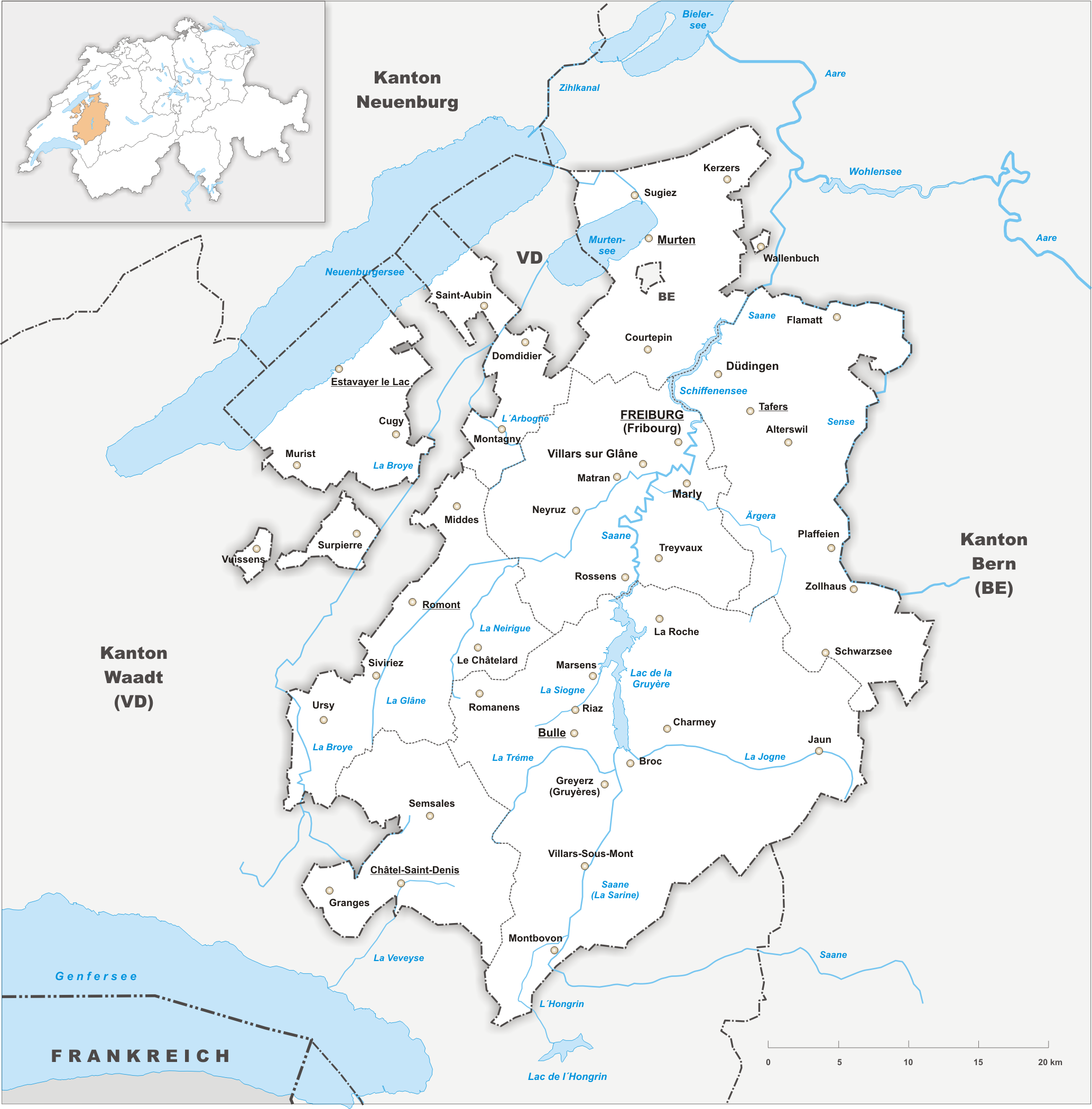
The canton of Fribourg, also canton of Freiburg (french: Canton de Fribourg ; german: Kanton Freiburg ; frp, Canton de Fribôrg rm, Chantun Friburg it, Canton Friburgo) is located in western Switzerland. The canton is bilingual, with French spoken by more than two thirds of the citizens and German by a little more than a quarter. Both are official languages in the canton. The canton takes its name from its capital city of Fribourg. History On the shores of Lake Neuchâtel and Lake Morat significant traces of prehistoric settlements have been unearthed. The canton of Fribourg joined the Swiss Confederation in 1481. The area is made up of lands acquired by the capital Fribourg. The present extent was reached in 1803 when Murten (Morat) was acquired. The canton of Fribourg joined the separatist league of Catholic cantons in 1846 (Sonderbund). The following year, its troops surrendered to the federal army. Geography The canton is bounded to the west by Lake Neuchâtel, to the ... [...More Info...] [...Related Items...] OR: [Wikipedia] [Google] [Baidu] |
Canton Of Bern
The canton of Bern or Berne (german: Kanton Bern; rm, Chantun Berna; french: canton de Berne; it, Canton Berna) is one of the 26 cantons forming the Swiss Confederation. Its capital city, Bern, is also the ''de facto'' capital of Switzerland. The bear is the heraldic symbol of the canton, displayed on a red-yellow background. Comprising ten districts, Bern is the second-largest canton by both surface area and population. Located in west-central Switzerland, it is surrounded by eleven cantons. It borders the canton of Jura and the canton of Solothurn to the north. To the west lie the canton of Neuchâtel, the canton of Fribourg and canton of Vaud. To the south lies the canton of Valais. East of the canton of Bern lie the cantons of Uri, Nidwalden, Obwalden, Lucerne and Aargau. The geography of the canton includes a large share of all three natural regions of Switzerland: the Jura Mountains (the Bernese Jura), the Swiss Plateau (the Bernese Mittelland) and the Alps (th ... [...More Info...] [...Related Items...] OR: [Wikipedia] [Google] [Baidu] |
Jaun
Jaun (french: Bellegarde; frp, Bèlagouàrda ) is a municipality in the district of Gruyère in the canton of Fribourg in Switzerland. It is the only German-speaking municipality in Gruyère. History Jaun is first mentioned in 1228 as ''Balavarda''. In 1397 it was mentioned as ''Youn''. Geography Jaun has an area, , of . Of this area, or 42.5% is used for agricultural purposes, while or 38.9% is forested. Of the rest of the land, or 1.7% is settled (buildings or roads), or 0.8% is either rivers or lakes and or 16.1% is unproductive land.Swiss Federal Statistical Office-Land Use Statistics 2009 data accessed 25 March 2010 Of the built up area, housing and buildings made up 0.5% and transportation infrastructure made up 1.0%. Out of the for ... [...More Info...] [...Related Items...] OR: [Wikipedia] [Google] [Baidu] |


