|
Jubbal
Jubbal is a tehsil, town and a nagar panchayat in Shimla district in the Indian state of Himachal Pradesh which shares its boundary with the state of Uttrakhand towards south-east. Jubbal is recognised as a major apple producing area in Shimla district along with Kotgarh, Kumarsain, Kotkhai and Chopal. It is famous for its Hindu temples, picturesque mountains and its royal palace situated in the town. Geography Jubbal, located at has an average elevation of 2200 metres (7220 feet). A small hill town, it is famous for its apple orchards and the Jubbal Palace. Jubbal has a combination of vast landscapes, thick woods, and buildings. It is located at an elevation of 1901 meters. History The history of Jubbal State goes back to the 12th century. Among the 18 Thakuries located in the valleys of Sutlej, Pabbar and Giri this Thakurai was of considerable importance. Rulers of Jubbal belong to the Rathore clan. During 12th century Ugar Chand, the Raja of Sirmoor State, had ... [...More Info...] [...Related Items...] OR: [Wikipedia] [Google] [Baidu] |
Shimla District
Shimla is a District (India), district in the state of Himachal Pradesh in northern India. Its headquarters is the state capital of Shimla. Neighbouring districts are Mandi District, Mandi and Kullu in the north, Kinnaur in the east, Uttarakhand in the southeast, Solan to the southwest and Sirmaur District, Sirmaur in the south. The elevation of the district ranges from to . As of 2011 it is the third most populous district of Himachal Pradesh (out of List of districts of Himachal Pradesh, 12), after Kangra district, Kangra and Mandi district, Mandi. It is the most urbanized district of Himachal Pradesh. Administrative structure Access By road Shimla is connected by road to all the major towns. Distance between the major towns and Shimla: * Kalka - 80 km * Patiala - 172 km * Chandigarh - 119 km * Ambala - 166 km * Delhi - 380 km * Agra - 568 km * Amritsar - 342 km * Jammu (via Pathankot) - 482 km * Srinagar - 787 km * Ja ... [...More Info...] [...Related Items...] OR: [Wikipedia] [Google] [Baidu] |
Sirmoor State
Sirmur (also spelled as Sirmor, Sirmaur, Sirmour, or Sirmoor) was an independent kingdom in India, founded in 1616, located in the region that is now the Sirmaur district of Himachal Pradesh. The state was also known as Nahan, after its main city, Nahan. The state ranked predominant amongst the Punjab hill States. It had an area of 4,039 km2 and a revenue of 300,000 rupees in 1891. History Nahan, the predecessor state of Sirmur, was founded by Soba Rawal in 1095 AD who assumed the name Raja Subans Prakash. The new capital was founded in 1621 by Raja Karam Prakash, and the state was renamed to Sirmur. Sirmur was surrounded by the hill states of Balsan and Jubbal in the North, Dehradun district in the East, Ambala district in the South West, and the states of Patiala and Keonthal in the North-West. But by chance, shortly after this event a prince of Jaisalmer visited Haridwar as a pilgrim, and was invited by one of the minstrels of the Sirmoor kingdom to become its s ... [...More Info...] [...Related Items...] OR: [Wikipedia] [Google] [Baidu] |
Thakur Ram Lal
Thakur Ram Lal (7 July 1929 – 6 July 2002) was an Indian politician and a leader of the Indian National Congress in Himachal Pradesh. He was elected to the Himachal Pradesh Vidhan Sabha from Jubbal Kotkhai constituency in 1957. Later, he was re-elected to the Himachal Pradesh Vidhan Sabha from the same constituency in 1962, 1967, 1977, 1980, and 1982. He became the second Chief Minister of Himachal Pradesh on 28 January 1977 and remained in office till 30 April 1977. He was the leader of opposition in the Himachal Pradesh Vidhan Sabha from 29 June 1977 to 13 February 1980. He again became the Chief Minister of the state on 14 February 1980 and remained in office till 7 April 1983. Later, he served as Governor of Andhra Pradesh from 15 August 1983 to 29 August 1984. His name got etched in infamy, as he appointed the Finance minister of Andhrapradesh Mr. N Baskar Rao as Chief Minister, when the incumbent CM sri. N.T.Rama Rao was getting surgery in the USA. This change ... [...More Info...] [...Related Items...] OR: [Wikipedia] [Google] [Baidu] |
Mahasu Pahari Language
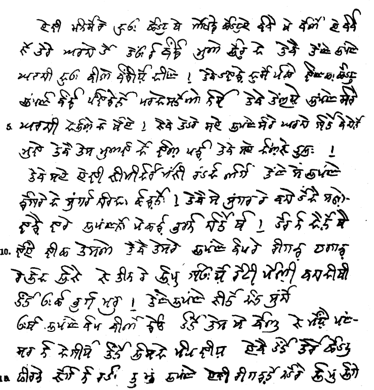
Mahasu Pahari (Takri: ) is a Western Pahari (Himachali, Takri: ) language spoken in Himachal Pradesh. It is also known as Mahasui or Mahasuvi. The speaking population is about 1,000,000 (2001). It is more commonly spoken in the Himachal Pradesh, Shimla (Simla) and Solan districts. It is to be known that Shimla and Solan were parts of the old Mahasu district. Himachal Pradesh State on 1 September, 1972 reorganised the districts dissolving Mahasu district. The Solan district was carved out of Solan and Arki tehsils of the then Mahasu district and tehsils of Kandaghat and Nalagarh of the then Shimla District of Punjab. Area According to different locations, the language has developed several dialects. Lower Mahasu Pahari (Baghati, Baghliani, Kiunthali), Upper Mahasu Pahari (Rampuri, Rohruri, Nawari, Jubbali, Shimla Siraji, Sodochi). The Kiunthali variety appears to be understood by others, and their attitude toward it is favorable. Rampuri is also called Kochi; Rohruri is also ... [...More Info...] [...Related Items...] OR: [Wikipedia] [Google] [Baidu] |
Hatkoti
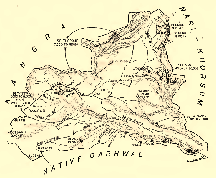
Hatkoti is a village in Shimla district of Himachal Pradesh, India. It is a village located at the banks of Pabbar River and it is about 102 kilometres away from Shimla city. Hatkoti is also famous for Hateshwari temple and Sawra Kuddu Hydro Electric Project (111 MW). History Hatkoti temples date back to the period between the eighth to the ninth century CE, the Gurjara-Pratihara Period in Indian history. Parallels of these can also be found in the Balag Village in Theog Tehsil and the Hanol Region in Uttrakhand. The temples reflect the beautiful architecture of that era and were most likely built during the Pratihara Invasion of Kashmir, the route to which passed through the region. The architecture and design of Hatkoti Temple was originally in the classical Shikhara or tower style. The Shikhara style represents ancient structures that are conical or narrow at the top and have a wide base at the bottom. The walls of the temples are carved with ornate sculptures and speak vo ... [...More Info...] [...Related Items...] OR: [Wikipedia] [Google] [Baidu] |
States And Territories Of India
India is a federal union comprising 28 states and 8 union territories, with a total of 36 entities. The states and union territories are further subdivided into districts and smaller administrative divisions. History Pre-independence The Indian subcontinent has been ruled by many different ethnic groups throughout its history, each instituting their own policies of administrative division in the region. The British Raj mostly retained the administrative structure of the preceding Mughal Empire. India was divided into provinces (also called Presidencies), directly governed by the British, and princely states, which were nominally controlled by a local prince or raja loyal to the British Empire, which held ''de facto'' sovereignty ( suzerainty) over the princely states. 1947–1950 Between 1947 and 1950 the territories of the princely states were politically integrated into the Indian union. Most were merged into existing provinces; others were organised into ... [...More Info...] [...Related Items...] OR: [Wikipedia] [Google] [Baidu] |
Gori Ganga
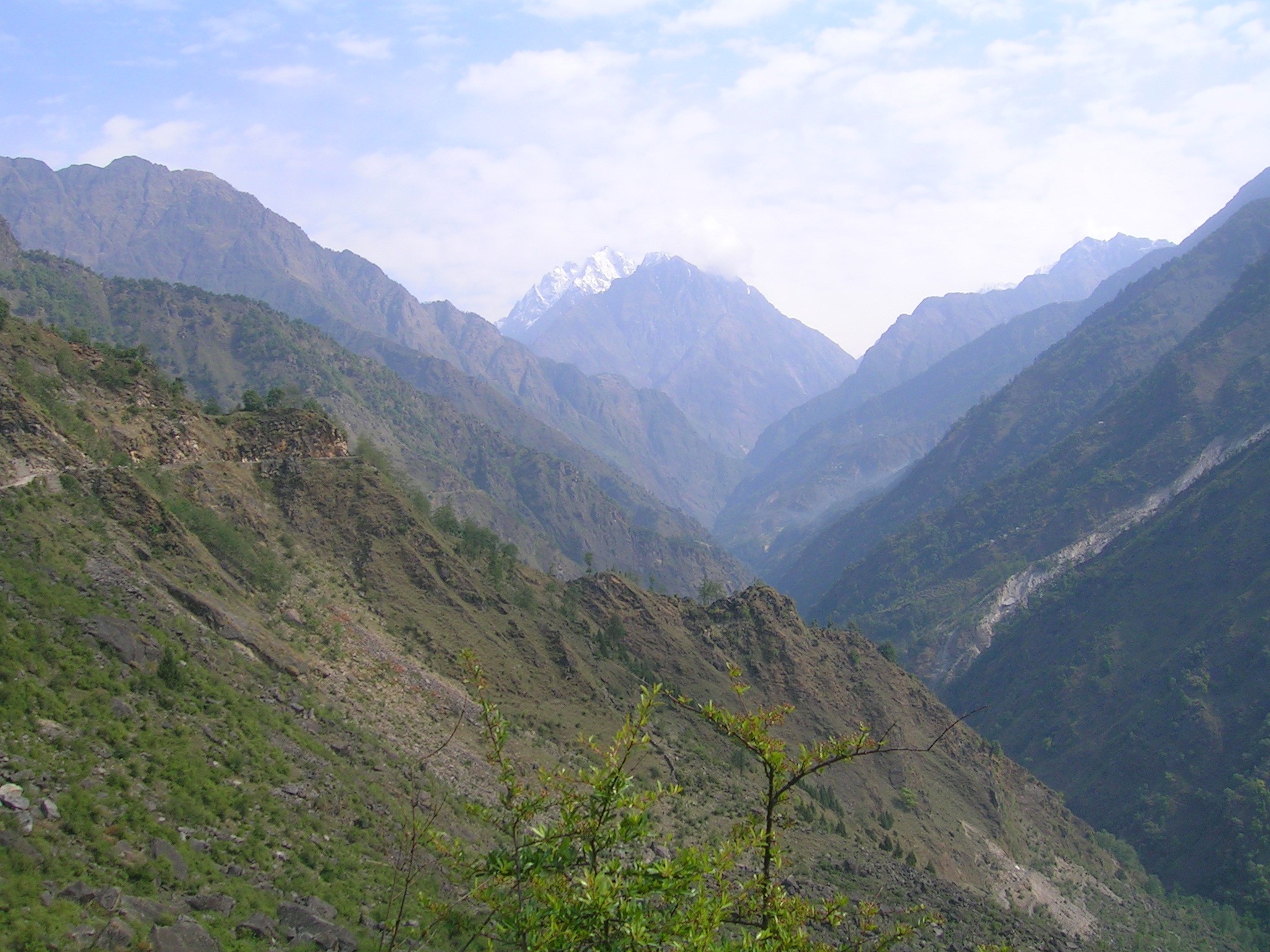
Gori Ganga ( Kumaoni: ''Gori Gād'') is a river in the Munsiari tehsil of the Pithoragarh District, part of the state of Uttarakhand in northern India. Its principal source is the Milam Glacier, just northeast of Nanda Devi along with the Glaciers of the Ralam River, and the Pyunshani and Uttari & Dakshini Balati Glaciers that lie on the western face of the Panchachuli Peaks. Etymology In the local language "gori" means white or fair. "Gad" and "ganga" both mean river. The water of this river froths and contains white clay/sand, so it looks white most of the time. Course The alpine trans-humant village of Milam is located one kilometer below the snout of the glacier. Here a left-bank stream called ''Gonka'' joins the Gori. The valley provides the approach route for access to peaks such as Nanda Devi East, Hardeol, Trishuli, Panchchuli and Nanda Kot. The Gori is also fed by glaciers and streams flowing from the eastern slopes of the east wall of the Nanda Devi Sanctuary, ... [...More Info...] [...Related Items...] OR: [Wikipedia] [Google] [Baidu] |
Shimla
Shimla (; ; also known as Simla, List of renamed Indian cities and states#Himachal Pradesh, the official name until 1972) is the capital and the largest city of the States and union territories of India, northern Indian state of Himachal Pradesh. In 1864, Shimla was declared as the summer capital of British Raj, British India. After Indian independence movement, independence, the city became the capital of East Punjab and was later made the capital city of Himachal Pradesh. It is the principal commercial, cultural and educational centre of the state. Small hamlets were recorded before 1815 when British forces took control of the area. The climatic conditions attracted the British to establish the city in the dense forests of the Himalayas. As the summer capital, Shimla hosted many important political meetings including the Simla Accord (1914), Simla Accord of 1914 and the Simla Conference of 1945. After independence, the state of Himachal Pradesh came into being in 1948 as a re ... [...More Info...] [...Related Items...] OR: [Wikipedia] [Google] [Baidu] |
Cedrus Deodara
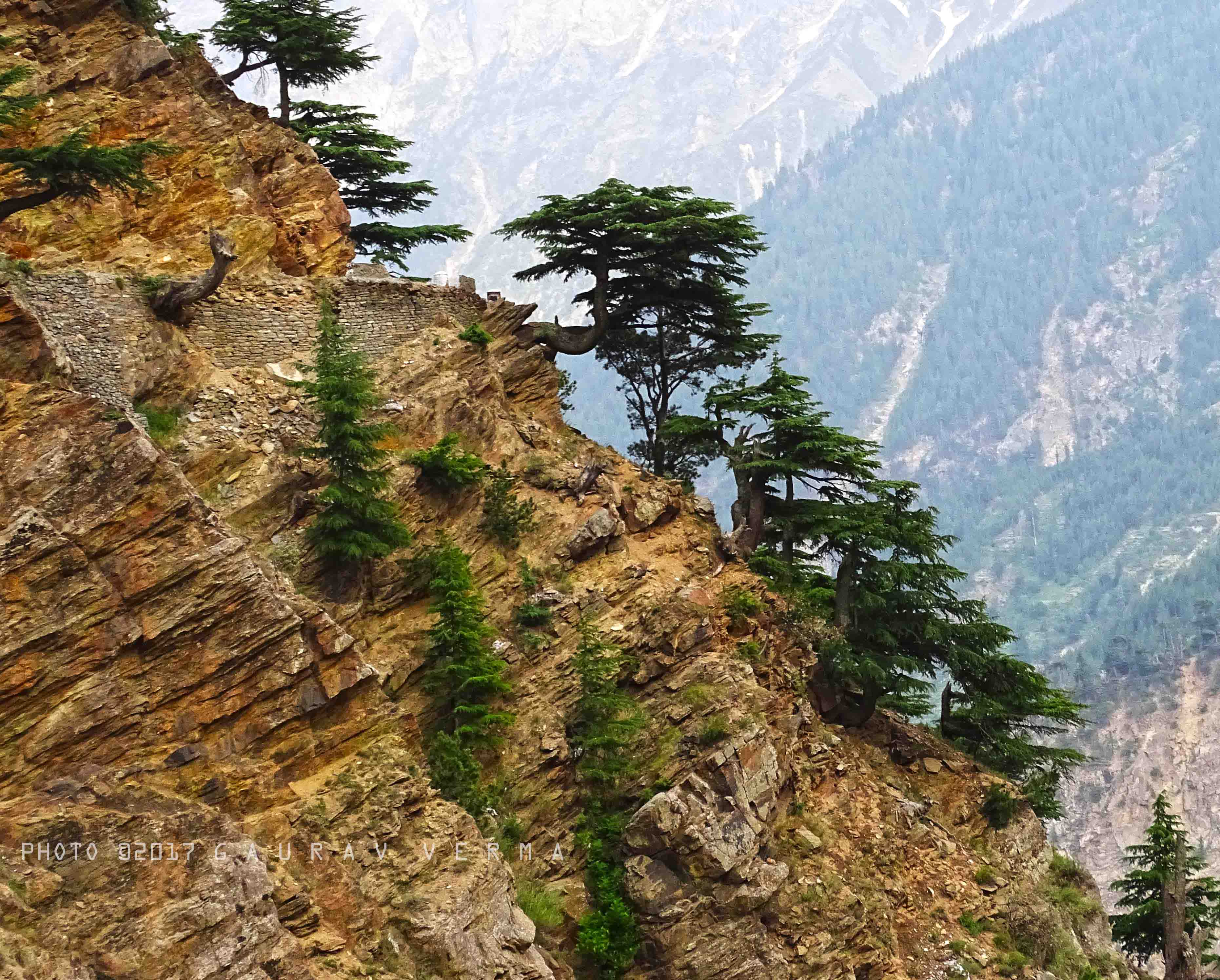
''Cedrus deodara'', the deodar cedar, Himalayan cedar, or deodar, is a species of cedar native to the Himalayas. Description It is a large evergreen coniferous tree reaching tall, exceptionally with a trunk up to in diameter. It has a conic crown with level branches and drooping branchlets. The leaves are needle-like, mostly long, occasionally up to long, slender ( thick), borne singly on long shoots, and in dense clusters of 20–30 on short shoots; they vary from bright green to glaucous blue-green in colour. The female cones are barrel-shaped, long and broad, and disintegrate when mature (in 12 months) to release the winged seeds. The male cones are long, and shed their pollen in autumn. Chemistry The bark of ''Cedrus deodara'' contains large amounts of taxifolin. The wood contains cedeodarin, ampelopsin, cedrin, cedrinoside, and deodarin (3′,4′,5,6-tetrahydroxy-8-methyl dihydroflavonol). The main components of the needle essential oil include α-terpine ... [...More Info...] [...Related Items...] OR: [Wikipedia] [Google] [Baidu] |
Bushahr
Bushahr, also spelt as 'Bashahr' and 'Bussahir' or 'Bushair' was a Rajput princely state in India during the British Raj. It was located in the hilly western Himalaya promontory bordering Tibet in the northern part of colonial Punjab region. The territory of this former state is now part of Kinnaur and Shimla districts of the present Himachal Pradesh state. The erstwhile Bushahr state was traversed by the Sutlej river. It was bordered on the west by the Kulu, Lahaul and Spiti states and by Tehri Garhwal on the east. It had an area of . History The erstwhile Bushahr state was occupied by a Gorkha king from central Nepal from 1803 to 1815. Ranjit Singh, the ruler of the Sikh state in the Punjab, intervened in 1809 and drove the Nepalese army east of the Satluj river. A rivalry between Nepal and the British East India Company over the annexation of minor states bordering Nepal eventually led to the Anglo-Nepalese War (1815–16) or the Gurkha War. Both parties eventually sig ... [...More Info...] [...Related Items...] OR: [Wikipedia] [Google] [Baidu] |
British Raj
The British Raj (; from Hindi ''rāj'': kingdom, realm, state, or empire) was the rule of the British Crown on the Indian subcontinent; * * it is also called Crown rule in India, * * * * or Direct rule in India, * Quote: "Mill, who was himself employed by the British East India company from the age of seventeen until the British government assumed direct rule over India in 1858." * * and lasted from 1858 to 1947. * * The region under British control was commonly called India in contemporaneous usage and included areas directly administered by the United Kingdom, which were collectively called British India, and areas ruled by indigenous rulers, but under British paramountcy, called the princely states. The region was sometimes called the Indian Empire, though not officially. As ''India'', it was a founding member of the League of Nations, a participating nation in the Summer Olympics in 1900, 1920, 1928, 1932, and 1936, and a founding member of the United Nations in San F ... [...More Info...] [...Related Items...] OR: [Wikipedia] [Google] [Baidu] |
Kingdom Of Nepal
The Kingdom of Nepal ( ne, नेपाल अधिराज्य), also known as the Gorkha Empire ( ne, गोरखा अधिराज्य) or Asal Hindustan ( ne, असल हिन्दुस्तान)(), was a Hindu kingdom in South Asia, formed in 1768, by the unification of Nepal. Founded by King Prithvi Narayan Shah, a Gorkha monarch who claimed to be of Khas Thakuri origin, it existed for 240 years until the abolition of the Nepalese monarchy in 2008. During this period, Nepal was formally under the rule of the Shah dynasty, which exercised varying degrees of power during the kingdom's existence. After the invasion of Tibet and plundering of Digarcha by Nepali forces under Prince Regent Bahadur Shah in 1792, the Dalai Lama and Chinese Ambans reported to the Chinese administration for military support. The Chinese and Tibetan forces under Fuk'anggan attacked Nepal but went for negotiations after failure at Nuwakot. ''Mulkaji'' Damodar Pande, who w ... [...More Info...] [...Related Items...] OR: [Wikipedia] [Google] [Baidu] |
