|
John W. Stevenson (minister)
John W. Stevenson (August 15, 1835 - October 1, 1898) was an African Methodist Episcopal (AME) Church minister. He was the financier and builder of the Metropolitan African Methodist Episcopal Church in Washington, DC, which was the largest black church in the country at the time of its building. He was a talented fundraiser and built a number of other churches and was pastor of many churches in Maryland, New Jersey, Pennsylvania, New York, and New England. He was an important figure in the church and eventually held the position of presiding Elder of the New York district. Early life Stevenson was born in Baltimore, Maryland, on August 15, 1835, to John and Ann Stevenson. In 1840, the couple and their six children moved to Trinidad where Stevenson's father died within a year. His mother returned to Baltimore, with the six children and a seventh child which had been born to them during the passage. Stevenson was then bound out to work on the farm of J. P. Stamly. Stevenson w ... [...More Info...] [...Related Items...] OR: [Wikipedia] [Google] [Baidu] |
Baltimore, Maryland
Baltimore ( , locally: or ) is the most populous city in the U.S. state of Maryland, fourth most populous city in the Mid-Atlantic, and the 30th most populous city in the United States with a population of 585,708 in 2020. Baltimore was designated an independent city by the Constitution of Maryland in 1851, and today is the most populous independent city in the United States. As of 2021, the population of the Baltimore metropolitan area was estimated to be 2,838,327, making it the 20th largest metropolitan area in the country. Baltimore is located about north northeast of Washington, D.C., making it a principal city in the Washington–Baltimore combined statistical area (CSA), the third-largest CSA in the nation, with a 2021 estimated population of 9,946,526. Prior to European colonization, the Baltimore region was used as hunting grounds by the Susquehannock Native Americans, who were primarily settled further northwest than where the city was later built. Colonis ... [...More Info...] [...Related Items...] OR: [Wikipedia] [Google] [Baidu] |
West Chester, Pennsylvania
West Chester is a borough and the county seat of Chester County, Pennsylvania. Located within the Philadelphia metropolitan area, the borough had a population of 18,461 at the 2010 census. West Chester is the mailing address for most of its neighboring townships. When calculated by mailing address, the population as of the 2010 U.S. Census was 108,696, which would make it the 10th largest city by mailing address in the state of Pennsylvania. Much of the West Chester University of Pennsylvania North Campus and the Chester County government are located within the borough. The center of town is located at the intersection of Market and High Streets. History The area was originally known as Turk's Head—after the inn of the same name located in what is now the center of the borough. West Chester has been the seat of government in Chester County since 1786 when the seat was moved from nearby Chester in what is now Delaware County. The borough was incorporated in 1799. In the heart ... [...More Info...] [...Related Items...] OR: [Wikipedia] [Google] [Baidu] |
Washington, Pennsylvania
Washington is a city in and the county seat of Washington County, Pennsylvania. A part of the Greater Pittsburgh area in the southwestern part of the state, the city is home to Washington & Jefferson College and Pony League baseball. The population was 13,176 at the 2020 census. History Delaware Indian chief Tangooqua, commonly known as "Catfish", had a camp on a branch of Chartiers Creek, in what is now part of the city of Washington.Walkinshaw, Lewis Clark (c. 1939). ''Annals of southwestern Pennsylvania, Vol. 1''. New York. Lewis Historical Publishing Company, Inc, p. 16. The French labeled the area "Wissameking", meaning "catfish place", as early as 1757. The area of Washington was settled by many immigrants from Scotland and the north of Ireland along with settlers from eastern and central parts of colonial Virginia. It was first settled by colonists around 1768. The Pennsylvania General Assembly passed an act on March 28, 1781, erecting the County of Washington and na ... [...More Info...] [...Related Items...] OR: [Wikipedia] [Google] [Baidu] |
Delaware River
The Delaware River is a major river in the Mid-Atlantic (United States), Mid-Atlantic region of the United States. From the meeting of its branches in Hancock (village), New York, Hancock, New York, the river flows for along the borders of New York (state), New York, Pennsylvania, New Jersey, and Delaware, before emptying into Delaware Bay. It is the longest free-flowing river in the Eastern United States. The river has been recognized by the National Wildlife Federation as one of the country's Great Waters. The river's drainage basin, watershed drains an area of and provides drinking water for 17 million people. The river has two branches that rise in the Catskill Mountains of New York: the West Branch Delaware River, West Branch at Mount Jefferson (New York), Mount Jefferson in Jefferson, New York, Jefferson, Schoharie County, New York, Schoharie County, and the East Branch Delaware River, East Branch at Grand Gorge, New York, Grand Gorge, Delaware County, New York, ... [...More Info...] [...Related Items...] OR: [Wikipedia] [Google] [Baidu] |
Yardley, Pennsylvania
Yardley is a borough in Bucks County, Pennsylvania. Yardley borders the Delaware River and Ewing, New Jersey to its east and Lower Makefield Township to its north, west, and south. The United States Post Office assigns many addresses in Lower Makefield Township the preferred city of "Yardley", although they are outside the borough. The population was 2,434 at the 2010 census. Yardley is part of the Delaware Valley metropolitan area. Geography Yardley is located at (40.241508, -74.836325). According to the U.S. Census Bureau, the borough has a total area of , of which is land and (9.90%) is water. The Delaware Canal and its towpath bisect the borough from northwest to southeast. Access points to the canal are located at Edgewater Avenue, Afton Avenue, Fuld Avenue, College Avenue and South Canal Street. The Yardley station, a SEPTA Regional Rail station, is located on Main Street. Demographics As of the 2010 census, the borough was 89.7% Non-Hispanic White, 3.5% Black or ... [...More Info...] [...Related Items...] OR: [Wikipedia] [Google] [Baidu] |
Trenton, New Jersey
Trenton is the capital city of the U.S. state of New Jersey and the county seat of Mercer County. It was the capital of the United States from November 1 to December 24, 1784.New Jersey County Map New Jersey Department of State. Accessed July 10, 2017. The city's metropolitan area, including all of Mercer County, is grouped with the New York combined statistical area by the |
Burlington, New Jersey
Burlington is a city in Burlington County, in the U.S. state of New Jersey. It is a suburb of Philadelphia. As of the 2020 United States census, the city's population was 9,743. Burlington was first incorporated on October 24, 1693, and was reincorporated by Royal charter on May 7, 1733. After American independence, the city was incorporated by the State of New Jersey on December 21, 1784. On March 14, 1851, the city was reincorporated and enlarged with portions of the surrounding township.Snyder, John P''The Story of New Jersey's Civil Boundaries: 1606–1968'' Bureau of Geology and Topography; Trenton, New Jersey; 1969. p. 94. Accessed June 14, 2012. Burlington was originally the county seat of Burlington County. In 1796, in response to the growth of population to the east away from the Delaware River, the county seat was moved to Mount Holly Township, a more central location. History The council of West Jersey Proprietors purchased roughly of riverfront land in 1676 from ... [...More Info...] [...Related Items...] OR: [Wikipedia] [Google] [Baidu] |
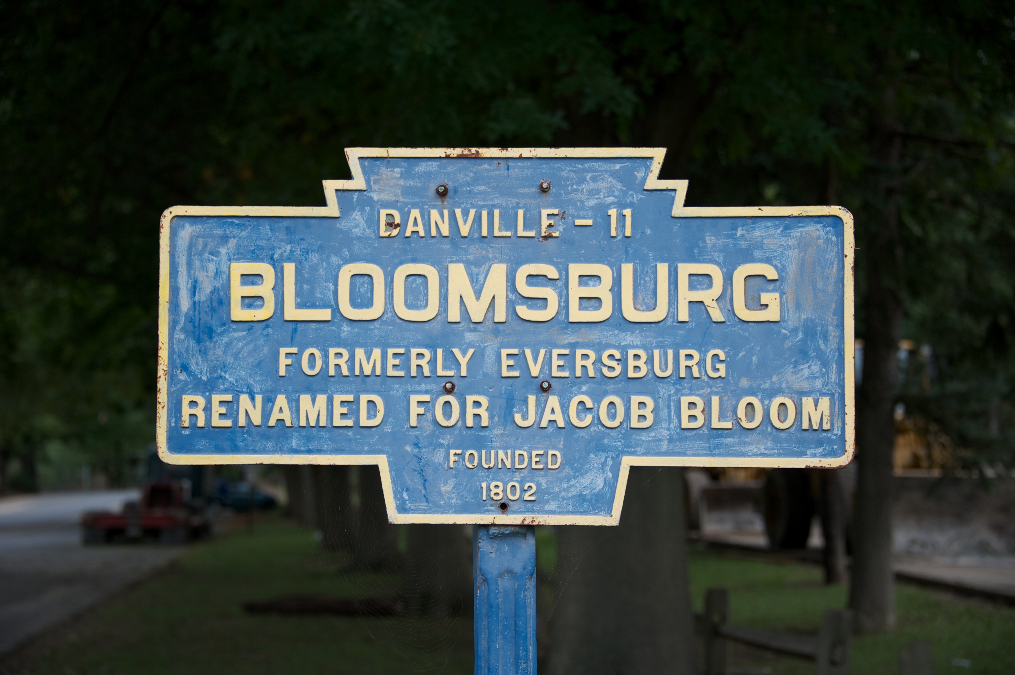
Bloomsburg, Pennsylvania
Bloomsburg is a town and the county seat of Columbia County, Pennsylvania, United States. It is part of Northeastern Pennsylvania and is located southwest of Wilkes-Barre, Pennsylvania, Wilkes-Barre along the Susquehanna River. It is the only list of municipalities in Pennsylvania, Pennsylvania municipality incorporated as a town. As of the 2010 United States census, 2010 census, Bloomsburg had a population of 14,855, with an estimated population of 13,811 in 2019. Bloomsburg is one of two principal communities of the Bloomsburg-Berwick metropolitan area, Bloomsburg-Berwick, PA Metropolitan Statistical Area, a United States metropolitan area, metropolitan area that covers Columbia and Montour County, Pennsylvania, Montour counties, and had a combined population of 85,562 at the 2010 United States Census, 2010 census. History The first signs of European settlement date to the year 1772, when James McClure established a log cabin in the area. Until the mid-19th century, it was ... [...More Info...] [...Related Items...] OR: [Wikipedia] [Google] [Baidu] |
Wilkes Barre, Pennsylvania
Wilkes-Barre ( or ) is a city in the U.S. state of Pennsylvania and the county seat of Luzerne County, Pennsylvania, Luzerne County. Located at the center of the Wyoming Valley in Northeastern Pennsylvania, it had a population of 44,328 in the 2020 census. It is the second-largest city, after Scranton, Pennsylvania, Scranton, in the Scranton–Wilkes-Barre–Hazleton, PA Metropolitan Statistical Area, which had a population of 563,631 as of the 2010 United States census, 2010 census and is the fourth-largest metropolitan area in Pennsylvania after the Delaware Valley, Greater Pittsburgh, and the Lehigh Valley with an urban population of 401,884. Scranton/Wilkes-Barre is the cultural and economic center of a region called Northeastern Pennsylvania, which is home to over 1.3 million residents. Wilkes-Barre and the surrounding Wyoming Valley are framed by the Pocono Mountains to the east, the Endless Mountains to the north and west, and the Lehigh Valley to the south. The Susqu ... [...More Info...] [...Related Items...] OR: [Wikipedia] [Google] [Baidu] |
Dover, Delaware
Dover () is the capital and second-largest city of the U.S. state of Delaware. It is also the county seat of Kent County and the principal city of the Dover, DE, Metropolitan Statistical Area, which encompasses all of Kent County and is part of the Philadelphia– Wilmington– Camden, PA– NJ–DE– MD, Combined Statistical Area. It is located on the St. Jones River in the Delaware River coastal plain. It was named by William Penn for Dover in Kent, England (for which Kent County is named). As of 2010, the city had a population of 36,047. Etymology The city is named after Dover, Kent, in England. First recorded in its Latinised form of ''Portus Dubris'', the name derives from the Brythonic word for waters (''dwfr'' in Middle Welsh). The same element is present in the town's French (Douvres) and Modern Welsh (Dofr) forms. History Dover was founded as the court town for newly established Kent County in 1683 by William Penn, the proprietor of the territory generally known ... [...More Info...] [...Related Items...] OR: [Wikipedia] [Google] [Baidu] |
Camden, Delaware
Camden is a town in Kent County, Delaware, United States. It is part of the Dover, Delaware Metropolitan Statistical Area. The population was 3,464 at the 2010 census. History Camden was established in 1783 as a community originally known as Mifflin's Crossroads. The community of Mifflin's Crossroads was a Quaker settlement laid out by Daniel Mifflin on the Piccadilly tract. The town originally gained some commercial trade through wharves in nearby Forest Landing and Lebanon on the St. Jones River. From these wharves, regular boat service connected the area to Philadelphia and New York City, with local merchants shipping cordwood, staves, grain, and Spanish-oak bark. The Delaware Railroad was built through nearby Wyoming in the 1850s and expanded the market for local farm products, bringing increased prosperity to Camden. The town has numerous historic properties and part of it is designated as the Camden Historic District. In addition, Brecknock, Camden Friends Meetinghouse, Sta ... [...More Info...] [...Related Items...] OR: [Wikipedia] [Google] [Baidu] |
Milford, New Jersey
Milford is a borough located in western Hunterdon County, in the U.S. state of New Jersey. As of the 2020 United States census, the borough's population was 1,232, a decrease of one person (−0.1%) from the 2010 census count of 1,233, which in turn reflected an increase of 38 (+3.2%) from the 1,195 counted at the 2000 census. Milford was incorporated as a borough by an act of the New Jersey Legislature on April 15, 1911, from portions of Holland Township, based on the results of a referendum held on May 8, 1911. The borough's incorporation was confirmed on March 13, 1925.Snyder, John P''The Story of New Jersey's Civil Boundaries: 1606-1968'' Bureau of Geology and Topography; Trenton, New Jersey; 1969. p. 157. Accessed October 29, 2012. The borough is located on the Delaware River in the western portion of Hunterdon County, known as the Hunterdon Plateau. The Borough dates to the mid-18th century when a grist mill was established beside a river in what was then Bethlehem To ... [...More Info...] [...Related Items...] OR: [Wikipedia] [Google] [Baidu] |


.jpg)
