|
Jetersville, Virginia
Jetersville is a mostly rural unincorporated community in southwestern Amelia County in the U.S. state of Virginia, just off (Patrick Henry Highway). The town is centered around the intersection of SR 671 (Jetersville Road, a short loop segment of old US 360) and SR 640 (Perkinson Road). The Norfolk Southern Railway runs along the main roads. Jetersville, which may at first have been called Perkinsonville, was named for John "Black Jack" Jeter, according to local lore. Other sources hold that it was named for John's father, Rodophil Jeter (for whom the community of Rodophil was also named). Apparently the Jeters originally were French Huguenots who fled persecution, eventually coming to America around the beginning of the 1700s. Rodophil Jeter was a delegate to the state legislature and a prominent figure in Amelia County government in the early 1800s, and several members of his family established businesses in the area. The town's post office, one of the earliest in ... [...More Info...] [...Related Items...] OR: [Wikipedia] [Google] [Baidu] |
Unincorporated Community
An unincorporated area is a region that is not governed by a local municipal corporation. Widespread unincorporated communities and areas are a distinguishing feature of the United States and Canada. Most other countries of the world either have no unincorporated areas at all or these are very rare: typically remote, outlying, sparsely populated or uninhabited areas. By country Argentina In Argentina, the provinces of Chubut, Córdoba, Entre Ríos, Formosa, Neuquén, Río Negro, San Luis, Santa Cruz, Santiago del Estero, Tierra del Fuego, and Tucumán have areas that are outside any municipality or commune. Australia Unlike many other countries, Australia has only one level of local government immediately beneath state and territorial governments. A local government area (LGA) often contains several towns and even entire metropolitan areas. Thus, aside from very sparsely populated areas and a few other special cases, almost all of Australia is part of an LGA. Uninc ... [...More Info...] [...Related Items...] OR: [Wikipedia] [Google] [Baidu] |
Army Of Northern Virginia
The Army of Northern Virginia was the primary military force of the Confederate States of America in the Eastern Theater of the American Civil War. It was also the primary command structure of the Department of Northern Virginia. It was most often arrayed against the Union Army of the Potomac. Origin The name ''Army of Northern Virginia'' referred to its primary area of operation, as did most Confederate States Army names. The Army originated as the Army of the Potomac, which was organized on June 20, 1861, from all operational forces in northern Virginia. On July 20 and July 21, the Army of the Shenandoah and forces from the District of Harpers Ferry were added. Units from the Army of the Northwest were merged into the Army of the Potomac between March 14 and May 17, 1862. The Army of the Potomac was renamed ''Army of Northern Virginia'' on March 14. The Army of the Peninsula was merged into it on April 12, 1862.Eicher, pp. 889–90. Robert E. Lee's biographer, Douglas S. ... [...More Info...] [...Related Items...] OR: [Wikipedia] [Google] [Baidu] |
Southern United States
The Southern United States (sometimes Dixie, also referred to as the Southern States, the American South, the Southland, or simply the South) is a geographic and cultural region of the United States of America. It is between the Atlantic Ocean and the Western United States, with the Midwestern and Northeastern United States to its north and the Gulf of Mexico and Mexico to its south. Historically, the South was defined as all states south of the 18th century Mason–Dixon line, the Ohio River, and 36°30′ parallel.The South . ''Britannica.com''. Retrieved June 5, 2021. Within the South are different subregions, such as the |
Rosenwald School
The Rosenwald School project built more than 5,000 schools, shops, and teacher homes in the United States primarily for the education of African-American children in the South during the early 20th century. The project was the product of the partnership of Julius Rosenwald, a Jewish-American clothier who became part-owner and president of Sears, Roebuck and Company and the African-American leader, educator, and philanthropist Booker T. Washington, who was president of the Tuskegee Institute. The need arose from the chronic underfunding of public education for African-American children in the South, as black people had been discriminated against at the turn of the century and excluded from the political system in that region. Children were required to attend segregated schools, and even those did not exist in many places. Rosenwald was the founder of the Rosenwald Fund. He contributed seed money for many schools and other philanthropic causes. To encourage local commitment to the ... [...More Info...] [...Related Items...] OR: [Wikipedia] [Google] [Baidu] |
Chula, Virginia
Chula is a mostly rural unincorporated community in the northeastern part of Amelia County just west of the Appomattox River in the U.S. state of Virginia. The town is centered around the T-intersection of SR 636 (Lodore Road) and SR 740 (Old Chula Road) in Giles District. Chula is just west of SR 604 (Chula Road), which includes a short bypass segment built around the town in the late 20th century. The area is served by the post office 7 miles southwest at Amelia Court House, ZIP code 23002. The nearest fire station to Chula is Amelia County Volunteer Fire Department Station 4, near Mattoax, 3 miles north. History Origins The word "Chula" was likely derived from a Native American word meaning "fox" or "red fox". The town apparently was founded in the 1850s as a stop on the recently completed rail line from the state capital: Chula is notably absent on a map of Amelia County circa 1850; but a postal facility using the name "Chula Depot" was establi ... [...More Info...] [...Related Items...] OR: [Wikipedia] [Google] [Baidu] |
Tornado
A tornado is a violently rotating column of air that is in contact with both the surface of the Earth and a cumulonimbus cloud or, in rare cases, the base of a cumulus cloud. It is often referred to as a twister, whirlwind or cyclone, although the word cyclone is used in meteorology to name a weather system with a low-pressure area in the center around which, from an observer looking down toward the surface of the Earth, winds blow counterclockwise in the Northern Hemisphere and clockwise in the Southern. Tornadoes come in many shapes and sizes, and they are often visible in the form of a condensation funnel originating from the base of a cumulonimbus cloud, with a cloud of rotating debris and dust beneath it. Most tornadoes have wind speeds less than , are about across, and travel several kilometers (a few miles) before dissipating. The most extreme tornadoes can attain wind speeds of more than , are more than in diameter, and stay on the ground for more than 100 k ... [...More Info...] [...Related Items...] OR: [Wikipedia] [Google] [Baidu] |
Feldspar
Feldspars are a group of rock-forming aluminium tectosilicate minerals, also containing other cations such as sodium, calcium, potassium, or barium. The most common members of the feldspar group are the ''plagioclase'' (sodium-calcium) feldspars and the ''alkali'' (potassium-sodium) feldspars. Feldspars make up about 60% of the Earth's crust, and 41% of the Earth's continental crust by weight. Feldspars crystalize from magma as both intrusive and extrusive igneous rocks and are also present in many types of metamorphic rock. Rock formed almost entirely of calcic plagioclase feldspar is known as anorthosite. Feldspars are also found in many types of sedimentary rocks. Compositions The feldspar group of minerals consists of tectosilicates, silicate minerals in which silicon ions are linked by shared oxygen ions to form a three-dimensional network. Compositions of major elements in common feldspars can be expressed in terms of three endmembers: * potassium feldspar (K-spar) ... [...More Info...] [...Related Items...] OR: [Wikipedia] [Google] [Baidu] |
Mica
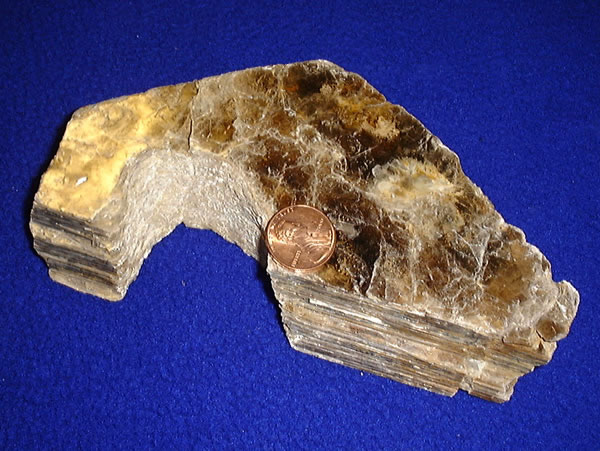
Micas ( ) are a group of silicate minerals whose outstanding physical characteristic is that individual mica crystals can easily be split into extremely thin elastic plates. This characteristic is described as perfect basal cleavage. Mica is common in igneous and metamorphic rock and is occasionally found as small flakes in sedimentary rock. It is particularly prominent in many granites, pegmatites, and schists, and "books" (large individual crystals) of mica several feet across have been found in some pegmatites. Micas are used in products such as drywalls, paints, fillers, especially in parts for automobiles, roofing and shingles, as well as in electronics. The mineral is used in cosmetics and food to add "shimmer" or "frost." Properties and structure The mica group is composed of 37 phyllosilicate minerals. All crystallize in the monoclinic system, with a tendency towards pseudohexagonal crystals, and are similar in structure but vary in chemical composition. Micas are ... [...More Info...] [...Related Items...] OR: [Wikipedia] [Google] [Baidu] |
Farmville, Virginia
Farmville is a town in Prince Edward and Cumberland counties in the U.S. state of Virginia. The population was 8,216 at the 2010 census. It is the county seat of Prince Edward County. Farmville developed near the headwaters of the Appomattox River in central Virginia; the waterway was long its main transportation access to other markets. In the 19th century, a railroad was constructed here. Since the late 20th century, the former railway has been converted to the High Bridge Trail State Park, a more than rail trail park. US 15, VA 45 and US 460 now intersect at Farmville. The town is the home of Longwood University and is the town nearest to Hampden–Sydney College. History Near the headwaters of the Appomattox River, the town of Farmville was formed in 1798 and incorporated in 1912. Upper Appomattox Canal Navigation System Between 1795 and 1890, Farmville was the end of the line for the Upper Appomattox Canal Navigation System, built to improve navigation on the river ... [...More Info...] [...Related Items...] OR: [Wikipedia] [Google] [Baidu] |
Richmond And Danville Railroad
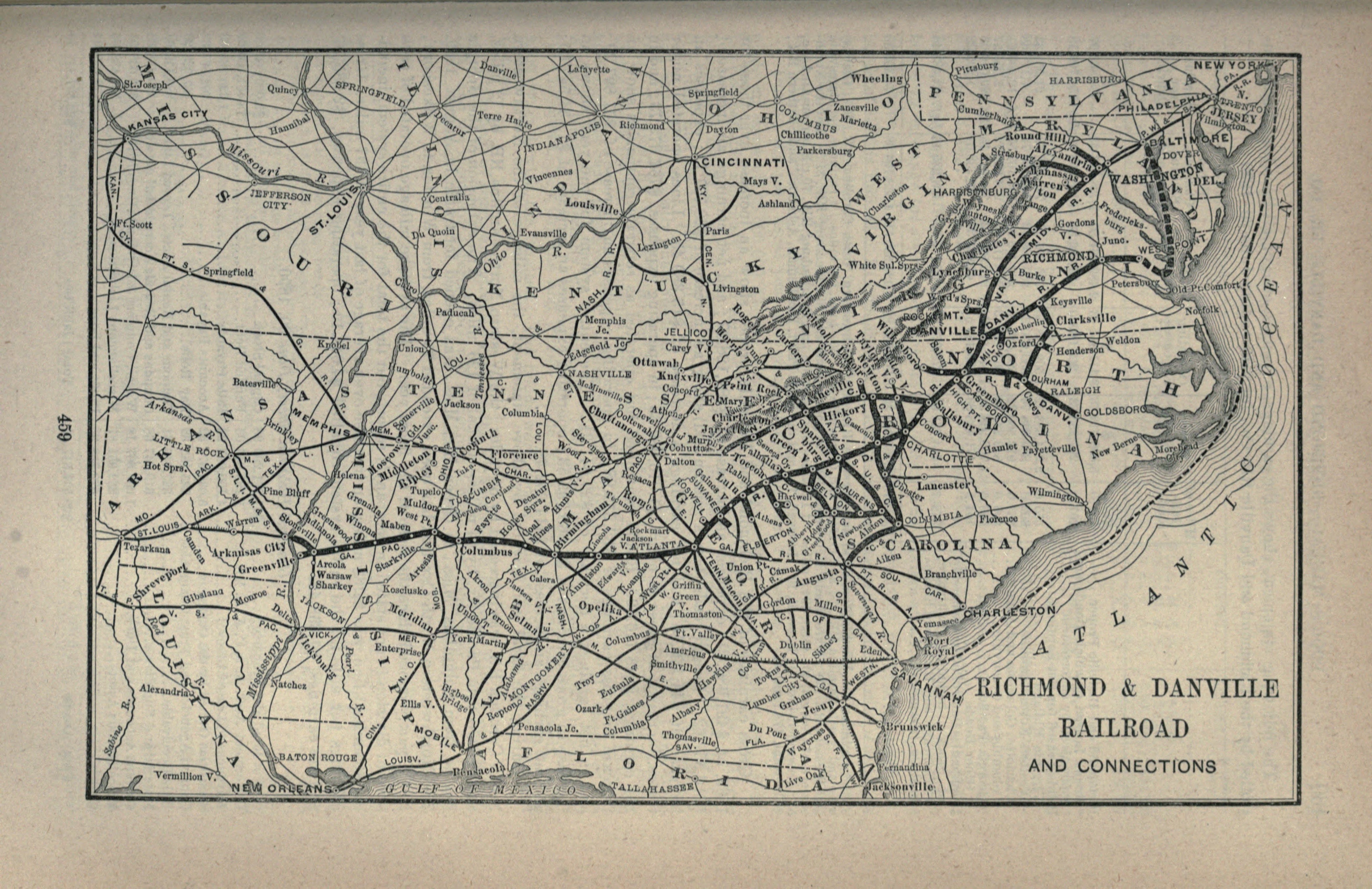
The Richmond and Danville Railroad (R&D) Company was a railroad that operated independently from 1847 until 1894, first in the U.S. state of Virginia, and later on of track in nine states. Chartered on March 9, 1847, the railroad completed its line between Richmond and Danville in 1856.Interstate Commerce Commission. ''Southern Ry. Co.'', Volume 37, Interstate Commerce Commission Valuation Reports, November 6, 1931, p. 555. Washington: United States Government Printing Office, 1932. . During the American Civil War, the railroad was a vital link between the Confederate capital of Richmond and the rest of the Confederacy. After the Civil War, the railroad grew to become the Richmond and Danville Railroad Company System. Placed in receivership in 1892, the Richmond and Danville Railroad Company was sold in 1894 and conveyed into the new Southern Railway Company (later the Norfolk Southern Railway) in 1896 and 1897. History Beginnings (1847-61) The new Richmond and Danville Ra ... [...More Info...] [...Related Items...] OR: [Wikipedia] [Google] [Baidu] |
Prince Edward County, Virginia
Prince Edward County is located in the Commonwealth of Virginia. As of the 2020 census, the population was 21,849. Its county seat is Farmville. History Formation and county seats Prince Edward County was formed in the Virginia Colony in 1754 from Amelia County. It was named for Prince Edward, second son of Frederick, Prince of Wales, and younger brother of George III of the United Kingdom. The original county seat housed the courthouse and was called Prince Edward Courthouse; it is now the village of Worsham. Near the headwaters of the Appomattox River, the Town of Farmville was formed in 1798, and was incorporated in 1912. The county seat was moved from Worsham to Farmville in 1871. Railroads In the 1850s, the Southside Railroad between Petersburg and Lynchburg was built through Farmville between Burkeville and Pamplin City. The route, which was subsidized by a contribution from Farmville, required an expensive crossing of the Appomattox River slightly downst ... [...More Info...] [...Related Items...] OR: [Wikipedia] [Google] [Baidu] |
Battle Of Sayler's Creek
The Battle of Sailor's Creek was fought on April 6, 1865, near Farmville, Virginia, as part of the Appomattox Campaign, near the end of the American Civil War. It was the last major engagement between the Confederate Army of Northern Virginia, commanded by General Robert E. Lee and the Army of the Potomac, under the overall direction of Union General-in-Chief Lieutenant General Ulysses S. Grant. After abandoning Petersburg, the exhausted and starving Confederates headed west, hoping to re-supply at Danville or Lynchburg, before joining General Joseph E. Johnston in North Carolina. But the stronger Union army kept pace with them, exploiting the rough terrain full of creeks and high bluffs, where the Confederates’ long wagon trains were highly vulnerable. The two small bridges over Sailor's Creek and Little Sailor's Creek caused a bottleneck that further delayed the Confederates’ attempt to escape. After some desperate hand-to-hand fighting, about a quarter of the remaining e ... [...More Info...] [...Related Items...] OR: [Wikipedia] [Google] [Baidu] |


.jpg)
