|
Jefferson River
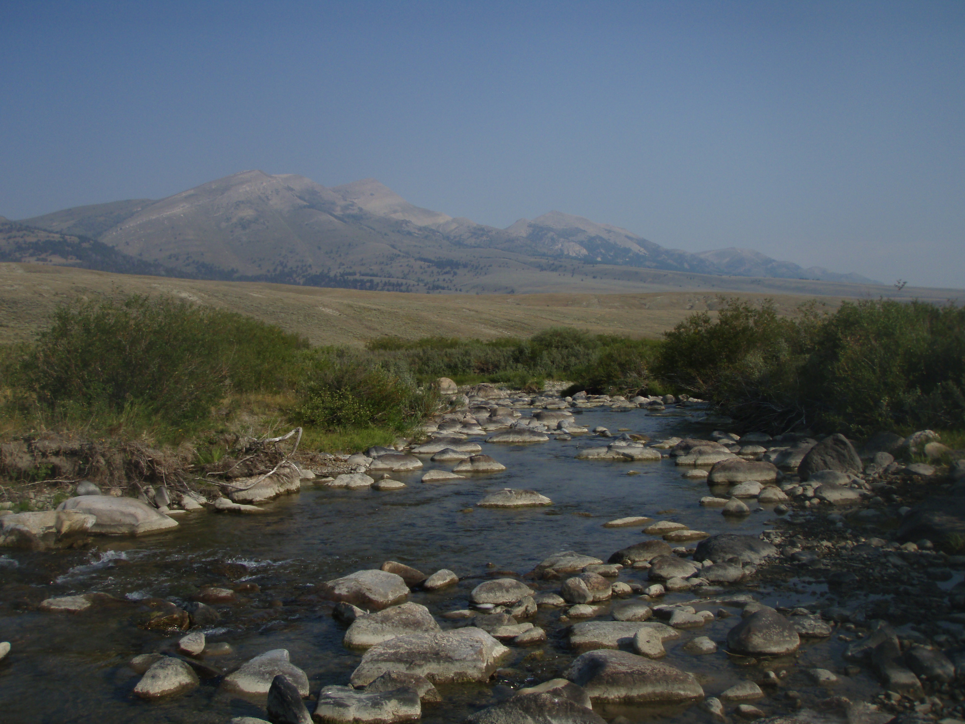
The Jefferson River is a tributary of the Missouri River, approximately long, in the U.S. state of Montana. The Jefferson River and the Madison River form the official beginning of the Missouri at Missouri Headwaters State Park near Three Forks. It is joined downstream (northeast) by the Gallatin. From broad valleys to a narrow canyon, the Jefferson River passes through a region of significant geological diversity, with some of the oldest and youngest rocks of North America and a diversity of igneous, metamorphic, and sedimentary formations. The region was only intermittently inhabited by Native Americans until relatively recent times, and no single tribe had exclusive use of the Jefferson River when the Lewis and Clark Expedition first ascended the river in 1805. Today, the Jefferson River retains much of its scenic beauty and wildlife diversity from the days of Lewis and Clark, yet is threatened by water use issues and encroaching development. The Jefferson is a segment ... [...More Info...] [...Related Items...] OR: [Wikipedia] [Google] [Baidu] |
Big Hole River
The Big Hole River is a tributary of the Jefferson River, approximately long, in Beaverhead County, in southwestern Montana, United States. It is the last habitat in the contiguous United States for native fluvial Arctic grayling and is a historically popular destination for fly fishing, especially for trout. History At the time the Lewis and Clark Expedition traveled through the Big Hole River watershed, it was a buffer zone between several rival Native American tribes including the Nez Percé, Shoshone, Coast Salish, and Blackfeet. Lewis and Clark considered navigating up the Big Hole River, but chose the slower-flowing Beaverhead River instead. Trappers from both the Hudson's Bay Company, the North West Company and the American Fur Company exploited the region from about 1810 to the 1840s. Miners and homesteaders settled the area between 1864 and the early 1900s. The Montana Salish called the river ''Sk͏ʷumcné Sewɫk͏ʷs'', meaning "waters of the pocket gopher". ... [...More Info...] [...Related Items...] OR: [Wikipedia] [Google] [Baidu] |
Centennial Mountains
The Centennial Mountains are the southernmost sub-range of the Bitterroot Range in the U.S. states of Idaho and Montana. The Centennial Mountains include the Western and Eastern Centennial Mountains. The range extends east from Monida Pass along the Continental Divide to Henrys Fork NNW of Ashton, Idaho; bounded on the west by Beaver Creek, on the north by Centennial Valley and Henrys Lake Mountains, on the east by Henrys Lake Flat, and on the south by Shotgun Valley and the Snake River Plain. The highest peak in the range is Mount Jefferson. They are one of only a few ranges within the Rocky Mountains that trend west to east, and the Continental Divide runs along their ridge line. The Western Centennial Mountains extends west from the Eastern Centennial Mountains along the Continental Divide to Monida Pass, 25 mi NE of Dubois, Idaho; Snake River Plain, on the north by Centennial Valley, and the east by a line connecting Odell Creek and an unnamed tributary, in Montana ... [...More Info...] [...Related Items...] OR: [Wikipedia] [Google] [Baidu] |
List Of Rivers By Length
This is a list of the longest rivers on Earth. It includes river systems over in length. Definition of length There are many factors, such as the identification of the source, the identification or the definition of the mouth, and the scale of measurement of the river length between source and mouth, that determine the precise meaning of "river length". As a result, the length measurements of many rivers are only approximations (see also coastline paradox). In particular, there seems to exist disagreement as to whether the Nile or the Amazon is the world's longest river. The Nile has traditionally been considered longer, but in 2007 and 2008 some scientists claimed that the Amazon is longerAmazon Longer Than Nile River, Scientists Say [...More Info...] [...Related Items...] OR: [Wikipedia] [Google] [Baidu] |
Gulf Of Mexico
The Gulf of Mexico ( es, Golfo de México) is an oceanic basin, ocean basin and a marginal sea of the Atlantic Ocean, largely surrounded by the North American continent. It is bounded on the northeast, north and northwest by the Gulf Coast of the United States; on the southwest and south by the Mexico, Mexican States of Mexico, states of Tamaulipas, Veracruz, Tabasco, Campeche, Yucatan, and Quintana Roo; and on the southeast by Cuba. The Southern United States, Southern U.S. states of Texas, Louisiana, Mississippi, Alabama, and Florida, which border the Gulf on the north, are often referred to as the "Third Coast" of the United States (in addition to its Atlantic and Pacific Ocean, Pacific coasts). The Gulf of Mexico took shape approximately 300 million years ago as a result of plate tectonics.Huerta, A.D., and D.L. Harry (2012) ''Wilson cycles, tectonic inheritance, and rifting of the North American Gulf of Mexico continental margin.'' Geosphere. 8(1):GES00725.1, first p ... [...More Info...] [...Related Items...] OR: [Wikipedia] [Google] [Baidu] |
Mississippi River
The Mississippi River is the second-longest river and chief river of the second-largest drainage system in North America, second only to the Hudson Bay drainage system. From its traditional source of Lake Itasca in northern Minnesota, it flows generally south for to the Mississippi River Delta in the Gulf of Mexico. With its many tributaries, the Mississippi's watershed drains all or parts of 32 U.S. states and two Canadian provinces between the Rocky and Appalachian mountains. The main stem is entirely within the United States; the total drainage basin is , of which only about one percent is in Canada. The Mississippi ranks as the thirteenth-largest river by discharge in the world. The river either borders or passes through the states of Minnesota, Wisconsin, Iowa, Illinois, Missouri, Kentucky, Tennessee, Arkansas, Mississippi, and Louisiana. Native Americans have lived along the Mississippi River and its tributaries for thousands of years. Most were hunter-ga ... [...More Info...] [...Related Items...] OR: [Wikipedia] [Google] [Baidu] |
Three Forks, Gallatin County, Montana
Three Forks is a city in Gallatin County, Montana, United States and is located within the watershed valley system of both the Missouri and Mississippi rivers drainage basins — and is historically considered the birthplace or start of the Missouri River. The population was 1,989 at the 2020 census. The city of Three Forks is named so because it lies geographically near the point, in nearby Missouri Headwaters State Park, where the Jefferson, Madison, and Gallatin Rivers converge to form the Missouri River — the longest single river in North America, as well as the major portion of the Missouri-Mississippi River System from the headwaters near Three Forks to its discharge into the Gulf of Mexico. Three Forks is part of the Bozeman, MT Micropolitan Statistical Area of approximately 100,000 people and located thirty miles west of Bozeman. History The three rivers, west to east, were named by Meriwether Lewis in late July 1805 for President Thomas Jefferson, Secretary ... [...More Info...] [...Related Items...] OR: [Wikipedia] [Google] [Baidu] |
Willow Creek, Montana
Willow Creek is a census-designated place (CDP) in Gallatin County, Montana, United States. The population was 210 at the 2010 census. It is part of the Bozeman, MT Micropolitan Statistical Area. History The settlement here began in 1864 and soon grew due to a mining boom in nearby Norwegian Gulch. The Northern Pacific Railroad arrived at Willow Creek in 1883. Geography Willow Creek is located in western Gallatin County at (45.827110, -111.635392), where the valley of Willow Creek (the stream) enters the valley of the Jefferson River. It is southwest of Three Forks and southwest of Interstate 90. According to the United States Census Bureau, the CDP has a total area of , all land. Demographics As of the census of 2000, there were 209 people, 81 households, and 52 families residing in the CDP. The population density was 192.4 people per square mile (74.0/km). There were 84 housing units at an average density of 77.3 per square mile (29.8/km). The racial makeup of the CDP ... [...More Info...] [...Related Items...] OR: [Wikipedia] [Google] [Baidu] |
Lewis And Clark Caverns State Park
Lewis and Clark Caverns State Park is a public recreation and nature preservation area located east of Whitehall in Jefferson County, Montana. The state park includes two visitor centers, ten miles of hiking trails, a campground, and its namesake limestone caverns. The Lewis and Clark Caverns Historic District was placed on the National Register of Historic Places in 2018. History The caverns may have been familiar to Native Americans since long before their discovery by Europeans, though there has been no documented evidence of human presence in the cave before the late 1800s. The Lewis and Clark Expedition camped within sight of the caverns on July 31, 1805, when they camped along Antelope Creek. In 1892, local ranchers Tom Williams and Bert (or Burt) Pannel saw steam coming from the caverns while hunting. Following the discovery, two people from Whitehall, Montana, Charles Brooke and Mexican John claimed that they had discovered the cavern in 1882. However, their claims ar ... [...More Info...] [...Related Items...] OR: [Wikipedia] [Google] [Baidu] |
Whitehall, Montana
Whitehall is a town in Jefferson County, Montana, United States. The population was 1,006 at the 2020 census. It is part of the Helena Micropolitan Statistical Area. The town is nestled in the Jefferson Valley, which is shadowed by the Tobacco Root and Highland Mountain ranges and sits in the heart of the Deerlodge National Forest. It is also within 23–60 miles of three major airports, four colleges, five ski resorts, seven major rivers, mountain lakes for fishing and backpacking, four lakes for boating, and three hot springs. There are numerous snowmobiling trails for winter riding and summer trail rides. The mountain ranges surrounding the valley, provide excellent opportunity for hunting big game. Whitehall's local attractions include Lewis and Clark Caverns State Park, Jefferson River, Ringing Rocks, and the Jefferson Valley Museum. History Whitehall began as a rail depot created by the Northern Pacific and Montana Railroad on September 25, 1889. The name for the de ... [...More Info...] [...Related Items...] OR: [Wikipedia] [Google] [Baidu] |
Ruby River
The Ruby River is a tributary of the Beaverhead River, approximately 76 mi (122 km) long, in southwestern Montana in the United States. It rises in the Beaverhead National Forest in southwestern Madison County between the Snowcrest Range and the Gravelly Range. It flows north through the Ruby River Reservoir, past Alder, then northwest, flowing between the Tobacco Root Mountains to the northeast and the Ruby Range to the southwest. It joins the Beaverhead near Twin Bridges. The Beaverhead becomes the Jefferson River 2 mi (3.2 km) downstream where it joins the Big Hole River. The river has also been known by these various names: Pah-mamar-roi, Pak-sam-ma-oi, Pashmaroi, Passamari, Philanthropy River, Stinking Water Creek, Stinking Water River, Stinkingwater River. The Ruby is a Class II river for stream access for recreational purposes. [...More Info...] [...Related Items...] OR: [Wikipedia] [Google] [Baidu] |
Dillon, Montana
Dillon is a city in and the county seat of Beaverhead County, Montana, United States. The population was 3,880 at the 2020 census. The city was named for Sidney Dillon (1812–1892), president of Union Pacific Railroad. History Dillon was founded in the Beaverhead Valley as a railroad town in 1880. Originally named “Terminus” as it was temporarily the northernmost stop on the Utah and Northern Railway while it was under construction, in 1881, the community was renamed for Union Pacific Railroad President Sidney Dillon, who had directed the project of bringing the railroad through to Butte, Montana. The town's location was selected by the railroad in part because of its proximity to gold mines in the area. The first ore discovered in the Dillon area was silver. Gold was first discovered at Grasshopper Creek in 1862, precipitating a flood of immigration to the area. The last real gold rush in the area occurred near Argenta in 1920 and lasted for 30 years. Dillon serv ... [...More Info...] [...Related Items...] OR: [Wikipedia] [Google] [Baidu] |


