|
Jean-Marie Bayol
Jean-Marie Bayol (24 December 1849 – 3 October 1905) was a French army doctor, colonial administrator and politician. Early years Jean-Marie Bayol was born on 24 December 1849 in Eyguières, Bouches du Rhone, France. He studied medicine in Montpellier, then joined the naval health department in 1869. He was given his doctorate in 1874. He was assigned to the marine artillery. Bayol's first assignment was on the ''Venus'', which visited the coast of West Africa between 1875 and 1876. He undertook some minor explorations of the Como and Romboé tributaries of the Gabon Estuary in 1878 and explored the Crique Obelo to its source. In 1879 he was made a first-class naval doctor. In 1880 he was assigned by Senegal Governor Louis Brière de l'Isle to Captain Joseph Gallieni's expedition in the Upper Niger region. He was give the title of second in command. Explorer Bayol left the naval health service after the Gallieni expedition and joined the colonial administration. In 1881-1 ... [...More Info...] [...Related Items...] OR: [Wikipedia] [Google] [Baidu] |
Eyguières
Eyguières (; oc, Aiguiera) is a commune in the Bouches-du-Rhône department in southern France. Population See also * Alpilles * Communes of the Bouches-du-Rhône department The following is a list of the 119 communes of the Bouches-du-Rhône department of France. The communes cooperate in the following intercommunalities (as of 2020):Official website Communes of Bouches-du-Rhône [...More Info...] [...Related Items...] OR: [Wikipedia] [Google] [Baidu] |
Kaarta
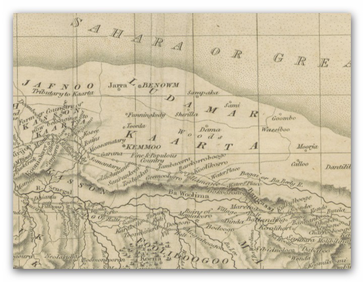
Kaarta, or Ka'arta, was a short-lived Bambara kingdom in what is today the western half of Mali. As Bitòn Coulibaly tightened his control over Ségou, capital of his newly founded Bambara Empire, a faction of Ségou Bambara dissatisfied with his rule fled west. In 1753, they founded the kingdom of Kaarta on the homeland of the long-defunct Ghana Empire, taking Nioro du Sahel as their capital. The kingdom was destroyed as an independent force in 1854 by El Hadj Umar Tall's jihad across West Africa West Africa or Western Africa is the westernmost region of Africa. The United Nations defines Western Africa as the 16 countries of Benin, Burkina Faso, Cape Verde, The Gambia, Ghana, Guinea, Guinea-Bissau, Ivory Coast, Liberia, Mali, M ...; Umar Tall seized Nioro, and put the Kaarta king (Fama) Mamady Kandian and his entire family to death. In 1878 the French governor of Senegal Briere de l'Isle sent a French force against the Kaarta Toucouleur vassal state alo ... [...More Info...] [...Related Items...] OR: [Wikipedia] [Google] [Baidu] |
Abomey
Abomey is the capital of the Zou Department of Benin. The commune of Abomey covers an area of 142 square kilometres and, as of 2012, had a population of 90,195 people. Abomey houses the Royal Palaces of Abomey, a collection of small traditional houses that were inhabited by the Kings of Dahomey from 1600 to 1900, and which were designated a World Heritage Site by UNESCO in 1985.Butler, Stuart (2019) ''Bradt Travel Guide - Benin'', pgs. 135-45 History Abomey was founded in the 17th century as the capital of the Kingdom of Dahomey (1600–1904), on the site of the former village of Kana. Traditional legends state that the town was founded by Do-Aklin, a son of the king of Allada who ventured north to found his own kingdom; the name is thought to come from Danhomé, also spelled Danxomé, meaning "belly of Dan", Dan being the original chief of the village. Dahomey expanded rapidly in the 1700s, absorbing many of the surrounding kingdoms, and growing rich from the slave trade. ... [...More Info...] [...Related Items...] OR: [Wikipedia] [Google] [Baidu] |
Porto-Novo
Porto-Novo (Portuguese: "New Port", , ; yo, Àjàṣẹ́, ), also known as Hogbonu and Ajashe, is the capital of Benin. The commune covers an area of and as of 2002 had a population of 223,552 people. Situated on an inlet of the Gulf of Guinea, in the southeastern portion of the country, the city was originally developed as a port for the transatlantic slave trade led by the Portuguese Empire. It is Benin's second-largest city, and although it is the official capital, where the national legislature sits, the larger city of Cotonou is the seat of government, where most of the government buildings are situated and government departments operate. Etymology The name ''Porto-Novo'' is of Portuguese origin, literally meaning "New Port". It remains untranslated in French, the national language of Benin. History Porto-Novo was once a tributary of the Yoruba kingdom of Oyo, which had offered it protection from the neighbouring Fon, who were expanding their influence and powe ... [...More Info...] [...Related Items...] OR: [Wikipedia] [Google] [Baidu] |
Glele
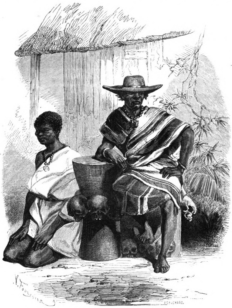
Glele, or Badohou (died December 29, 1889), was the tenth King of Dahomey, ruling from 1858 until his suicide in 1889. Life Badohou, who took the throne name Glele, is considered (if Adandozan is not counted) to be the tenth King of the Aja kingdom of Dahomey (part of modern-day Benin). He succeeded his father, Ghezo, and ruled from 1858 to 1889. Glele continued his father's successful war campaigns, in part to avenge his father's death, in part to capture slaves. During his rule he sustained Dahomey's renaissance as a center of palm oil sales and slave trade. Glele also signed treaties with the French, who had previously acquired a concession in Porto-Novo from its king. The French were successful in negotiating with Glele and receiving a grant for a customs and commerce concession in Cotonou during his reign. Glele resisted British diplomatic overtures, however, distrusting their manners and noting that they were much more activist in their opposition to the slave trade: th ... [...More Info...] [...Related Items...] OR: [Wikipedia] [Google] [Baidu] |
Dahomey
The Kingdom of Dahomey () was a West African kingdom located within present-day Benin that existed from approximately 1600 until 1904. Dahomey developed on the Abomey Plateau amongst the Fon people in the early 17th century and became a regional power in the 18th century by expanding south to conquer key cities like Whydah belonging to the Kingdom of Whydah on the Atlantic coast which granted it unhindered access to the tricontinental triangular trade. For much of the middle 19th century, the Kingdom of Dahomey became a key regional state, after eventually ending tributary status to the Oyo Empire. European visitors extensively documented the kingdom, and it became one of the most familiar African nations to Europeans. The Kingdom of Dahomey was an important regional power that had an organized domestic economy built on conquest and slave labor, significant international trade and diplomatic relations with Europeans, a centralized administration, taxation systems, and an org ... [...More Info...] [...Related Items...] OR: [Wikipedia] [Google] [Baidu] |
Conakry
Conakry (; ; sus, Kɔnakiri; N’ko: ߞߐߣߊߞߙߌ߫, Fula: ''Konaakiri'' 𞤑𞤮𞤲𞤢𞥄𞤳𞤭𞤪𞤭) is the capital and largest city of Guinea. A port city, it serves as the economic, financial and cultural centre of Guinea. Its population as of the 2014 Guinea census was 1,660,973. The current population of Conakry is difficult to ascertain, although the U.S. Department of State's Bureau of African Affairs has estimated it at two million, accounting for one-sixth of the entire population of the country. History Conakry was originally settled on the small Tombo Island and later spread to the neighboring Kaloum Peninsula, a stretch of land wide. The city was essentially founded after Britain ceded the island to France in 1887. In 1885 the two island villages of Conakry and Boubinet had fewer than 500 inhabitants. Conakry became the capital of French Guinea in 1904 and prospered as an export port, particularly after a railway (now closed) to Kankan opened u ... [...More Info...] [...Related Items...] OR: [Wikipedia] [Google] [Baidu] |
French Guinea
French Guinea (french: Guinée française) was a French colonial possession in West Africa. Its borders, while changed over time, were in 1958 those of the current independent nation of Guinea. French Guinea was established by France in 1891, within the same borders as its previous colony known as Rivières du Sud (1882–1891). Prior to 1882, the coastal portions of French Guinea were part of the French colony of Senegal. In 1891, Rivières du Sud was placed under the colonial lieutenant governor at Dakar, who had authority over the French coastal regions east to Porto-Novo (modern Benin). In 1894 Rivières du Sud, Cote d'Ivoire and Dahomey were separated into 'independent' colonies, with Rivières du Sud being renamed as the Colony of French Guinea. In 1895, French Guinea was made one of several dependent colonies and its Governor became one of several Lieutenant Governors who reported to a Governor-General in Dakar. In 1904, this federation of colonies was formalised as ... [...More Info...] [...Related Items...] OR: [Wikipedia] [Google] [Baidu] |
Pierre Camille Victor Huas
Pierre Camille Victor Huas (29 June 1858 – after 1901) was a French Naval medical officer known as a photographer active in nineteenth century West Africa. Naval career Huas joined the French Navy as a 3rd Class Physician in 1880, receiving promotion to 2nd class on 3 May 1884 at Rochefort. 1 January 1885 he was appointed as Medical Staff to the sloop ''Ardent'' stationed in Senegal. On January 1, 1886, he was 1st class doctor in residence at Rochefort. He entered the Naval Reserve at Lorient on July 27, 1901. Photography He accompanied Jean Bayol on his travels through Rivières du Sud Rivières du Sud (English: ''Southern Rivers'') was a French colonial division in West Africa, roughly corresponding to modern coastal sections of Guinea. While the designation was used from the 18th to 20th century, the administrative division o ... in 1885 taking many photographs on the journey. Works * (1886) ''Considérations sur l'hygiène des troupes en campagne'' References {{DEFAU ... [...More Info...] [...Related Items...] OR: [Wikipedia] [Google] [Baidu] |
Timbuktu
Timbuktu ( ; french: Tombouctou; Koyra Chiini: ); tmh, label=Tuareg, script=Tfng, ⵜⵏⴱⴾⵜ, Tin Buqt a city in Mali, situated north of the Niger River. The town is the capital of the Tombouctou Region, one of the eight administrative regions of Mali and one town of Songhai people. It had a population of 54,453 in the 2009 census. Timbuktu began as a seasonal settlement and became a permanent settlement early in the 12th century. After a shift in trading routes, particularly after the visit by Mansa Musa around 1325, Timbuktu flourished from the trade in salt, gold, ivory and slaves. It gradually expanded as an important Islamic city on the Saharan trade route and attracted many scholars and traders. It became part of the Mali Empire early in the 14th century. In the first half of the 15th century, the Tuareg people took control of the city for a short period until the expanding Songhai Empire absorbed the city in 1468. A Moroccan army defeated the Songhai in 1 ... [...More Info...] [...Related Items...] OR: [Wikipedia] [Google] [Baidu] |
Bamako
Bamako ( bm, ߓߡߊ߬ߞߐ߬ ''Bàmakɔ̌'', ff, 𞤄𞤢𞤥𞤢𞤳𞤮 ''Bamako'') is the capital and largest city of Mali, with a 2009 population of 1,810,366 and an estimated 2022 population of 2.81 million. It is located on the Niger River, near the rapids that divide the upper and middle Niger valleys in the southwestern part of the country. Bamako is the nation's administrative centre. The city proper is a cercle in its own right. Bamako's river port is located in nearby Koulikoro, along with a major regional trade and conference center. Bamako is the seventh-largest West African urban center after Lagos, Abidjan, Kano, Ibadan, Dakar, and Accra. Locally manufactured goods include textiles, processed meat, and metal goods as well as mining. Commercial fishing occurs on the Niger River. The name Bamako ( ''Bàmakɔ̌'' in Bambara) comes from the Bambara word meaning "crocodile river". History The area of the city has evidence of settlements since the Palaeolithic ... [...More Info...] [...Related Items...] OR: [Wikipedia] [Google] [Baidu] |


.jpg)


