|
Japan National Route 235
is a national highway connecting Muroran, Hokkaido and Urakawa, Hokkaido in Japan. Route description *Length: *Origin: Muroran, Hokkaido *Terminus: Urakawa, Hokkaido (Terminates at junction with National Route 236 and National Route 336 *Major cities: Muroran, Noboribetsu, Tomakomai History *18 May 1953: Second Class National Highway 235 from Muroran to Urakawa *1 April 1965: First Class National Highway 235 Passes through ; Hokkaidō Prefecture ;; Iburi Subprefecture ::* Muroran, Hokkaidō ::* Noboribetsu, Hokkaidō ;;; Shiraoi District, Hokkaidō :::* Shiraoi, Hokkaidō ::* Tomakomai, Hokkaidō ;;; Yūfutsu District, Hokkaidō :::* Atsuma, Hokkaidō :::* Mukawa, Hokkaidō ;; Hidaka Subprefecture ;;; Saru District, Hokkaidō :::* Hidaka, Hokkaidō ;;; Niikappu District, Hokkaidō :::* Niikappu, Hokkaidō ;;; Hidaka District, Hokkaidō :::* Shinhidaka, Hokkaidō ;;; Urakawa District, Hokkaidō :::* Urakawa, Hokkaidō References * Japanese Wikipedia article ... [...More Info...] [...Related Items...] OR: [Wikipedia] [Google] [Baidu] |
Tomakomai, Hokkaidō
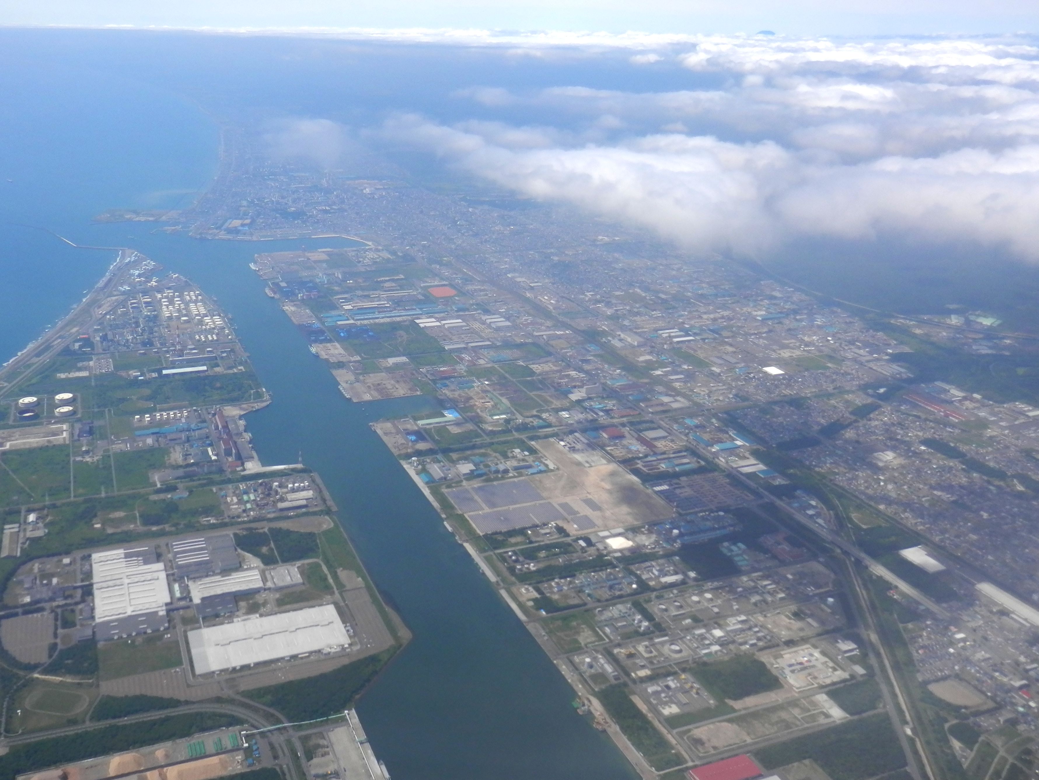
is a city and port in Iburi Subprefecture, Hokkaido, Japan. It is the largest city in the Iburi Subprefecture, and the fourth largest city in Hokkaido. As of 29 February 2012, it had an estimated population of 174,216, with 83,836 households, and a population density of 310.27 persons per km2 (803.60 persons per sq. mi.). The total area is . History The name of Tomakomai is derived from Ainu words "to" and "makomai", meaning "Marsh" and "River which goes into the depths of the mountain", respectively. *1879: Yūfutsu branch of Hokkaidō Development Commission was transferred into Tomakomai (Foundation anniversary). *1902: Tomakomai became second class village. *1918: Tomakomai village became Tomakomai town. *1948: Tomakomai town became Tomakomai city. *1963: Tomakomai Port (West) was opened. *1980: Tomakomai Port (East) was opened. *6 September 2018: Tomakomai City is the nearest city from the epicenter of the 2018 Hokkaido Eastern Iburi earthquake. Geography Mount Tarumae i ... [...More Info...] [...Related Items...] OR: [Wikipedia] [Google] [Baidu] |
Urakawa, Hokkaidō
is a town located in Hidaka Subprefecture, Hokkaido, Japan. As of September 2016, the town has an estimated population of 12,800 and a density of 18 persons per km2. The total area is 694.24 km2. Climate Urakawa has a humid continental climate (Köppen ''Dfb'') with warm summers and cold winters. Owing to its slightly more southerly latitude, easterly aspect and location on the sea, snowfall is much lighter than in the major cities of western Hokkaido like Sapporo, Hakodate, Asahikawa and Wakkanai, with the most in one month being in January 1969. Precipitation in heaviest in the summer months when remnant typhoons may approach; the heaviest daily rainfall being on 5 August 1981 and the wettest month being in August 1995. The driest month has been in February 2003. Year-round sunshine, although less than in the Tokachi Plain, is also higher than western Hokkaido, with the dullest month being 48.0 hours in August 1941 and the sunniest, in April 2014, being 288.0 hours, w ... [...More Info...] [...Related Items...] OR: [Wikipedia] [Google] [Baidu] |
Urakawa District, Hokkaidō
is a district located in Hidaka Subprefecture, Hokkaido, Japan. As of 2004, the district has an estimated population of 15,986 and a density of 23.03 persons per km2. The total area is 694.23 km2. Towns and villages *Urakawa is a town located in Hidaka Subprefecture, Hokkaido, Japan. As of September 2016, the town has an estimated population of 12,800 and a density of 18 persons per km2. The total area is 694.24 km2. Climate Urakawa has a humid continental cl ... Districts in Hokkaido {{Hokkaido-geo-stub ... [...More Info...] [...Related Items...] OR: [Wikipedia] [Google] [Baidu] |
Shinhidaka, Hokkaidō
is a town located in Hidaka Subprefecture, Hokkaido, Japan. Shinhidaka is the most populous town, and the economic center of Hidaka Subprefecture. History The river valleys of what is now Shinhidaka were occupied by the Ainu. From the 19th century, people from Japan began to settle in the region. On March 31, 2006, the town of Mitsuishi merged with the town of Shizunai to create the new town of Shinhidaka. Geography Shinhidaka is in southeastern Hokkaido, between the Pacific Ocean to the South and the Hidaka Mountains to the North. Several rivers rise in the mountains and empty into the sea, including the Shizunai River and the Mitsuishi River. Shinhidaka has total area of 1,147.74 km2.Official Home Page of Shinhidaka , last access 30 May 2008. Its highest location is [...More Info...] [...Related Items...] OR: [Wikipedia] [Google] [Baidu] |
Hidaka District, Hokkaidō
is a newly created district located in Hidaka Subprefecture, Hokkaido, Japan. As of October 31, 2006, the district has an estimated population of 27,150 and a density Density (volumetric mass density or specific mass) is the substance's mass per unit of volume. The symbol most often used for density is ''ρ'' (the lower case Greek letter rho), although the Latin letter ''D'' can also be used. Mathematical ... of 23.7 persons per km2. The total area is 1,147.74 km2. Towns and villages * Shinhidaka - merger of the former towns of Mitsuishi (from the former Mitsuishi District) and Shizunai (from the former Shizunai District) Districts in Hokkaido {{Hokkaido-geo-stub ... [...More Info...] [...Related Items...] OR: [Wikipedia] [Google] [Baidu] |
Niikappu, Hokkaidō
is a town located in Hidaka Subprefecture, Hokkaido, Japan. History The town was established September 1881. Geography Niikappu stretches from the Pacific Ocean of southeast Hokkaido north to the Hidaka Mountains along the Niikappu River. The town covers a total area of 585.88 km2. Its highest point is Mount Poroshiri, and the lowest is at the coast. The town runs East-West and North-South Economy The town is mainly known for production of racehorses, including Haiseiko, Narita Brian, and Oguri Cap. Other popular exports include kelp, Capsicum, green capsicum, and milk. Art and Culture Niikappu has a large collection of gramophone record, records, preserved in Japan's largest vinyl record museum. In the Taiyo district of Niikappu lies the Forest of the Sun Dimaccio Museum, a converted elementary school dedicated to housing the works of French artist Gerard Dimaccio. Other features of Niikappu include: * A mud volcano ''deikazan'' (Supposedly the only one in Japan.) * ... [...More Info...] [...Related Items...] OR: [Wikipedia] [Google] [Baidu] |

