|
Jangalkanya Setu
Jangalkanya Setu or ''Bhasaraghat Bridge '' is a bridge located in Nayagram in Jhargram district, West Bengal.This bridge was launched in 2016. The bridge is about 1.47 km (0.915 mi) long built on Subarnarekha river. It is the longest bridge in West Bengal. On this day, about 95 kilometers of road to reach Kharagpur via Gobibalppur from Nayagram.To reach Kharagpur via the Nayagram-Keshiariyi, it is only 45 km to reach the 1.47 km long junctional bridge.The bridge was under the control of Midnapore Highway Sub-Division 2 P.W(ROADS)DTE. Construction Subarnarekha River was blocked by Nayagram and Keshri. The river blocked the communication of this area. In 2011, Chief Minister Mamata Banerjee announced the construction of the bridge of Vasraghat. But there were already temporary bridges which were constructed every year and during the rainy season, the concrete bridge would be broken. The construction of the bridge was completed in 2016. Bridge was inaugura ... [...More Info...] [...Related Items...] OR: [Wikipedia] [Google] [Baidu] |
Nayagram
Nayagram is a village and a gram panchayat in the Nayagram CD block in the Jhargram subdivision of the Jhargram district in West Bengal, India. Geography Location Nayagram is located at Area overview Jhargram subdivision, the only one in Jhargram district, shown in the map alongside, is composed of hills, mounds and rolling lands. It is rather succinctly described in the ''District Human Development Report'', 2011 (at that time it was part of Paschim Medinipur district), “The western boundary is more broken and picturesque, for the lower ranges of the Chhotanagpur Hills line the horizon, the jungle assumes the character of forest, and large trees begin to predominate. The soil, however, is lateritic, a considerable area is unproductive, almost uninhabited, especially in the extreme north-west where there are several hills over 1000 feet in height. The remainder of the country is an almost level plain broken only by the sand hills.” 3.48% of the population lives in urba ... [...More Info...] [...Related Items...] OR: [Wikipedia] [Google] [Baidu] |
Jhargram District
Jhargram is a district in the state of West Bengal, India.The district lies between the Kangsabati River in the north and the Subarnarekha in the south. Jhargram has one of the lowest population densities among the districts of West Bengal, with almost all its population living in rural areas. It is a popular tourist destination known for its sal forests, elephants, ancient temples and royal palaces. The district was formed on 4 April 2017, after bifurcation from the Paschim Medinipur district as the 22nd district of West Bengal. The district has its headquarters at Jhargram. Geography Jhargram district covers an area of 3037.64 Sq. km. Out of which 268249 hectare is agricultural land and 59497 hectare is under forest coverage. The district is a part of Chota Nagpur Plateau which gradually slopes down towards east, hilly terrain occurs in the north-western part of the district. Kakrajhore area is having the highest altitude of about 300 metres. This area is covered with ... [...More Info...] [...Related Items...] OR: [Wikipedia] [Google] [Baidu] |
West Bengal
West Bengal (, Bengali: ''Poshchim Bongo'', , abbr. WB) is a state in the eastern portion of India. It is situated along the Bay of Bengal, along with a population of over 91 million inhabitants within an area of . West Bengal is the fourth-most populous and thirteenth-largest state by area in India, as well as the eighth-most populous country subdivision of the world. As a part of the Bengal region of the Indian subcontinent, it borders Bangladesh in the east, and Nepal and Bhutan in the north. It also borders the Indian states of Odisha, Jharkhand, Bihar, Sikkim and Assam. The state capital is Kolkata, the third-largest metropolis, and seventh largest city by population in India. West Bengal includes the Darjeeling Himalayan hill region, the Ganges delta, the Rarh region, the coastal Sundarbans and the Bay of Bengal. The state's main ethnic group are the Bengalis, with the Bengali Hindus forming the demographic majority. The area's early history featured a succession ... [...More Info...] [...Related Items...] OR: [Wikipedia] [Google] [Baidu] |
Indian Rupee
The Indian rupee ( symbol: ₹; code: INR) is the official currency in the republic of India. The rupee is subdivided into 100 ''paise'' (singular: ''paisa''), though as of 2022, coins of denomination of 1 rupee are the lowest value in use whereas 2000 rupees is the highest. The issuance of the currency is controlled by the Reserve Bank of India. The Reserve Bank manages currency in India and derives its role in currency management on the basis of the Reserve Bank of India Act, 1934. Etymology The immediate precursor of the rupee is the ''rūpiya''—the silver coin weighing 178 grains minted in northern India by first Sher Shah Suri during his brief rule between 1540 and 1545 and adopted and standardized later by the Mughal Empire. The weight remained unchanged well beyond the end of the Mughals until the 20th century. Though Pāṇini mentions (), it is unclear whether he was referring to coinage. ''Arthashastra'', written by Chanakya, prime minister to the first Maurya ... [...More Info...] [...Related Items...] OR: [Wikipedia] [Google] [Baidu] |
Kharagpur
Kharagpur () is a planned urban agglomeration and a major industrial city in Paschim Medinipur district of West Bengal, India. It is the headquarters of the Kharagpur subdivision. It is the largest, most populated, multicultural and cosmopolitan city of the district.It is located 120 kms west of state capital Kolkata and 1300 kms south east of national capital New Delhi. The first Indian Institute of Technology (IIT Kharagpur), one of the Institutes of National Importance, was founded in Kharagpur in May 1950. It has one of the largest railway workshops in India, and the fourth longest railway platform in the world (1072.5 m). Also it is the headquarters of the Kharagpur Division of South Eastern Railway. History Kharagpur received its name from the twelfth king of the Mallabhum dynasty, Kharga Malla, when he conquered it. Kharagpur was a part of the Hijli Kingdom and ruled by Hindu Odia rulers as a feudatory under Gajapati Kings of Odisha. Historians claim that in th ... [...More Info...] [...Related Items...] OR: [Wikipedia] [Google] [Baidu] |
Mamata Banerjee
Mamata Banerjee (; born 5 January 1955) is an Indian politician who is serving as the eighth and current List of chief ministers of West Bengal, chief minister of the States and union territories of India, Indian state of West Bengal since 20 May 2011, the first woman to hold the office. Having served many times as a Union Cabinet Minister, Mamata Banerjee became the Chief Minister of West Bengal for the first time in 2011. She founded the All India Trinamool Congress (AITC or TMC) in 1998 after separating from the Indian National Congress, and became its first chairperson. She is often referred to as 'Didi' (meaning ''elder sister'' in Bengali language, Bengali). Banerjee previously served twice as Minister of Railways (India), Minister of Railways, the first woman to do so. She is also the second female Ministry of Coal, Minister of Coal, and Ministry of Education, Minister of Human Resource Development, Ministry of Youth Affairs and Sports, Youth Affairs and Sports, Ministr ... [...More Info...] [...Related Items...] OR: [Wikipedia] [Google] [Baidu] |
Midnapore
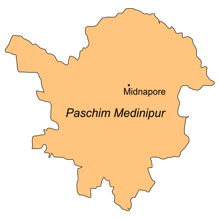
Medinipur or Midnapore (Pron: med̪iːniːpur) is a city known for its history in the Indian state of West Bengal. It is the headquarters of the West Medinipur district. It is situated on the banks of the Kangsabati River (variously known as ''Kasai'' and ''Cossye''). The Urban Agglomeration of Midnapore consists of the city proper, Mohanpur, Keranichoti and Khayerullachak. Etymology The English name Midnapore is a corruption of the original name of the town which was Madanipur. It was named after Haji Mustafa Madani, a 17th-century Bengali Muslim scholar who was gifted tax-free land in the present area in addition to an estate there which included a mosque. Madani is the ancestor of Mohammad Abu Bakr Siddique of Furfura Sharif. According to Sri Hari Sadhan Das, the city got its name from Medinikar, the founder of the city in 1238, who was the son of Prankara, the feudal king of Gondichadesh (now Odisha). He was also the writer of "Medinikosh". Hara Prasad Shastri thinks that t ... [...More Info...] [...Related Items...] OR: [Wikipedia] [Google] [Baidu] |

.jpg)
