|
Jamundí
Jamundí is a town and municipality in the Department of Valle del Cauca, Colombia. Jamundí is located south of Cali (the capital of the department) in the west riverside of the Cauca River The average temperature is 23° Celsius. History Jamundi was founded on March 23, 1536; four months before Cali, by the Spanish conquistadors Pedro de Añasco and Juan de Ampudia. The name comes from the ''cacique'' Jamundí, chief of the tribe that lived in the territory before the arrival of the Spanish.Official website Jamundí Geography The municipality is characterized by a flat surface, although some mountainous terrain at the west, the "''Farallones de Cali''", ...[...More Info...] [...Related Items...] OR: [Wikipedia] [Google] [Baidu] |
Cali
Santiago de Cali (), or Cali, is the capital of the Valle del Cauca department, and the most populous city in southwest Colombia, with 2,227,642 residents according to the 2018 census. The city spans with of urban area, making Cali the second-largest city in the country by area and the third most populous after Bogotá and Medellín. As the only major Colombian city with access to the Pacific Coast, Cali is the main urban and economic center in the south of the country, and has one of Colombia's fastest-growing economies. The city was founded on 25 July 1536 by the Spanish explorer Sebastián de Belalcázar. As a sporting center for Colombia, it was the host city for the 1971 Pan American Games. Cali also hosted the 1992 World Wrestling Championships, the 2013 edition of the World Games, the UCI Track Cycling World Championships in 2014, the World Youth Championships in Athletics in 2015 as well as the inaugural Junior Pan American Games in 2021 and the 2022 World Athletic ... [...More Info...] [...Related Items...] OR: [Wikipedia] [Google] [Baidu] |
Cholado
{{Colombia-stub ...
Cholado or Raspao is an icy beverage with fresh fruit and sweetened condensed milk traditional from Jamundí, in the region of Valle del Cauca, Colombia. It is made from crushed ice or shaved ice, chopped fruit, condensed milk, fruit syrup, and served with a wafer cookie, sometimes topped with whipped cream and shredded cheese. The common fruits that are used in the preparation include banana, apple, kiwi, strawberry, papaya, pineapple, mango, and soursop. See also *Colombian cuisine * Granizado *Halo halo *Chamoyada References Cholado Cholado Cholado or Raspao is an icy beverage with fresh fruit and sweetened condensed milk traditional from Jamundí, in the region of Valle del Cauca, Colombia. It is made from crushed ice or shaved ice, chopped fruit, condensed milk, fruit syrup, and ... [...More Info...] [...Related Items...] OR: [Wikipedia] [Google] [Baidu] |
Municipalities Of Colombia
The Municipalities of Colombia are decentralized subdivisions of the Republic of Colombia. Municipalities make up most of the departments of Colombia with 1,122 municipalities (''municipios''). Each one of them is led by a mayor (''alcalde'') elected by popular vote and represents the maximum executive government official at a municipality level under the mandate of the governor of their department which is a representative of all municipalities in the department; municipalities are grouped to form departments. The municipalities of Colombia are also grouped in an association called the ''Federación Colombiana de Municipios'' (Colombian Federation of Municipalities), which functions as a union under the private law and under the constitutional right to free association to defend their common interests. Categories Conforming to the law 1551/12 that modified the sixth article of the law 136/94 Article 7 http://www.alcaldiabogota.gov.co/sisjur/normas/Norma1.jsp?i=48267 the mu ... [...More Info...] [...Related Items...] OR: [Wikipedia] [Google] [Baidu] |
Farallones De Cali
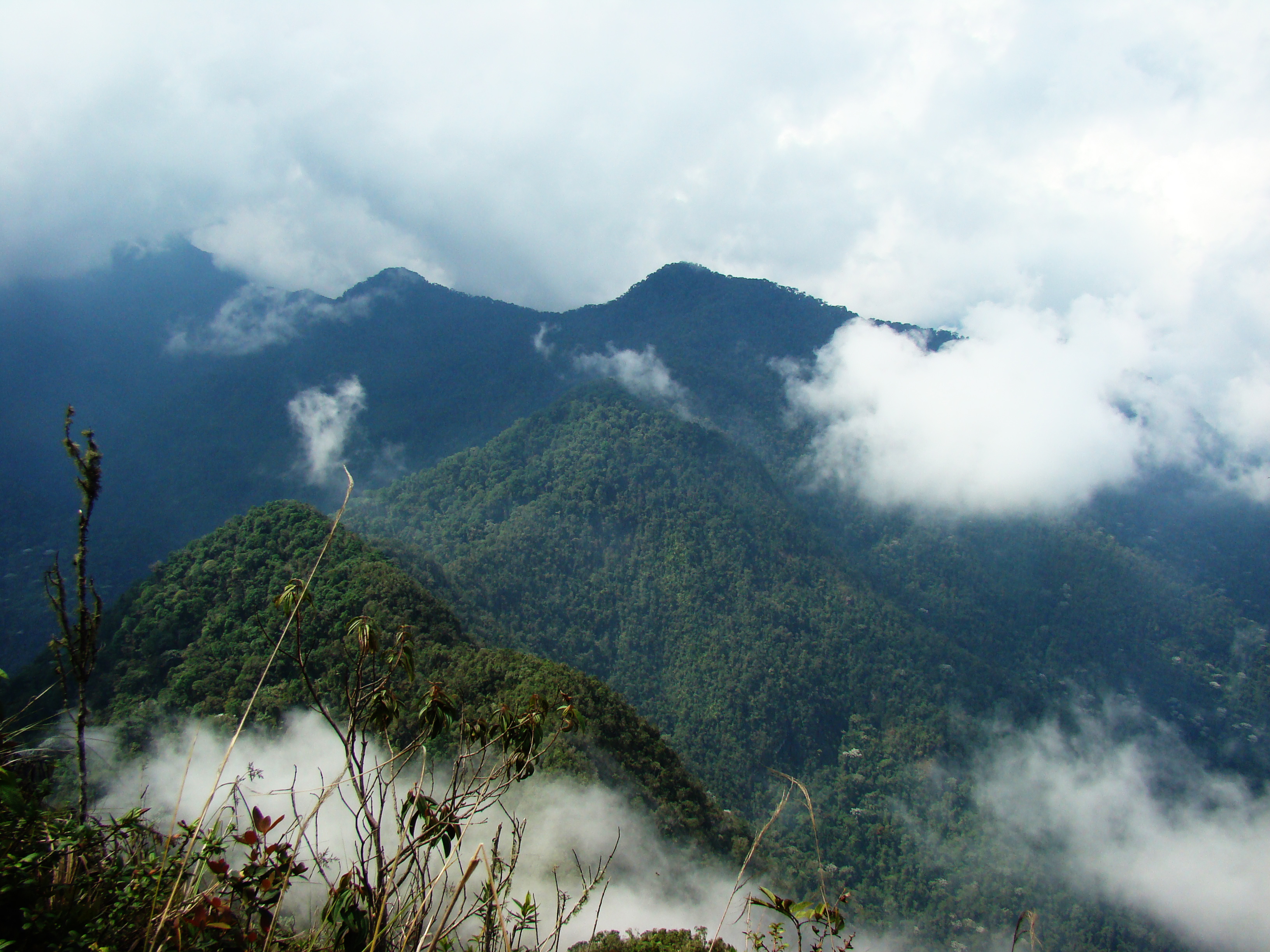
Farallones de Cali is a cluster of mountains in the West Andes of Colombia. It is located west of the city of Cali and gives rise to many of the rivers that provide water and electricity to Cali. The PNN Farallones de Cali encompasses in the mountains as well as much of the Pacific slope and is an area of very high biodiversity. The average temperature ranges from in the tropical foothills to in the páramo. In this territory are located the district of Pichinde, Andes and Leonera, and two villages Penas Blancas and Lomas de la Cajita. Climate and topography Average yearly rainfall is in the Pacific region and in the mountainous sector. Plants growing in the area have sufficient water throughout the year. The topography of the park is characterized by the high, craggy peaks, the highest being . These peaks are referred to as ''Los Farallones'' (which means ''cliffs''), the namesake of the mountains and national park. The foothills on the eastern side meet the Cauca Va ... [...More Info...] [...Related Items...] OR: [Wikipedia] [Google] [Baidu] |
Juan De Ampudia
Captain Juan de Ampudia (died 1541) was a Spanish explorer and conquistador. He was born in Jérez de la Frontera, Spain. De Ampudia participated in the Spanish founding of many towns and cities. He took part in the conquests of Nicaragua, Perú, Ecuador and Colombia. De Ampudia accompanied Pedro de Alvarado to Perú and then took part of the foundation of the city of San Francisco de Quito on December 6, 1534. His name can be read in the atrium of the Metropolitan Cathedral in Quito. Juan de Ampudia was, with Diego de Tapia, one of the first mayors (''alcaldes'') of the Quito city government. He also created the first tile factory on the side of a hill now called "El Tejar". He helped Sebastián de Belalcázar to pacify the area around Quito and killed Zopozopanqui, a local chieftain, leading to the rebellion against the Spanish. He died in Popayán. Captain De Ampudia joined Pedro de Añasco's expedition and founded the town of Timbío on November 1, 1535. He undertook many ex ... [...More Info...] [...Related Items...] OR: [Wikipedia] [Google] [Baidu] |
National Administrative Department Of Statistics
The National Administrative Department of Statistics ( es, Departamento Administrativo Nacional de Estadística), commonly referred to as DANE, is the Colombian Administrative Department responsible for the planning, compilation, analysis and dissemination of the official statistics of Colombia. DANE is responsible for conducting the National Population and Housing census every ten years, among several other studies. See also * Administrative Department of Security References Colombia Colombia (, ; ), officially the Republic of Colombia, is a country in South America with insular regions in North America—near Nicaragua's Caribbean coast—as well as in the Pacific Ocean. The Colombian mainland is bordered by the Car ... Demographics of Colombia National Administrative Department of Statistics Government agencies established in 1953 1953 establishments in Colombia {{Colombia-stub ... [...More Info...] [...Related Items...] OR: [Wikipedia] [Google] [Baidu] |
Cauca River
The Cauca River () is a river in Colombia that lies between the Occidental and Central cordilleras. From its headwaters in southwestern Colombia near the city of Popayán, it joins the Magdalena River near Magangue in Bolivar Department, and the combined river eventually flows out into the Caribbean Sea. It has a length of to its junction with the Magdalena, for a total length of . from origin to seamouth. The river is under the supervision of the ''Cauca Regional Corporation'' and the ''Cauca Valley Regional Autonomous Corporation'', and is navigable for above its junction with the Magdalena. File:Rio cauca popayan.JPG File:Salvajina.jpg File:Río Cauca. Puente Anacaro (3). Cartago - Ansermanuevo, Valle, Colombia.JPG File:Río Cauca.JPG File:Puentes en La Pintada 01.jpg File:Puente de Occidente.JPG File:El río Cauca.jpg Environmental issues On November 18, 2007, Colombian newspaper '' El Tiempo'' reported that the river was receiving an average of 500 tons of residual was ... [...More Info...] [...Related Items...] OR: [Wikipedia] [Google] [Baidu] |
List Of Conquistadors In Colombia
This is a list of conquistadors who were active in the conquest of terrains that presently belong to Colombia. The nationalities listed refer to the state the conquistador was born into; Granada and Castile are currently part of Spain, but were separate states at the time of birth of the early conquistadors. Important conquistadors and explorers were Alonso de Ojeda, who landed first at Colombian soil and founded the first settlement ''Santa Cruz'',Personajes de la Conquista a América – |
Colombia
Colombia (, ; ), officially the Republic of Colombia, is a country in South America with insular regions in North America—near Nicaragua's Caribbean coast—as well as in the Pacific Ocean. The Colombian mainland is bordered by the Caribbean Sea to the north, Venezuela to the east and northeast, Brazil to the southeast, Ecuador and Peru to the south and southwest, the Pacific Ocean to the west, and Panama to the northwest. Colombia is divided into 32 departments and the Capital District of Bogotá, the country's largest city. It covers an area of 1,141,748 square kilometers (440,831 sq mi), and has a population of 52 million. Colombia's cultural heritage—including language, religion, cuisine, and art—reflects its history as a Spanish colony, fusing cultural elements brought by immigration from Europe and the Middle East, with those brought by enslaved Africans, as well as with those of the various Amerindian civilizations that predate colonization. Spanish is th ... [...More Info...] [...Related Items...] OR: [Wikipedia] [Google] [Baidu] |
Cordillera Occidental (Colombia)
The Cordillera Occidental ( en, Western Ranges) is the lowest in elevation of the three branches of the Colombian Andes. The average altitude is and the highest peak is Cerro Tatamá at . The range extends from south to north dividing from the Colombian Massif in Nariño Department, passes north through Cauca, Valle del Cauca, Risaralda, Chocó, and Caldas Departments to the Paramillo Massif in Antioquia and Córdoba Departments. From this massif the range divides further to form the Serranías de Ayapel, San Jerónimo and Abibe. Only to recede into the Caribbean plain and the Sinú River valley. Geography The western part of the mountain range belongs to the Pacific region of Colombia and its Chocó–Darién moist forests ecoregion, with the San Juan River being the main watershed, while the eastern part belongs to the Cauca River basin. The northern and northwestern parts belong to the Atlantic Slope, with the Atrato and Sinú Rivers being the main water ... [...More Info...] [...Related Items...] OR: [Wikipedia] [Google] [Baidu] |
Stream
A stream is a continuous body of water, body of surface water Current (stream), flowing within the stream bed, bed and bank (geography), banks of a channel (geography), channel. Depending on its location or certain characteristics, a stream may be referred to by a variety of local or regional names. Long large streams are usually called rivers, while smaller, less voluminous and more intermittent river, intermittent streams are known as streamlets, brooks or creeks. The flow of a stream is controlled by three inputs – surface runoff (from precipitation or meltwater), daylighting (streams), daylighted subterranean river, subterranean water, and surfaced groundwater (Spring (hydrology), spring water). The surface and subterranean water are highly variable between periods of rainfall. Groundwater, on the other hand, has a relatively constant input and is controlled more by long-term patterns of precipitation. The stream encompasses surface, subsurface and groundwater fluxes th ... [...More Info...] [...Related Items...] OR: [Wikipedia] [Google] [Baidu] |


_nahe_dem_Weiherdamm_in_Wildbergerhütte.jpg)