|
James Rolfe (legislator)
James Rolfe (1821 – April 1, 1888) was an American farmer from Polk, Wisconsin, Polk, Wisconsin, who spent a single one-year term in 1855 as an independent (politics), independent member of the Wisconsin State Senate from the Wisconsin Senate, District 4, 4th District. Background Rolfe, born in Hillsboro, Massachusetts, in 1821, was the son of Stephen and Mary A. (Reed) Rolfe. He came to Wisconsin Territory in 1846, and located in Milwaukee, living there for seven years, when he moved to the town of Polk and acquired 400 acres of land. In 1849 he married Matilda Meade. Public service In November 1854 Rolfe was one of three committee members appointed by Washington County's Board of Supervisors who negotiated a final settlement of financial controversies deriving from the division of Ozaukee County, Wisconsin, Ozaukee County from that county in the spring of 1853. He held various Administrative divisions of Wisconsin#Towns, town offices as well. At the time of Rolfe's 18 ... [...More Info...] [...Related Items...] OR: [Wikipedia] [Google] [Baidu] |
Polk, Wisconsin
Polk is a town in Washington County, Wisconsin, United States. The population was 3,938 at the 2000 census. The unincorporated communities of Ackerville, Cedar Creek, Cedar Lake, Diefenbach Corners, Mayfield, and Rugby Junction are located in the town. The town derives its name from James K. Polk, 11th U.S. president, who was in office when the town incorporated in 1846. History In the early 19th century, Polk was home to Potawatomi Native Americans, who surrendered the land the United States Federal Government in 1833 through the 1833 Treaty of Chicago, which (after being ratified in 1835) required them to leave Wisconsin by 1838. While many Potawatomis moved west of the Mississippi River to Kansas, some chose to remain, and were referred to as "strolling Potawatomi" in contemporary documents because many of them were migrants who subsisted by squatting on their ancestral lands, which were now owned by white settlers. One band of strolling Potawatomi travelled through Do ... [...More Info...] [...Related Items...] OR: [Wikipedia] [Google] [Baidu] |
West Bend, Wisconsin
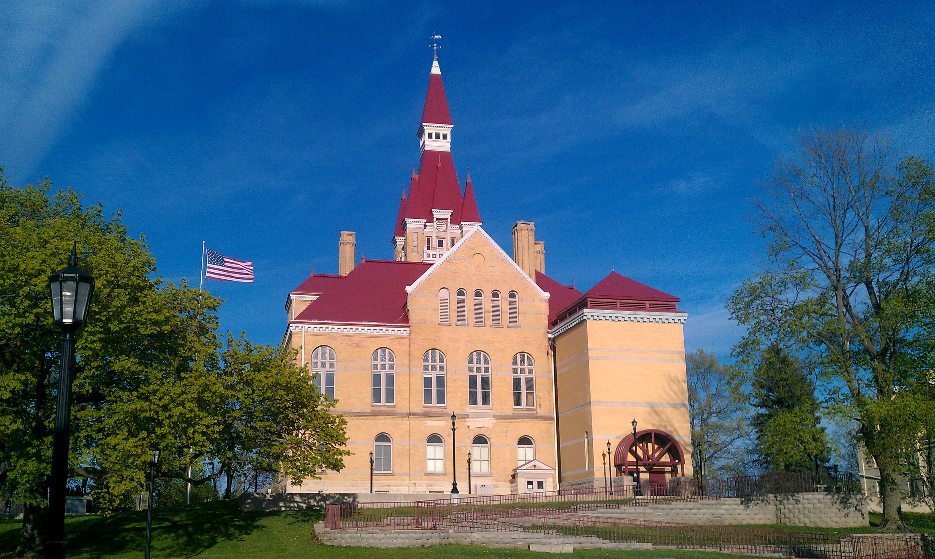
West Bend is the county seat of Washington County, Wisconsin. As of the 2020 census, the population was 31,752. History Early history and settlement Northeastern Washington County's earliest known inhabitants were pre-Columbian Mound Builders, who constructed effigy mounds in the area sometime between 650 CE and 1300 CE. They were semi-nomadic and survived by hunting, fishing, and gathering wild plants. They made pottery and constructed tools from bone, wood, stone, and occasionally copper. They built effigy mounds shaped like mammals, reptiles, birds and other creatures, both real and mythical, as well as conical, oval, and linear mounds, some of which contain human burials. Some mounds in the West Bend area were destroyed by settlers to create farm fields, but several dozen survive and are listed on the National Register of Historic Places as the Washington County "Island" Effigy Mound District, which includes the Lizard Mound County Park site in nearby Farmington ... [...More Info...] [...Related Items...] OR: [Wikipedia] [Google] [Baidu] |
Johnstown Center, Wisconsin
Johnstown Center is an unincorporated community located in the town of Johnstown, Rock County, Wisconsin Wisconsin () is a state in the upper Midwestern United States. Wisconsin is the 25th-largest state by total area and the 20th-most populous. It is bordered by Minnesota to the west, Iowa to the southwest, Illinois to the south, Lake M ..., United States. In 1854, land was purchased in Johnstown Center by the Rock County Board to establish the Rock County Poor Farm and Alms House. The institution became the Rock County Asylum in 1881. Notes Unincorporated communities in Rock County, Wisconsin Unincorporated communities in Wisconsin {{RockCountyWI-geo-stub ... [...More Info...] [...Related Items...] OR: [Wikipedia] [Google] [Baidu] |
Slinger, Wisconsin
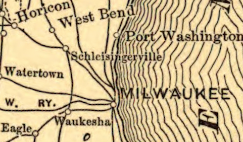
Slinger (formerly Schleisingerville) is a village in Washington County, Wisconsin, United States. The population was 5,992 at the 2020 census. Toponymy The village was originally known as Schleisingerville, after Baruch Schleisinger Weil, a merchant and politician who developed the community as a railroad stop in the 1840s and 1850s. Locals sometimes abbreviated the four-syllable name to "Slinger," and on May 3, 1921, the village residents overwhelmingly voted to make Slinger the official name. History In the early 19th century, the Slinger area was home to Potawatomi Native Americans, who surrendered the land the United States Federal Government in 1833 through the 1833 Treaty of Chicago, which (after being ratified in 1835) required them to leave Wisconsin by 1838. While many Potawatomis moved west of the Mississippi River to Kansas, some chose to remain, and were referred to as "strolling Potawatomi" in contemporary documents because many of them were migrants who subsiste ... [...More Info...] [...Related Items...] OR: [Wikipedia] [Google] [Baidu] |
Baruch Schleisinger Weil
Baruch Schleisinger Weil, born Baruch Schleisinger, also known as Benjamin S. Weil, () was a French American immigrant, farmer, real estate broker, and politician. He is the founder and namesake of Slinger, Wisconsin; he served three years in the Wisconsin State Senate and four years in the Assembly representing Washington County. Biography Born in Strasbourg, Alsace, France, in a Jewish family, as Baruch Schleisinger, he legally changed his name to Baruch Schleisinger Weil. In 1843, he emigranted to the United States, settling first in New York City and then in New Orleans. Then in 1845 he moved to Wisconsin Territory. Weil platted the village of Schleisingerville, Wisconsin (now Slinger, Wisconsin) in Washington County, Wisconsin, where he had various business interests. Since the nearest Jewish community was in Milwaukee, he arranged for teachers to come the roughly 35 miles by ox team to instruct his children. In 1853, 1856, 1857, Weil served as a Democratic member o ... [...More Info...] [...Related Items...] OR: [Wikipedia] [Google] [Baidu] |
Cholera
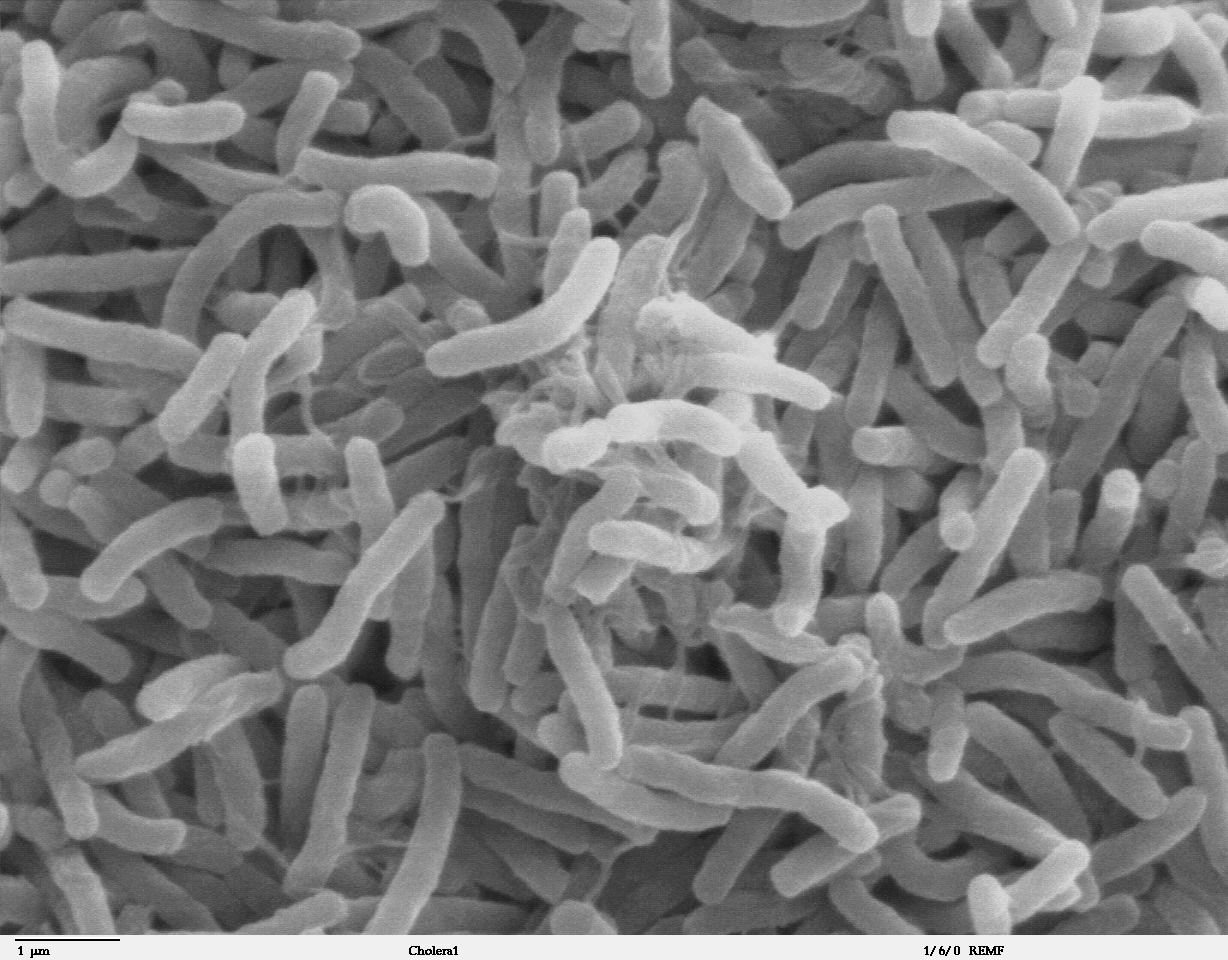
Cholera is an infection of the small intestine by some strains of the bacterium ''Vibrio cholerae''. Symptoms may range from none, to mild, to severe. The classic symptom is large amounts of watery diarrhea that lasts a few days. Vomiting and muscle cramps may also occur. Diarrhea can be so severe that it leads within hours to severe dehydration and electrolyte imbalance. This may result in sunken eyes, cold skin, decreased skin elasticity, and wrinkling of the hands and feet. Dehydration can cause the skin to turn bluish. Symptoms start two hours to five days after exposure. Cholera is caused by a number of types of ''Vibrio cholerae'', with some types producing more severe disease than others. It is spread mostly by unsafe water and unsafe food that has been contaminated with human feces containing the bacteria. Undercooked shellfish is a common source. Humans are the only known host for the bacteria. Risk factors for the disease include poor sanitation, not enough clea ... [...More Info...] [...Related Items...] OR: [Wikipedia] [Google] [Baidu] |
Meeker, Wisconsin
Meeker was a hamlet in Washington County, Wisconsin, United States. The area is now part of the Village of Germantown Germantown or German Town may refer to: Places Australia * Germantown, Queensland, a locality in the Cassowary Coast Region United States * Germantown, California, the former name of Artois, a census-designated place in Glenn County * Ger ..., at latitude 43.2217 and longitude -88.1731, centered on what is now the intersection of Mequon Road and Meeker Hill Lane. Notable people * Baltus Mantz, Wisconsin State Senator, lived in Meeker.'Wisconsin Blue Book 1913,' Members of Wisconsin Legislatures, pg. 459 References Populated places in Washington County, Wisconsin Neighborhoods in Wisconsin {{WashingtonCountyWI-geo-stub ... [...More Info...] [...Related Items...] OR: [Wikipedia] [Google] [Baidu] |
Democratic Party (United States)
The Democratic Party is one of the two major contemporary political parties in the United States. Founded in 1828, it was predominantly built by Martin Van Buren, who assembled a wide cadre of politicians in every state behind war hero Andrew Jackson, making it the world's oldest active political party.M. Philip Lucas, "Martin Van Buren as Party Leader and at Andrew Jackson's Right Hand." in ''A Companion to the Antebellum Presidents 1837–1861'' (2014): 107–129."The Democratic Party, founded in 1828, is the world's oldest political party" states Its main political rival has been the Republican Party since the 1850s. The party is a big tent, and though it is often described as liberal, it is less ideologically uniform than the Republican Party (with major individuals within it frequently holding widely different political views) due to the broader list of unique voting blocs that compose it. The historical predecessor of the Democratic Party is considered to be th ... [...More Info...] [...Related Items...] OR: [Wikipedia] [Google] [Baidu] |
Baltus Mantz
Baltus (Balthus) Mantz (January 29, 1815 – August 9, 1854) was an American politician. Mantz was a farmer, from Meeker, Wisconsin. He was born in Germany in 1815 and immigrated to the United States in 1837. Mantz served as register of deeds for Washington County, Wisconsin and in town government. He then served in the Wisconsin State Senate, in 1854, from Washington County, Wisconsin. He backed a plan to drain the lakes at Muskego, Wisconsin Muskego () is a city in Waukesha County, Wisconsin, United States. As of the 2010 census, the city had a population of 24,135. Muskego is the fifth largest community in Waukesha County, Wisconsin. Muskego has a large Norwegian population. The nam .... Mantz died of cholera on August 8 or August 9, 1854 while still in office.''The Cedarburg Weekly News'' (Cedarburg, Ozaukee County, Wisconsin), Local Matters, March 19, 1884. Notes References 1815 births 1854 deaths People from Germantown, Wisconsin County officials in Wisconsin ... [...More Info...] [...Related Items...] OR: [Wikipedia] [Google] [Baidu] |
Washington County, Wisconsin
Washington County is a county in the U.S. state of Wisconsin. As of the 2020 census, the population was 136,761. Its county seat is West Bend. The county was created from Wisconsin Territory in 1836 and organized in 1845. It was named after President George Washington. Washington County is part of the Milwaukee- Waukesha-West Allis, WI Metropolitan Statistical Area. History Washington County was created on December 7, 1836, by the Wisconsin Territory Legislature, with Port Washington designated as the county seat. It was run administratively from Milwaukee County until 1840, when an Act of Organization allowed the county self-governance, and the county seat was moved to Grafton, then called Hamburg. This solution was not satisfactory, as at that time four cities were vying to become the county seat: Port Washington, Grafton, Cedarburg, and West Bend. At least four inconclusive elections were held between 1848 and 1852, but the results were unusable due to accusations of f ... [...More Info...] [...Related Items...] OR: [Wikipedia] [Google] [Baidu] |
Wayne, Washington County, Wisconsin
Wayne is a town in Washington County, Wisconsin, United States. The population was 1,727 at the 2000 census. The unincorporated communities of Kohlsville and Wayne are located in the town. History In the early 19th century when the first white settlers arrived in Southeastern Wisconsin, the Potawatomi and Menominee Native Americans inhabited the land now occupied by the Town of Wayne. In 1831, the Menominee surrendered their claims to the land to the United States Federal Government through the Treaty of Washington. The Potawatomi surrendered their land claims in 1833 through the 1833 Treaty of Chicago, which (after being ratified in 1833) required them to leave the area by 1838. While many Native people moved west of the Mississippi River to Kansas, some chose to remain, and were referred to as "strolling Potawatomi" in contemporary documents because many of them were migrants who subsisted by squatting on their ancestral lands, which were now owned by white settlers. Eventual ... [...More Info...] [...Related Items...] OR: [Wikipedia] [Google] [Baidu] |
Kewaskum, Wisconsin
Kewaskum is a village in Washington and Fond du Lac counties in Wisconsin, United States. The population was 4,004 at the 2010 census. All of this population resided in the Washington County portion of the village. The village is mostly surrounded by the Town of Kewaskum. Toponymy Kewaskum was the leader of a group of Potawatomi Native Americans who lived in Washington County in the 1840s. He was friendly with the early settlers, including future Wisconsin state senator Densmore Maxon. He died sometime between 1847 and 1850. In 1849, the early settlers named the Town of Kewaskum (and later the village) in his honor. In the Potawatomi language, Kewaskum means "turning back on his tracks" or "retracing his steps." History In the early 19th century, the Kewaskum area was home to Potawatomi Native Americans, who surrendered the land the United States Federal Government in the 1833 Treaty of Chicago, which required them to leave Wisconsin by 1838. While many Potawatomis moved ... [...More Info...] [...Related Items...] OR: [Wikipedia] [Google] [Baidu] |


