|
James Graham Fairley
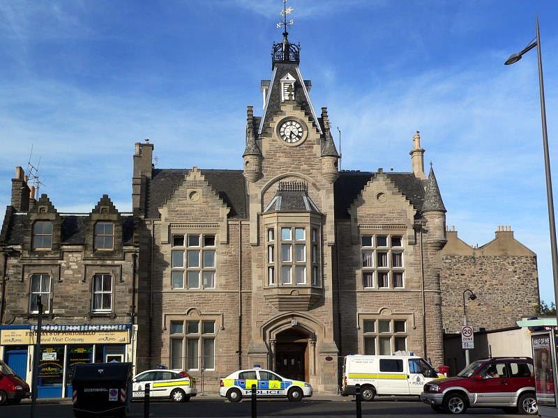
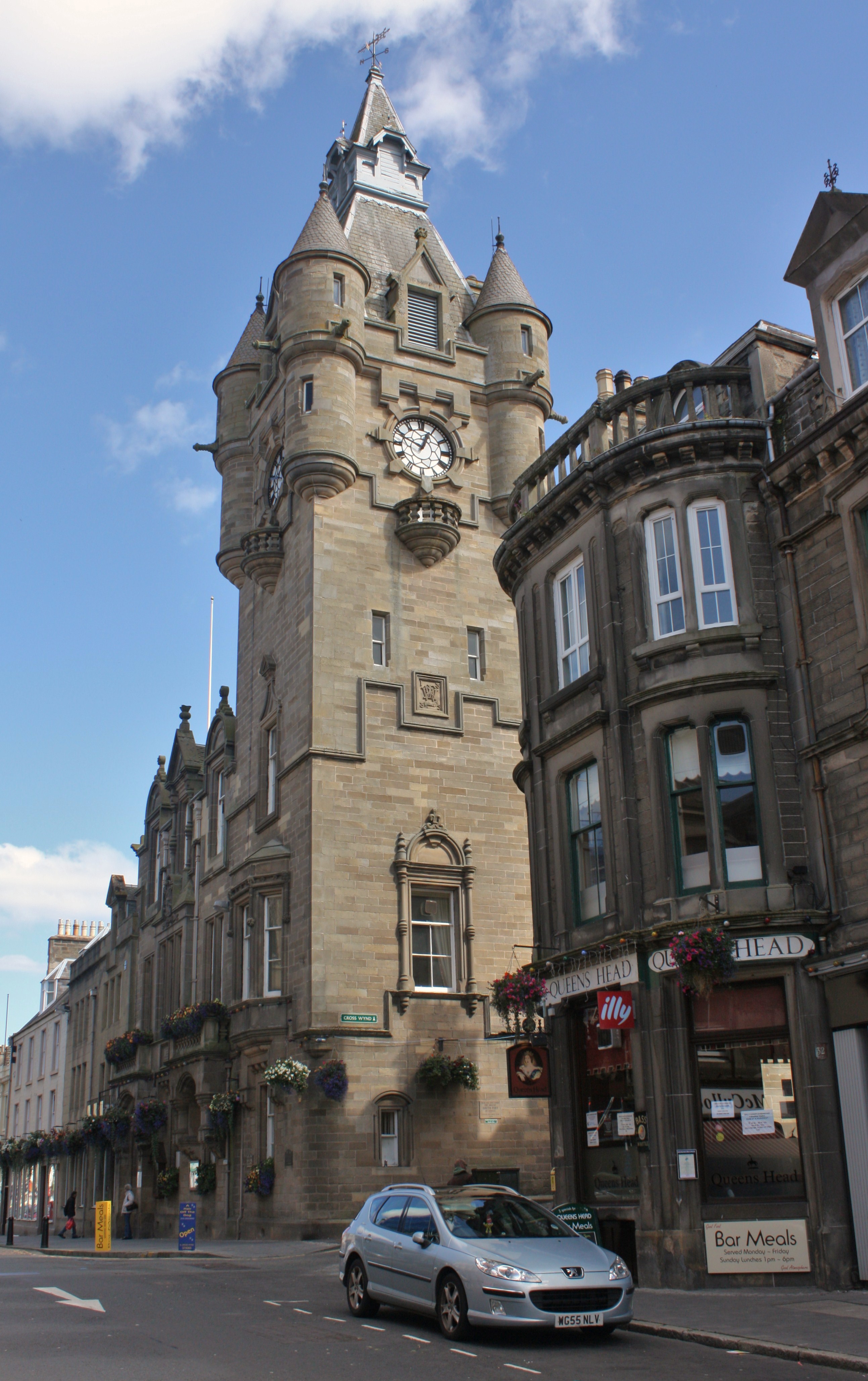
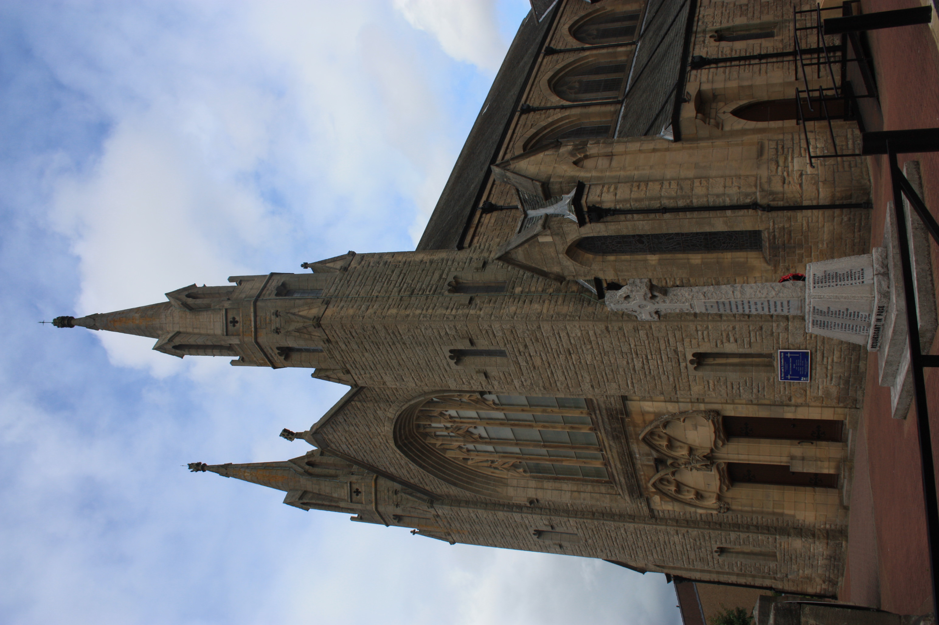
James Graham Fairley FRIBA MSGS (1846–1934) was a 19th/20th century Scottish architect working mainly in the West Lothian area, specialising in churches and schools. Life He was born in West Calder in West Lothian the son of William Fairley, a mill-wright and engineer, and his wife, Elizabeth Graham. He was educated at Edinburgh Academy. He was then apprenticed as an architect to Robert Thornton Shiells at 7 Gilmore Place in Edinburgh. He did further training in the City Engineer's Department under Robert Matheson, whilst also taking engineering classes at the University of Edinburgh alongside Robert Louis Stevenson (who briefly trained as an engineer in his family's tradition). He then went to London for six months in 1873, working under Sir Edmund Frederick du Cane, before returning to Edinburgh to set up his own practice at 21 Rintoul Place in the Stockbridge Colonies. In 1875 he moved to larger and grander offices at 1 India Buildings at the head of Victoria Stree ... [...More Info...] [...Related Items...] OR: [Wikipedia] [Google] [Baidu] |
Portobello, Edinburgh
Portobello is a coastal suburb of Edinburgh in eastern central Scotland. It lies 3 miles (5 km) east of the city centre, facing the Firth of Forth, between the suburbs of Joppa and Craigentinny. Although historically it was a town in its own right, it is officially a residential suburb of Edinburgh. The promenade fronts onto a wide sandy beach. History Early years The area was originally known as Figgate Muir, an expanse of moorland through which the Figgate Burn flowed, from Duddingston Loch fed by the Braid Burn to the west, to the sea, with a broad sandy beach on the Firth of Forth. The name "Figgate" has been thought to come from an Old English term for "cow's ditch", but the land was used as pasture for cattle by the monks of Holyrood Abbey and the name is more likely to mean "cow road", as in Cowgate in Edinburgh. In 1650 it was the supposed scene of a secret meeting between Oliver Cromwell and Scottish leaders. A report from 1661 describes a race in which ... [...More Info...] [...Related Items...] OR: [Wikipedia] [Google] [Baidu] |
High School Of Dundee
The High School of Dundee is an independent, co-educational, day school in Dundee, Scotland, which provides nursery, primary and secondary education to just over one thousand pupils. Its foundation has been dated to 1239, and it is the only private school in Dundee. The school's rector is a member of the Headmasters' and Headmistresses' Conference. The school has been registered as a charity in Scotland since July 1897. History The Grammar School The school has origins in the Grammar School of Dundee founded by the abbot and monks of Lindores Abbey after they were granted a charter by Gregory, Bishop of Brechin, in the early 1220s to "plant schools wherever they please in the burgh". Their rights were confirmed by a papal bull conferred by Pope Gregory IX on 14 February 1239. It is from this bull that the school's Latin motto "''Prestante Domino''", translated as "Under the Leadership of God", is taken. Little information survives about the early grammar school: it would ... [...More Info...] [...Related Items...] OR: [Wikipedia] [Google] [Baidu] |
Hawick
Hawick ( ; sco, Haaick; gd, Hamhaig) is a town in the Scottish Borders council area and historic county of Roxburghshire in the east Southern Uplands of Scotland. It is south-west of Jedburgh and south-south-east of Selkirk. It is one of the farthest towns from the sea in Scotland, in the heart of Teviotdale, and is the biggest town in the former county of Roxburghshire. The town is at the confluence of the Slitrig Water with the River Teviot. The town was formally established in the 16th century, but was previously the site of historic settlement going back hundreds of years. By the late 17th century, the town began to grow significantly, especially during the Industrial Revolution and Victorian era as a centre for the production of textiles, with a focus on knitting and weaving, involving materials such as tweed and cashmere. By the late 20th century, textile production had declined but the town remains an important regional centre for shopping, tourism and services. ... [...More Info...] [...Related Items...] OR: [Wikipedia] [Google] [Baidu] |
Leith
Leith (; gd, Lìte) is a port area in the north of the city of Edinburgh, Scotland, founded at the mouth of the Water of Leith. In 2021, it was ranked by ''Time Out'' as one of the top five neighbourhoods to live in the world. The earliest surviving historical references are in the royal charter authorising the construction of Holyrood Abbey in 1128 in which it is termed ''Inverlet'' (Inverleith). After centuries of control by Edinburgh, Leith was made a separate burgh in 1833 only to be merged into Edinburgh in 1920. Leith is located on the southern coast of the Firth of Forth and lies within the City of Edinburgh Council area; since 2007 it has formed one of 17 multi-member wards of the city. History As the major port serving Edinburgh, Leith has seen many significant events in Scottish history. First settlement The earliest evidence of settlement in Leith comes from several archaeological digs undertaken in The Shore area in the late 20th century. Amongst the f ... [...More Info...] [...Related Items...] OR: [Wikipedia] [Google] [Baidu] |
Bathgate
Bathgate ( sco, Bathket or , gd, Both Chèit) is a town in West Lothian, Scotland, west of Livingston, Scotland, Livingston and adjacent to the M8 motorway (Scotland), M8 motorway. Nearby towns are Armadale, West Lothian, Armadale, Blackburn, West Lothian, Blackburn, Linlithgow, Livingston, West Calder and Whitburn, West Lothian, Whitburn. Situated south of the ancient Neolithic burial site at Cairnpapple Hill, Bathgate and the surrounding area show signs of habitation since about 3500 BC and the world's oldest known reptile fossil has been found in the town. By the 12th century, Bathgate was a small settlement, with a church at Kirkton and a castle south of the present day town centre. Local mines were established in the 17th century but the town remained small in size until the coming of the industrial revolution. By the Victorian era, Bathgate grew in prominence as an industrial and mining centre, principally associated with the coal and Shale oil extraction, shale oil indu ... [...More Info...] [...Related Items...] OR: [Wikipedia] [Google] [Baidu] |
Ratho
Ratho ( gd, Ràthach) is a village in the Rural West Edinburgh area of Edinburgh, Scotland. Its population at the 2011 census was 1,634 based on the 2010 definition of the locality. It was formerly in the old county of Midlothian. Ratho Station, Newbridge and Kirkliston are other villages in the area. The Union Canal passes through Ratho. Edinburgh Airport is situated only 4 miles (7 km) away. The village has a high ratio of its older houses built from whin stone due to a whin quarry nearby. The older, historical, part of the village was designated a Conservation Area in 1971 by Midlothian County Council. Origins Ratho appears in written records from 1243 with various spellings such as Rath (ewe, eu, ew, ow, au) but most consistently, from 1292, with its present name Ratho. Other places nearby having "Ratho" in their names include Ratho Byres, Ratho Park and Ratho Bank (now named Ashley). It is believed that the name Ratho comes from ''Rath'', Scottish Gaelic, for a ... [...More Info...] [...Related Items...] OR: [Wikipedia] [Google] [Baidu] |
Currie
Currie ( gd, Currach, IPA: �kʰuːᵲəx is a village and suburb on the outskirts of Edinburgh, Scotland, situated south west of the city centre. Formerly within the County of Midlothian, it now falls within the jurisdiction of the City of Edinburgh Council. It is situated between Juniper Green to the northeast and Balerno to the southwest. It gives its name to a civil parish. In 2001, the population of Currie was 8,550 and it contained 3,454 houses. Etymology The name is recorded from 1210 onwards under various spellings such as ''Curey'', ''Cory'', ''Curri'' with ''Currie'' in 1402. There is no accepted derivation of the name Currie but it is possibly from the Scottish Gaelic word ''curagh/curragh'', a wet or boggy plain, or from the Brythonic word ''curi'', a dell or dirt hole. The neighbouring suburb of Balerno derives its name from Scottish Gaelic, whilst the nearby Pentland Hills derive their name from Brythonic, so either is possible. History The earliest re ... [...More Info...] [...Related Items...] OR: [Wikipedia] [Google] [Baidu] |
Colinton
Colinton ( gd, Baile Cholgain) is a suburb of Edinburgh, Scotland situated south-west of the city centre. Up until the late 18th century it appears on maps as Collington. It is bordered by Dreghorn to the south and Craiglockhart to the north-east. To the north-west it extends to Lanark Road (the A70) and to the south-west to the City Bypass. Bonaly is a subsection of the area on its southern side. Colinton is a designated conservation area. History Originally sited within a steep-sided glen on a convenient fording point on the Water of Leith, and expanding from there, Colinton's history dates back to before the 11th century. Close to the Water of Leith is Colinton Parish Church, correctly called St Cuthbert's Parish Church, which was founded as the Church of Halis (Hailes) around 1095 by Elthelred, third son of Malcolm III and Queen Margaret. The current exterior largely dates from 1907 but the structure dates from 1650. The entrance is marked by a lych gate, rar ... [...More Info...] [...Related Items...] OR: [Wikipedia] [Google] [Baidu] |
Juniper Green
Juniper Green is a village on the outskirts of Edinburgh, Scotland, situated about south-west of the city centre. It bridges the city bypass, and extends along the foothills of the Pentlands. It is bordered by Colinton to the east, Baberton immediately to the north, and Currie to the south-west. It centres on Lanark Road, the main route leading out south-west of Edinburgh into the Central Borders. The village stands on an elevated ridge above the Water of Leith to its south. Administratively, Juniper Green falls within the jurisdiction of the City of Edinburgh Council having been officially absorbed into the city in 1920. History Juniper Green's earliest mention is in the Kirk records of Colinton in 1707. However, it is largely called Curriemuirend up until the end of the 18th century and the area only really developed as a village from around 1810. Indeed Adair's map published in 1735 shows no sign of the village, nor does Laurie's more accurate map of 1766. Only one h ... [...More Info...] [...Related Items...] OR: [Wikipedia] [Google] [Baidu] |
Polkemmet
Whitburn (originally Whiteburn) is a small town in West Lothian, Scotland, halfway between Scotlands's two largest cities, about east of Glasgow and west of Edinburgh. The nearest major towns are Bathgate, and Livingston, . History Originally a small farming & weaving community centred around the burn that runs through, it was once a district of Linlithgow until 1973 and a parish of Livingston until 1730 when it established into its own as the population began to rise. When reliable statistics began with the Statistical Accounts of Scotland the population was counted at 1,322 in 1755 followed by a more accurately count of 1,322 in 1795. Whitburn has appeared on maps since the 17th century of the Early Modern period and appears on a manuscript authored by Scottish map maker John Adair in 1680. The earliest documented reference to Whitburn is dated 26 September 1363 and can be found in the Index of Charters by King David II of Scotland. It grants William de Carnys and his he ... [...More Info...] [...Related Items...] OR: [Wikipedia] [Google] [Baidu] |
Armadale, West Lothian
Armadale ( sco, Airmadale, gd, Armadal) is a town within the county of West Lothian in the Central Belt of Scotland. It lies to the west of Bathgate and to the east of Blackridge. Armadale, formerly known as Barbauchlaw, is an ex-mining town which was also known for its brick manufacturing. It is named after Armadale in Sutherland, this estate being owned by Sir William Honeyman who later acquired the land of Barbauchlaw. Primarily a residential community, the town has a number of different public places, a central Mains Street and a series of parks, green spaces and nature reserves, many of which lie atop former mines and industrial areas. History To the north of Armadale (Woodend Farm) is the site of Ogilface Castle. Woodend Farm has another site nearer Blackridge, marked as 'Ogelface in ruins' on a 1773 map. These sites have been the subject of archaeological geophysics surveys and kite aerial photography by the Edinburgh Archaeological Field Society and the West Lothian ... [...More Info...] [...Related Items...] OR: [Wikipedia] [Google] [Baidu] |


