|
James Gardner (surveyor)
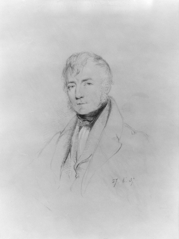
James Gardner was an English surveyor, lithographer, cartographer, engraver and publisher who played an active role in the trigonometrical survey of Great Britain. His career spanned the years 1808 to 1840. Career Colonel William Mudge appointed Gardner as a surveyor in 1808, on the recommendation of civil engineer John Rennie."James Gardner 1808-1840" David L Walker, ''Sheetlines'', 101 (December 2014), pp31-38 With his 36-inch , he began working on the of |
Surveying
Surveying or land surveying is the technique, profession, art, and science of determining the terrestrial two-dimensional or three-dimensional positions of points and the distances and angles between them. A land surveying professional is called a land surveyor. These points are usually on the surface of the Earth, and they are often used to establish maps and boundaries for ownership, locations, such as the designed positions of structural components for construction or the surface location of subsurface features, or other purposes required by government or civil law, such as property sales. Surveyors work with elements of geodesy, geometry, trigonometry, regression analysis, physics, engineering, metrology, programming languages, and the law. They use equipment, such as total stations, robotic total stations, theodolites, GNSS receivers, retroreflectors, 3D scanners, LiDAR sensors, radios, inclinometer, handheld tablets, optical and digital levels, subsurface locators, d ... [...More Info...] [...Related Items...] OR: [Wikipedia] [Google] [Baidu] |
Counties Of England
The counties of England are areas used for different purposes, which include administrative, geographical, cultural and political demarcation. The term "county" is defined in several ways and can apply to similar or the same areas used by each of these demarcation structures. These different types of county each have a more formal name but are commonly referred to just as "counties". The current arrangement is the result of incremental reform. The original county structure has its origins in the Middle Ages. These counties are often referred to as the historic, traditional or former counties. The Local Government Act 1888 created new areas for organising local government that it called administrative counties and county boroughs. These administrative areas adopted the names of, and closely resembled the areas of, the traditional counties. Later legislative changes to the new local government structure led to greater distinction between the traditional and the administrative ... [...More Info...] [...Related Items...] OR: [Wikipedia] [Google] [Baidu] |
Great Reform Act
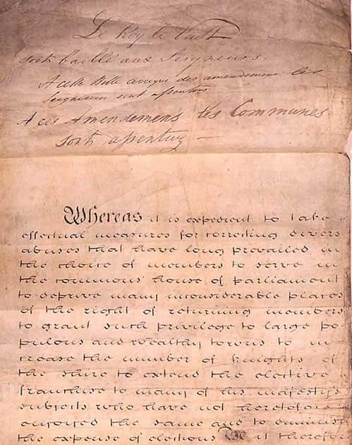
The Representation of the People Act 1832 (also known as the 1832 Reform Act, Great Reform Act or First Reform Act) was an Act of Parliament of the United Kingdom (indexed as 2 & 3 Will. IV c. 45) that introduced major changes to the electoral system of England and Wales. It abolished tiny districts, gave representation to cities, gave the vote to small landowners, tenant farmers, shopkeepers, householders who paid a yearly rental of £10 or more, and some lodgers. Only qualifying men were able to vote; the Act introduced the first explicit statutory bar to women voting by defining a voter as a male person. It was designed to correct abuses – to "take effectual Measures for correcting divers Abuses that have long prevailed in the Choice of Members to serve in the Commons House of Parliament". Before the reform, most members nominally represented boroughs. The number of electors in a borough varied widely, from a dozen or so up to 12,000. Frequently the selection of Memb ... [...More Info...] [...Related Items...] OR: [Wikipedia] [Google] [Baidu] |
Royal Geographical Society
The Royal Geographical Society (with the Institute of British Geographers), often shortened to RGS, is a learned society and professional body for geography based in the United Kingdom. Founded in 1830 for the advancement of geographical sciences, the Society has 16,000 members, with its work reaching the public through publications, research groups and lectures. The Society was founded in 1830 under the name ''Geographical Society of London'' as an institution to promote the 'advancement of geographical science'. It later absorbed the older African Association, which had been founded by Sir Joseph Banks in 1788, as well as the Raleigh Club and the Palestine Association. In 1995 it merged with the Institute of British Geographers, a body for academic geographers, to officially become the Royal Geographical Society ''with IBG''. The society is governed by its Council, which is chaired by the Society's President, according to a set of statutes and standing orders. The members ... [...More Info...] [...Related Items...] OR: [Wikipedia] [Google] [Baidu] |
Aaron Arrowsmith
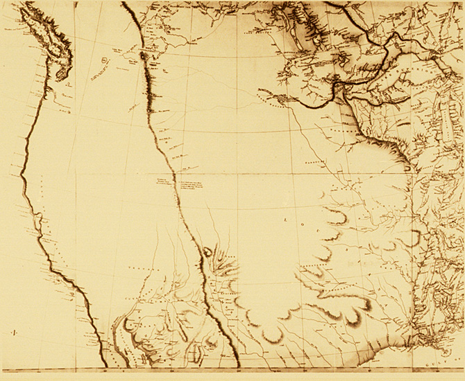
Aaron Arrowsmith (1750–1823) was an English cartographer, engraver and publisher and founding member of the Arrowsmith family of geographers. Life He moved to Soho Square, London from Winston, County Durham, when about twenty years of age, and was employed by John Cary, the engraver and William Faden. He became Hydrographer to the Prince of Wales and subsequently to the King in 1820. In January 1790 he made himself famous by his large chart of the world on Mercator projection. Four years later he published another large map of the world on the globular projection, with a companion volume of explanation. Improperly called "Arrowsmith's projection," the globular projection used by Arrowsmith was invented by Giovan Battista Nicolosi, of Paternò, Sicily, in 1660, while Arrowsmith did not use it until 1794. The maps of North America (1796) and Scotland (1807) are the most celebrated of his many later productions. In 1804, 63 maps drawn by Arrowsmith and Samuel Lewis of Phi ... [...More Info...] [...Related Items...] OR: [Wikipedia] [Google] [Baidu] |
Eastern Hemisphere
The Eastern Hemisphere is the half of the planet Earth which is east of the prime meridian (which crosses Greenwich, London, United Kingdom) and west of the antimeridian (which crosses the Pacific Ocean and relatively little land from pole to pole). It is also used to refer to Afro-Eurasia (Africa and Eurasia) and Australia, in contrast with the Western Hemisphere, which includes mainly North and South America. The Eastern Hemisphere may also be called the "Oriental Hemisphere", and may in addition be used in a cultural or geopolitical sense as a synonym for the " Old World." Geography The almost perfect circle (the earth is an oblate that is fatter around the equator), drawn with a line, demarcating the Eastern and Western Hemispheres must be an arbitrarily decided and published convention, unlike the Equator (an imaginary line encircling Earth, equidistant from its poles), which divides the Northern and Southern Hemispheres. The prime meridian at 0° longitude and the ... [...More Info...] [...Related Items...] OR: [Wikipedia] [Google] [Baidu] |
Western Hemisphere
The Western Hemisphere is the half of the planet Earth that lies west of the prime meridian (which crosses Greenwich, London, United Kingdom) and east of the antimeridian. The other half is called the Eastern Hemisphere. Politically, the term Western Hemisphere is often used as a metonymy for the Americas, even though geographically the hemisphere also includes parts of other continents. . Geography The Western Hemisphere consists of the , excluding some of the |
Real Versus Nominal Value (economics)
In economics, nominal value is measured in terms of money, whereas real value is measured against goods or services. A real value is one which has been adjusted for inflation, enabling comparison of quantities as if the prices of goods had not changed on average; therefore, changes in real value exclude the effect of inflation. In contrast, a nominal value has not been adjusted for inflation, and so changes in nominal value reflect at least in part the effect of inflation but will not hold the same purchasing power. Commodity bundles, price indices and inflation A commodity bundle is a sample of goods, which is used to represent the sum total of goods across the economy to which the goods belong, for the purpose of comparison across different times (or locations). At a single point of time, a commodity bundle consists of a list of goods, and each good in the list has a market price and a quantity. The market value of the good is the market price times the quantity at that poin ... [...More Info...] [...Related Items...] OR: [Wikipedia] [Google] [Baidu] |
Ordnance Survey
, nativename_a = , nativename_r = , logo = Ordnance Survey 2015 Logo.svg , logo_width = 240px , logo_caption = , seal = , seal_width = , seal_caption = , picture = , picture_width = , picture_caption = , formed = , preceding1 = , dissolved = , superseding = , jurisdiction = Great BritainThe Ordnance Survey deals only with maps of Great Britain, and, to an extent, the Isle of Man, but not Northern Ireland, which has its own, separate government agency, the Ordnance Survey of Northern Ireland. , headquarters = Southampton, England, UK , region_code = GB , coordinates = , employees = 1,244 , budget = , minister1_name = , minister1_pfo = , chief1_name = Steve Blair , chief1_position = CEO , agency_type = , parent_agency = , child1_agency = , keydocument1 = , website = , footnotes = , map = , map_width = , map_caption = Ordnance Survey (OS) is the national mapping agency for Great Britain. The agency's name indicates its original military purpose (se ... [...More Info...] [...Related Items...] OR: [Wikipedia] [Google] [Baidu] |
William Faden
William Faden (1749 – 1836) was an English cartographer and a publisher of maps. He was the royal geographer to King George III. He replaced Thomas Jefferys in that role. The title of "geographer to the king" was given to various people in the 18th century, including John Senex, Herman Moll, Emanuel Bowen and Thomas Jeffreys. All of these men, including William Faden, were engravers and publishers, not scholars or academics. Their part was to publish and supply maps to the crown and parliament. Life and works William Faden was born as the son of the printer ''Willam Faden senior'' (1711-1783). He self printed the North American Atlas in 1777, and "...it became the most important atlas chronicling the Revolution's battles." There were 29 maps in the atlas, and they included detailed battle maps drawn by eyewitnesses. William Faden was also the publisher of the periodical "the Public Ledger" or "The Daily Register" in London. A list of the English county maps printed by Will ... [...More Info...] [...Related Items...] OR: [Wikipedia] [Google] [Baidu] |
Simon Woolcot
Simon may refer to: People * Simon (given name), including a list of people and fictional characters with the given name Simon * Simon (surname), including a list of people with the surname Simon * Eugène Simon, French naturalist and the genus authority ''Simon'' * Tribe of Simeon, one of the twelve tribes of Israel Places * Şimon ( hu, links=no, Simon), a village in Bran Commune, Braşov County, Romania * Șimon, a right tributary of the river Turcu in Romania Arts, entertainment, and media Films * ''Simon'' (1980 film), starring Alan Arkin * ''Simon'' (2004 film), Dutch drama directed by Eddy Terstall Games * ''Simon'' (game), a popular computer game * Simon Says, children's game Literature * ''Simon'' (Sutcliff novel), a children's historical novel written by Rosemary Sutcliff * Simon (Sand novel), an 1835 novel by George Sand * ''Simon Necronomicon'' (1977), a purported grimoire written by an unknown author, with an introduction by a man identified only as "Si ... [...More Info...] [...Related Items...] OR: [Wikipedia] [Google] [Baidu] |
Henry Kater
Henry Kater FRS, FRAS (16 April 1777 – 26 April 1835) was a British physicist of German descent. Early life He was born at Bristol. At first he intended to study law; but he gave up the idea on his father's death in 1794. He entered the army, obtaining a commission in the 12th Regiment of Foot, then stationed in India, where he assisted William Lambton in the Great Trigonometric Survey. Failing health obliged him to return to England; and in 1808, then a lieutenant, he entered on a student career at the Senior Division of the new Royal Military College at High Wycombe. Shortly afterwards he was promoted to the rank of captain. In 1814 he retired on half-pay, and devoted the remainder of his life to scientific research. Scientist His first major contribution to science was the comparison of the merits of the Cassegrainian and Gregorian telescopes; Kater determined the latter to be an inferior design. His most substantial work was the invention of Kater's pendulum, enabl ... [...More Info...] [...Related Items...] OR: [Wikipedia] [Google] [Baidu] |

_crop.jpg)


