|
Jalaur River
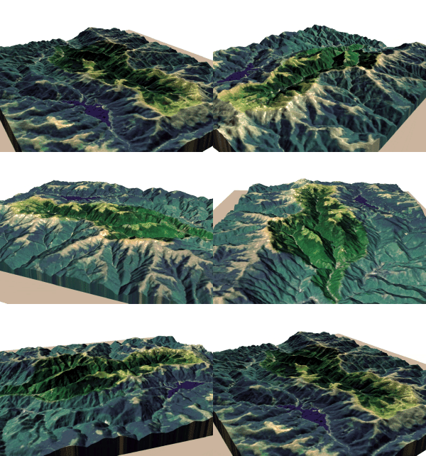
The Jalaur River, also known as Jalaud River, is the second longest river on Panay island in the Philippines, with a total length of and the second largest by drainage basin after Panay River in Capiz. The Jalaur has a drainage area of . Its source is in the Central Panay Mountain Range, west of Calinog, and the river traverses east to southeast before emptying into the Guimaras Strait. It drains the eastern portion of Panay and courses through Passi City and the towns of Leganes, Zarraga, Dumangas, Barotac Nuevo, Pototan, Dingle, San Enrique, Duenas, and Calinog, all in Iloilo province. The river provides irrigation to farmlands as well as providing a source of potable water. The river is the site of the Jalaur Mega Dam project that begun in 2019. Etymology ''Jalaur'', also known by its variant form ''Jalaud'', seems to be a Hispanicized form of Halawod, the river which serves as the core setting of ''Hinilawod'', an epic poem from Panay. Geography Discharge The Jalau ... [...More Info...] [...Related Items...] OR: [Wikipedia] [Google] [Baidu] |
Passi, Iloilo
Passi, officially the City of Passi ( krj, Syudad kang Passi/Syudad ka Passi; hil, Dakbanwa sang Passi; fil, Lungsod ng Passi), is a 4th class Cities of the Philippines#Legal classification, component city in the Provinces of the Philippines, province of Iloilo, Philippines. According to the 2020 census, it has a population of 88,873 people. It has a total land area of , making up 5.39% of the provincial land area of Iloilo. Its relatively flat land stretches alongside the Jalaur River, Jalaur and Lamunan Rivers. Mountainous areas are found along the northern part of the city. Passi is a rice, pineapple, and sugar-rich area and the only component city and the largest in the Province of Iloilo in terms of land area and income and second in population after Oton. It is popularly known with its slogan ''"The Sweet City at The Heart of Panay"'' due to its vast pineapple plantations and annual output in fruit production. History Passi is considered to be one of the oldest Spanish ... [...More Info...] [...Related Items...] OR: [Wikipedia] [Google] [Baidu] |
Iloilo Province
Iloilo (), officially the Province of Iloilo ( hil, Kapuoran sang Iloilo; krj, Kapuoran kang Iloilo; tl, Lalawigan ng Iloilo), is a province in the Philippines located in the Western Visayas region. Its capital is the City of Iloilo, the regional center of Western Visayas. Iloilo occupies a major southeast portion of the Visayan island of Panay and is bordered by the province of Antique to the west, Capiz to the north, the Jintotolo Channel to the northeast, the Guimaras Strait to the east, and the Iloilo Strait and Panay Gulf to the southwest. Just off Iloilo's southeast coast is the island province of Guimaras, once part of Iloilo but now an independent province. Across the Panay Gulf and Guimaras Strait is Negros Occidental, occupying the northwestern half of the larger island of Negros. Iloilo City, its capital, is the center of the Iloilo–Guimaras Metropolitan Area or Metro Iloilo–Guimaras, and is geographically located in the province and is grouped under the p ... [...More Info...] [...Related Items...] OR: [Wikipedia] [Google] [Baidu] |
Passi City
Passi, officially the City of Passi ( krj, Syudad kang Passi/Syudad ka Passi; hil, Dakbanwa sang Passi; fil, Lungsod ng Passi), is a 4th class component city in the province of Iloilo, Philippines. According to the 2020 census, it has a population of 88,873 people. It has a total land area of , making up 5.39% of the provincial land area of Iloilo. Its relatively flat land stretches alongside the Jalaur and Lamunan Rivers. Mountainous areas are found along the northern part of the city. Passi is a rice, pineapple, and sugar-rich area and the only component city and the largest in the Province of Iloilo in terms of land area and income and second in population after Oton. It is popularly known with its slogan ''"The Sweet City at The Heart of Panay"'' due to its vast pineapple plantations and annual output in fruit production. History Passi is considered to be one of the oldest Spanish settlements in Iloilo. It was organized as a pueblo (community settlement of natives) in 17 ... [...More Info...] [...Related Items...] OR: [Wikipedia] [Google] [Baidu] |
Drainage Area
A drainage basin is an area of land where all flowing surface water converges to a single point, such as a river mouth, or flows into another body of water, such as a lake or ocean. A basin is separated from adjacent basins by a perimeter, the ''drainage divide'', made up of a succession of elevated features, such as ridges and hills. A basin may consist of smaller basins that merge at river confluences, forming a hierarchical pattern. Other terms for a drainage basin are catchment area, catchment basin, drainage area, river basin, water basin, and impluvium. In North America, they are commonly called a watershed, though in other English-speaking places, "watershed" is used only in its original sense, that of a drainage divide. In a closed drainage basin, or endorheic basin, the water converges to a single point inside the basin, known as a sink, which may be a permanent lake, a dry lake, or a point where surface water is lost underground. Drainage basins are similar but no ... [...More Info...] [...Related Items...] OR: [Wikipedia] [Google] [Baidu] |
Capiz (province)
Capiz, officially the Province of Capiz (Capiznon/ Hiligaynon: ''Kapuoran sang Capiz''; tl, Lalawigan ng Capiz), is a province in the Philippines located in the central section of Western Visayas region. Its capital is the city of Roxas. It is located at the northeastern portion of Panay Island, bordering Aklan to the north, Antique to the west, and Iloilo to the south. Capiz faces the Sibuyan Sea to the north. Capiz is known for the '' Placuna placenta'' oyster shell that has the same name locally and is used for decoration and making lampshades, trays, window and doors. Likewise, the province is known as the "Seafood Capital of the Philippines" and was among the top 15 most frequently visited places in the Philippines. Capiz is the site of the famous coral-stone Santa Monica Church in the town of Panay, home to the largest Catholic Church bell in Asia. The bell was made from 70 sacks of gold and silver coins donated by the townsfolk. Measuring seven feet in diameter, five fe ... [...More Info...] [...Related Items...] OR: [Wikipedia] [Google] [Baidu] |
Panay River
The Panay River (known as Pan-ay River) is the longest river on Panay Island in the Philippines, with a total length of approximately and a drainage basin area of . It drains almost the entire province of Capiz and northern portion of Iloilo province. The source of the Panay River is on the slopes of Mount Igabon–Mount Angas Mountain Range. Starting in Tapaz, it runs southward and changing its direction toward east-northeast to Dumalag and Cuartero, then traversing north through the municipalities of Dao and Panitan. In Panay the river splits, with the primary branch emptying into the Sibuyan Sea at Roxas City. Tributaries The main tributaries of the river are the Tapaz River and Mambusao River on the left and the Badbaran River and Maayon River on the right. Panay River list of tributaries by length: #Mambusao River Mambusao, officially the Municipality of Mambusao (Capiznon language, Capiznon/Hiligaynon language, Hiligaynon: ''Banwa sang Mambusao''; tl, Bayan ng Mam ... [...More Info...] [...Related Items...] OR: [Wikipedia] [Google] [Baidu] |
Drainage Basin
A drainage basin is an area of land where all flowing surface water converges to a single point, such as a river mouth, or flows into another body of water, such as a lake or ocean. A basin is separated from adjacent basins by a perimeter, the '' drainage divide'', made up of a succession of elevated features, such as ridges and hills. A basin may consist of smaller basins that merge at river confluences, forming a hierarchical pattern. Other terms for a drainage basin are catchment area, catchment basin, drainage area, river basin, water basin, and impluvium. In North America, they are commonly called a watershed, though in other English-speaking places, "watershed" is used only in its original sense, that of a drainage divide. In a closed drainage basin, or endorheic basin, the water converges to a single point inside the basin, known as a sink, which may be a permanent lake, a dry lake, or a point where surface water is lost underground. Drainage basins are similar ... [...More Info...] [...Related Items...] OR: [Wikipedia] [Google] [Baidu] |
Panay Island
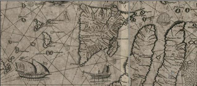
Panay is the sixth-largest and fourth-most populous island in the Philippines, with a total land area of and has a total population of 4,542,926 as of 2020 census. Panay comprises 4.4 percent of the entire population of the country. The City of Iloilo is its largest settlement with a total population of 457,626 inhabitants as of 2020 census. Panay is a triangular island, located in the western part of the Visayas. It is about across. It is divided into four provinces: Aklan, Antique, Capiz and Iloilo, all in the Western Visayas Region. Just closely off the mid-southeastern coast lies the island-province of Guimaras. It is located southeast of the island of Mindoro and northwest of Negros across the Guimaras Strait. To the north and northeast is the Sibuyan Sea, Jintotolo Channel and the island-provinces of Romblon and Masbate; to the west and southwest is the Sulu Sea and the Palawan archipelago and to the south is Panay Gulf. Panay is the only main island in the Visayas whos ... [...More Info...] [...Related Items...] OR: [Wikipedia] [Google] [Baidu] |
River
A river is a natural flowing watercourse, usually freshwater, flowing towards an ocean, sea, lake or another river. In some cases, a river flows into the ground and becomes dry at the end of its course without reaching another body of water. Small rivers can be referred to using names such as Stream#Creek, creek, Stream#Brook, brook, rivulet, and rill. There are no official definitions for the generic term river as applied to Geographical feature, geographic features, although in some countries or communities a stream is defined by its size. Many names for small rivers are specific to geographic location; examples are "run" in some parts of the United States, "Burn (landform), burn" in Scotland and northeast England, and "beck" in northern England. Sometimes a river is defined as being larger than a creek, but not always: the language is vague. Rivers are part of the water cycle. Water generally collects in a river from Precipitation (meteorology), precipitation through a ... [...More Info...] [...Related Items...] OR: [Wikipedia] [Google] [Baidu] |


_OldCathedral_1901.jpg)


