|
Jageshwar
Jageshwar Temples, also referred to as Jageswar Temples or Jageshwar Valley Temples, are a group of 125 ancient Hindu temples dated between 7th and 14th century, near Almora in Almora district of the Himalayan Indian state of Uttarakhand. The valley has a number of temple clusters such as the Dandeshwar and Jageshwar sites. Some locations have attracted construction of new temples through the 20th-century. Together these clusters over the valley consist of over 200 structural temples built from cut stone. Many are small, while a few are substantial. They predominantly illustrate North Indian Nagara style of architecture with a few exceptions that show South and Central Indian style designs, many are dedicated to god Shiva, while others in immediate vicinity are dedicated to god Vishnu, Shakti goddesses and Surya traditions of Hinduism. Jageshwar is a Hindu pilgrimage town and one of the Dhams (pilgrimage region) in the Shaivism tradition. The site is protected under Indian laws, a ... [...More Info...] [...Related Items...] OR: [Wikipedia] [Google] [Baidu] |
Almora District
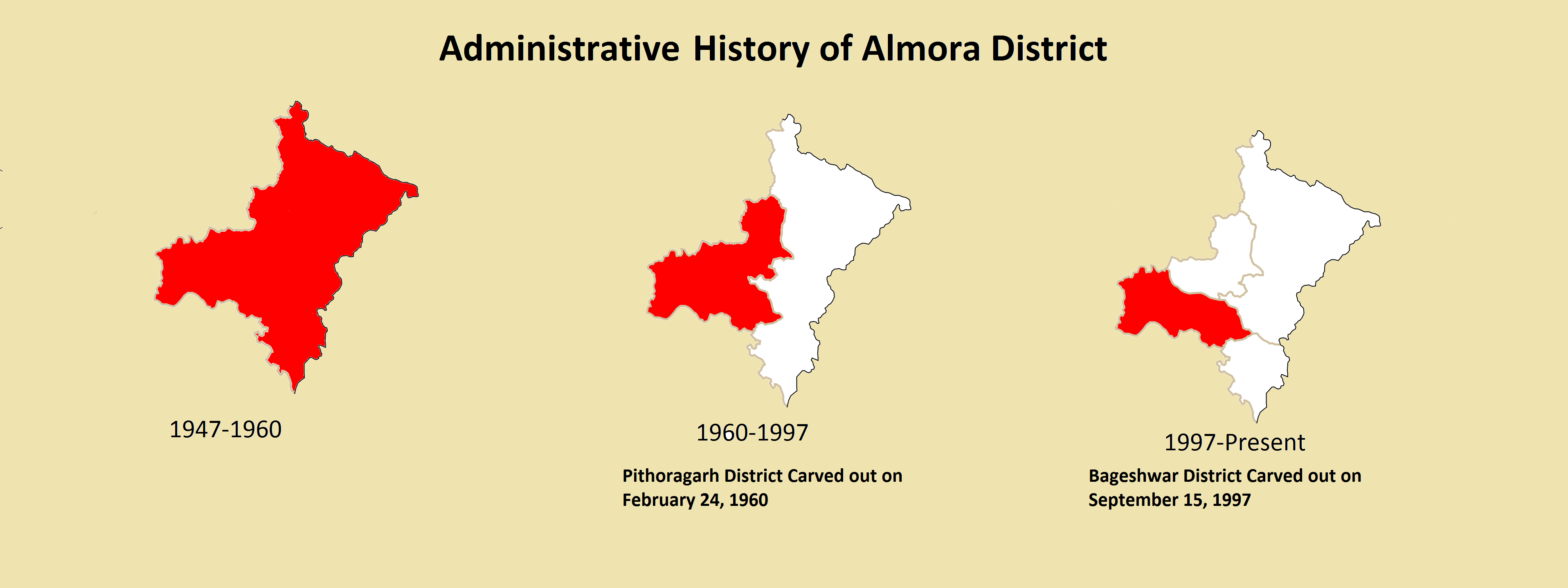
Almora is a District (India), district in the Kumaon Division of Uttarakhand state, India. The headquarters is at Almora. It is 1,638 meters above sea level. The neighbouring regions are Pithoragarh district to the east, Chamoli district to the west, Bageshwar district to the north and Nainital district to the south. History The ancient town of Almora was capital of the Kumaon Kingdom, before its establishment, it was under the possession of Katyuri Kings, Katyuri king Baichaldeo. Later on when the Chand dynasty was founded in Champawat, the town of Almora was founded at this centrally located place in 1568 by Kalyan Chand. Later Chand kings shifted the capital of the Kumaon Kingdom from Champawat to Almora. Almora town was the administrative headquarter of the Kumaun district; that was formed in 1815 following the defeat of Gorkha army in the Anglo-Gorkha war and the 1816 Treaty of Sugauli. The Kumaun district then consisted of the complete Kumaon Division excluding the Udham ... [...More Info...] [...Related Items...] OR: [Wikipedia] [Google] [Baidu] |
Kumaon Division
Kumaon (; Kumaoni: ''Kumāū''; ; historically romanized as KemāonJames Prinsep (Editor)John McClelland ) is a revenue and administrative division in the Indian State of Uttarakhand. It spans over the eastern half of the state and is bounded on the north by Tibet, on the east by Nepal, on the south by the state of Uttar Pradesh, and on the west by Garhwal. Kumaon comprises six districts of the state: Almora, Bageshwar, Champawat, Nainital, Pithoragarh and Udham Singh Nagar. Historically known as Manaskhand and then Kurmanchal, the Kumaon region has been ruled by several Hindu dynasties over the course of history; most notably the Katyuris and the Chands. The Kumaon division was established in 1816, when the British reclaimed this region from the Gorkhas, who had annexed the erstwhile Kingdom of Kumaon in 1790. It was formed into a division of what was then called Ceded and Conquered Provinces, later known as United Provinces. In independent India the state was called Utt ... [...More Info...] [...Related Items...] OR: [Wikipedia] [Google] [Baidu] |
Uttarakhand
Uttarakhand ( , or ; , ), also known as Uttaranchal ( ; the official name until 2007), is a state in the northern part of India. It is often referred to as the "Devbhumi" (literally 'Land of the Gods') due to its religious significance and numerous Hindu temples and pilgrimage centres found throughout the state. Uttarakhand is known for the natural environment of the Himalayas, the Bhabar and the Terai regions. It borders the Tibet Autonomous Region of China to the north; the Sudurpashchim Province of Nepal to the east; the Indian states of Uttar Pradesh to the south and Himachal Pradesh to the west and north-west. The state is divided into two divisions, Garhwal and Kumaon, with a total of 13 districts. The winter capital of Uttarakhand is Dehradun, the largest city of the state, which is a rail head. Bhararisain, a town in Chamoli district, is the summer capital of Uttarakhand. The High Court of the state is located in Nainital. Archaeological evidence supports the e ... [...More Info...] [...Related Items...] OR: [Wikipedia] [Google] [Baidu] |
Almora
Almora ( Kumaoni: ''Almāḍ'') is a municipal board and a cantonment town in the state of Uttarakhand, India. It is the administrative headquarters of Almora district. Almora is located on a ridge at the southern edge of the Kumaon Hills of the Himalaya range. Koshi (Kaushiki) and Suyal (Salmale) rivers flow along the city and snow-capped Himalayas can be seen in the background. Almora was founded in 1568 by King Kalyan Chand; however, there are accounts of human settlements in the hills and surrounding region in the Hindu epic Mahabharata (8th and 9th century BCE). Almora was the seat of Chand kings that ruled over the Kumaon Kingdom. It is considered the cultural heart of the Kumaon region of Uttarakhand. According to the provisional results of the 2019 national census of India Almora had a population of 179,000. Nestled within higher peaks of the Himalaya, Almora enjoys a year-round mild temperate climate. The town is visited by thousands of tourists annually from all ove ... [...More Info...] [...Related Items...] OR: [Wikipedia] [Google] [Baidu] |
North India
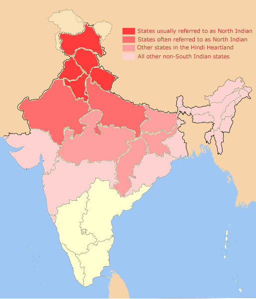
North India is a loosely defined region consisting of the northern part of India. The dominant geographical features of North India are the Indo-Gangetic Plain and the Himalayas, which demarcate the region from the Tibetan Plateau and Central Asia. The term North India has varying definitions. The Ministry of Home Affairs in its Northern Zonal Council Administrative division included the states of Haryana, Himachal Pradesh, Punjab and Rajasthan and Union Territories of Chandigarh, Delhi, Jammu and Kashmir and Ladakh. The Ministry of Culture in its ''North Culture Zone'' includes the state of Uttarakhand but excludes Delhi whereas the Geological Survey of India includes Uttar Pradesh and Delhi but excludes Rajasthan and Chandigarh. Other states sometimes included are Bihar, Gujarat, Jharkhand, Madhya Pradesh and West Bengal. North India has been the historical centre of the Mughal Empire, the Delhi Sultanate and the British Indian Empire. It has a diverse culture, and includ ... [...More Info...] [...Related Items...] OR: [Wikipedia] [Google] [Baidu] |
Mallikarjuna Jyotirlinga
Sri Bhramaramba Mallikarjuna Temple or Srisailam Temple is a Hindu temple dedicated to the deities Shiva and Parvati, located at Srisailam in the Indian state of Andhra Pradesh. It is significant to the Hindu sects of both Shaivism and Shaktism as this temple is referred to as one of the twelve Jyotirlingas of Shiva and as one of the eighteen Shakti Peethas, centres of the Hindu Goddess. Shiva is worshiped as Mallikarjuna, and is represented by the ''lingam''. His consort Parvati is depicted as Bhramaramba. Legend When Shiva and Parvati decided to find suitable brides for their sons. Shiva got Buddhi (intellect), Siddhi (spiritual power), and Riddhi (prosperity) married to Ganesha. Kartikeya on his return was enraged and went away to stay alone on Mount Kraunja in the name of ''Kumarabrahmachari''. On seeing his father coming over to pacify him, he tried to move to another place, but on the request of the Devas, stayed close by. The place where Shiva and Parvati stayed c ... [...More Info...] [...Related Items...] OR: [Wikipedia] [Google] [Baidu] |
Nainital
Nainital ( Kumaoni: ''Naintāl''; ) is a city and headquarters of Nainital district of Kumaon division, Uttarakhand, India. It is the judicial capital of Uttarakhand, the High Court of the state being located there and is the headquarters of an eponymous district. It also houses the Governor of Uttarakhand, who resides in the Raj Bhavan. Nainital was the summer capital of the United Provinces. Nainital is located in the Kumaon foothills of the Jagbeer Himalayas at a distance of from the state capital Dehradun and from New Delhi, the capital of India. Situated at an altitude of above sea level, the city is set in a valley containing an eye-shaped lake, approximately two miles in circumference, and surrounded by mountains, of which the highest are Naina Peak () on the north, Deopatha () on the west, and Ayarpatha () on the south. From the tops of the higher peaks, "magnificent views can be obtained of the vast plain to the south, or of the mass of tangled ridges lying no ... [...More Info...] [...Related Items...] OR: [Wikipedia] [Google] [Baidu] |
Pines
A pine is any conifer tree or shrub in the genus ''Pinus'' () of the family Pinaceae. ''Pinus'' is the sole genus in the subfamily Pinoideae. The World Flora Online created by the Royal Botanic Gardens, Kew and Missouri Botanical Garden accepts 187 species names of pines as current, together with more synonyms. The American Conifer Society (ACS) and the Royal Horticultural Society accept 121 species. Pines are commonly found in the Northern Hemisphere. ''Pine'' may also refer to the lumber derived from pine trees; it is one of the more extensively used types of lumber. The pine family is the largest conifer family and there are currently 818 named cultivars (or trinomials) recognized by the ACS. Description Pine trees are evergreen, coniferous resinous trees (or, rarely, shrubs) growing tall, with the majority of species reaching tall. The smallest are Siberian dwarf pine and Potosi pinyon, and the tallest is an tall ponderosa pine located in southern Oregon's Rogue Riv ... [...More Info...] [...Related Items...] OR: [Wikipedia] [Google] [Baidu] |
Himachal Pradesh
Himachal Pradesh (; ; "Snow-laden Mountain Province") is a state in the northern part of India. Situated in the Western Himalayas, it is one of the thirteen mountain states and is characterized by an extreme landscape featuring several peaks and extensive river systems. Himachal Pradesh is the northernmost state of India and shares borders with the union territories of Jammu and Kashmir and Ladakh to the north, and the states of Punjab to the west, Haryana to the southwest, Uttarakhand to the southeast and a very narrow border with Uttar Pradesh to the south. The state also shares an international border to the east with the Tibet Autonomous Region in China. Himachal Pradesh is also known as , meaning 'Land of Gods' and which means 'Land of the Brave'. The predominantly mountainous region comprising the present-day Himachal Pradesh has been inhabited since pre-historic times, having witnessed multiple waves of human migrations from other areas. Through its history, the ... [...More Info...] [...Related Items...] OR: [Wikipedia] [Google] [Baidu] |
Pithoragarh
Pithoragarh ( Kumaoni: ''Pithor'garh'') is a Himalayan city with a Municipal Board in Pithoragarh district in the Indian state of Uttarakhand. It is the fourth largest city of Kumaon and the largest in Kumaon hills. It is an education hub of the hilly region as the town has Laxman Singh Mahar Govt.P.G.College, Seemant Institute of Technology, now known as Nanhi Pari Seemant Engineering Institute and a nursing college. Etymology "The district is named after its headquarters town, Pithoragarh. Tradition has it that during the reign of the Chand Rajas of Kumaon, one Piru, also called Prithvi Gosain, built a fort here and named it Prithvigarh which, in the course of time, got changed to Pithoragarh." History Pithoragarh city and its surrounding areas were part of the Manaskhand region, which extended from the Kailash Mountain in the north to Bhabar & Terai in the south, as mentioned in the Skanda Purana. The Asuras and Nagas appear to be the earliest inhabitants of the reg ... [...More Info...] [...Related Items...] OR: [Wikipedia] [Google] [Baidu] |
Cedrus Deodara
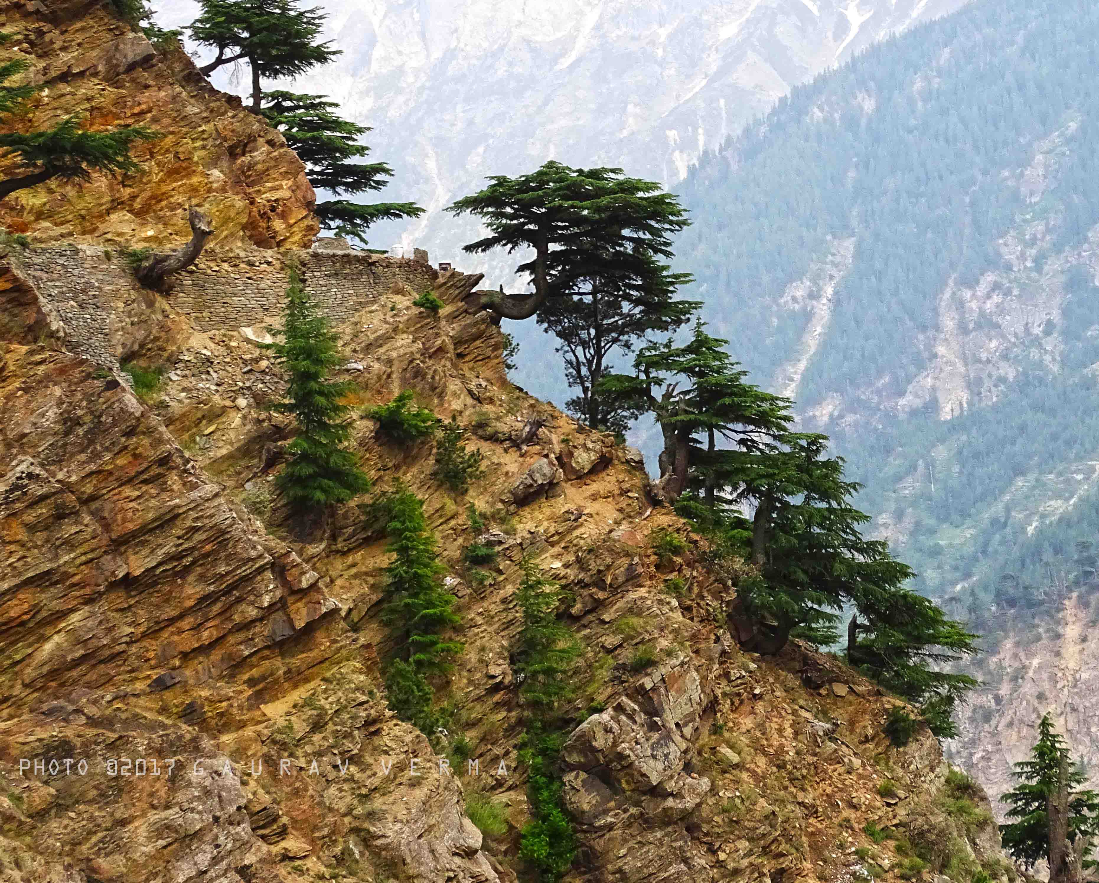
''Cedrus deodara'', the deodar cedar, Himalayan cedar, or deodar, is a species of cedar native to the Himalayas. Description It is a large evergreen coniferous tree reaching tall, exceptionally with a trunk up to in diameter. It has a conic crown with level branches and drooping branchlets. The leaves are needle-like, mostly long, occasionally up to long, slender ( thick), borne singly on long shoots, and in dense clusters of 20–30 on short shoots; they vary from bright green to glaucous blue-green in colour. The female cones are barrel-shaped, long and broad, and disintegrate when mature (in 12 months) to release the winged seeds. The male cones are long, and shed their pollen in autumn. Chemistry The bark of ''Cedrus deodara'' contains large amounts of taxifolin. The wood contains cedeodarin, ampelopsin, cedrin, cedrinoside, and deodarin (3′,4′,5,6-tetrahydroxy-8-methyl dihydroflavonol). The main components of the needle essential oil include α-terpine ... [...More Info...] [...Related Items...] OR: [Wikipedia] [Google] [Baidu] |


