|
Jabal Zawiya
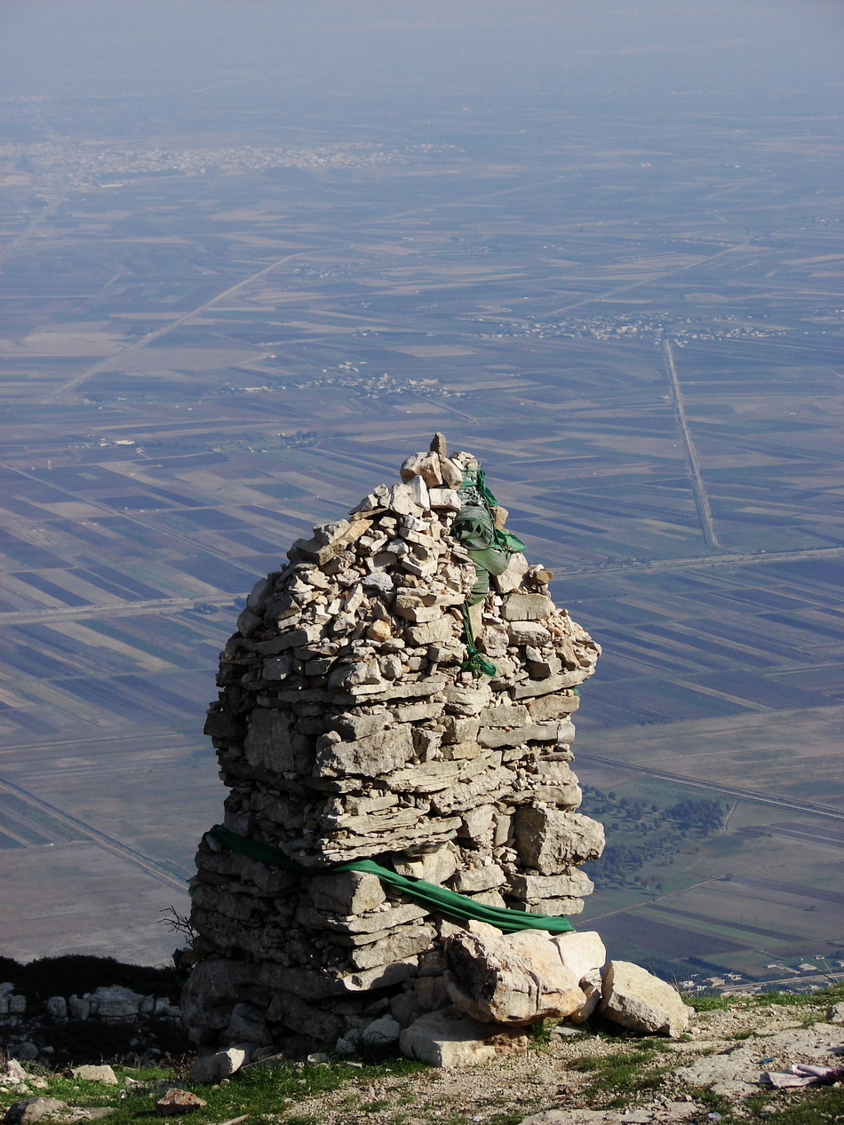
Mount Zāwiya ( ar, جبل الزاوية, Jabal az-Zāwiyah) or Mount Rīḥā ( ar, جبل ريحا, Jabal Rīḥā) (also in medieval times: Banī-ʻUlaym Mountain ( ar, جبل بني عليم, Jabal Banī-ʻUlaym) is a highland region in Idlib Governorate in northwestern Syria. Around 36 towns and villages exist in the Mount Zawiya region. The biggest towns are Rīḥā (Arīḥā) and Maʻarrat an-Nuʻmān. It was the location of the December 2011 Jabal al-Zawiya massacres. It was bombed again as part of a Syrian government and Russian offensive in September 2017.Suleiman Al-KhalidRussia, Syria intensify bombing of rebel-held Idlib, witnesses say Reuters, 24 September 2017 Location and description Mount Zāwiya forms the southern group of the Limestone Massif of the western Aleppo plateau. To the north and northwest of the mountain lies the Rouge Plain. The Ghāb Plain is on the western side. South of the mountain are the plains of Ḥamā, and on the eastern side ... [...More Info...] [...Related Items...] OR: [Wikipedia] [Google] [Baidu] |
Idlib Governorate
Idlib Governorate ( ar, مُحافظة ادلب / ALA-LC: ''Muḥāfaẓat Idlib'') is one of the 14 governorates of Syria. It is situated in northwestern Syria, bordering Turkey's Hatay province to the north, Aleppo Governorate to the east, Hama Governorate to the south, and Latakia Governorate to the west. Reports of its area vary, depending on the source, from 5,933 km2 to 6,097 km2. The provincial capital is Idlib. In 2011, the governorate was taken over by Syrian rebel militias in the context of the Syrian civil war. In 2017, the governorate came under the nominal control of the Syrian Salvation Government, with Tahrir al-Sham becoming the dominant militia in the region. The governorate saw intense fighting in the 2019 Northwestern Syria offensive and subsequent 2020 offensive, as Syrian government forces advanced deep into rebel territory; by 8 February, only a little more than half of the governorate's territory was reported to still be under rebel control. ... [...More Info...] [...Related Items...] OR: [Wikipedia] [Google] [Baidu] |
Syria
Syria ( ar, سُورِيَا or سُورِيَة, translit=Sūriyā), officially the Syrian Arab Republic ( ar, الجمهورية العربية السورية, al-Jumhūrīyah al-ʻArabīyah as-Sūrīyah), is a Western Asian country located in the Eastern Mediterranean and the Levant. It is a unitary republic that consists of 14 governorates (subdivisions), and is bordered by the Mediterranean Sea to the west, Turkey to the north, Iraq to the east and southeast, Jordan to the south, and Israel and Lebanon to the southwest. Cyprus lies to the west across the Mediterranean Sea. A country of fertile plains, high mountains, and deserts, Syria is home to diverse ethnic and religious groups, including the majority Syrian Arabs, Kurds, Turkmens, Assyrians, Armenians, Circassians, Albanians, and Greeks. Religious groups include Muslims, Christians, Alawites, Druze, and Yazidis. The capital and largest city of Syria is Damascus. Arabs are the largest ethnic group, and Mu ... [...More Info...] [...Related Items...] OR: [Wikipedia] [Google] [Baidu] |
Al Jazeera English
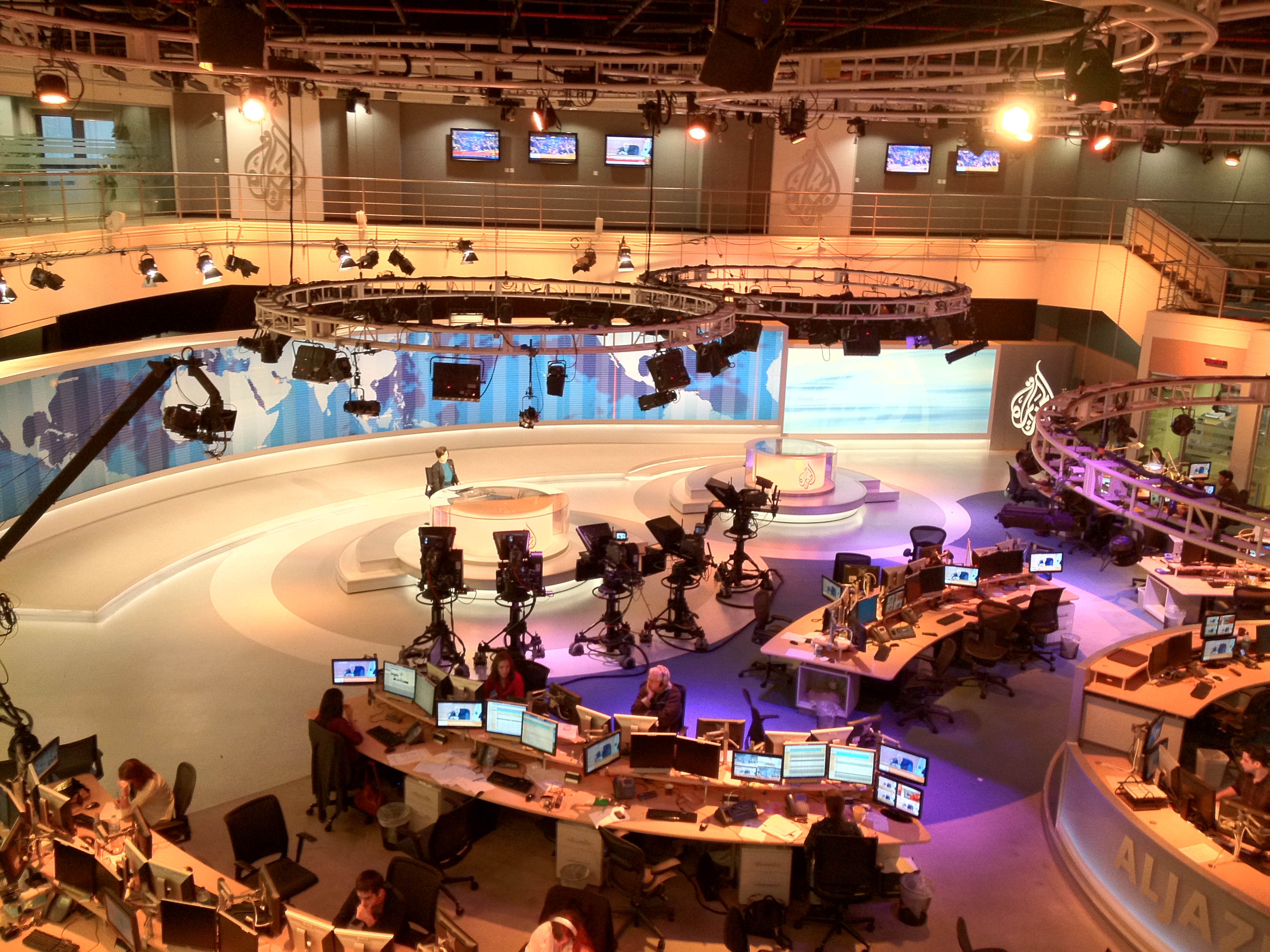
Al Jazeera English (AJE; ar, الجزيرة, translit=al-jazīrah, , literally "The Peninsula", referring to the Qatar Peninsula) is an international 24-hour English-language news channel owned by the Al Jazeera Media Network, which is owned by the monarchy government of Qatar. It is the first English-language news channel to be headquartered in the Middle East. Instead of being run centrally, news management rotates between broadcasting centres in Doha and London. History The channel was launched on 15 November 2006, at 12:00 PM GMT. It had aimed to begin broadcasting in June 2006 but had to postpone its launch because its HDTV technology was not yet ready. The channel was due to be called ''Al Jazeera International'', but the name was changed nine months before the launch because one of the channel's backers argued that the original Arabic-language channel already had an international scope. The channel was anticipated to reach around 40 million households, but it far ex ... [...More Info...] [...Related Items...] OR: [Wikipedia] [Google] [Baidu] |
Riha (Syria)
Ariha ( ar, أَرِيحَا, ʾArīḥā, also called Rīḥā, ) is a town in northern Syria, administratively part of the Idlib Governorate, located south of Idlib. Nearby localities include Urum al-Jawz to the southwest, Sarjah to the south, Kafr Latah to the southeast, Maar Bilit to the east, al-Nayrab to the northeast, Nahlaya and al-Mastumah to the north, Kurin to the northwest and Maataram to the west. According to the Syria Central Bureau of Statistics, Ariha had a population of 39,501 in the 2004 census.General Census of Population and Housing 2004 . Syria Central Bureau of Statistics (CBS). Idlib Governorate. The town ... [...More Info...] [...Related Items...] OR: [Wikipedia] [Google] [Baidu] |
Ma'arrat An-Nu'man
, timezone = EET , utc_offset = +3 , timezone_DST = EEST , utc_offset_DST = +2 , blank_name = Climate , blank_info = BSk , coordinates= , elevation_footnotes= , elevation_m = 522 , elevation_ft= , postal_code_type = , postal_code= , area_code= , parts_type = , parts_style = , p1 = , geocode = C3985 , website= , footnotes= Maarat al-Numan ( ar, مَعَرَّةُ النُّعْمَانِ, Maʿarrat an-Nuʿmān), also known as al-Ma'arra, is a city in northwestern Syria, south of Idlib and north of Hama, with a population of about 58,008 before the Civil War (2004 census). In 2017, it was estimated to have a population of 80,000, including several displaced by fighting in neighbouring towns. It is located on the highway between Aleppo and Hama and near the Dead Cities of Bara and Serjilla. Name The city, known as Arra to t ... [...More Info...] [...Related Items...] OR: [Wikipedia] [Google] [Baidu] |
December 2011 Jabal Al-Zawiya Massacres
The Jabal al-Zawiya massacres took place on 19–20 December 2011, in the Idlib province of Syria during the 2011-2012 Idlib Governorate clashes between the Syrian Army and opposition forces, within the larger scope of the 2011-2012 Syrian uprising. Human rights and opposition activists said that some 200 people were killed by Syrian security forces in the hills and villages of the north-western province of Idlib on 19 and 20 December 2011. The Syrian state news agency claimed that 1 terrorist was killed and several more wounded. The event occurred following a large scale defection of hundreds of Syrian soldiers on 19 December, while some 70 of them were gunned down by loyalists. On 20 December, government forces backed by tanks reportedly launched an operation to hunt down the defectors who managed to escape. Events On 19 December, the FSA suffered its largest loss of life when new defectors tried to abandon their positions and bases between the villages of Kansafra and Ka ... [...More Info...] [...Related Items...] OR: [Wikipedia] [Google] [Baidu] |
Limestone Massif
The Limestone Massif (from French ''Le Massif Calcaire'') or Belus Massif is the highlands on the western part of the Aleppo plateau in northwestern Syria. The Massif is famed for having the Dead Cities of Syria. The Massif includes three groups of highlands; the first is the northern group of Mount Simeon and Mount Kurd. The second middle group is the group of Harim Mountains. The third southern group is the group of Zawiya Mountain Mount Zāwiya ( ar, جبل الزاوية, Jabal az-Zāwiyah) or Mount Rīḥā ( ar, جبل ريحا, Jabal Rīḥā) (also in medieval times: Banī-ʻUlaym Mountain ( ar, جبل بني عليم, Jabal Banī-ʻUlaym) is a highland region in Idli .... See also * Aleppo plateau References *Darke, Diana (2006) ''Syria'' p.132 {{coord missing, Syria Aleppo Aleppo Governorate Idlib Governorate Mountains of Syria Geography of Syria de:Tote Städte#Geografie ... [...More Info...] [...Related Items...] OR: [Wikipedia] [Google] [Baidu] |
Aleppo Plateau
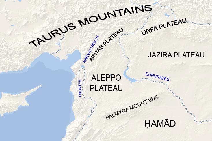
The Aleppo plateau ( ar, هضبة حلب ) is a low, gently undulating plateau of northern Syria. It lies at the northern end of the junction between the Arabian Plate and the African Plate at the Dead Sea Rift. The plateau lies mostly in the Aleppo Governorate and Idlib Governorate. Aleppo is located in the north-center of the plateau. Boundaries The Aleppo plateau lies immediately north of the Palmyra mountain belt. To the east it is bounded by the Euphrates river valley, which separates it from the Jazirah plateau. To the west it is bounded by the northern half of the Dead Sea Rift, namely the Orontes river valley. The Aintab plateau forms a northern continuation of the plateau that leads to the Taurus Mountains. Description The average elevation of the plateau is 400 m. The surface gradually slopes down in north-south and west-east directions. The surface undulates gently with an amplitude of 10–30 m for each wave. The lowlands are covered with combined Paleozoic an ... [...More Info...] [...Related Items...] OR: [Wikipedia] [Google] [Baidu] |
Rouge Plain
Rouge is the French word for "red" and may refer to: Compounds * Rouge (cosmetics), a cosmetic used to color the cheeks and emphasize the cheekbones * Jeweler's rouge or iron(III) oxide * Rouging, a form of corrosion applicable to stainless steel People and characters * Adrien de Rougé (1782-1838), French statesman * Aurélie Rouge (born 1992), Martiniquais footballer * Caesar Rougé (born 2002), French footballer * Emmanuel de Rougé (1811-1872), French Egyptologist * Guillaume le Rouge Guillaume may refer to: People * Guillaume (given name), the French equivalent of William * Guillaume (surname) Other uses * Guillaume (crater) See also * '' Chanson de Guillaume'', an 11th or 12th century poem * Guillaume affair, a Cold War espi ... (1385-1450), Dutch musician * Rouge (rapper), South African female rapper * Roger Rouge (born 1914), Swiss sailor Characters * Rouge (Power Stone), Rouge (''Power Stone''), a character in ''Power Stone'' media * Rouge (Ranma½), Rouge ... [...More Info...] [...Related Items...] OR: [Wikipedia] [Google] [Baidu] |
Ghab Plain
The Ghab Plain ( ar, سَهْلُ ٱلْغَابِ, Sahl al-Ġāb, literally: Forest Plain) is a fertile depression lying mainly in the Al-Suqaylabiyah District in northwest Syria. The Orontes River, flowing north, enters the Plain near Muhradah, around 25 km north-west of Hama.Federal Research Division, 2004, p. 74.Topography and Hydrology Map of the Orontes valley water-security.org  The valley was flooded for centuries by the waters of the Orontes River, which rendered it a swamp.Sofer, 1999, p. 205. The "Ghab project", beginning in the ...
[...More Info...] [...Related Items...] OR: [Wikipedia] [Google] [Baidu] |
Hama Governorate
Hama Governorate ( ar, مُحافظة حماة / ALA-LC: ''Muḥāfaẓat Ḥamā'') is one of the 14 Governorates of Syria, governorates of Syria. It is situated in western-central Syria, bordering Idlib Governorate, Idlib and Aleppo Governorates to the south, Raqqa Governorate to the west, Homs Governorate to the north, and Tartus Governorate, Tartus and Latakia Governorate to the east. It is the only Governorate (excluding Damascus Governorate, Damascus) that does not border a foreign country. Measures of its area vary from 8,844 km2 to 8,883 km2, with its capital being the city of Hama. History Archaeological sites * Abu Qubays, Syria, Al Qubays - medieval castle * Apamea, Syria, Apamea - Graeco-Roman city * Bourzey castle - Byzantine castle * Masyaf Castle - medieval castle * Shmemis - Ayyubid castle * Tell Salhab, Tell Asharneh - possible site of Bronze Age Tunip * Tell Qarqur - ancient settlement Modern Syria Hama has historically been a centre of opposition to th ... [...More Info...] [...Related Items...] OR: [Wikipedia] [Google] [Baidu] |


