|
J. Rich Steers, Inc.
J. Rich Steers, Inc. was a prominent New York-based contracting company focusing on waterfront work. It specialized in heavy maritime infrastructure projects such as bridge and pier construction, tunnel, foundation and sewer and drain work. The firm and its related businesses maintained offices at Whitehall Building, 17 Battery Place in lower Manhattan, until ceasing operations in 1986. Family and background Of English descent, the Steers family had been involved in various maritime pursuits for over 200 years in England and the US, a long lineage that included involvement in the HMNB Devonport, Plymouth Royal Dockyards. The family came to the United States in 1817, when naval architect Henry Steers relocated to New York City with his sons James Rich Steers (1808-1896) and George Steers. James would go on to co-found the boatbuilding concern George Steers and Co with George, who is perhaps best known as the designer of the yacht America (yacht), America, winner of the first Americ ... [...More Info...] [...Related Items...] OR: [Wikipedia] [Google] [Baidu] |
Whitehall Building
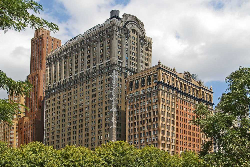
The Whitehall Building is a three-section residential and office building near the southern tip of Manhattan Island in New York City, adjacent to Battery Park in lower Manhattan. The original 20-story structure on Battery Place, between West Street and Washington Street, was designed by Henry Janeway Hardenbergh, while the 31-story Whitehall Building Annex on West Street was designed by Clinton and Russell. The original building and annex are both at 17 Battery Place. Another 22-story addition at 2 Washington Street, an International Style building located north of the original building and east of the annex, was designed by Morris Lapidus. The original Whitehall Building and its annex has a Renaissance Revival style facade, and the two original structures' articulations consist of three horizontal sections similar to the components of a column—namely a base, shaft, and capital. Since the building is located on landfill along the Hudson River, its foundation incorporates a ... [...More Info...] [...Related Items...] OR: [Wikipedia] [Google] [Baidu] |
New Jersey
New Jersey is a state in the Mid-Atlantic and Northeastern regions of the United States. It is bordered on the north and east by the state of New York; on the east, southeast, and south by the Atlantic Ocean; on the west by the Delaware River and Pennsylvania; and on the southwest by Delaware Bay and the state of Delaware. At , New Jersey is the fifth-smallest state in land area; but with close to 9.3 million residents, it ranks 11th in population and first in population density. The state capital is Trenton, and the most populous city is Newark. With the exception of Warren County, all of the state's 21 counties lie within the combined statistical areas of New York City or Philadelphia. New Jersey was first inhabited by Native Americans for at least 2,800 years, with the Lenape being the dominant group when Europeans arrived in the early 17th century. Dutch and Swedish colonists founded the first European settlements in the state. The British later seized control o ... [...More Info...] [...Related Items...] OR: [Wikipedia] [Google] [Baidu] |
Cold War
The Cold War is a term commonly used to refer to a period of geopolitical tension between the United States and the Soviet Union and their respective allies, the Western Bloc and the Eastern Bloc. The term '' cold war'' is used because there was no large-scale fighting directly between the two superpowers, but they each supported major regional conflicts known as proxy wars. The conflict was based around the ideological and geopolitical struggle for global influence by these two superpowers, following their temporary alliance and victory against Nazi Germany and Imperial Japan in 1945. Aside from the nuclear arsenal development and conventional military deployment, the struggle for dominance was expressed via indirect means such as psychological warfare, propaganda campaigns, espionage, far-reaching embargoes, rivalry at sports events, and technological competitions such as the Space Race. The Western Bloc was led by the United States as well as a number of other First W ... [...More Info...] [...Related Items...] OR: [Wikipedia] [Google] [Baidu] |
Jersey City
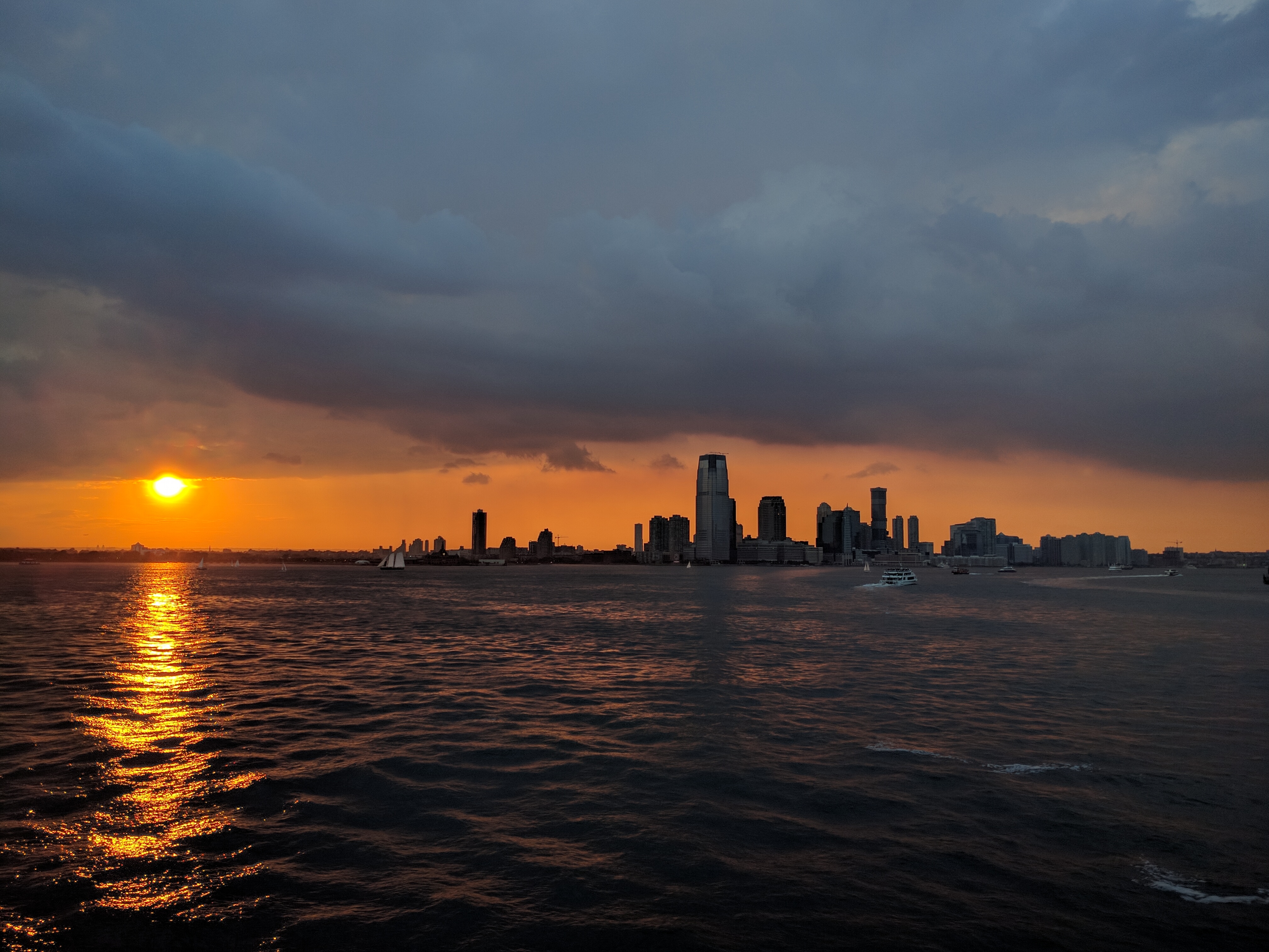
Jersey City is the second-most populous city in the U.S. state of New Jersey, after Newark.The Counties and Most Populous Cities and Townships in 2010 in New Jersey: 2000 and 2010 , . Accessed November 7, 2011. It is the of and the county's largest city. [...More Info...] [...Related Items...] OR: [Wikipedia] [Google] [Baidu] |
Landing Craft, Tank
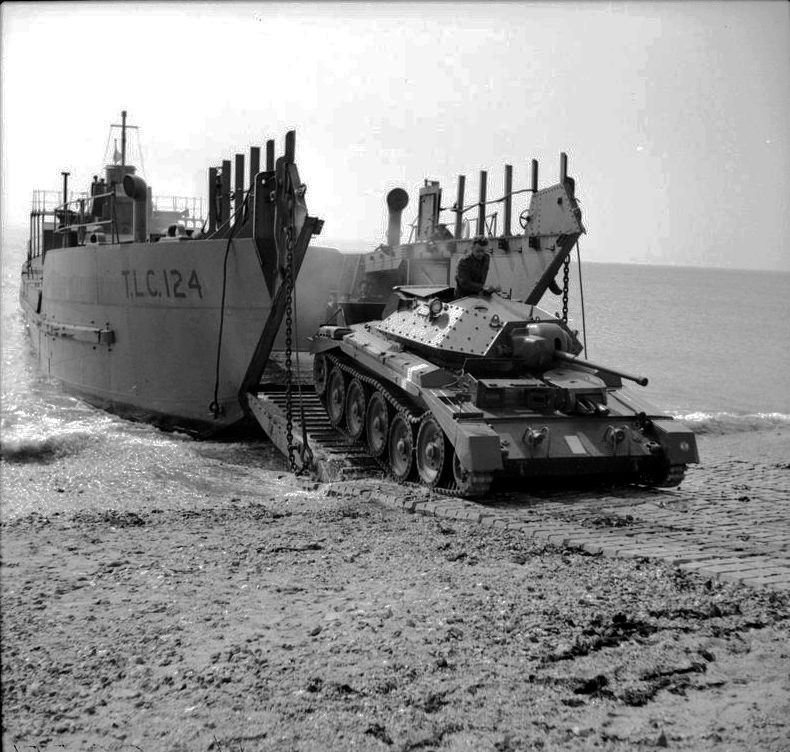
The Landing Craft, Tank (LCT) (or Tank Landing Craft TLC) was an amphibious assault craft for landing tanks on beachheads. They were initially developed by the Royal Navy and later by the United States Navy during World War II in a series of versions. Initially known as the "tank landing craft" (TLC) by the British, they later adopted the U.S. nomenclature "landing craft, tank" (LCT). The United States continued to build LCTs post-war, and used them under different designations in the Korean and Vietnam Wars. Development In 1926, the first motor landing craft (MLC1) was built by the Royal Navy. It weighed 16 tons, with a draught of , and was capable of about . It was later developed into the landing craft mechanised. It was at the insistence of the British prime minister Winston Churchill in mid-1940 that the LCT was created. Its speed was on engines delivering about . Designated the LCT Mark 1, 20 were ordered in July 1940 and a further 10 in October 1940.) Mark 1 The firs ... [...More Info...] [...Related Items...] OR: [Wikipedia] [Google] [Baidu] |
Landing Craft Mechanized
The landing craft mechanized (LCM) is a landing craft designed for carrying vehicles. They came to prominence during the Second World War when they were used to land troops or tanks during Allied amphibious assaults. Variants There was no single design of LCM used, unlike the landing craft, vehicle, personnel (LCVP) or Landing Craft Assault (LCA) landing craft made by the US and UK respectively. There were several different designs built by the UK and US and by different manufacturers. The British motor landing craft was conceived and tested in the 1920s and was used from 1924 in exercises. Nine were in service at the start of the war. It was the first purpose built tank landing craft. It was the progenitor of all subsequent LCM designs. LCM (1) The landing craft, mechanised Mark I was an early British model. It was able to be slung under the davits of a liner or on a cargo ship boom with the result that it was limited to a 16-ton tank. The LCM Mark I was used durin ... [...More Info...] [...Related Items...] OR: [Wikipedia] [Google] [Baidu] |
Cantonment
A cantonment (, , or ) is a military quarters. In Bangladesh, India and other parts of South Asia, a ''cantonment'' refers to a permanent military station (a term from the British India, colonial-era). In military of the United States, United States military parlance, a cantonment is, essentially, "a permanent residential section (i.e. barrack) of a fort or other military installation," such as Fort Hood. The word ''cantonment'', derived from the French language, French word '':fr:canton, canton'', meaning ''corner'' or ''district'', refers to a temporary military or winter encampment. For example, at the start of the Waterloo campaign in 1815, while the Arthur Wellesley, 1st Duke of Wellington, Duke of Wellington's headquarters were in Brussels, most of his Anglo–allied army of 93,000 soldiers were ''cantoned'', or stationed, to the south of Brussels. List of permanent cantonments Afghanistan The former Sherpur Cantonment in Kabul, Afghanistan, which was the site of the Siege ... [...More Info...] [...Related Items...] OR: [Wikipedia] [Google] [Baidu] |
Pelham Bay
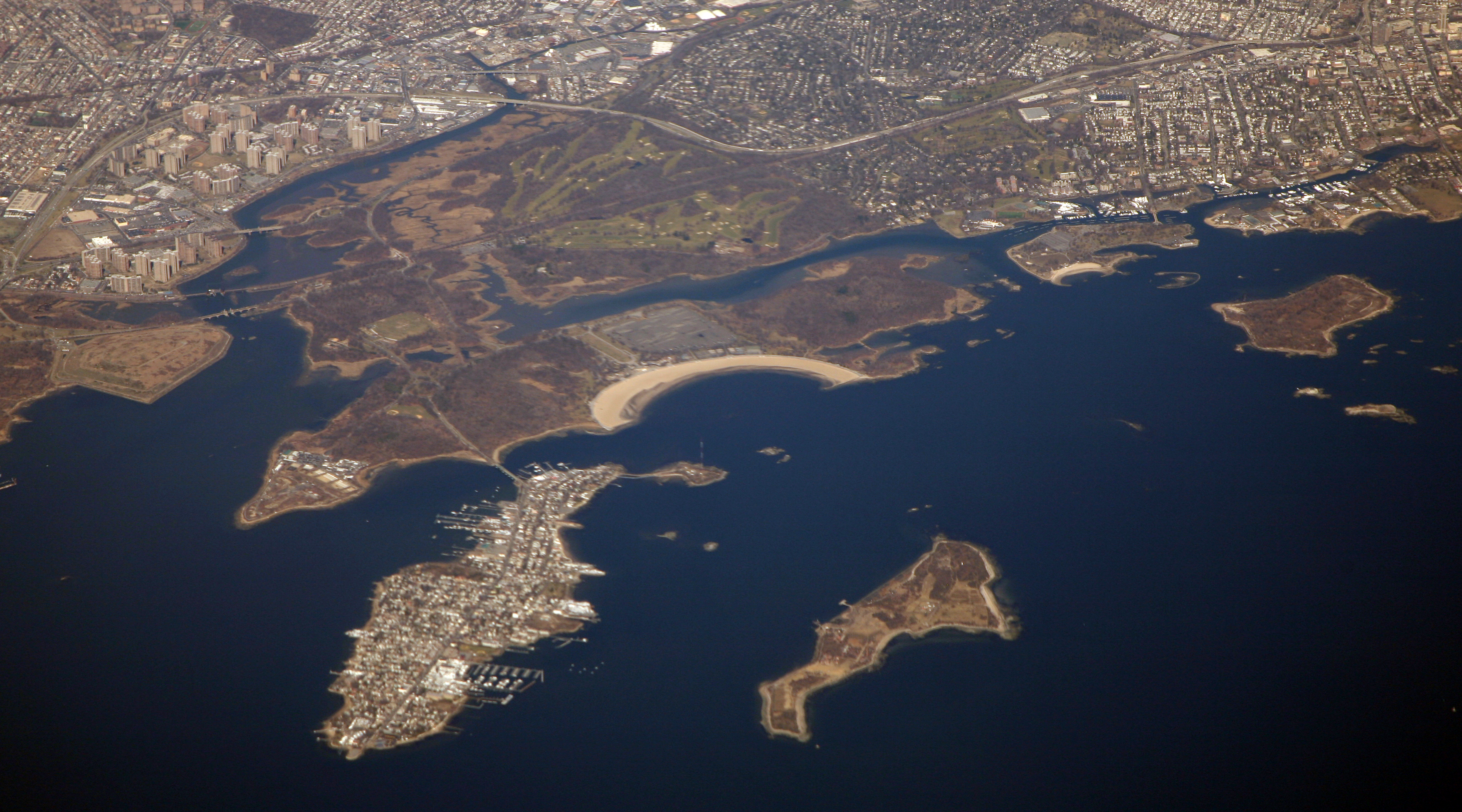
Pelham Bay Park is a municipal park located in the northeast corner of the New York City borough of the Bronx. It is, at , the largest public park in New York City. The park is more than three times the size of Manhattan's Central Park. The park is operated by the New York City Department of Parks and Recreation (NYC Parks). Pelham Bay Park contains many geographical features, both natural and man-made. The park includes several peninsulas, including Rodman's Neck, Tallapoosa Point, and the former Hunter and Twin Islands. A lagoon runs through the center of Pelham Bay Park, and Eastchester Bay splits the southwestern corner from the rest of the park. There are also several recreational areas within the park. Orchard Beach runs along Pelham Bay on the park's eastern shore. Two golf courses and various nature trails are located within the park's central section. Other landmarks include the Bartow-Pell Mansion, a city landmark, as well as the Bronx Victory Column & Memorial Gro ... [...More Info...] [...Related Items...] OR: [Wikipedia] [Google] [Baidu] |
American Federation Of Labor
The American Federation of Labor (A.F. of L.) was a national federation of labor unions in the United States that continues today as the AFL-CIO. It was founded in Columbus, Ohio, in 1886 by an alliance of craft unions eager to provide mutual support and disappointed in the Knights of Labor. Samuel Gompers was elected the full-time president at its founding convention and reelected every year, except one, until his death in 1924. He became the major spokesperson for the union movement. The A.F. of L. was the largest union grouping, even after the creation of the Congress of Industrial Organizations (CIO) by unions that were expelled by the A.F. of L. in 1935. The Federation was founded and dominated by craft unions. especially the building trades. In the late 1930s craft affiliates expanded by organizing on an industrial union basis to meet the challenge from the CIO. The A.F. of L. and CIO competed bitterly in the late 1930s, but then cooperated during World War II and a ... [...More Info...] [...Related Items...] OR: [Wikipedia] [Google] [Baidu] |
Texas Tower 4
Texas Tower 4 (ADC ID: TT-4) was a United States Air Force Texas Tower General Surveillance Radar station, located south-southeast off the coast of Long Island, New York in of water. Hurricane Donna struck the tower in September 1960, seriously damaging it. The tower was the site of an accident and was destroyed by a winter storm on January 15, 1961. None of the twenty-eight airmen and civilian contractors who were manning the station survived. Texas Tower 4 was one in a series of manned radar stations called " Texas Towers" because they resembled the oil-drilling platforms of the Gulf of Mexico. Air Defense Command (ADC) estimated that the Texas Towers would help extend contiguous East Coast radar coverage some 300 to 500 miles seaward. This would provide the United States with an extra 30 minutes of warning time in the event of an incoming bomber attack by the Soviet Union. History Early history Texas Tower 4 began construction in December 1956 in South Port ... [...More Info...] [...Related Items...] OR: [Wikipedia] [Google] [Baidu] |
Chesapeake Bay Bridge
The Chesapeake Bay Bridge (also known locally as the Bay Bridge) is a major twin bridges, dual-span bridge in the U.S. state of Maryland. Spanning the Chesapeake Bay, it connects the state's rural Eastern Shore of Maryland, Eastern Shore region with the urban Western Shore, between Stevensville, Maryland, Stevensville and the capital city of Annapolis, Maryland, Annapolis. The original span, opened in 1952 and with a length of , was the world's longest continuous over-water steel structure. The parallel span was added in 1973. The bridge is officially named the Gov. William Preston Lane Jr. Memorial Bridge after William Preston Lane Jr. who, as the 52nd Governor of Maryland, initiated its construction in the late 1940s finally after decades of political indecision and public controversy. The bridge is part of U.S. Route 50 in Maryland, U.S. Route 50 (US 50) and U.S. Route 301 in Maryland, US 301, and serves as a vital link in both routes. As part of cross-country US&n ... [...More Info...] [...Related Items...] OR: [Wikipedia] [Google] [Baidu] |
Matawan
Matawan is a Borough (New Jersey), borough in Monmouth County, New Jersey, Monmouth County, in the U.S. state of New Jersey. A historic community located near the Raritan Bay in the much larger Raritan River, Raritan Valley region, the borough is a commuter town of New York City within the New York Metropolitan Area. As of the 2020 United States census, the borough's population was 9,565, reflecting an increase of 755 (8.6%) from the 8,810 counted in the 2010 United States census, 2010 census,DP-1 - Profile of General Population and Housing Characteristics: 2010 for Matawan borough, Monmouth County, New Jersey , United States Census Bureau. Accessed July 30, 2012. [...More Info...] [...Related Items...] OR: [Wikipedia] [Google] [Baidu] |

.png)


.jpg)