|
Itapevi (CPTM)
Itapevi is a Brazilian municipality in the state of São Paulo located in the western part of the Greater São Paulo metropolitan area (35 km to the west of São Paulo city). The population is 240,961 (2020 est.) in an area of 82.7 km2. Its boundaries are Santana de Parnaíba to the north, Barueri in the northeast, Jandira in the east, Cotia to the south, Vargem Grande Paulista to the southwest and São Roque to the west. The city is served by Castello Branco and Raposo Tavares highways and also by Line 8 of CPTM, the São Paulo Metropolitan Railway Company. Etymology The toponym comes from the Tupi language Itapevi and means "river of flat stones," according to two books: "Vocabulário Tupi-Guarani - Português", by Prof. Silveira Bueno (Brasilivros Editora), and "A Origem dos Nomes dos Municípios Paulistas" (Imprensa Oficial do Estado de São Paulo, 2003), by Enio Squeff and Helder Perri Ferreira. Says the constant entry of final work: "Itapevi (by Tupi - itá ... [...More Info...] [...Related Items...] OR: [Wikipedia] [Google] [Baidu] |
Municipalities Of Brazil
The municipalities of Brazil ( pt, municípios do Brasil) are administrative divisions of the states of Brazil, Brazilian states. Brazil currently has 5,570 municipalities, which, given the 2019 population estimate of 210,147,125, makes an average municipality population of 37,728 inhabitants. The average state in Brazil has 214 municipalities. Roraima is the least subdivided state, with 15 municipalities, while Minas Gerais is the most subdivided state, with 853. The Federal District (Brazil), Federal District cannot be divided into Municipality, municipalities, which is why its territory is composed of several Administrative regions of the Federal District (Brazil), administrative regions. These regions are directly managed by the government of the Federal District, which exercises constitutional and legal powers that are equivalent to those of the Federated state, states, as well as those of the Municipality, municipalities, thus simultaneously assuming all the obligations a ... [...More Info...] [...Related Items...] OR: [Wikipedia] [Google] [Baidu] |
Barueri
Barueri ( or ) is a Brazilian municipality in the State of São Paulo located in the northwestern part of the Metropolitan Region of São Paulo. The population is 276,982 (2020 est.) in an area of . Its boundaries are Santana de Parnaíba to the north, Osasco in the east, Carapicuíba in the Southeast, Jandira to the south and southwest, and Itapevi the west. The city is served by the trains of line 8 of the Companhia Paulista de Trens Metropolitanos (literally ''São Paulo Metropolitan Railway Company''), (CPTM). History ''Barueri'' means "Red flower that amazes" in a Tupi–Guarani language. According to historians, the history of Barueri dates back to November 11, 1560 with the establishment of ''Nossa Senhora Da Escada Chapel'' by jesuit missionary José de Anchieta and his further settlement. The hamlet grew to the point of the construction, in 1870 of the ''Sorocabana Railway'' that initiated its duties in 1875 turning Barueri into an important point of connection betwee ... [...More Info...] [...Related Items...] OR: [Wikipedia] [Google] [Baidu] |
Humid Subtropical Climate
A humid subtropical climate is a zone of climate characterized by hot and humid summers, and cool to mild winters. These climates normally lie on the southeast side of all continents (except Antarctica), generally between latitudes 25° and 40° and are located poleward from adjacent tropical climates. It is also known as warm temperate climate in some climate classifications. Under the Köppen climate classification, ''Cfa'' and ''Cwa'' climates are either described as humid subtropical climates or warm temperate climates. This climate features mean temperature in the coldest month between (or ) and and mean temperature in the warmest month or higher. However, while some climatologists have opted to describe this climate type as a "humid subtropical climate", Köppen himself never used this term. The humid subtropical climate classification was officially created under the Trewartha climate classification. In this classification, climates are termed humid subtropical when the ... [...More Info...] [...Related Items...] OR: [Wikipedia] [Google] [Baidu] |
Köppen Climate Classification
The Köppen climate classification is one of the most widely used climate classification systems. It was first published by German-Russian climatologist Wladimir Köppen (1846–1940) in 1884, with several later modifications by Köppen, notably in 1918 and 1936. Later, the climatologist Rudolf Geiger (1894–1981) introduced some changes to the classification system, which is thus sometimes called the Köppen–Geiger climate classification system. The Köppen climate classification divides climates into five main climate groups, with each group being divided based on seasonal precipitation and temperature patterns. The five main groups are ''A'' (tropical), ''B'' (arid), ''C'' (temperate), ''D'' (continental), and ''E'' (polar). Each group and subgroup is represented by a letter. All climates are assigned a main group (the first letter). All climates except for those in the ''E'' group are assigned a seasonal precipitation subgroup (the second letter). For example, ''Af'' indi ... [...More Info...] [...Related Items...] OR: [Wikipedia] [Google] [Baidu] |
Vila Belmira
Vila Belmira is a rural neighborhood of Itapevi, municipality in the state of São Paulo, located southwest of its urban center. The postcode of the neighborhood begins with 06675. Being a rural neighborhood, residences are the predominant farms and country houses with large pastures for livestock, rich vegetation and unpaved roads. Besides rich vegetation, the neighborhood also has natural springs and Atlantic Forest largely preserved its territory. Vegetation The vegetation of Vila Belmira is very rich and consists mainly of native Atlantic Forest fragments and Araucaria moist forest, but these two biomes are increasingly diminishing in the region due to the advancement of urbanization. The neighborhood also has natural springs amidst the Atlantic Forest. Culture Although the district belongs to the municipality of Itapevi in the Metropolitan Region of São Paulo, it still contains influences of the popular rural culture thus making the neighborhood having an independent c ... [...More Info...] [...Related Items...] OR: [Wikipedia] [Google] [Baidu] |
Granja Carolina
Granja Carolina is a rural neighborhood of the municipality of Itapevi and the city of Cotia, in the state of São Paulo. Granja Carolina is an old farm that belongs to the estate of Celso Santos. With an acreage of 8,896,100.25 m2, it is divided into two tracts: one located in Itapevi with 5,660,320.00 m2, and another in Cotia, with 3,235,780.25 m2. A partnership agreement was established between the owners and Alphaville Urbanismo SA, in which the owners provided the whole property and Alphaville would implement real estate developments in the neighborhood. A large real estate development (Vila Florestal - Reserva Cotia) was developed by Alphaville to deploy a high standard condominium in the neighborhood. Vila Florestal - Reserva Cotia "Vila Florestal - Reserva Cotia" is a large real estate project of the responsibility of AlphaVille, the company that implemented the condominium complex in the upscale city of Barueri. The project will have two residential settlements with to ... [...More Info...] [...Related Items...] OR: [Wikipedia] [Google] [Baidu] |
Jânio Quadros
Jânio da Silva Quadros (; January 25, 1917 – February 16, 1992) was a Brazilian lawyer and politician who served as the 22nd president of Brazil The president of Brazil ( pt, Presidente do Brasil), officially the president of the Federative Republic of Brazil ( pt, Presidente da República Federativa do Brasil) or simply the ''President of the Republic'', is the head of state and head o ... from January 31 to August 25, 1961, when he resigned from office. He also served as the 24th and 36th mayor of São Paulo, and the 18th governor of the state of São Paulo. Quadros was known for his populist style of government, honesty, and eccentric behavior. As president, he focused on economic reform and attempted to root out corruption. He also pursued an independent foreign policy, trying to balance relations between the United States and the Eastern Bloc. Although he was elected by a huge margin, his term was marked by uncertainty and political instability, culminating in ... [...More Info...] [...Related Items...] OR: [Wikipedia] [Google] [Baidu] |
Bandeirantes
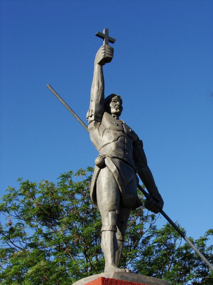
The ''Bandeirantes'' (), literally "flag-carriers", were slavers, explorers, adventurers, and fortune hunters in early Colonial Brazil. They are largely responsible for Brazil's great expansion westward, far beyond the Tordesillas Line of 1494, by which Pope Alexander VI divided the new continent into a western, Crown of Castile, Castilian section, and an eastern, Portugal, Portuguese section. The ''bandeirantes'' were also known as Paulistas and Mamelucos. They mostly hailed from the São Paulo (state), São Paulo region, called the Captaincy of São Vicente until 1709 and then as the Captaincy of São Paulo. The São Paulo settlement served as the home base for the most famous ''bandeirantes.'' Some ''bandeirante'' leaders were descendants of first- and second-generation Portuguese who settled in São Paulo, but the bulk of their numbers was made of people of mameluco background (people of both European and Indigenous peoples in Brazil, Indian ancestries) and natives. Misceg ... [...More Info...] [...Related Items...] OR: [Wikipedia] [Google] [Baidu] |
Tupi Language
Old Tupi, Ancient Tupi or Classical Tupi (also spelled as Tupí) is an extinct Tupian language which was spoken by the aboriginal Tupi people of Brazil, mostly those who inhabited coastal regions in South and Southeast Brazil. It belongs to the Tupi–Guarani language family, and has a written history spanning the 16th, 17th, and early 18th centuries. In the early colonial period, Tupi was used as a ''lingua franca'' throughout Brazil by Europeans and aboriginal Americans, and had literary usage, but it was later suppressed almost to extinction. Today, only one modern descendant is living, the Nheengatu language. The names Old Tupi or classical Tupi are used for the language in English and by modern scholars (it is referred to as in Portuguese), but native speakers called it variously "the good language", "common language", "human language", in Old Tupi, or, in Portuguese, "general language", "Amazonian general language", "Brazilian language". History Old Tupi was firs ... [...More Info...] [...Related Items...] OR: [Wikipedia] [Google] [Baidu] |
Companhia Paulista De Trens Metropolitanos
, owner = São Paulo State Government , area served = Greater São Paulo, Brazil , transit_type = Commuter rail , lines = 5 , line_number = , stations = 57 , daily_ridership = , annual_ridership = , chief_executive = Pedro Tegon Moro (Chairman) , headquarters = Rua Boa Vista, 162 SéSão Paulo , website = , began_operation = , marks = , host = , character = Mostly at-gradePartially elevated , stock = , headway = 4' to 35' , system_length = , notrack = , track_gauge = , ogauge = , el = 3,000 V DC catenary , average_speed = , top_speed ... [...More Info...] [...Related Items...] OR: [Wikipedia] [Google] [Baidu] |
São Roque, São Paulo
São Roque (meaning Saint Roch in Portuguese) is a city in the state of São Paulo in Brazil. It is part of the Metropolitan Region of Sorocaba. The population is 92,060 (2020 est.) in an area of 306.91 km². The city is at an altitude of 771 m. São Roque is connected by two main highways: Rodovia Raposo Tavares and Rodovia Castelo Branco. It is located 60 km west from the state capital. Some of the neighboring municipalities are Cotia, Vargem Grande Paulista, Ibiúna, Mairinque and Aluminio. São Roque has protected greenspaces and maintains itself as a lush ecological paradise. It has a good climate with a wonderful countryside. The Serra do Mar mountains cover the southeast. It has an excellent infrastructure, especially well-developed for wine production. In the 19th century, immigrants from Italy and Portugal arrived in São Roque to work in vineyards. Tourism is also a significant part of the economy. It holds the largest artificial ski park in Latin America, ... [...More Info...] [...Related Items...] OR: [Wikipedia] [Google] [Baidu] |


