|
Island Of Dordrecht
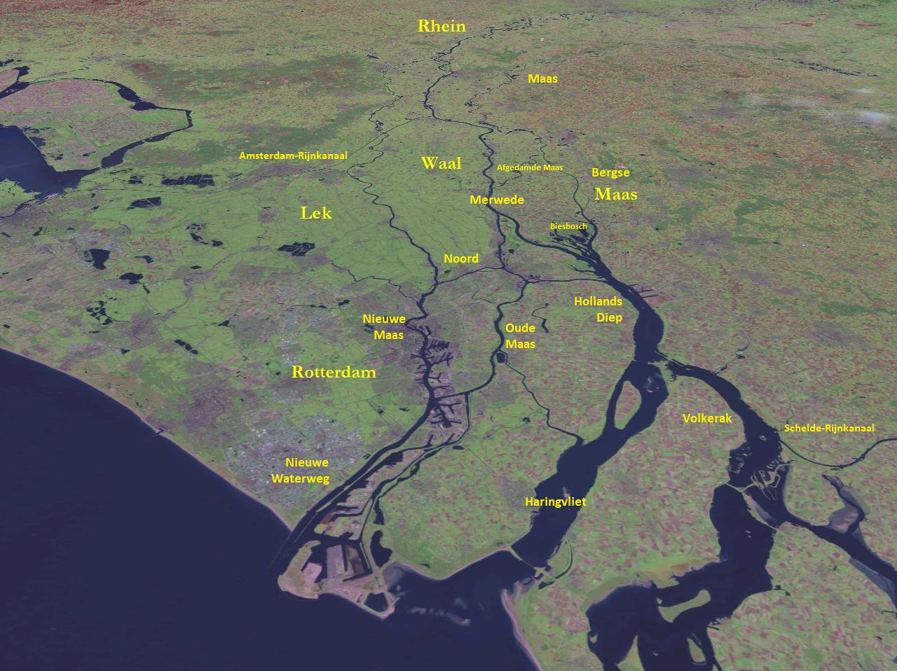
Dordrecht (), historically known in English as Dordt (still colloquially used in Dutch, ) or Dort, is a city and municipality in the Western Netherlands, located in the province of South Holland. It is the province's fifth-largest city after Rotterdam, The Hague, Zoetermeer and Leiden, with a population of . The municipality covers the entire Dordrecht Island, also often called ''Het Eiland van Dordt'' ("the Island of Dordt"), bordered by the rivers Oude Maas, Beneden Merwede, Nieuwe Merwede, Hollands Diep, and Dordtsche Kil. Located about 17 km south east of Rotterdam, Dordrecht is the largest and most important city in the Drechtsteden and is also part of the Randstad, the main conurbation in the Netherlands. Dordrecht is the oldest city in Holland and has a rich history and culture. Etymology The name Dordrecht comes from ''Thuredriht'' (circa 1120), ''Thuredrecht'' (circa 1200). The name seems to mean 'thoroughfare'; a ship-canal or -river through which ships w ... [...More Info...] [...Related Items...] OR: [Wikipedia] [Google] [Baidu] |
List Of Cities In The Netherlands By Province
There are no formal rules in the Netherlands to distinguish cities from other settlements. Smaller settlements are usually called ''dorp'', comparable with villages in English speaking countries. The Dutch word for city is ''stad'' (plural: ''steden''). The intermediate category of town does not exist in the Netherlands. Historically, there existed systems of city rights, granted by the territorial lords, which defined the status of a place: a ''stad'' or ''dorp''. Cities were self-governing and had several privileges. In 1851 the granting of city rights and all privileges and special status of cities were abolished. Since then, the only local administrative unit is the municipality. Regardless of this legal change, many people still use the old city rights as a criterion: certain small settlements proudly call themselves a ''stad'' because they historically had city rights, while other, newer towns may not get this recognition. Geographers and policy makers can distinguish betw ... [...More Info...] [...Related Items...] OR: [Wikipedia] [Google] [Baidu] |
Leiden
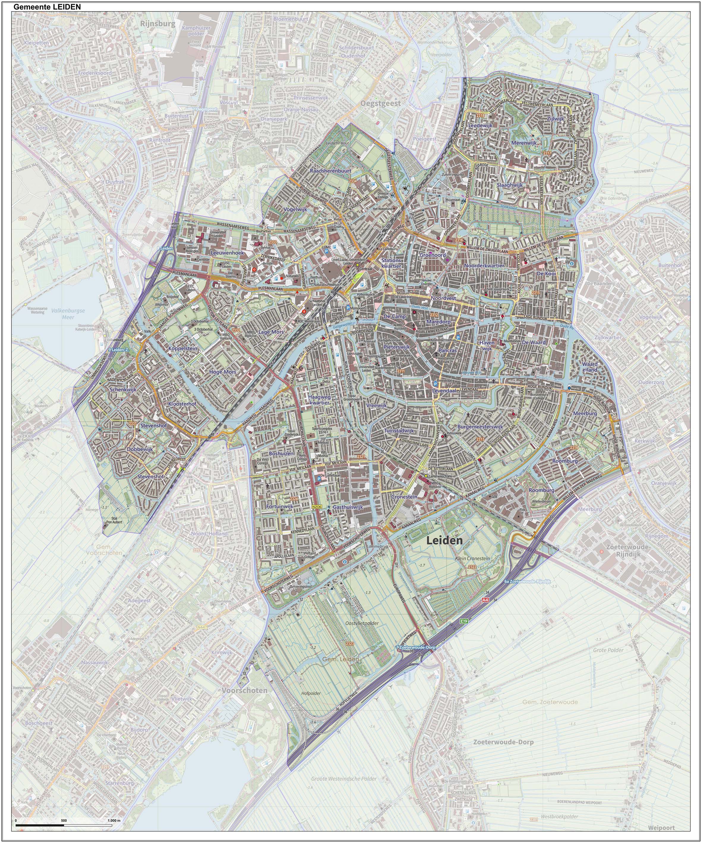
Leiden (; in English and archaic Dutch also Leyden) is a city and municipality in the province of South Holland, Netherlands. The municipality of Leiden has a population of 119,713, but the city forms one densely connected agglomeration with its suburbs Oegstgeest, Leiderdorp, Voorschoten and Zoeterwoude with 206,647 inhabitants. The Netherlands Central Bureau of Statistics (CBS) further includes Katwijk in the agglomeration which makes the total population of the Leiden urban agglomeration 270,879, and in the larger Leiden urban area also Teylingen, Noordwijk, and Noordwijkerhout are included with in total 348,868 inhabitants. Leiden is located on the Oude Rijn, at a distance of some from The Hague to its south and some from Amsterdam to its north. The recreational area of the Kaag Lakes ( Kagerplassen) lies just to the northeast of Leiden. A university city since 1575, Leiden has been one of Europe's most prominent scientific centres for more than four centuries ... [...More Info...] [...Related Items...] OR: [Wikipedia] [Google] [Baidu] |
Beguinage
A beguinage, from the French term ''béguinage'', is an architectural complex which was created to house beguines: lay religious women who lived in community without taking vows or retiring from the world. Originally the beguine institution was the convent, an association of beguines living together or in close proximity of each other under the guidance of a single superior, called a mistress or prioress. Although they were not usually referred to as "convents", in these houses dwelt a small number of women together: the houses small, informal, and often poor communities that emerged across Europe after the twelfth century. In most cases, beguines who lived in a convent agreed to obey certain regulations during their stay and contributed to a collective fund. In the first decades of the thirteenth century much larger and more stable types of community emerged in the region of the Low Countries: large ''court'' beguinages were formed which consisted of several houses for beguines ... [...More Info...] [...Related Items...] OR: [Wikipedia] [Google] [Baidu] |
Holland
Holland is a geographical regionG. Geerts & H. Heestermans, 1981, ''Groot Woordenboek der Nederlandse Taal. Deel I'', Van Dale Lexicografie, Utrecht, p 1105 and former province on the western coast of the Netherlands. From the 10th to the 16th century, Holland proper was a unified political region within the Holy Roman Empire as a county ruled by the counts of Holland. By the 17th century, the province of Holland had risen to become a maritime and economic power, dominating the other provinces of the newly independent Dutch Republic. The area of the former County of Holland roughly coincides with the two current Dutch provinces of North Holland and South Holland into which it was divided, and which together include the Netherlands' three largest cities: the capital city (Amsterdam), the home of Europe's largest port (Rotterdam), and the seat of government (The Hague). Holland has a population of 6,583,534 as of November 2019, and a population density of 1203/km2. The name ... [...More Info...] [...Related Items...] OR: [Wikipedia] [Google] [Baidu] |
Conurbation
A conurbation is a region comprising a number of metropolises, cities, large towns, and other urban areas which through population growth and physical expansion, have merged to form one continuous urban or industrially developed area. In most cases, a conurbation is a polycentric urbanised area in which transportation has developed to link areas. They create a single urban labour market or travel to work area. Patrick Geddes coined the term in his book ''Cities In Evolution'' (1915). He drew attention to the ability of the new technology at the time of electric power and motorised transport to allow cities to spread and agglomerate together, and gave as examples " Midlandton" in England, the Ruhr in Germany, Randstad in the Netherlands, and the Northeastern Seaboard in the United States. The term as described is used in Britain whereas in the United States, each polycentric "metropolitan area" may have its own common designation such as San Francisco Bay Area or the Dallasâ ... [...More Info...] [...Related Items...] OR: [Wikipedia] [Google] [Baidu] |
Randstad
The Randstad (; "Rim" or "Edge" City) is a roughly crescent-shaped conurbation in the central-western Netherlands, consisting primarily of the four largest Dutch cities (Amsterdam, Rotterdam, The Hague, and Utrecht); their suburbs, and many towns in between, that all grew and merged into each other, containing almost half the country's population. Among other things, it includes the Port of Rotterdam (the busiest seaport outside of Asia), the Port of Amsterdam (Europe's fourth-busiest seaport), and Amsterdam Airport Schiphol (the busiest airport in Europe by aircraft movements). With a population of approximately 8.4 million people it is one of the largest metropolitan regions in Europe, comparable in population size to the Rhine-Ruhr metropolitan region or the San Francisco Bay Area, and covers an area of approximately . The Randstad had a gross regional product of €397 billion in 2017, making it the third most productive region in the European Union, behind the Paris Regi ... [...More Info...] [...Related Items...] OR: [Wikipedia] [Google] [Baidu] |
Drechtsteden
The Drechtsteden (; Dutch for "Drecht cities") are a number of towns and cities bordering each other in the delta area of the rivers Oude Maas, Noord, and Beneden-Merwede in the province of South Holland, Netherlands. These cooperate in the ''Gemeenschappelijke Regeling Drechtsteden'' ("joint arrangement Drechtsteden"), which performs common tasks for the municipalities in the field of economy, development, culture, and social assistance. Collectively, a little more than 250,000 people call one of the towns and cities of Drechtsteden home. The associated towns and cities are: * Alblasserdam * Dordrecht * Hendrik-Ido-Ambacht * Papendrecht * Sliedrecht * Hardinxveld-Giessendam * Zwijndrecht The name "Drechtsteden" was chosen because the name of several of the associated cities and towns ends in the suffix In linguistics, a suffix is an affix which is placed after the stem of a word. Common examples are case endings, which indicate the grammatical case of nouns, adjectives, ... [...More Info...] [...Related Items...] OR: [Wikipedia] [Google] [Baidu] |
Dordtsche Kil
The Dordtse Kil ( pre-1947 spelling: Dordtsche Kil) is a short river in South Holland in the Netherlands. The river is tidal and forms the connection between the Oude Maas river and the Hollands Diep. The river is for most part artificial in origin, since it has been a relatively small tidal creek until the 19th century. River crossings Connection between Hoeksche Waard island on the west and the Dordrecht Dordrecht (), historically known in English as Dordt (still colloquially used in Dutch, ) or Dort, is a city and municipality in the Western Netherlands, located in the province of South Holland. It is the province's fifth-largest city after ... island on the east: * Kiltunnel ( toll tunnel) See also * Kill (body of water) References Rivers of the Rhine–Meuse–Scheldt delta Hoeksche Waard Dordrecht Rivers of South Holland Rivers of the Netherlands {{Netherlands-river-stub ... [...More Info...] [...Related Items...] OR: [Wikipedia] [Google] [Baidu] |
Hollands Diep
Hollands Diep ( pre-1947 spelling: Hollandsch Diep) is a wide river in the Netherlands and an estuary of the Rhine and Meuse rivers. Through the Scheldt-Rhine Canal it connects to the Scheldt river and Antwerp. The Bergse Maas river and the Nieuwe Merwede river join near Lage Zwaluwe to form the Hollands Diep. The Dordtsche Kil connects to it near Moerdijk. Near Numansdorp it splits into the Haringvliet and the Volkerak. History The Hollands Diep was formed as a result of the extensive flood of 1216, which breached the dunes of Voorne and created a deep saltwater inlet (the current Haringvliet). During a second flood, the St. Elizabeth floods, this inlet connected to the Merwede and became an important estuary of the Rhine and Meuse rivers. From that moment on, the freshwater part of the estuary (east of the Hellegatsplein) was renamed Hollands Diep. The former river Striene, that used to connect the Meuse with the Scheldt, was completely destroyed by these floods and c ... [...More Info...] [...Related Items...] OR: [Wikipedia] [Google] [Baidu] |


