|
Irondale, Bancroft And Ottawa Railway
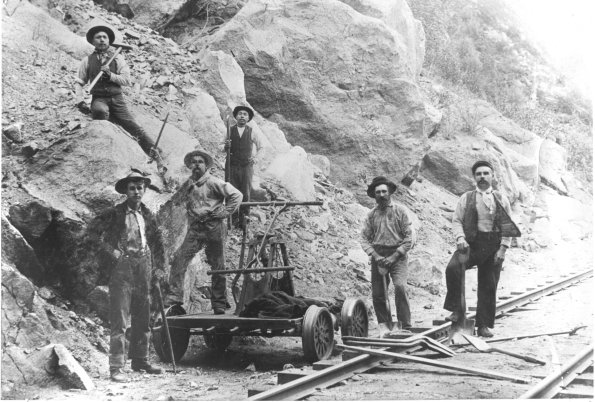
The Irondale, Bancroft and Ottawa Railway (IB&O) was a short line railway in Central Ontario, Canada. The line was originally opened in 1878 as the Myles Branch Tramway, a horse-drawn wagonway connecting the Snowdon Iron Mine to the Victoria Railway a few miles away. The line was taken over by a group looking to build a northern extension of the Toronto and Nipissing Railway (T&N) as the Toronto and Nipissing Eastern Extension Railway. This extension was never built; instead, the company rechartered as the IB&O and used the Tramway as the basis for a new line with the ultimate aim to connect Orillia to the Ottawa area. The Tramway initially ran east from Howland to Furnace Falls, and the IB&O began pushing further northeast through Irondale, Gooderham, Wilberforce and Harcourt, then turning east for Bancroft. Construction stopped at Baptiste Lake when the owner died in July 1899. The line was eventually purchased by Mackenzie and Mann in 1909, who connected it to the Central On ... [...More Info...] [...Related Items...] OR: [Wikipedia] [Google] [Baidu] |
Ontario
Ontario ( ; ) is one of the thirteen provinces and territories of Canada.Ontario is located in the geographic eastern half of Canada, but it has historically and politically been considered to be part of Central Canada. Located in Central Canada, it is Canada's most populous province, with 38.3 percent of the country's population, and is the second-largest province by total area (after Quebec). Ontario is Canada's fourth-largest jurisdiction in total area when the territories of the Northwest Territories and Nunavut are included. It is home to the nation's capital city, Ottawa, and the nation's most populous city, Toronto, which is Ontario's provincial capital. Ontario is bordered by the province of Manitoba to the west, Hudson Bay and James Bay to the north, and Quebec to the east and northeast, and to the south by the U.S. states of (from west to east) Minnesota, Michigan, Ohio, Pennsylvania, and New York. Almost all of Ontario's border with the United States f ... [...More Info...] [...Related Items...] OR: [Wikipedia] [Google] [Baidu] |
Rail Trail
A rail trail is a shared-use path on railway right of way. Rail trails are typically constructed after a railway has been abandoned and the track has been removed, but may also share the right of way with active railways, light rail, or streetcars (rails with trails), or with disused track. As shared-use paths, rail trails are primarily for non-motorized traffic including pedestrians, bicycles, horseback riders, skaters, and cross-country skiers, although snowmobiles and ATVs may be allowed. The characteristics of abandoned railways—gentle grades, well-engineered rights of way and structures (bridges and tunnels), and passage through historical areas—lend themselves to rail trails and account for their popularity. Many rail trails are long-distance trails, while some shorter rail trails are known as greenways or linear parks. Rail trails around the world Americas Bermuda The Bermuda Railway ceased to operate as such when the only carrier to exist in Bermuda folded in 1948. ... [...More Info...] [...Related Items...] OR: [Wikipedia] [Google] [Baidu] |
Henry Stark Howland
Henry Stark Howland (August 2, 1824-January 28, 1902) was a businessman and founder of the Imperial Bank of Canada in 1873. Howland was born in 1824 in Pawling, New York to William Howland and moved to Upper Canada to join his brother William Pearce Howland in 1840 and settled in Lambton Mills, Ontario. Howland acquired a grist mill, sawmill, and general store in Kleinburg, Ontario in 1852 who eventually entered in political life. Howland spent the 1850s and 1860s in Vaughan, Ontario, becoming postmaster, town councilor and reeve. In 1864 he moved to Toronto, where he later began a business known as H. S. Howland, Sons and Company. He was one of the founding partners of the Canadian Bank of Commerce The Canadian Bank of Commerce was a Canadian bank which was founded in 1867, and had hundreds of branches throughout Canada. It merged in 1961 with the Imperial Bank of Canada to form the Canadian Imperial Bank of Commerce. History In 1866 a ... in 1867 and left to help found ... [...More Info...] [...Related Items...] OR: [Wikipedia] [Google] [Baidu] |
List Of Ontario Colonization Roads
The colonization roads were created during the 1840s and 1850s to open up or provide access to areas in Central and Eastern Ontario for settlement and agricultural development. The colonization roads were used by settlers to lead them toward areas for settlement, much like modern-day highways. History The colonization roads of the 1840s and 1850s were preceded by other government-sponsored road programmes going back to the period immediately after the American Revolutionary War. One early road was cut through the geographic Beverley Township from Ancaster westward toward the Grand River by two Englishmen named Ward and Smith in 1799–1800. This allowed European settlers to access the northern part of the Grand River Valley. During and after the War of 1812, government spending on roads in Upper Canada (present-day Ontario) increased significantly, leading to the improvement and extension of a number of roads. Roads into the interior were still not plentiful, however. By this ... [...More Info...] [...Related Items...] OR: [Wikipedia] [Google] [Baidu] |
Bay Of Quinte Railway
The Bay of Quinte Railway was a short-line railway in eastern Ontario, Canada. It was formed as the Napanee, Tamworth and Quebec Railway (NT&QR), chartered in 1878 by Edward Rathbun and Alexander Campbell, with plans to run from Napanee through Renfrew County and on to the Ottawa Valley. Lacking funding from the governments, development never began. Rathburn took over the charter in 1881. He started construction with the shorter Bay of Quinte Railway and Navigation Company (BQR&NC) that ran from his factories in Deseronto to the Grand Trunk Railway mainline at Napanee. Construction on the NT&QR out of Napanee through Yarkers to Tamworth started the same year, but was abandoned by the contractor and Rathburn had to pay the workers out of pocket. The line finally opened to Tamworth in 1884. In 1889 it was extended westward to Tweed while a branch eastward from Yarker to Harrowsmith connected to the Kingston and Pembroke Railway with running rights to Kingston. In 1890 the line ... [...More Info...] [...Related Items...] OR: [Wikipedia] [Google] [Baidu] |
Belleville And North Hastings Railway
The Belleville and North Hastings Railway (B&NHR) was a Shortline railroad, short-line railway in Hastings County, Ontario, Canada. It branched off the Grand Junction Railway (Ontario), Grand Junction Railway (GJR) north of Belleville, Ontario, Belleville and ended on the Central Ontario Railway (COR) outside Eldorado, Ontario, Eldorado for a total distance of . In spite of its name, the line did not reach either Belleville or the northern part of Hastings County. The line was completed in January 1880 and leased to the GJR in June that year. Both companies were merged into the Midland Railway of Canada in 1881, part of the Midland's efforts to consolidate a number of unprofitable lines east of Toronto. The section north of Madoc offered nothing the COR lacked and closed in 1893. The section from Madoc, Ontario (village), Madoc remained in use until the 1980s as a branch line of Canadian National Railway, CN known as the Madoc Subdivision. This section eventually closed in 1984. L ... [...More Info...] [...Related Items...] OR: [Wikipedia] [Google] [Baidu] |
Trenton, Ontario
Trenton (2001 population 16,770) is a large unincorporated community in Central Ontario in the municipality of Quinte West, Ontario, Canada. Located on the Bay of Quinte, it is the starting point for the Trent-Severn Waterway, which continues northwest to Peterborough and eventually Port Severn on Georgian Bay. History The Trenton area is part of the traditional area of the Mississauga and other Indigenous First Nations. The first known expedition by Europeans in the area was one by French explorer Samuel de Champlain, which followed the Trent passing through Trenton in 1615. The Trent River is known to the Mississauga as ''Sangichiwigewonk'', or 'fast flowing.' Settlers gave it the name 'Trent', after the River Trent in England. The area around the mouth of the Trent River was first settled by Europeans in the 1780s, after the area was ceded to the British in 1783 as part of the Crawford Purchase. United Empire Loyalists first settled in Trenton in 1792. First named Trent Por ... [...More Info...] [...Related Items...] OR: [Wikipedia] [Google] [Baidu] |
Eldorado, Ontario
Eldorado is community in Madoc, Ontario (township), Madoc Township, in Ontario, Canada, with a 2019 population of 50. In 1866, it was the location of Ontario's first gold rush after Marcus Herbert Powell found gold on John Richardson's farm.ONTARIO'S FIRST GOLD MINE' (public sign), John Street and Ontario Highway 62, Highway 62, Archeological and Historic Sites Board of Ontario Location Eldorado is located six miles away from the centre of Madoc. History Municipal employee and part-time prospector Marcus Herbert Powell found gold on August 15, 1866, on a farm owned by John Richardson's. The town of Eldorado was founded in 1867. The same year the Richardson Mine went into operation. Despite higher expectations, Powell extracted about 100 ounces of gold, worth $1,500 to $2,000 at the time, but no further gold was found. Various other mines that had quickly opened, quickly closed. Demographics In 2019 the population of Eldorado was 50, down from 4,000 during the gold rus ... [...More Info...] [...Related Items...] OR: [Wikipedia] [Google] [Baidu] |
Rice Lake (Ontario)
Rice Lake is a lake located in Northumberland and Peterborough counties in south-eastern Ontario. The lake is located south of the city of Peterborough, and the Kawartha Lakes and north of Cobourg. It is part of the Trent-Severn Waterway, which flows into the lake by the Otonabee and out via the Trent. The lake is long and 5 km wide. Its maximum depth is 10m, with a surface water level at 187 m above sea level, raised to its present height by the Hastings Dam, built in the 19th century as part of the Trent-Severn canal system. Natives called it ''Pemadashdakota'' or "lake of the burning plains". A drumlin field is located northwest of the lake, and the lake's islands are partially submerged drumlins. Rice Lake nearly bisects the Oak Ridges Moraine, with three wedges to the west (''Albion'', ''Uxbridge'' and ''Pontypool''), and one wedge to the east (''Rice Lake'') which has terminus at the Trent River. A narrow corridor to the south of Rice Lake connects these wedges. R ... [...More Info...] [...Related Items...] OR: [Wikipedia] [Google] [Baidu] |
Trent–Severn Waterway
The Trent–Severn Waterway is a canal route connecting Lake Ontario at Trenton to Georgian Bay, Lake Huron, at Port Severn. Its major natural waterways include the Trent River, Otonabee River, Kawartha Lakes, Lake Simcoe, Lake Couchiching and Severn River. Its scenic, meandering route has been called "one of the finest interconnected systems of navigation in the world". The canal was surveyed as a military route, but the first lock was built in 1833 as a commercial venture. This connected a number of lakes and rivers near the centre of the waterway, opening a large area to navigation by steamship. The government had begun construction of three additional locks when the Upper Canada Rebellion of 1837 broke out. This led the government to re-examine the project, concluding that the route would have too many locks to allow rapid movement for military purposes. They decided that the locks under construction would be completed, but the rest could be turned into timber slides. Thi ... [...More Info...] [...Related Items...] OR: [Wikipedia] [Google] [Baidu] |
Trent River (Ontario)
The Trent River is a river in southeastern Ontario which flows from Rice Lake to empty into the Bay of Quinte on Lake Ontario. This river is part of the Trent-Severn Waterway which leads to Georgian Bay. The river is long. The Trent drains a large portion of south-central Ontario, including most of the Kawartha Lakes and their supplying watersheds. The river is host to numerous species of birds, amphibians and fish. Some species of fish in the river include: Smallmouth bass, Largemouth bass, Pike, Walleye, Freshwater drums, Crappie as well as other smaller fish such as Sunfish, Rock Bass and Bluegill. Located in traditional territory of the Mississauga Anishinaabek, Trent River's name in Ojibwe is both "zaagidawijiwanaang", and "Saugechewigewonk", meaning "Strong Rapids Waters". Tributaries of this river include the Crowe River and the Otonabee River, which runs through the city of Peterborough, Ontario. Trent University, located in Peterborough, is named after the region, ... [...More Info...] [...Related Items...] OR: [Wikipedia] [Google] [Baidu] |


