|
Interstate 39 In Illinois
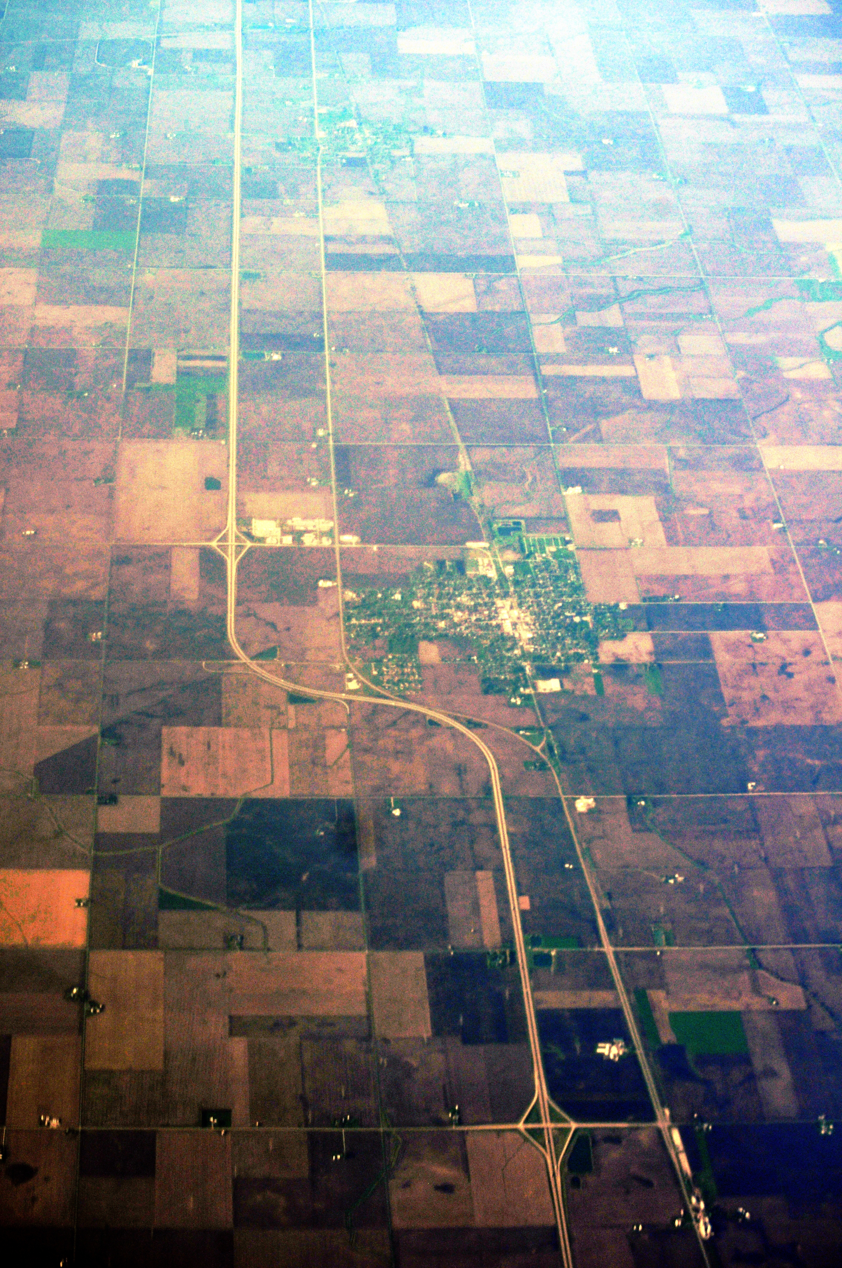
Interstate 39 (I-39) is a highway in the Midwestern United States. I-39 runs from Normal, Illinois, at I-55 to State Trunk Highway 29 (WIS 29) in the town of Rib Mountain, Wisconsin, which is approximately south of Wausau. I-39 was designed to replace U.S. Route 51 (US 51), which, in the early 1980s, was one of the busiest two-lane highways in the United States. I-39 was built in the 1980s and 1990s. In Illinois, the route has a total length of . In Wisconsin, I-39 has a distance of . With the exception of an segment around Portage, Wisconsin, the Interstate shares a route with at least one other route number in I-39's entirety. From Rockford, Illinois, to Portage, Wisconsin, I-39 runs concurrently with I-90. In Wisconsin, I-94 joins the pair in Madison until Portage. At in length, this concurrency of three Interstates is the longest in the country. From Portage northward, US 51 is cosigned with the Interstate and has exit numbers based on its ... [...More Info...] [...Related Items...] OR: [Wikipedia] [Google] [Baidu] |
Illinois Department Of Transportation
The Illinois Department of Transportation (IDOT) is a state agency in charge of state-maintained public roadways of the U.S. state of Illinois. In addition, IDOT provides funding for rail, public transit and airport projects and administers fuel tax and federal funding to local jurisdictions in the state. The Secretary of Transportation reports to the Governor of Illinois. IDOT is headquartered in unincorporated Sangamon County, located near the state capital, Springfield. In addition, the IDOT Division of Highways has offices in nine locations throughout the state. The mission of IDOT is to provide safe, cost-effective transportation for Illinois in ways that enhance quality of life, promote economic prosperity and demonstrate respect for the environment. Organization As of February 2009, the Illinois Department of Transportation was divided into the following offices and divisions: Offices *The Office of Business and Workforce Diversity oversees the implementation of direct ... [...More Info...] [...Related Items...] OR: [Wikipedia] [Google] [Baidu] |
LaSalle County, Illinois
LaSalle County is located within the Fox Valley and Illinois River Valley regions of the U.S. state of Illinois. As of the 2020 Census, it had a population of 109,658. Its county seat and largest city is Ottawa. LaSalle County is part of the Ottawa, IL Micropolitan Statistical Area of Northern Illinois. LaSalle County borders Woodford, Marshall, Putnam, Bureau, Livingston, Lee, DeKalb, Kendall, and Grundy counties. Though LaSalle County is in the Chicago media market, it retains a unique identity with a mix of river towns and vast expanses of farmland. The county lies at the intersection of the Chicago, Peoria, Quad Cities and Rockford television markets with all four regions broadcasting within its borders and having a strong influence on the area, despite the county being only southwest of Chicago. History LaSalle County was formed on January 15, 1831, out of Tazewell and Putnam Counties. It is named for the early French explorer René-Robert Cavelier, Sieur de La S ... [...More Info...] [...Related Items...] OR: [Wikipedia] [Google] [Baidu] |
Wisconsin Highway 29
State Trunk Highway 29 (often called Highway 29, STH-29 or WIS 29) is a state highway running east–west across central Wisconsin. It is a major east–west corridor connecting the Twin Cities and the Chippewa Valley with Wausau and Green Bay. A multi-year project to upgrade the corridor to a four-lane freeway or expressway from Elk Mound to Green Bay was completed in 2005. The expansion served to improve safety on the route, which was over capacity as a two-lane road. The remainder of WIS 29 is two-lane surface road or urban multi-lane road. Route description Prescott to Elk Mound WIS 29 begins at its western terminus at U.S. Highway 10 (US 10), on the north side of Prescott. From this point, WIS 29 follows WIS 35 northeast to River Falls, passing the University of Wisconsin–River Falls campus. At the junction with WIS 65, WIS 35 turns northbound with WIS 65 while WIS 29 continues east. WIS 2 ... [...More Info...] [...Related Items...] OR: [Wikipedia] [Google] [Baidu] |
Interstate 55
Interstate 55 (I-55) is a major Interstate Highway in the central United States. As with most primary Interstates that end in a five, it is a major cross-country, north–south route, connecting the Gulf of Mexico to the Great Lakes. The highway travels from LaPlace, Louisiana, at I-10 to Chicago, Illinois, at U.S. Route 41 (US 41, Lake Shore Drive), at McCormick Place. The major cities that I-55 connects to are (from south to north) New Orleans, Louisiana; Jackson, Mississippi; Memphis, Tennessee; St. Louis, Missouri; and Chicago, Illinois. The section of I-55 between Chicago and St. Louis was built as an alternate route for U.S. Route 66 (US 66). The Interstate crosses the Mississippi River twice: once at Memphis and again at St. Louis. History When it was realized that a national highway system was needed, the Federal Aid Highway Act of 1956 provided for a highway replacing the old US 66 which I-55 filled. I-55 was originally constructed in ... [...More Info...] [...Related Items...] OR: [Wikipedia] [Google] [Baidu] |
Midwestern United States
The Midwestern United States, also referred to as the Midwest or the American Midwest, is one of four census regions of the United States Census Bureau (also known as "Region 2"). It occupies the northern central part of the United States. It was officially named the North Central Region by the Census Bureau until 1984. It is between the Northeastern United States and the Western United States, with Canada to the north and the Southern United States to the south. The Census Bureau's definition consists of 12 states in the north central United States: Illinois, Indiana, Iowa, Kansas, Michigan, Minnesota, Missouri, Nebraska, North Dakota, Ohio, South Dakota, and Wisconsin. The region generally lies on the broad Interior Plain between the states occupying the Appalachian Mountain range and the states occupying the Rocky Mountain range. Major rivers in the region include, from east to west, the Ohio River, the Upper Mississippi River, and the Missouri River. ... [...More Info...] [...Related Items...] OR: [Wikipedia] [Google] [Baidu] |
Marathon County, Wisconsin
Marathon County is a county located in the U.S. state of Wisconsin. As of the 2020 census, the population was 138,013. Marathon County's seat is Wausau. It was founded in 1850, created from a portion of Portage County. At that time the county stretched to the northern border with the upper Michigan peninsula. It is named after the battlefield at Marathon, Greece. Marathon County comprises the Wausau, WI Metropolitan Statistical Area and is included in the Wausau- Stevens Point- Wisconsin Rapids, WI Combined Statistical Area. Geography According to the U.S. Census Bureau, the county has a total area of , of which is land and (2.0%) is water. It is the largest county in Wisconsin by land area and fourth-largest by total area. The Marathon County Park Commission has posted a geographical marker that identifies the spot (45°N, 90°W) of the exact center of the northern half of the Western Hemisphere, meaning that it is a quarter of the way around the world from the Pri ... [...More Info...] [...Related Items...] OR: [Wikipedia] [Google] [Baidu] |
Portage County, Wisconsin
Portage County is a county in the U.S. state of Wisconsin. As of th2020 census the population was 70,377. Its county seat is Stevens Point. Portage County comprises the Stevens Point, WI Micropolitan Statistical Area and is included in the Wausau-Stevens Point-Wisconsin Rapids, WI Combined Statistical Area. History Portage County was created from the Wisconsin Territory in 1836 and organized in 1844. Like the city of Portage, Portage County is named for the portage between the Fox and Wisconsin rivers; Portage County originally included the portage and Portage but boundary changes detached the county from its namesake. Geography According to the U.S. Census Bureau, the county has a total area of , of which is land and (2.7%) is water. Major highways Railroads *Canadian National Buses * Stevens Point Transit *List of intercity bus stops in Wisconsin Airport * KSTE - Stevens Point Municipal Airport Adjacent counties * Marathon County - north * Shawano County - nort ... [...More Info...] [...Related Items...] OR: [Wikipedia] [Google] [Baidu] |
Waushara County, Wisconsin
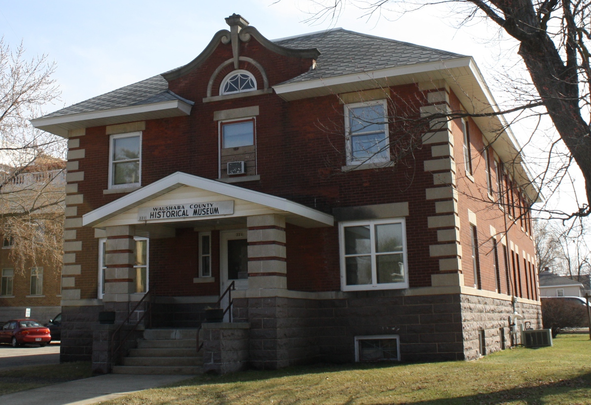
Waushara County is a county located in the U.S. state of Wisconsin. As of the 2020 census, the population was 24,520. Its county seat is Wautoma. Waushara County is located in central Wisconsin, about north of Madison. History Waushara County was established by an act of the Wisconsin Legislature on February 15, 1851. It originally consisted of a single organized Town of Waushara. In 1852 the county achieved full organization. The county seat was first located at Sacramento and was relocated to Wautoma in 1854 after a bitter fight between proponents of the two places. The name is of Ho-Chunk origin and is believed to mean "good land". Geography According to the U.S. Census Bureau, the county has a total area of , of which is land and (1.8%) is water. Major highways * Interstate 39 * U.S. Highway 51 * Highway 21 (Wisconsin) * Highway 22 (Wisconsin) * Highway 49 (Wisconsin) * Highway 73 (Wisconsin) Buses *List of intercity bus stops in Wisconsin Airports * Waut ... [...More Info...] [...Related Items...] OR: [Wikipedia] [Google] [Baidu] |
Marquette County, Wisconsin
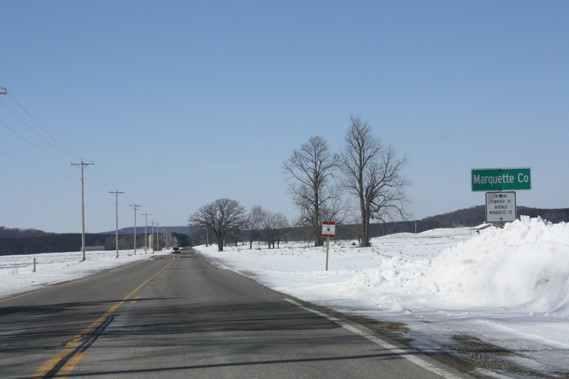
Marquette County is a county located in the U.S. state of Wisconsin. As of the 2020 census, the population was 15,592. Its county seat is Montello. The county was created in 1836 from the Wisconsin Territory and organized in 1848. Geography According to the U.S. Census Bureau, the county has a total area of , of which is land and (1.9%) is water. The Mecan River, Buffalo Lake, and Puckaway Lake lie within Marquette County. The highest altitude in the county is a rocky area known as Mt. Shaw. Major highways * Interstate 39 * U.S. Highway 51 * Highway 22 (Wisconsin) * Highway 23 (Wisconsin) * Highway 73 (Wisconsin) * Highway 82 (Wisconsin) Railroads *Union Pacific Buses *List of intercity bus stops in Wisconsin Adjacent counties * Waushara County - north * Green Lake County - east * Columbia County - south * Adams County - west National protected area * Fox River National Wildlife Refuge Demographics 2020 census As of the census of 2020, the population was ... [...More Info...] [...Related Items...] OR: [Wikipedia] [Google] [Baidu] |
Columbia County, Wisconsin
Columbia County is a county located in the U.S. state of Wisconsin. As of the 2020 census, the population was 58,490. Its county seat and largest city is Portage. The county was created in 1846 as part of Wisconsin Territory. Columbia County is part of the Madison, WI Metropolitan Statistical Area as well as the Madison- Janesville- Beloit, WI Combined Statistical Area. Geography According to the U.S. Census Bureau, the county has a total area of , of which is land and (3.8%) is water. The county's highest point is in the Baraboo Range, near Durward's Glen at 1,480 feet above sea level. Major highways * Interstate 39 * Interstate 90 * Interstate 94 * U.S. Highway 51 * U.S. Highway 151 * Highway 13 * Highway 16 * Highway 22 * Highway 23 * Highway 33 * Highway 44 * Highway 60 * Highway 73 * Highway 78 * Highway 89 * Highway 113 * Highway 127 * Highway 146 * Highway 188 Railroads *Amtrak *Wisconsin and Southern Railroad *Canadian Pacific *Union ... [...More Info...] [...Related Items...] OR: [Wikipedia] [Google] [Baidu] |
Dane County, Wisconsin
Dane County is a county in the U.S. state of Wisconsin. As of the 2020 census, the population was 561,504, making it the second-most populous county in Wisconsin. The county seat is Madison, which is also the state capital. Dane County is the central county of the Madison, Wisconsin, Metropolitan Statistical Area, as well as the Madison- Janesville- Beloit Combined Statistical Area. History Dane County was formed in 1836 as a territorial county and organized in 1839. It was named after Nathan Dane, a Massachusetts delegate to the Congress of the Confederation who helped carve Wisconsin out of the Northwest Territory. Dane County was settled in the 1840s by settlers from New England. Geography According to the U.S. Census Bureau, the county has an area of , of which is land and (3.3%) is water. Major highways * Interstate 39 * Interstate 90 * Interstate 94 * U.S. Highway 12 * U.S. Highway 14 * U.S. Highway 18 * U.S. Highway 51 * U.S. Highway 151 * Highway ... [...More Info...] [...Related Items...] OR: [Wikipedia] [Google] [Baidu] |
Rock County, Wisconsin
Rock County is a county in the U.S. state of Wisconsin. As of the 2020 census, the population was 163,687. Its county seat is Janesville. Rock County comprises the Janesville- Beloit, WI Metropolitan Statistical Area and is included in the Madison-Janesville-Beloit, WI Combined Statistical Area. History Rock County was created in 1836 as a territorial county on December 7, 1836, from Milwaukee County and fully organized February 19, 1839. The county is named for the Rock River, which bisects the county from north to south. Geography According to the U.S. Census Bureau, the county has a total area of , of which is land and (1.1%) is water. Cook Memorial Arboretum, a natural area with birding and nature trails, is located northwest of Janesville. It is owned by the Janesville School District. Transportation Major highways * Interstate 39 * Interstate 43 * Interstate 90 * U.S. Highway 12 * U.S. Highway 14 * U.S. Highway 51 * Highway 11 * Highway 26 * Highway ... [...More Info...] [...Related Items...] OR: [Wikipedia] [Google] [Baidu] |


