|
Iceberg B-31
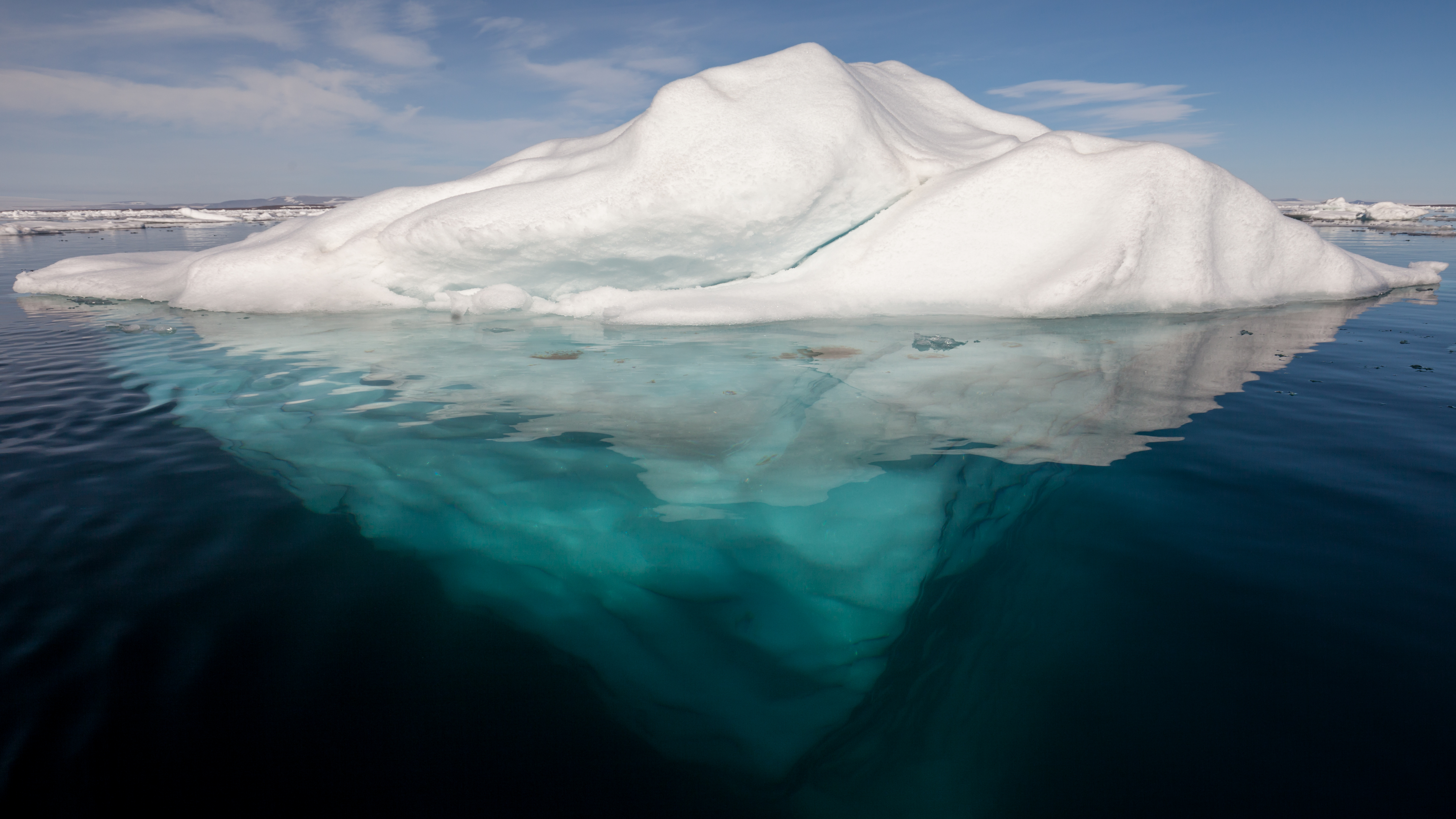
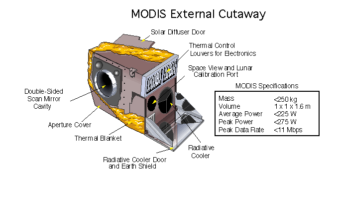
Iceberg B-31 is a large iceberg that formed in November 2013, when it separated from the Pine Island Glacier. B-31 is heading into the Antarctic ocean, which may have possible repercussions for international shipping. Soon it would not be possible to track the iceberg as the winter darkness completely hides it. The ice island is 20 miles by 12 miles and 500 m of height. It was first observed by Moderate Resolution Imaging Spectroradiometer The Moderate Resolution Imaging Spectroradiometer (MODIS) is a satellite-based sensor used for earth and climate measurements. There are two MODIS sensors in Earth orbit: one on board the Terra ( EOS AM) satellite, launched by NASA in 19 ... (MODIS), an instrument on NASA's Terra and Aqua satellites of NASA. References {{Reflist B-31 Geography of Antarctica 2013 in Antarctica ... [...More Info...] [...Related Items...] OR: [Wikipedia] [Google] [Baidu] |
Iceberg
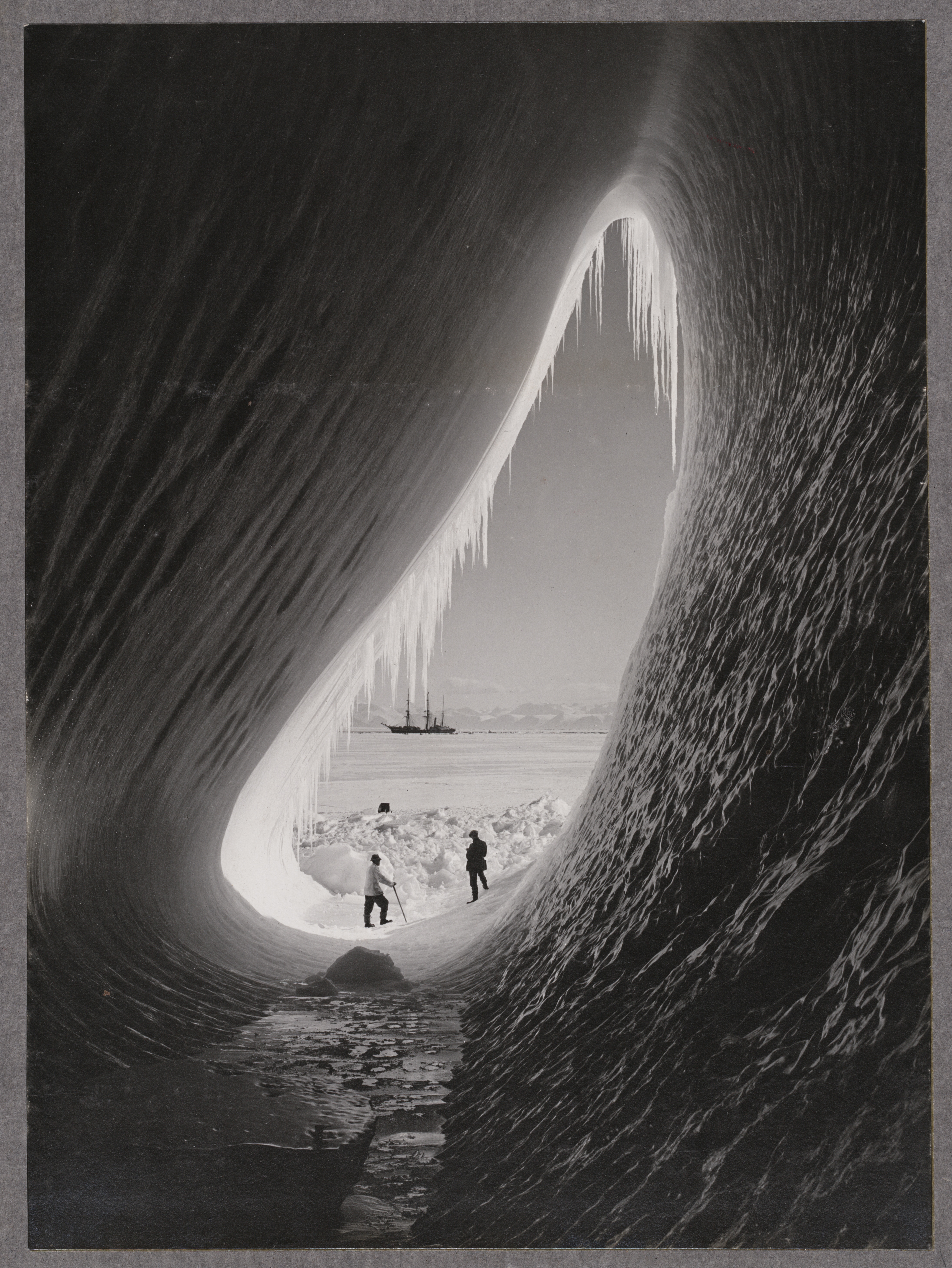
An iceberg is a piece of freshwater ice more than 15 m long that has broken off a glacier or an ice shelf and is floating freely in open (salt) water. Smaller chunks of floating glacially-derived ice are called "growlers" or "bergy bits". The sinking of the ''Titanic'' in 1912 led to the formation of the International Ice Patrol in 1914. Much of an iceberg is below the surface, which led to the expression "tip of the iceberg" to illustrate a small part of a larger unseen issue. Icebergs are considered a serious maritime hazard. Icebergs vary considerably in size and shape. Icebergs that calve from glaciers in Greenland are often irregularly shaped while Antarctic ice shelves often produce large tabular (table top) icebergs. The largest iceberg in recent history (2000), named B-15, measured nearly 300 km × 40 km. The largest iceberg on record was an Antarctic tabular iceberg of over [] sighted west of Scott Island, in the South Pacific Ocean, by the USS Glacier ... [...More Info...] [...Related Items...] OR: [Wikipedia] [Google] [Baidu] |
Pine Island Glacier
Pine Island Glacier (PIG) is a large ice stream, and the fastest melting glacier in Antarctica, responsible for about 25% of Antarctica's ice loss. The glacier ice streams flow west-northwest along the south side of the Hudson Mountains into Pine Island Bay, Amundsen Sea, Antarctica. It was mapped by the United States Geological Survey (USGS) from surveys and United States Navy (USN) air photos, 1960–66, and named by the Advisory Committee on Antarctic Names (US-ACAN) in association with Pine Island Bay. The area drained by Pine Island Glacier comprises about 10% of the West Antarctic Ice Sheet. Satellite measurements have shown that the Pine Island Glacier Basin has a greater net contribution of ice to the sea than any other ice drainage basin in the world and this has increased due to recent acceleration of the ice stream. An iceberg about twice the size of Washington, DC broke off from the glacier in February 2020. Pine Island Glacier's ice velocity has accelerated to over ... [...More Info...] [...Related Items...] OR: [Wikipedia] [Google] [Baidu] |
Antarctic Ocean
The Southern Ocean, also known as the Antarctic Ocean, comprises the southernmost waters of the World Ocean, generally taken to be south of 60° S latitude and encircling Antarctica. With a size of , it is regarded as the second-smallest of the five principal oceanic divisions: smaller than the Pacific, Atlantic Ocean, Atlantic, and Indian Ocean, Indian oceans but larger than the Arctic Ocean. Over the past 30 years, the Southern Ocean has been subject to rapid climate change, which has led to changes in the marine ecosystem. By way of his voyages in the 1770s, James Cook proved that waters encompassed the southern latitudes of the globe. Since then, geographers have disagreed on the Southern Ocean's northern boundary or even existence, considering the waters as various parts of the Pacific, Atlantic, and Indian oceans, instead. However, according to Commodore John Leech of the International Hydrographic Organization (IHO), recent oceanographic research has discovered ... [...More Info...] [...Related Items...] OR: [Wikipedia] [Google] [Baidu] |
NASA
The National Aeronautics and Space Administration (NASA ) is an independent agency of the US federal government responsible for the civil space program, aeronautics research, and space research. NASA was established in 1958, succeeding the National Advisory Committee for Aeronautics (NACA), to give the U.S. space development effort a distinctly civilian orientation, emphasizing peaceful applications in space science. NASA has since led most American space exploration, including Project Mercury, Project Gemini, the 1968-1972 Apollo Moon landing missions, the Skylab space station, and the Space Shuttle. NASA supports the International Space Station and oversees the development of the Orion spacecraft and the Space Launch System for the crewed lunar Artemis program, Commercial Crew spacecraft, and the planned Lunar Gateway space station. The agency is also responsible for the Launch Services Program, which provides oversight of launch operations and countdown management f ... [...More Info...] [...Related Items...] OR: [Wikipedia] [Google] [Baidu] |
Moderate Resolution Imaging Spectroradiometer
The Moderate Resolution Imaging Spectroradiometer (MODIS) is a satellite-based sensor used for earth and climate measurements. There are two MODIS sensors in Earth orbit: one on board the Terra (satellite), Terra (Earth Observing System, EOS AM) satellite, launched by NASA in 1999; and one on board the Aqua (satellite), Aqua (EOS PM) satellite, launched in 2002. MODIS has now been replaced by the VIIRS, which first launched in 2011 aboard the Suomi NPP satellite. The MODIS instruments were built by Santa Barbara Remote Sensing. They capture data in 36 spectral bands ranging in wavelength from 0.4 μm to 14.4 μm and at varying spatial resolutions (2 bands at 250 m, 5 bands at 500 m and 29 bands at 1 km). Together the instruments image the entire Earth every 1 to 2 days. They are designed to provide measurements in large-scale global dynamics including changes in Earth's cloud cover, radiation budget and processes occurring in the oceans, on land, and in the Atmos ... [...More Info...] [...Related Items...] OR: [Wikipedia] [Google] [Baidu] |
Icebergs
An iceberg is a piece of freshwater ice more than 15 m long that has broken off a glacier or an ice shelf and is floating freely in open (salt) water. Smaller chunks of floating glacially-derived ice are called "growlers" or "bergy bits". The sinking of the ''Titanic'' in 1912 led to the formation of the International Ice Patrol in 1914. Much of an iceberg is below the surface, which led to the expression "tip of the iceberg" to illustrate a small part of a larger unseen issue. Icebergs are considered a serious maritime hazard. Icebergs vary considerably in size and shape. Icebergs that calve from glaciers in Greenland are often irregularly shaped while Antarctic ice shelves often produce large tabular (table top) icebergs. The largest iceberg in recent history (2000), named B-15, measured nearly 300 km × 40 km. The largest iceberg on record was an Antarctic tabular iceberg of over [] sighted west of Scott Island, in the South Pacific Ocean, by the USS Glacie ... [...More Info...] [...Related Items...] OR: [Wikipedia] [Google] [Baidu] |
Geography Of Antarctica
Geography (from Greek: , ''geographia''. Combination of Greek words ‘Geo’ (The Earth) and ‘Graphien’ (to describe), literally "earth description") is a field of science devoted to the study of the lands, features, inhabitants, and phenomena of Earth. The first recorded use of the word γεωγραφία was as a title of a book by Greek scholar Eratosthenes (276–194 BC). Geography is an all-encompassing discipline that seeks an understanding of Earth and its human and natural complexities—not merely where objects are, but also how they have changed and come to be. While geography is specific to Earth, many concepts can be applied more broadly to other celestial bodies in the field of planetary science. One such concept, the first law of geography, proposed by Waldo Tobler, is "everything is related to everything else, but near things are more related than distant things." Geography has been called "the world discipline" and "the bridge between the human and t ... [...More Info...] [...Related Items...] OR: [Wikipedia] [Google] [Baidu] |


