|
IV Postcode Area
The IV postcode area, also known as the Inverness postcode area, is a group of 52 postcode districts for post towns: Achnasheen, Alness, Avoch, Beauly, Bonar Bridge, Cromarty, Dingwall, Dornoch, Elgin, Moray, Elgin, Fochabers, Forres, Fortrose, Gairloch, Garve, Invergordon, Inverness, Isle of Skye, Kyle of Lochalsh, Kyle, Lairg, Lossiemouth, Muir of Ord, Munlochy, Nairn, Plockton, Portree, Rogart, Strathcarron, Highland, Strathcarron, Strathpeffer, Strome Ferry, Tain and Ullapool in north Scotland. __TOC__ Coverage Approximate coverage of the postcode districts: , - ! IV1 , INVERNESS , Inverness centre and north, including the Longman, Inverness, Longman, plus North Kessock and Kilmuir, Black Isle, Kilmuir , Highland (council area), Highland , - ! IV2 , INVERNESS , Inverness east, plus Culloden, Highland, Culloden, Balloch, Highland, Balloch and Ardersier , Highland , - ! IV3 , INVERNESS , Inverness west, plus Dochgarroch, Abriachan and Bunchrew , Highland , - ! IV4 ... [...More Info...] [...Related Items...] OR: [Wikipedia] [Google] [Baidu] |
Achnasheen
Achnasheen (Gaelic ''Achadh na Sìne'') is a small village in Ross-shire in the Highland council area of Scotland. The village is situated on the River Bran at the junction of two roads built by Thomas Telford. Despite the size of the village, Achnasheen is also the name of a postal district which covers several much larger communities including Kinlochewe, Poolewe and Laide. This dates from the time when the village railway station, built in 1870, was an important stop on the Kyle of Lochalsh Line, serving a large area of Wester Ross. The railway still operates but all freight and mail, and most passengers, now travel by road. In 1893, a scheme was considered to build a railway from Achnasheen to Aultbea, but it was soon dropped. Facilities in the village are limited. The Ledgowan Lodge Hotel is a mile west of the village, but the Achnasheen Hotel (by the railway station) burnt down in the early 1990s and has never been rebuilt. Between 1961 and 1991, the village was the ... [...More Info...] [...Related Items...] OR: [Wikipedia] [Google] [Baidu] |
Kyle Of Lochalsh
Kyle of Lochalsh (from the Scottish Gaelic, Gaelic ''Caol Loch Aillse'', "strait of the foaming loch") is a village in the historic county of Ross-shire on the northwest coast of Scotland, located around west-southwest of Inverness. It is located on the Lochalsh peninsula, at the entrance to Loch Alsh, opposite the village of Kyleakin on the Isle of Skye. A ferry used to connect the two villages until it was replaced by the Skye Bridge, about to the west, in 1995. Geography The village is the transport and shopping centre for the area as well as having a harbour and marina with pontoons for maritime visitors. The Plock offers a local woodland hike and viewpoint over the peninsula. The Plock was formerly home to a golf course. It is owned by the Kyle of Lochalsh Community Trust, who also own the adjacent building which was formerly the toll building for the Skye Bridge. The surrounding scenery and wildlife are regarded as attractions of the village, as is the slow pace of lif ... [...More Info...] [...Related Items...] OR: [Wikipedia] [Google] [Baidu] |
Ullapool
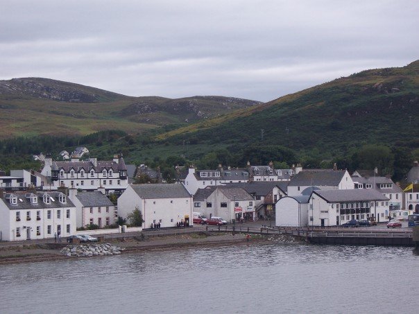
Ullapool (; gd, Ulapul ) is a village and port located in Northern Scotland. Ullapool has a population of around 1,500 inhabitants. It is located around northwest of Inverness in Ross and Cromarty, Scottish Highlands. Despite its modest size, it is the largest settlement for many miles around, and an important port and tourist destination. The North Atlantic Drift passes Ullapool, moderating the temperature. A few ''Cordyline australis'' (New Zealand cabbage trees) are grown in the town and are often mistaken for palm trees. The town lies on Loch Broom, on the A835 road from Inverness. The Ullapool River flows through the village. History On the east shore of Loch Broom, Ullapool was founded in 1788 as a herring port by the British Fisheries Society. It was designed by Thomas Telford. Prior to 1788 the town was only an insignificant hamlet made up of just over 20 households. The harbour is used as a fishing port, yachting haven, and ferry port. Ferries sail to Stornoway in the ... [...More Info...] [...Related Items...] OR: [Wikipedia] [Google] [Baidu] |
Tain
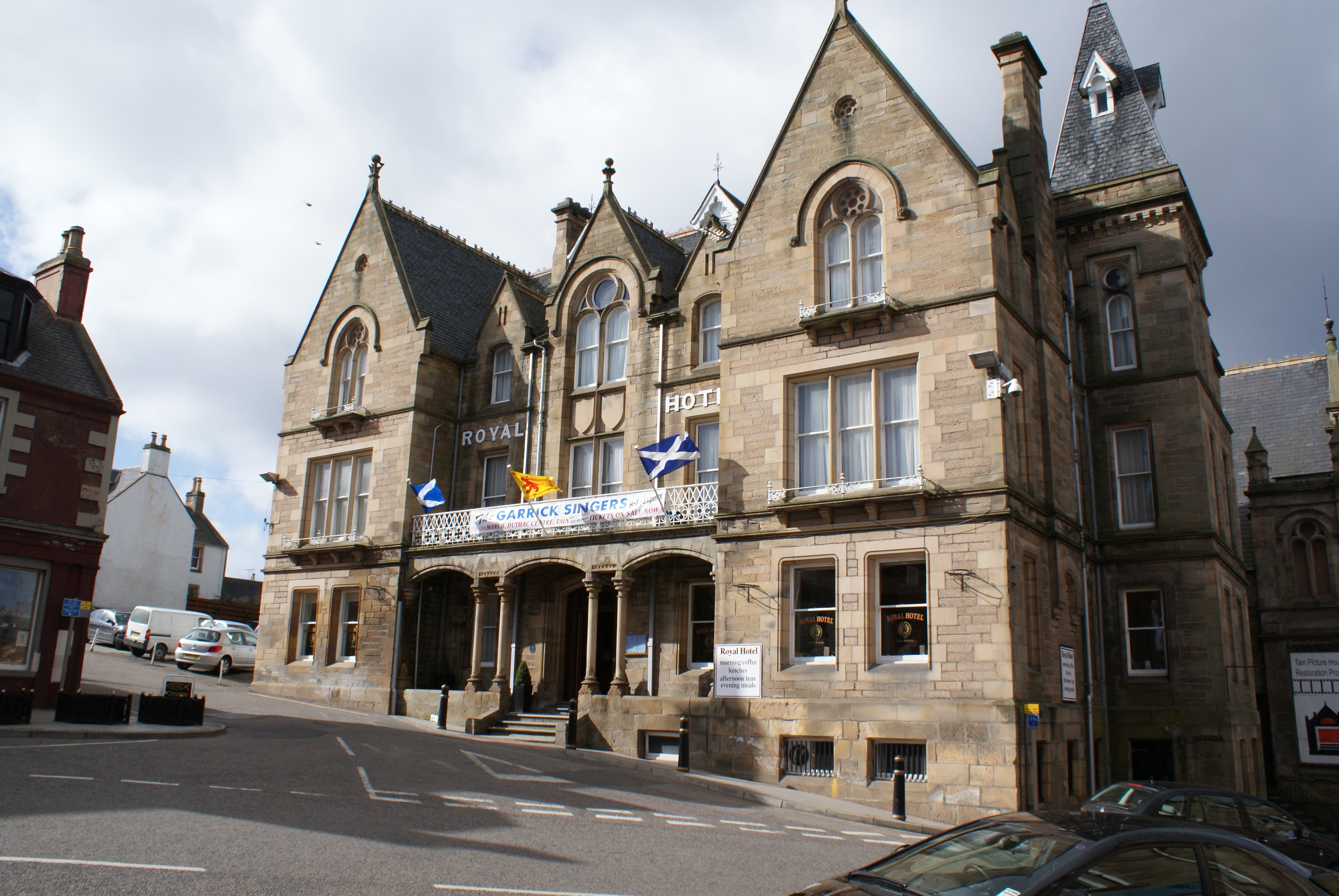
Tain ( Gaelic: ''Baile Dhubhthaich'') is a royal burgh and parish in the County of Ross, in the Highlands of Scotland. Etymology The name derives from the nearby River Tain, the name of which comes from an Indo-European root meaning 'flow'. The Gaelic name, ''Baile Dubhthaich'', means 'Duthac's town', after a local saint also known as Duthus. History Tain was granted its first royal charter in 1066, making it Scotland's oldest royal burgh, commemorated in 1966 with the opening of the Rose Garden by Queen Elizabeth, the Queen Mother. The 1066 charter, granted by King Malcolm III, confirmed Tain as a sanctuary, where people could claim the protection of the church, and an immunity, in which resident merchants and traders were exempt from certain taxes. Little is known of earlier history although the town owed much of its importance to Duthac. He was an early Christian figure, perhaps 8th or 9th century, whose shrine had become so important by 1066 that it resulted in the royal ch ... [...More Info...] [...Related Items...] OR: [Wikipedia] [Google] [Baidu] |
Strome Ferry
Stromeferry ( gd, Port an t-Sròim) is a village, located on the south shore of the west coast sea loch, Loch Carron, in western Ross-shire, Scottish Highlands and is in the Scottish council area of Highland. Its name reflects its former role as the location of one of the many coastal ferry services which existed prior to the expansion of the road network in the 20th century. It is served by Stromeferry railway station and is close to the A890 road. Stromeferry is on the southern bank of Loch Carron; Strome Castle is opposite on the northern bank. The village is referred to in Iain Banks's novel ''Complicity'', where the narrator describes the road sign marking the village, which states "Strome Ferry (No ferry)". Some local shinty players once competed as "Stromeferry (No Ferry) United". The village has been subject of various development proposals focussing on the derelict hotel. In November 2007, W.A. Fairhurst & Partners, on behalf of the Helmsley Group, secured an outli ... [...More Info...] [...Related Items...] OR: [Wikipedia] [Google] [Baidu] |
Strathpeffer
Strathpeffer ( gd, Srath Pheofhair) is a village and spa town in Ross and Cromarty, Highland, Scotland, with a population of 1,469. Geography It lies in a strath west of Dingwall, with the elevation ranging from above sea level. Sheltered on the west and north, it has a comparatively dry and warm climate. History The strategic location of the village has led to several battles being fought in the area : *Blar Nan Ceann (battle (field) of the heads), lies at the western end of the modern village (). Very little is known about the battle there, not even its date, other than the MacKenzies of Seaforth defeated the MacDonells of Glengarry and some incident took place at a well near the battlefield, subsequently called Tobar a' Chinn (well of the head). *Battle of Blar Na Pairce (battle (field) of the park), in approximately 1486 saw the local MacKenzies, under their chief Kenneth MacKenzie, defeat a large invading force of MacDonalds. The battlefield lies south-west of the mo ... [...More Info...] [...Related Items...] OR: [Wikipedia] [Google] [Baidu] |
Strathcarron, Highland
Strathcarron ( gd, Srath Carrann) is a hamlet, in the Highland council area of Scotland. Geography It is situated at the head of the sea loch, Loch Carron, between the rivers, River Carron and River Taodail, in Wester Ross, Scottish Highlands. Climate Amenities It has a hotel called the Strathcarron Hotel and the Strathcarron railway station. History In the spring of 1854, one of the most notorious incidents of resistance to the Highland Clearances took place at Greenyards in Strathcarron, when Major Robertson of Kindeace attempted to evict his tenants to make way for more profitable sheep farming. It was reported by ''The Inverness Courier'' that the Sheriff Taylor at the head of about thirty-five men traveled from Tain and arrived at Greenyards at about dawn. Their arrival was expected and they were met by a crowd of about 300 people, two thirds of whom were women. They were all apparently prepared to ''resist the execution of the law''. The women lined up at the fron ... [...More Info...] [...Related Items...] OR: [Wikipedia] [Google] [Baidu] |
Rogart
Rogart ( , , meaning "great enclosed field") is a small village in Sutherland, Highland, Scotland. The village was the home of Major Andrew MacDonald, who fought in the French and Indian War. It was originally a scattered crofting village, until the opening of the Rogart railway station at Pittentrail to the southeast. A newer industrial village grew after the arrival of the railway in 1886, with the older village remaining. The village of Golspie Golspie ( , gd, Goillspidh) is a village and parish in Sutherland, Highland, Scotland, which lies on the North Sea coast in the shadow of Ben Bhraggie. It has a population of around 1,350. History The name derives from the Norse for "gull ... is east of Rogart. References Populated places in Sutherland {{Highland-geo-stub ... [...More Info...] [...Related Items...] OR: [Wikipedia] [Google] [Baidu] |
Portree
Portree (; gd, Port Rìgh, ) is the largest town on, and capital of, the Isle of Skye in the Inner Hebrides of Scotland. Murray, W.H. (1966) ''The Hebrides''. London. Heinemann. Pages 154-155. It is the location for the only secondary school on the island, Portree High School. Public transport services are limited to buses. Portree has a harbour, fringed by cliffs, with a pier designed by Thomas Telford. Attractions in the town include the Aros centre which celebrates the island's Gaelic heritage. Further arts provision is made through arts organisation ATLAS Arts, a Creative Scotland regularly-funded organisation. The town also serves as a centre for tourists exploring the island.Haswell-Smith, Hamish. (2004) ''The Scottish Islands''. Edinburgh. Canongate. Pages 173-4 Around 939 people (37.72% of the population) can speak Scottish Gaelic. The A855 road leads north out of the town, passing through villages such as Achachork, Staffin and passes the rocky landscape of the Sto ... [...More Info...] [...Related Items...] OR: [Wikipedia] [Google] [Baidu] |
Plockton
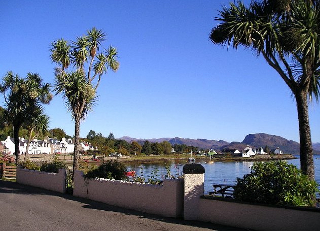
Plockton ( gd, Am Ploc/Ploc Loch Aillse) is a village in the Lochalsh, Wester Ross area of the Scottish Highlands with a 2020 population of 468. Plockton settlement is on the shores of Loch Carron. It faces east away from the prevailing winds, and together with the North Atlantic Drift gives it a mild climate despite the far-north latitude, allowing the Cordyline australis palm to prosper. History Most of the houses date from the nineteenth and twentieth centuries. It was established as a planned fishing village on the northern edge of the Lochalsh, built ‘when introducing sheep farming in 1814-20 and removing the population from their old hamlets in Glen Garron, founded the villages of Jeantown and Plockton on Loch Carronside’ (Geddes: 1945, pp38). Some maritime charts including MacKenzie (1776) and Heather (1804) mark the peninsula where the village sits as ‘Plack’, however it generally considered that the village was built on the ‘Ploc’ of Lochalsh, with ‘Ploc� ... [...More Info...] [...Related Items...] OR: [Wikipedia] [Google] [Baidu] |
Nairn
Nairn (; gd, Inbhir Narann) is a town and royal burgh in the Highland council area of Scotland. It is an ancient fishing port and market town around east of Inverness, at the point where the River Nairn enters the Moray Firth. It is the traditional county town of Nairnshire. At the 2011 census, Nairn had a population of 9,773, making it the third-largest settlement in the Highland council area, behind Inverness and Fort William. Nairn is best known as a seaside resort, with two golf courses, award-winning beaches, a community centre and arts venue, a small theatre (called The Little Theatre) and one small museum, providing information on the local area and incorporating the collection of the former Fishertown museum. History The History of Nairn is a broad and diverse topic spanning its Palaeolithic and Mesolithic roots before recorded history, to the Picts and the visitation of Roman general Agriocola. Its possible founding under the name Ekkailsbakki by Sigurd, Earl of ... [...More Info...] [...Related Items...] OR: [Wikipedia] [Google] [Baidu] |
Munlochy
Munlochy ( ; Scottish Gaelic: ''Poll Lochaidh'') is a small village, lying at the head of Munlochy Bay (''Ob Poll Lochaidh''), in the Black Isle in Ross and Cromarty, in northern Scotland. There are few early records of a settlement, but it seems likely that Munlochy expanded in the 1760s due to quarry workers extracting stone nearby to build Fort George on the far side of the Moray Firth. Geography Munlochy sits at the top of the tidal inlet of Munlochy Bay, that is itself an opening of the Moray Firth. Munlochy Bridge This is the name of popular pipe tune, a two line, three part Strathspey, which is often played for dancing. See also * Clootie well * Black Isle The Black Isle ( gd, an t-Eilean Dubh, ) is a peninsula within Ross and Cromarty, in the Scottish Highlands. It includes the towns of Cromarty and Fortrose, and the villages of Culbokie, Jemimaville, Rosemarkie, Avoch, Munlochy, Tore, and Nor ... References {{reflisthttps://musescore.com/song/munlochy_bridg ... [...More Info...] [...Related Items...] OR: [Wikipedia] [Google] [Baidu] |


.png)
.jpg)

