|
Isunigu (Cherokee Town)
Isunigu (also called Seneca, Esseneca, and Sinica) was a Cherokee town on the Keowee River. It was on the west side of the Keowee River, near the mouth of Coneross Creek, in today's Oconee County, South Carolina. Present-day Clemson and Seneca, South Carolina later developed near here. During the colonial period, Isunigu was classified by English traders and colonists as one of the Cherokee "Lower Towns", a geographical grouping that included Piedmont towns along the Keowee River in southwestern South Carolina and towns along the Tugaloo River in northeastern Georgia. The principal town of this grouping was considered to be Keowee, on the river of the same name. In the late 18th and early 19th centuries, the Cherokee ceded their land of the Lower Towns to South Carolina. Andrew Pickens developed his "Hopewell" plantation on the east side of the Keowee River. Following the American Revolution and conflict between the Cherokee and European Americans, this was where the 1785 Trea ... [...More Info...] [...Related Items...] OR: [Wikipedia] [Google] [Baidu] |
Cherokee
The Cherokee (; chr, ᎠᏂᏴᏫᏯᎢ, translit=Aniyvwiyaʔi or Anigiduwagi, or chr, ᏣᎳᎩ, links=no, translit=Tsalagi) are one of the indigenous peoples of the Southeastern Woodlands of the United States. Prior to the 18th century, they were concentrated in their homelands, in towns along river valleys of what is now southwestern North Carolina, southeastern Tennessee, edges of western South Carolina, northern Georgia, and northeastern Alabama. The Cherokee language is part of the Iroquoian language group. In the 19th century, James Mooney, an early American ethnographer, recorded one oral tradition that told of the tribe having migrated south in ancient times from the Great Lakes region, where other Iroquoian peoples have been based. However, anthropologist Thomas R. Whyte, writing in 2007, dated the split among the peoples as occurring earlier. He believes that the origin of the proto-Iroquoian language was likely the Appalachian region, and the split betw ... [...More Info...] [...Related Items...] OR: [Wikipedia] [Google] [Baidu] |
Lake Hartwell
Lake Hartwell is a man-made reservoir bordering Georgia and South Carolina and encompassing parts of the Savannah, Tugaloo, and Seneca rivers. Lake Hartwell is one of the Southeastern United States' largest recreation lakes. The lake was created by the construction of the Hartwell Dam, completed in 1962 and located on the Savannah River seven miles (11 km) below the point at which the Tugaloo and Seneca Rivers join to form the Savannah. Extending up the Tugaloo and up the Seneca at normal pool elevation, the lake comprises nearly 56,000 acres (230 km2) of water with a shoreline of . The entire Hartwell "Project" contains 76,450 acres (309 km2) of land and water. I-85 bisects Hartwell Lake and makes the area easily accessible to visitors. Background The Flood Control Act of 17 May 1950 authorized the Hartwell Dam and Reservoir as the second unit in the comprehensive development of the Savannah River Basin. The estimated cost was $68.4 million based on 1948 price lev ... [...More Info...] [...Related Items...] OR: [Wikipedia] [Google] [Baidu] |
Chickamauga Cherokee
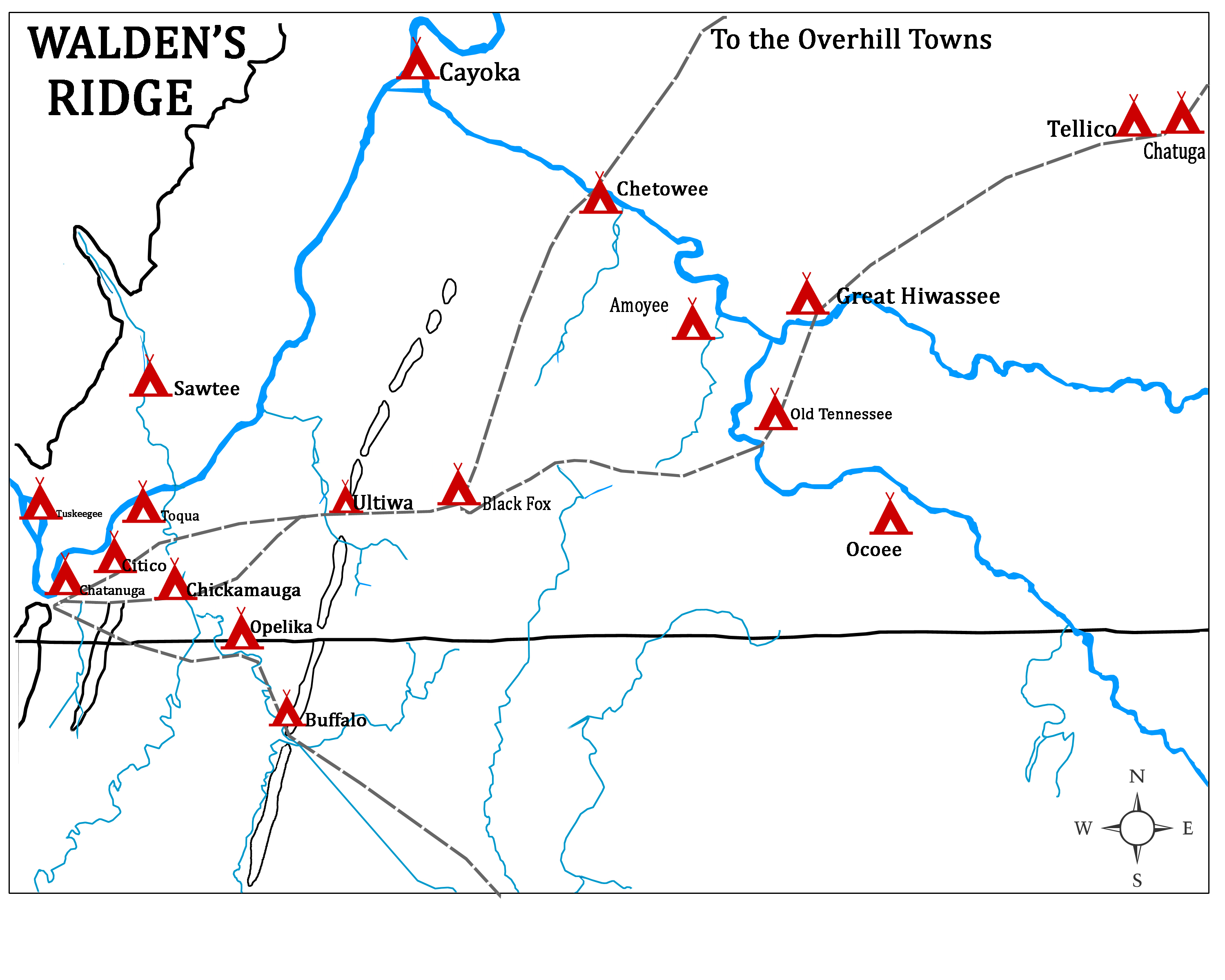
The Chickamauga Cherokee refers to a group that separated from the greater body of the Cherokee during the American Revolutionary War. The majority of the Cherokee people wished to make peace with the Americans near the end of 1776, following several military setbacks and American reprisals. The followers of the skiagusta (or red chief), Dragging Canoe, moved with him in the winter of 1776–77 down the Tennessee River away from their historic Overhill Cherokee towns. Relocated in a more isolated area, they established 11 new towns in order to gain distance from colonists' encroachments. The frontier Americans associated Dragging Canoe and his band with their new town on Chickamauga Creek and began to refer to them as the ''Chickamaugas.'' Five years later, the Chickamauga moved further west and southwest into present-day Alabama, establishing five larger settlements. They were then more commonly known as the ''Lower Cherokee''. This term was closely associated with the peop ... [...More Info...] [...Related Items...] OR: [Wikipedia] [Google] [Baidu] |
Pre-historic Cities In The United States
Prehistory, also known as pre-literary history, is the period of human history between the use of the first stone tools by hominins 3.3 million years ago and the beginning of recorded history with the invention of writing systems. The use of symbols, marks, and images appears very early among humans, but the earliest known writing systems appeared 5000 years ago. It took thousands of years for writing systems to be widely adopted, with writing spreading to almost all cultures by the 19th century. The end of prehistory therefore came at very different times in different places, and the term is less often used in discussing societies where prehistory ended relatively recently. In the early Bronze Age, Sumer in Mesopotamia, the Indus Valley Civilisation, and ancient Egypt were the first civilizations to develop their own scripts and to keep historical records, with their neighbors following. Most other civilizations reached the end of prehistory during the following Iron Age. T ... [...More Info...] [...Related Items...] OR: [Wikipedia] [Google] [Baidu] |
Cherokee Towns
The Cherokee (; chr, ᎠᏂᏴᏫᏯᎢ, translit=Aniyvwiyaʔi or Anigiduwagi, or chr, ᏣᎳᎩ, links=no, translit=Tsalagi) are one of the indigenous peoples of the Southeastern Woodlands of the United States. Prior to the 18th century, they were concentrated in their homelands, in towns along river valleys of what is now southwestern North Carolina, southeastern Tennessee, edges of western South Carolina, northern Georgia, and northeastern Alabama. The Cherokee language is part of the Iroquoian language group. In the 19th century, James Mooney, an early American ethnographer, recorded one oral tradition that told of the tribe having migrated south in ancient times from the Great Lakes region, where other Iroquoian peoples have been based. However, anthropologist Thomas R. Whyte, writing in 2007, dated the split among the peoples as occurring earlier. He believes that the origin of the proto-Iroquoian language was likely the Appalachian region, and the split between Norther ... [...More Info...] [...Related Items...] OR: [Wikipedia] [Google] [Baidu] |
James Mooney
James Mooney (February 10, 1861 – December 22, 1921) was an American ethnographer who lived for several years among the Cherokee. Known as "The Indian Man", he conducted major studies of Southeastern Indians, as well as of tribes on the Great Plains. "Register to the Papers of James Mooney" , National Anthropological Archives, Smithsonian Institution, accessed 10 Nov 2009 He did ethnographic studies of the Ghost Dance, a spiritual movement among various Native American culture groups, after |
Hartwell Dam
Hartwell Dam is a concrete and embankment dam located on the Savannah River at the border of South Carolina and Georgia, creating Lake Hartwell. The dam was built by the U.S. Army Corps of Engineers between 1955 and 1962 for the purposes of flood control, hydropower and navigation. The concrete and earthen structure spans . The concrete section is long and rises above the riverbed at its apex. The Hartwell Dam currently produces 468 million KWh of electricity annually, has prevented over $40 million in flood damage since completion and also provides recreation, water quality, water supply, along with fish and wildlife management. Construction In 1890, Lieutenant Oberlin M. Carter of the U.S. Army Corps of Engineers (USACE) Savannah Office issued a survey report that recommended the construction of dams on the Savannah River in order to prevent flooding in Augusta, Georgia. His report was overlooked until the 1927 Rivers and Harbors Act allowed the USACE to investigate deve ... [...More Info...] [...Related Items...] OR: [Wikipedia] [Google] [Baidu] |
Treaty Of Hopewell
Three agreements, each known as the Treaty of Hopewell, were signed between representatives of the Congress of the United States and the Cherokee, Choctaw, and Chickasaw peoples, were negotiated and signed at the Hopewell plantation in South Carolina during the winter of 1785–86. Hopewell plantation The treaties were signed at the plantation owned by General Andrew Pickens, which and the treaty texts refer to as “Hopewell on the Keowee.” Anthropologist James Mooney records that, "It was situated on the northern edge of the present Anderson county, on the east side of Keowee River, opposite and a short distance below the entrance of Little river, and about three miles from the present Pendleton. In sight of it, on the opposite side of Keowee, was the old Cherokee town of Seneca, destroyed by the Americans in 1776." Cherokee treaty On November 28, 1785, the first Treaty of Hopewell was signed between the U.S. representative Benjamin Hawkins and the Cherokee Indians. The treat ... [...More Info...] [...Related Items...] OR: [Wikipedia] [Google] [Baidu] |
Keowee River
The Keowee River is created by the confluence of the Toxaway River and the Whitewater River in northern Oconee County, South Carolina. The confluence is today submerged beneath the waters of Lake Jocassee, a reservoir created by Lake Jocassee Dam. The Keowee River flows out of Lake Jocassee Dam and into Lake Keowee, a reservoir created by Keowee Dam and Little River Dam. The Keowee River flows out of Keowee Dam to join Twelvemile Creek near Clemson, South Carolina, forming the beginning of the Seneca River, a tributary of the Savannah River. The Keowee River is long.U.S. Geological Survey. National Hydrography Dataset high-resolution flowline dataThe National Map , accessed April 26, 2011 The boundary between the Seneca River and the Keowee River has changed over time. In the Revolutionary War period and early eighteenth century, the upper part of the Seneca River was often called the Keowee River, as it was part of the Cherokee homeland. They also had a town named Keowee. ... [...More Info...] [...Related Items...] OR: [Wikipedia] [Google] [Baidu] |
Andrew Pickens (congressman)
Andrew Pickens (September 13, 1739August 11, 1817) was a militia leader in the American Revolution. A planter and slaveowner, he developed his Hopewell plantation on the east side of the Keowee River across from the Cherokee town of ''Isunigu'' (Seneca) in western South Carolina. He was elected as a member of the United States House of Representatives from western South Carolina. Several treaties with the Cherokee were negotiated and signed at his plantation of Hopewell. Early life Pickens was born in 1739 in Bucks County in the Province of Pennsylvania. He was the son of Scots-Irish immigrants, Presbyterians of primarily Scottish ancestry from Carrickfergus in County Antrim, Ireland (in what is today Northern Ireland.) His parents were Andrew Pickens Sr. and Anne (''née'' Davis). But his paternal great-grandparents were ethnic French Huguenots: Robert Andrew Pickens (Robert André Picon) had migrated to England and Northern Ireland; his wife Esther-Jeanne, widow Bonneau, was ... [...More Info...] [...Related Items...] OR: [Wikipedia] [Google] [Baidu] |
South Carolina
)''Animis opibusque parati'' ( for, , Latin, Prepared in mind and resources, links=no) , anthem = " Carolina";" South Carolina On My Mind" , Former = Province of South Carolina , seat = Columbia , LargestCity = Charleston , LargestMetro = Greenville (combined and metro) Columbia (urban) , BorderingStates = Georgia, North Carolina , OfficialLang = English , population_demonym = South Carolinian , Governor = , Lieutenant Governor = , Legislature = General Assembly , Upperhouse = Senate , Lowerhouse = House of Representatives , Judiciary = South Carolina Supreme Court , Senators = , Representative = 6 Republicans1 Democrat , postal_code = SC , TradAbbreviation = S.C. , area_rank = 40th , area_total_sq_mi = 32,020 , area_total_km2 = 82,932 , area_land_sq_mi = 30,109 , area_land_km2 = 77,982 , area_water_sq_mi = 1,911 , area_water_km2 = 4,949 , area_water_percent = 6 , population_rank = 23rd , population_as_of = 2022 , 2010Pop = 5282634 , population ... [...More Info...] [...Related Items...] OR: [Wikipedia] [Google] [Baidu] |


