|
Isle Of Doagh
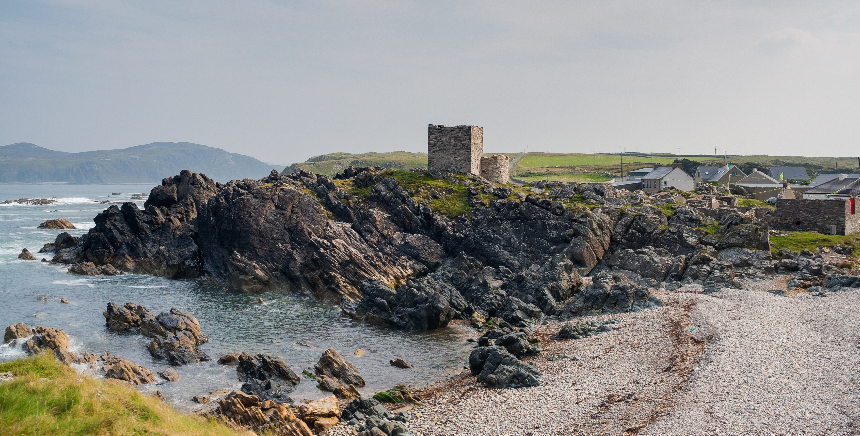
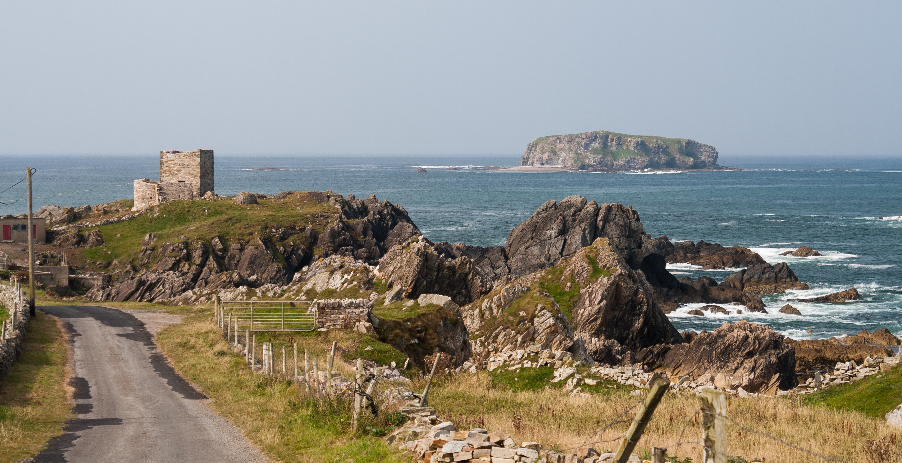
The Isle of Doagh (Irish: ''Oileán na Dumhcha'', meaning "Isle of the Dune"; also known in English as Doagh Isle or Doagh Island) is a small peninsula in the north of Inishowen on the north coast of County Donegal in Ulster, Ireland. It once was an island. Over time, the channel between Doagh and the mainland silted up and it became joined to the mainland. Nevertheless, the area continued to be referred as the Isle of Doagh or Doagh Island. The area comprises five townlands; Ballymacmoriarty, Carrickabraghy, Carrowreagh, Fegart and Lagacurry. Doagh Island is very near the village of Ballyliffin. The ruins of Carrickabraghy Castle stands at the north-western extremity of the peninsula. History Neolithic period The Isle of Doagh has one of the largest clusters of rock art sites in Ireland. The markings are around 4000–5000 years old. Early medieval period The Island was a stronghold of the Lords of ''Carraig Bhrachai'' who were part of the ''Ó Maolfabhail'' sept (ang ... [...More Info...] [...Related Items...] OR: [Wikipedia] [Google] [Baidu] |
Carrickfergus
Carrickfergus ( , meaning " Fergus' rock") is a large town in County Antrim, Northern Ireland. It sits on the north shore of Belfast Lough, from Belfast. The town had a population of 27,998 at the 2011 Census. It is County Antrim's oldest town and one of the oldest towns in Ireland as a whole. Carrickfergus Castle, built in the late 12th century at the behest of Anglo-Norman knight John de Courcy, was the capital of the Earldom of Ulster. After the earldom's collapse, it remained the only English outpost in Ulster for the next four centuries. Carrickfergus was the administrative centre for Carrickfergus Borough Council, before this was amalgamated into the Mid and East Antrim District Council in 2015, and forms part of the Belfast Metropolitan Area. It is also a townland of 65 acres, a civil parish and a barony. The town is the subject of the classic Irish folk song "Carrickfergus", a 19th-century translation of an Irish-language song (''Do Bhí Bean Uasal'') from Munster, ... [...More Info...] [...Related Items...] OR: [Wikipedia] [Google] [Baidu] |
Glashedy
Glashedy Island ( ga, Glaiséidí) is an uninhabited island approximately off Pollan strand, west of Trawbreaga Bay, and about south of Malin Head, Donegal, Ireland. Glashedy Island has an area of 22,548 m² which is equivalent to 2.25 hectares (5.57 acres / 5 acres, 2 roods, 11 perches). At its highest point, it is 119 ft high. The sea around the island is potentially very dangerous for shipping and unsafe for anchorage. Rocks and breakers extend up to a 1,000 meters from all sides of the Island. The waters are relatively shallow at between 4 and 5 fathoms. The shoals to the north of the island are particularly treacherous, lying at a depth of just 3 fathoms. Glashedy Sound is the channel between the island and the shore. It is also shallow. The island contains a number of caves. The island principally comprises quartzite. Etymology Its former name until the early 17th century was Seale Island. The English translation of the name is the ''Island of the Green Clo ... [...More Info...] [...Related Items...] OR: [Wikipedia] [Google] [Baidu] |
Folk Museum
A folk museum is a museum that deals with folk culture and heritage. Such museums cover local life in rural communities. A folk museum typically displays historical objects that were used as part of the people's everyday lives. Examples of such objects include clothes and tools. Many folk museums are also open-air museums and some cover rural history. History The concept of open-air museums originated in Scandinavia in the late 19th century. The Swedish folklorist Artur Hazelius founded what was to become the Nordic Museum in 1873 to house an ethnographic collection of peasant furniture, clothes, tools, toys and other objects. He later set up the open-air museum Skansen in Stockholm in 1891, where he erected about 150 houses and farmsteads from all over Sweden, transporting them piece by piece and rebuilding them to provide a unique picture of traditional Sweden. Skansen became a model for other open-air establishments in Northern Europe. Examples The National Folk Museum of K ... [...More Info...] [...Related Items...] OR: [Wikipedia] [Google] [Baidu] |
Bawn
A bawn is the defensive wall surrounding an Irish tower house. It is the anglicised version of the Irish word ''bábhún'' (sometimes spelt ''badhún''), possibly meaning "cattle-stronghold" or "cattle-enclosure".See alternative traditional spellings under ''badhbhdhún'' in ''Foclóir Uí Dhuinnín'': http://www.scriobh.ie/Page.aspx?id=26&l=1. The standard modern spelling is ''bábhún'': Ó Domhnaill, Niall (eag.), ''Foclóir Gaeilge Béarla'', Baile Átha Cliath: Oifig an tSoláthair (1977), p. 73. The Irish word for "cow" is ''bó'' and its plural is ''ba''. The Irish word for "stronghold, enclosure" is ''dún'', whose genitive case is ''dúin'". The original purpose of bawns was to protect cattle from attack. They included trenches that were often strengthened with stakes or hedges. Over time, these were gradually replaced by walls. The name then began to be used for the walls that were built around tower houses. English and Scottish names for the same thing include "pele" ... [...More Info...] [...Related Items...] OR: [Wikipedia] [Google] [Baidu] |
Irish Army
The Irish Army, known simply as the Army ( ga, an tArm), is the land component of the Defence Forces of Ireland.The Defence Forces are made up of the Permanent Defence Forces – the standing branches – and the Reserve Defence Forces. The Army is part of the PDF. Approximately 7,300 people served in the Irish Army on a permanent basis , and there were 1,600 active reservists, divided into two geographically organised brigades. By late September 2020, this had reduced to 6,878 permanent army personnel. As well as maintaining its primary roles of defending the State and internal security within the State, since 1958 the Army has had a continuous presence in peacekeeping missions around the world. The Army also participates in the European Union Battlegroups. The Air Corps and Naval Service support the Army in carrying out its roles. Roles of the Army The roles of the Army are: * To defend the Irish state against armed aggression. * To give aid to the civil power (ATCP). Th ... [...More Info...] [...Related Items...] OR: [Wikipedia] [Google] [Baidu] |
Carndonagh
Carndonagh (; ) is a town on the Inishowen peninsula in County Donegal, Ireland, close to Trawbreaga Bay. It is the site of the Donagh Cross (or St. Patrick's Cross), believed to date to the 7th century. The Irish name, ''Carn Domhnach'', means "the cairn or mound of the church". Amenities The town is laid out around a central square, or Diamond, and is dominated by its Romanesque Revival Catholic chapel. It is home to 6 national schools including St. Patrick's GNS and BNS, Glentogher NS, Craigtown NS, Donagh NS, St. Bridget's NS and Carndonagh Community School, formerly the largest community school in the Republic of Ireland. Carndonagh is home to a number of musicians, artists and writers and to the Inishowen Carnival Group, Carndonagh Musical Society, Brass Band, and the Inishowen Gospel Choir (both international performers). Transport Carndonagh railway station opened on 1 July 1907, but finally closed on 2 December 1935. There are private coach services from the town to D ... [...More Info...] [...Related Items...] OR: [Wikipedia] [Google] [Baidu] |
Irish National Land League
The Irish National Land League (Irish: ''Conradh na Talún'') was an Irish political organisation of the late 19th century which sought to help poor tenant farmers. Its primary aim was to abolish landlordism in Ireland and enable tenant farmers to own the land they worked on. The period of the Land League's agitation is known as the Land War. Historian R. F. Foster argues that in the countryside the Land League "reinforced the politicization of rural Catholic nationalist Ireland, partly by defining that identity against urbanization, landlordism, Englishness and—implicitly—Protestantism." Foster adds that about a third of the activists were Catholic priests, and Archbishop Thomas Croke was one of its most influential champions. Background Following the founding meeting of the Mayo Tenants Defence Association in Castlebar, County Mayo on 26 October 1878 the demand for ''The Land of Ireland for the people of Ireland'' was reported in the '' Connaught Telegraph'' 2 November ... [...More Info...] [...Related Items...] OR: [Wikipedia] [Google] [Baidu] |
Royal Irish Constabulary
The Royal Irish Constabulary (RIC, ga, Constáblacht Ríoga na hÉireann; simply called the Irish Constabulary 1836–67) was the police force in Ireland from 1822 until 1922, when all of the country was part of the United Kingdom. A separate civic police force, the unarmed Dublin Metropolitan Police (DMP), patrolled the capital and parts of County Wicklow, while the cities of Derry and Belfast, originally with their own police forces, later had special divisions within the RIC. For most of its history, the ethnic and religious makeup of the RIC broadly matched that of the Irish population, although Anglo-Irish Protestants were over-represented among its senior officers. The RIC was under the authority of the British administration in Ireland. It was a quasi-military police force. Unlike police elsewhere in the United Kingdom, RIC constables were routinely armed (including with carbines) and billeted in barracks, and the force had a militaristic structure. It policed Irela ... [...More Info...] [...Related Items...] OR: [Wikipedia] [Google] [Baidu] |
Poitín
Poitín (), anglicized as poteen () or potcheen, is a traditional Irish distilled beverage (40–90% ABV). Former common names for Poitín were "Irish moonshine" and "mountain dew". It was traditionally distilled in a small pot still and the term is a diminutive of the Irish word ''pota'', meaning "pot". The Irish word for a hangover is ''póit''. In accordance with the Irish Poteen/Irish Poitín technical file, it can only be made from cereals, grain, whey, sugar beet, molasses and potatoes. Legal status To authorise the distillation of spirits a requirement was introduced at the parliament at Drogheda in 1556 which necessitated a licence under the great seal. Today in Ireland there are a number of commercially produced spirits labelled as poitín, poteen or potcheen. In 2008, Irish poitín was accorded (GI) Geographical Indicative Status by the EU Council and Parliament. In 2015, in consultation with producers and stakeholders, the Irish Government adopted the Geographica ... [...More Info...] [...Related Items...] OR: [Wikipedia] [Google] [Baidu] |
Greenock
Greenock (; sco, Greenock; gd, Grianaig, ) is a town and administrative centre in the Inverclyde council areas of Scotland, council area in Scotland, United Kingdom and a former burgh of barony, burgh within the Counties of Scotland, historic county of Renfrewshire (historic), Renfrewshire, located in the west central Lowlands of Scotland. It forms part of a contiguous urban area with Gourock to the west and Port Glasgow to the east. The United Kingdom Census 2011, 2011 UK Census showed that Greenock had a population of 44,248, a decrease from the 46,861 recorded in the United Kingdom Census 2001, 2001 UK Census. It lies on the south bank of the Clyde at the "Tail of the Bank" where the River Clyde deepens into the Firth of Clyde. History Name Place-name scholar William J. Watson wrote that "Greenock is well known in Gaelic as Grianáig, dative of grianág, a sunny knoll". The Scottish Gaelic place-name ''Grianaig'' is relatively common, with another (Greenock) near Calla ... [...More Info...] [...Related Items...] OR: [Wikipedia] [Google] [Baidu] |


.jpg)


