|
Isabel Valley
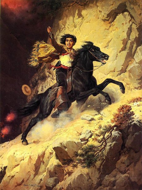
Isabel Valley is a valley in the Diablo Range in Santa Clara County, California. It is also known as Santa Ysabel Valley. The mouth of Isabel Valley lies at an elevation of . Its head is at at an elevation of . History Isabel Valley was used by the Five Joaquins Gang of Joaquin Murrieta to hold stolen horses until they could be driven southward on the La Vereda del Monte.Frank F. Latta Frank Forrest Latta (1892–1983), was a California historian and ethnographer of the Yokuts people. He also wrote histories of the early European-American settlement of the San Joaquin Valley. Early life Frank Forrest Latta was the son of Presbyte ..., JOAQUIN MURRIETA AND HIS HORSE GANGS, Bear State Books, Santa Cruz, California. 1980. References External links Map of Isabel Valley {{coord, 37, 19, 23, N, 121, 33, 23, W, display=title Valleys of Santa Clara County, California La Vereda del Monte ... [...More Info...] [...Related Items...] OR: [Wikipedia] [Google] [Baidu] |
Valley
A valley is an elongated low area often running between Hill, hills or Mountain, mountains, which will typically contain a river or stream running from one end to the other. Most valleys are formed by erosion of the land surface by rivers or streams over a very long period. Some valleys are formed through erosion by glacier, glacial ice. These glaciers may remain present in valleys in high mountains or polar areas. At lower latitudes and altitudes, these glaciation, glacially formed valleys may have been created or enlarged during ice ages but now are ice-free and occupied by streams or rivers. In desert areas, valleys may be entirely dry or carry a watercourse only rarely. In karst, areas of limestone bedrock, dry valleys may also result from drainage now taking place cave, underground rather than at the surface. Rift valleys arise principally from tectonics, earth movements, rather than erosion. Many different types of valleys are described by geographers, using terms th ... [...More Info...] [...Related Items...] OR: [Wikipedia] [Google] [Baidu] |
Diablo Range
The Diablo Range is a mountain range in the California Coast Ranges subdivision of the Pacific Coast Ranges in northern California, United States. It stretches from the eastern San Francisco Bay area at its northern end to the Salinas Valley area at its southern end. Geography The Diablo Range extends from the Carquinez Strait in the north to Orchard Peak and Polonio Pass in the south, near the point where State Route 46 crosses over the Coast Ranges at Cholame, as described by the United States Geological Survey (USGS). It is bordered on the northeast by the San Joaquin River, on the southeast by the San Joaquin Valley, on the southwest by the Salinas River, and on the northwest by the Santa Clara Valley. The USGS designation is somewhat ambiguous north of the Santa Clara Valley, but on USGS maps, the range is shown as the ridgeline which runs between its namesake Mount Diablo southeastward past Mount Hamilton. Geologically, the range corresponds to the California Coast R ... [...More Info...] [...Related Items...] OR: [Wikipedia] [Google] [Baidu] |
Santa Clara County, California
Santa Clara County, officially the County of Santa Clara, is the sixth-most populous county in the U.S. state of California, with a population of 1,936,259, as of the 2020 United States Census, 2020 census. Santa Clara County and neighboring San Benito County, California, San Benito County together form the U.S. Census Bureau's San Jose-Sunnyvale-Santa Clara metropolitan statistical area, which is part of the larger San Jose-San Francisco-Oakland, California, Oakland combined statistical area. Santa Clara is the most populous county in the San Francisco Bay Area and in Northern California. The county seat and largest city is San Jose, California, San Jose, the List of United States cities by population, 10th-most populous city in the United States, List of cities and towns in California, California's third-most populous city and the List of cities and towns in the San Francisco Bay Area, most populous city in the San Francisco Bay Area. Home to Silicon Valley, Santa Clara County ... [...More Info...] [...Related Items...] OR: [Wikipedia] [Google] [Baidu] |
Five Joaquins Gang
The Five Joaquins were a mid-19th-century outlaw gang in California which, according to the state legislature, was led by five men, identified as follows: "... the five Joaquins, whose names are Joaquin Murrieta, Joaquin Ocomorenia, Joaquin Valenzuela, Joaquin Botellier, and Joaquin Carrillo, and their banded associates." Operating between 1850 and 1853, during the California Gold Rush, the gang, joined by Murrieta's right-hand man, known as Three Fingered Jack, was reputed to have been responsible for most of the horse theft, robberies, and murders committed in the Mother Lode area of the Sierra Nevada. They were accused of stealing more than $100,000 in gold and over 100 horses, as well as killing at least 19 people, and had outrun three armed posses, killing three lawmen. Republished with introduction and additional translation by Luis Leal as ''Life and Adventures of the Celebrated Bandit Joaquin Murrieta: His Exploits in the State of California'', Arte Publico Press, 19 ... [...More Info...] [...Related Items...] OR: [Wikipedia] [Google] [Baidu] |
Joaquin Murrieta
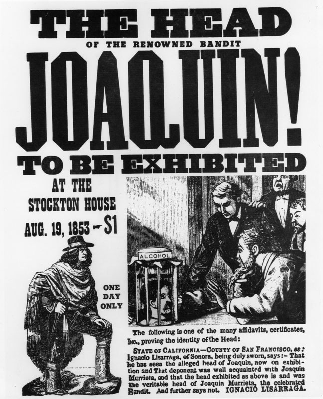
Joaquin Murrieta Carrillo (sometimes spelled Murieta or Murietta) (1829 – July 25, 1853), also called the Robin Hood of the West or the Robin Hood of El Dorado, was a Mexican-American figure of disputed historicity. The novel '' The Life and Adventures of Joaquín Murieta: The Celebrated California Bandit'' (1854) by John Rollin Ridge ostensibly recounts his story. Legends subsequently arose about a notorious outlaw in California during the California Gold Rush of the 1850s, but evidence for a historical Murrieta is scarce. Contemporary documents record testimony in 1852 concerning a minor horse thief of that name. Newspapers reported'' banditos'' named Joaquin, who robbed and killed several people during the same time. A California Ranger named Harry Love was assigned to track down Murrieta and was said to have brought his head in for the bounty. The popular legend of Joaquin Murrieta was that he was a forty-niner, a gold miner and a '' vaquero ''from Sonora. Peace lovin ... [...More Info...] [...Related Items...] OR: [Wikipedia] [Google] [Baidu] |
La Vereda Del Monte
La Vereda del Monte (Spanish language, Spanish for "The Mountain Trail") was a backcountry route through remote regions of the Diablo Range, one of the California Coast Ranges. La Vereda del Monte was the upper part of La Vereda Caballo, (Spanish for "The Horse Trail"), used by mesteñeros from the early 1840s to drive Alta California horses to Sonora for sale.Frank F. Latta, JOAQUIN MURRIETA AND HIS HORSE GANGS, Bear State Books, Santa Cruz, California. 1980. From its northern beginning at Point of Timber on the Sacramento River Delta near modern-day Brentwood, California, Brentwood, the trail traveled south to the Livermore Valley. It passed nearby east of Alisal, Pleasanton, California, Alisal (now part of Pleasanton, California) up into the mountains on Crane Ridge, then continued south through the San Antonio Valley, California, San Antonio Valley onto the rugged backcountry Drainage divide, divide of the Diablo Range, traversing what is now Henry Coe State Park and crossing Pac ... [...More Info...] [...Related Items...] OR: [Wikipedia] [Google] [Baidu] |
Frank Forrest Latta
Frank Forrest Latta (1892–1983), was a California historian and ethnographer of the Yokuts people. He also wrote histories of the early European-American settlement of the San Joaquin Valley. Early life Frank Forrest Latta was the son of Presbyterian minister Eli C. Latta and teacher Harmonia Campbell, born on September 18, 1892, in Stanislaus County, near Orestimba Creek. Latta lived most of his life in the San Joaquin Valley. His father and three older brothers had come to California from Arkansas during the California Gold Rush. His father and one brother remained in California, where they were joined by his mother. One brother returned to Arkansas, and the third wrote that he was returning to Arkansas with $8,000 in gold, but disappeared without a trace. As a young boy Latta worked on several ranches in the San Joaquin Valley. He became interested in the stories of the early pioneers. In 1906, at the age of 14, he began interviewing people and gathering research regarding ea ... [...More Info...] [...Related Items...] OR: [Wikipedia] [Google] [Baidu] |
Valleys Of Santa Clara County, California
A valley is an elongated low area often running between hills or mountains, which will typically contain a river or stream running from one end to the other. Most valleys are formed by erosion of the land surface by rivers or streams over a very long period. Some valleys are formed through erosion by glacial ice. These glaciers may remain present in valleys in high mountains or polar areas. At lower latitudes and altitudes, these glacially formed valleys may have been created or enlarged during ice ages but now are ice-free and occupied by streams or rivers. In desert areas, valleys may be entirely dry or carry a watercourse only rarely. In areas of limestone bedrock, dry valleys may also result from drainage now taking place underground rather than at the surface. Rift valleys arise principally from earth movements, rather than erosion. Many different types of valleys are described by geographers, using terms that may be global in use or else applied only locally. For ... [...More Info...] [...Related Items...] OR: [Wikipedia] [Google] [Baidu] |


