|
Inveresk
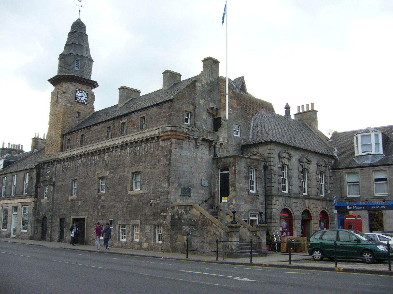
Inveresk (Gaelic: ''Inbhir Easg'') is a village in East Lothian, Scotland situated to the south of Musselburgh. It has been designated a conservation area since 1969. It is situated on slightly elevated ground on the north bank of a loop of the River Esk. This ridge of ground, 20 to 25 metres above sea level, was used by the Romans as the location for Inveresk Roman Fort in the 2nd century AD. The prefix "Inver" (Gaelic ''inbhir'') means a river mouth and refers to the point where the River Esk meets the Firth of Forth. The village was formerly in the Midlothian parish of Inveresk and developed separately from the burgh of Musselburgh. History A Roman cavalry fort sat on the hilltop around 200AD and numerous Roman artefacts and buildings have been found in the village over the years. In 2004, archaeological excavations by Headland Archaeology found Roman artefacts on Inveresk Brae. The lands were gifted to Dunfermline Abbey in the 12th century. Inveresk centres on a st ... [...More Info...] [...Related Items...] OR: [Wikipedia] [Google] [Baidu] |
Inveresk Roman Fort
Inveresk Roman Fort is an archaeological site within the grounds of St Michael's Church, Inveresk, a village in East Lothian, Scotland. Fort The fort covered an area of 6.6 acres (2.7 ha), placing it at the larger end of the spectrum of fort sizes. For this reason, the original excavator, Ian Richmond, believed that a cavalry regiment had been stationed here. In 2007 a Roman tombstone was found at nearby Carberry depicting a Roman Governor's guard cavalry trooper named ''"Crescens"'' who was perhaps residing at the fort when he died. Occupation All of the datable artefacts point to Antonine occupation. Consequently, the fort is thought to have been established in the immediate aftermath of the invasion of Scotland launched by the emperor Antoninus Pius in AD 139/140. Two clear phases of occupation were identified archaeologically, perhaps occasioned by a change of garrison during the Antonine period. The fort will have been abandoned, along with the other Scottish sites, arou ... [...More Info...] [...Related Items...] OR: [Wikipedia] [Google] [Baidu] |
Inveresk Lodge Garden
Inveresk Lodge Garden is in the care of the National Trust for Scotland, in the village of Inveresk, East Lothian. The lodge lies about 10 km south-east of Edinburgh, and for over a century was one of the homes of the Wedderburn family. History Inveresk Lodge was built in 1683, and between 1774 and 1911 it was the home of the Wedderburn family. The portrait painter Archibald Skirving died at the Lodge in 1819. John Brunton, a Quaker, bought Inveresk Lodge in 1911. His Brunton Wireworks provided the cable for the Forth Road Bridge. During World War II, Inveresk Lodge's garden was needed to grow vegetables in support of the war effort. After the war, he bought and sold exotic birds such as pheasants. In 1958, Mrs Helen Brunton left the house and gardens to the National Trust for Scotland. The Lodge is let by the Trust for private occupation, but visitors can enjoy the terraced garden. Garden The earliest evidence of a garden at Inveresk comes from a 1781 court case to reduc ... [...More Info...] [...Related Items...] OR: [Wikipedia] [Google] [Baidu] |
Musselburgh
Musselburgh (; sco, Musselburrae; gd, Baile nam Feusgan) is the largest settlement in East Lothian, Scotland, on the coast of the Firth of Forth, east of Edinburgh city centre. It has a population of . History The name Musselburgh is Old English in origin, with ''mussel'' referring to the shellfish.Musselburgh was famous for the mussel beds which grew in the Firth of Forth; after many years of claims that the mussels were unsafe for consumption, a movement has been started to reestablish the mussel beds as a commercial venture. The ''burgh'' element appears to derive from burh, in the same way as Edinburgh, before the introduction of formal burghs by David I. Its earliest Anglic name was ''Eskmuthe'' (Eskmouth) for its location at the mouth of the River Esk. Musselburgh was first settled by the Romans in the years following their invasion of Scotland in AD 80. They built a fort a little inland from the mouth of the River Esk, at Inveresk. They bridged the Esk dow ... [...More Info...] [...Related Items...] OR: [Wikipedia] [Google] [Baidu] |
Manor House, Inveresk
Manor House is a Category B listed manor house in the Scottish village of Inveresk, East Lothian East Lothian (; sco, East Lowden; gd, Lodainn an Ear) is one of the 32 council areas of Scotland, as well as a historic county, registration county and lieutenancy area. The county was called Haddingtonshire until 1921. In 1975, the hi .... It dates to 1748, and it received its historic designation in 1971. The house was built for Archibald Shiells. See also * List of listed buildings in Inveresk, East Lothian References Category B listed buildings in East Lothian Manor houses in Scotland 1748 establishments in Scotland {{Scotland-struct-stub ... [...More Info...] [...Related Items...] OR: [Wikipedia] [Google] [Baidu] |
Midlothian
Midlothian (; gd, Meadhan Lodainn) is a historic county, registration county, lieutenancy area and one of 32 council areas of Scotland used for local government. Midlothian lies in the east- central Lowlands, bordering the City of Edinburgh, East Lothian and the Scottish Borders. Midlothian emerged as a county in the Middle Ages under larger boundaries than the modern council area, including Edinburgh itself. The county was formally called the "shire of Edinburgh" or Edinburghshire until the twentieth century. It bordered West Lothian to the west, Lanarkshire, Peeblesshire and Selkirkshire to the south, and East Lothian, Berwickshire and Roxburghshire to the east. Traditional industries included mining, agriculture and fishing – although the modern council area is now landlocked. History Following the end of the Roman occupation of Britain, Lothian was populated by Brythonic-speaking ancient Britons and formed part of Gododdin, within the Hen Ogledd or Old North. I ... [...More Info...] [...Related Items...] OR: [Wikipedia] [Google] [Baidu] |
East Lothian
East Lothian (; sco, East Lowden; gd, Lodainn an Ear) is one of the 32 council areas of Scotland, as well as a historic county, registration county and lieutenancy area. The county was called Haddingtonshire until 1921. In 1975, the historic county was incorporated for local government purposes into Lothian Region as East Lothian District, with some slight alterations of its boundaries. The Local Government etc. (Scotland) Act 1994 later created East Lothian as one of 32 modern council areas. East Lothian lies south of the Firth of Forth in the eastern central Lowlands of Scotland. It borders Edinburgh to the west, Midlothian to the south-west and the Scottish Borders to the south. Its administrative centre and former county town is Haddington while the largest town is Musselburgh. Haddingtonshire has ancient origins and is named in a charter of 1139 as ''Hadintunschira'' and in another of 1141 as ''Hadintunshire''. Three of the county's towns were designated as ... [...More Info...] [...Related Items...] OR: [Wikipedia] [Google] [Baidu] |
Aber And Inver (placename Elements)
''Aber'' and ''Inver'' are common elements in place-names of Celtic origin. Both mean "confluence of waters" or "river mouth". Their distribution reflects the geographical influence of the Brittonic and Goidelic language groups, respectively. ''Aber'' ''Aber'' goes back to Common Brittonic. In Old Welsh it has the form ''oper'' (later ''aper'') and is derived from an assumed ''*od-ber'', meaning 'pouring away'. This is derived from the Proto-Indo-European root ''*bher-'', 'carry' (English ''bear'', Latin ''fero'') with the prefix ''ad-'', 'to'. It is found in Welsh, Cornish and Breton. Place names with ''aber'' are very common in Wales. They are also common on the east coast of Scotland, where they are assumed to be of Pictish origin. They are found to a lesser extent in Cornwall and other parts of England and Brittany. It may be that the relative dearth in Cornwall is simply a result of there being fewer rivers on a peninsula. In Anglicised forms, ''aber'' is often contracted: ... [...More Info...] [...Related Items...] OR: [Wikipedia] [Google] [Baidu] |
Robert Lorimer
Sir Robert Stodart Lorimer, KBE (4 November 1864 – 13 September 1929) was a prolific Scottish architect and furniture designer noted for his sensitive restorations of historic houses and castles, for new work in Scots Baronial and Gothic Revival styles, and for promotion of the Arts and Crafts movement. Early life Lorimer was born in Edinburgh, the son of Hannah Stodart (1835–1916) and James Lorimer, who was Regius Professor of Public Law at University of Edinburgh from 1862 to 1890. In his youth the family lived at 21 Hill Street, a Georgian house in Edinburgh's South Side, close to where his father worked at Old College. From 1877 to 1882 he was educated at Edinburgh Academy, going on to study at University of Edinburgh from 1882 to 1885, however he left without completing his studies. He was part of a talented family, being the younger brother of painter John Henry Lorimer, and father to the sculptor Hew Lorimer. In 1878 the Lorimer family acquired the leas ... [...More Info...] [...Related Items...] OR: [Wikipedia] [Google] [Baidu] |
Firth Of Forth
The Firth of Forth () is the estuary, or firth, of several Scottish rivers including the River Forth. It meets the North Sea with Fife on the north coast and Lothian on the south. Name ''Firth'' is a cognate of ''fjord'', a Norse word meaning a narrow inlet. ''Forth'' stems from the name of the river; this is ''*Vo-rit-ia'' (slow running) in Proto-Celtic, yielding '' Foirthe'' in Old Gaelic and '' Gweryd'' in Welsh. It was known as ''Bodotria'' in Roman times. In the Norse sagas it was known as the ''Myrkvifiörd''. An early Welsh name is ''Merin Iodeo'', or the "Sea of Iudeu". Geography and economy Geologically, the Firth of Forth is a fjord, formed by the Forth Glacier in the last glacial period. The drainage basin for the Firth of Forth covers a wide geographic area including places as far from the shore as Ben Lomond, Cumbernauld, Harthill, Penicuik and the edges of Gleneagles Golf Course. Many towns line the shores, as well as the petrochemical complexes at G ... [...More Info...] [...Related Items...] OR: [Wikipedia] [Google] [Baidu] |
Robert Wedderburn (radical)
Robert Wedderburn (1762 – 1835/1836?) was a British-Jamaican radical and abolitionist of multiracial descent active in early 19th-century London. Wedderburn was born in Kingston, Jamaica, an illegitimate son of an enslaved Black woman, Rosanna, and Scottish sugar planter James Wedderburn. During his life, Robert Wedderburn sought to reconcile his political priorities and religious views. Influenced by millenarian ideas, he moved from Methodism and towards Unitarian leanings, before rejecting Christianity and embracing a deist outlook. An early freethinker, the combination of his deist views, associations with well-known radicals and atheists, and utopian political ideals, led to his arrest for breach of blasphemy laws. In 1824 he published ''The Horrors of Slavery'', a tract which influenced the Abolitionist movement. Biography Early life Robert Wedderburn was born in Jamaica in around 1762. His mother, Rosanna was a black woman of dark brown complexion but not full ... [...More Info...] [...Related Items...] OR: [Wikipedia] [Google] [Baidu] |
River Esk, Lothian
The River Esk (Brythonic: Isca (water), gd, Easg (water)), also called the Lothian Esk, is a river that flows through Midlothian and East Lothian, Scotland. It initially runs as two separate rivers: the North Esk and the South Esk. Route The North Esk rises in the North Esk Reservoir in the Pentland Hills, in Midlothian, a mile (1.6 km) north of the village of Carlops. It flows north-east past Penicuik and Auchendinny, where it is joined by the Glencorse Burn, flowing in a south-easterly direction from the Glencorse Reservoir.Ordnance Survey, 1:25000 map The reservoir was built by the Edinburgh Water Company in the 1820s, to supply compensation water to millowners on the Esk when they started to take water from the Glencorse Burn for drinking water supplies. The river continues through Roslin Glen and the Penicuik–Dalkeith Walkway, past Hawthornden Castle, Polton, Lasswade and Melville Castle. The South Esk rises at the southernmost extremity of Midlothian, o ... [...More Info...] [...Related Items...] OR: [Wikipedia] [Google] [Baidu] |
Sixpence (British Coin)
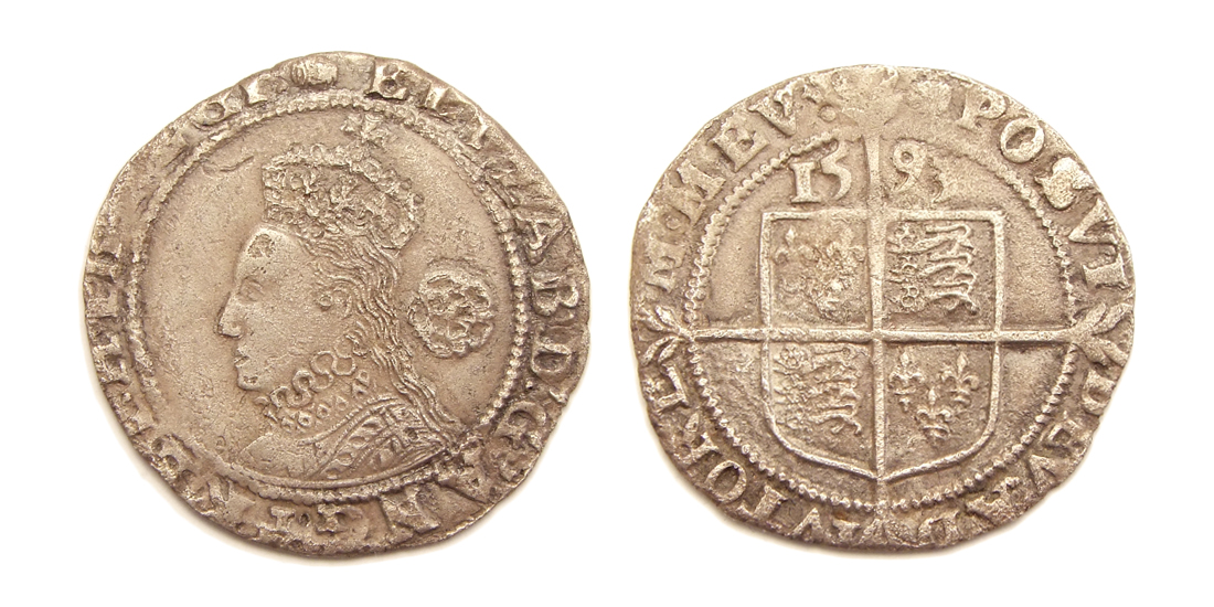
The British sixpence () piece, sometimes known as a tanner or sixpenny bit, was a denomination of sterling coinage worth of one pound or half of one shilling. It was first minted in 1551, during the reign of Edward VI, and circulated until 1980. The coin was made from silver from its introduction in 1551 until 1947, and thereafter in cupronickel. Before Decimal Day in 1971, sterling used the Carolingian monetary system ( £sd), under which the largest unit was a pound (£), divisible into 20 shillings (s), each of 12 pence (d). Following decimalisation, it had a value of new pence (£0.025). In 2016, new decimal sixpences began being minted by the Royal Mint as commemorative issues to celebrate Christmas; these coins have been produced for each year since, and are minted in sterling silver. History The first sixpences were minted in 1551, during the reign of Edward VI. They came about as a result of the debasement of silver coinage in the 1540s, in particular the si ... [...More Info...] [...Related Items...] OR: [Wikipedia] [Google] [Baidu] |


.jpg)

