|
Imizu
270px, Tonami-yotaka festival held in June is a city located in Toyama Prefecture, Japan. , the city had an estimated population of 93,447 in 37,734 households and a population density of 850 persons per km². Its total area was . Geography Imizu is located in the Tonami plains of western Toyama Prefecture, with a coastline on the Sea of Japan to the north. Much of the area is a dispersed settlement typical of this region of Japan. Himi has a humid continental climate (Köppen ''Cfa'') characterized by mild summers and cold winters with heavy snowfall. The average annual temperature in Imizu is 14.0 °C. The average annual rainfall is 2380 mm with September as the wettest month. The temperatures are highest on average in August, at around 26.5 °C, and lowest in January, at around 2.7 °C. Surrounding municipalities *Toyama Prefecture ** Toyama ** Takaoka ** Tonami Demographics Per Japanese census data, the population of Imizu has remained relatively stea ... [...More Info...] [...Related Items...] OR: [Wikipedia] [Google] [Baidu] |
Kosugi, Toyama
was a town located in Imizu District, Toyama Prefecture, Japan. In 2003, the town had an estimated population of 32,770 and a population density of . The total area was . On November 1, 2005, Kosugi, along with the city of Shinminato, the towns of Daimon and Ōshima, the village of Shimo (all from Imizu District), was merged to create the city of Imizu and no longer exists as an independent municipality A municipality is usually a single administrative division having corporate status and powers of self-government or jurisdiction as granted by national and regional laws to which it is subordinate. The term ''municipality'' may also mean the go .... Dissolved municipalities of Toyama Prefecture Imizu, Toyama {{Toyama-geo-stub ... [...More Info...] [...Related Items...] OR: [Wikipedia] [Google] [Baidu] |
Daimon, Toyama
was a town located in Imizu District, Toyama Prefecture, Japan. As of 2003, the town had an estimated population of 12,419 and a density of 570.46 persons per km². The total area was 21.77 km². On November 1, 2005, Daimon, along with the city of Shinminato, the towns of Kosugi and Ōshima, the village of Shimo (all from Imizu District), was merged to create the city of Imizu and no longer exists as an independent municipality A municipality is usually a single administrative division having corporate status and powers of self-government or jurisdiction as granted by national and regional laws to which it is subordinate. The term ''municipality'' may also mean the go .... References Dissolved municipalities of Toyama Prefecture Imizu, Toyama {{Toyama-geo-stub ... [...More Info...] [...Related Items...] OR: [Wikipedia] [Google] [Baidu] |
Shimo, Toyama
was a village located in Imizu District, Toyama Prefecture, Japan. As of 2003, the village had an estimated population of 2,065 and a density of 356.03 persons per km². The total area was 5.80 km². On November 1, 2005 Shimo, along with the city of Shinminato, and the towns of Daimon, Kosugi and Ōshima (all from Imizu District), was merged to create the city of Imizu and no longer exists as an independent municipality A municipality is usually a single administrative division having corporate status and powers of self-government or jurisdiction as granted by national and regional laws to which it is subordinate. The term ''municipality'' may also mean the go .... Dissolved municipalities of Toyama Prefecture Imizu, Toyama {{Toyama-geo-stub ... [...More Info...] [...Related Items...] OR: [Wikipedia] [Google] [Baidu] |
Ōshima, Toyama
was a town located in Imizu District, Toyama Prefecture, Japan. As of 2003, the town had an estimated population of 10,108 and a density of 1,269.85 persons per km². The total area was 7.96 km². On November 1, 2005, Ōshima, along with the city of Shinminato, the towns of Daimon and Kosugi, and the village of Shimo (all from Imizu District), was merged to create the city of Imizu and no longer exists as an independent municipality A municipality is usually a single administrative division having corporate status and powers of self-government or jurisdiction as granted by national and regional laws to which it is subordinate. The term ''municipality'' may also mean the go .... Dissolved municipalities of Toyama Prefecture Imizu, Toyama {{Toyama-geo-stub ... [...More Info...] [...Related Items...] OR: [Wikipedia] [Google] [Baidu] |
Toyama Prefecture
is a prefecture of Japan located in the Chūbu region of Honshu. Toyama Prefecture has a population of 1,044,588 (1 June 2019) and has a geographic area of 4,247.61 km2 (1,640.01 sq mi). Toyama Prefecture borders Ishikawa Prefecture to the west, Gifu Prefecture to the south, Nagano Prefecture to the east, and Niigata Prefecture to the northeast. Toyama is the capital and largest city of Toyama Prefecture, with other major cities including Takaoka, Imizu, and Nanto. Toyama Prefecture is part of the historic Hokuriku region, and the majority of prefecture's population lives on Toyama Bay, one of the largest bays in Japan. Toyama Prefecture is the leading industrial prefecture on the Japan Sea coast and has the advantage of cheap electricity from abundant hydroelectric resources. Toyama Prefecture contains the only known glaciers in East Asia outside of Russia, first recognized in 2012, and 30% of the prefecture's area is designated as national parks. History Hist ... [...More Info...] [...Related Items...] OR: [Wikipedia] [Google] [Baidu] |
Shinminato, Toyama
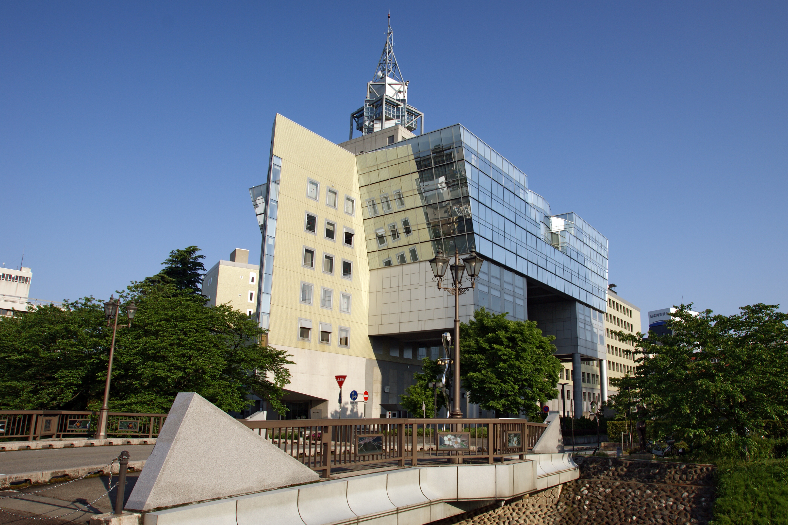
was a city in Toyama Prefecture, Japan. The city was founded on 15 March 1951 and dissolved in November 2005. Demographics As of 2003, the city had an estimated population of 37,094 and the population density of 1,146.29 persons per km². The total area is 32.36 km². History On November 1, 2005, Shinminato, along with the towns of Daimon, Kosugi and Ōshima, and the village of Shimo (all from Imizu District), was merged to create the city of Imizu, and no longer exists as an independent municipality. Places of interest This city was famous for such places as Shinminato-Bridge, Kaiwo-maru Park, Shinminato Fishery, Classical Float Parade in October, and the Uchikawa River. Education * Shinminato High School * Toyama National College of Technology is a college of technology in Toyama and Imizu, Toyama Prefecture is a prefecture of Japan located in the Chūbu region of Honshu. Toyama Prefecture has a population of 1,044,588 (1 June 2019) and has a geographi ... [...More Info...] [...Related Items...] OR: [Wikipedia] [Google] [Baidu] |
Takaoka, Toyama
is a city in the northwestern portion of Toyama Prefecture, Japan. Takaoka has the second largest population after Toyama City. The area that is east of Kureha hill (呉羽丘陵 Kureha-kyuryo) has been called Goto (呉東), which means the east of Kureha and the area that is west of Kureha hill has been called Gosei (呉西), which means the west of Kureha. Toyama city is a center city of "Goto," meanwhile Takaoka city is a center of this "Gosei." , the city had an estimated population of 173,086 in 68,350 households and a population density of 819 persons per km2. Its total area was . Geography Takaoka covers an area which equates to roughly 5% of the surface area of Toyama Prefecture. The surface area of the city comprises 36.96 km2 of real estate, 61.02 km2 of agricultural land, 22.69 km2 of mountains and forests, 80.43 km2 of public property (parks etc.), 6.10 km2 of wasteland, and 2.18 km2 of moorland. The Takaoka region extends 19.2 ... [...More Info...] [...Related Items...] OR: [Wikipedia] [Google] [Baidu] |
Toyama, Toyama
is the capital city of Toyama Prefecture, Japan, located on the coast of the Sea of Japan in the Chūbu region on central Honshū, about north of the city of Nagoya and northwest of Tokyo. , the city had an estimated population of 415,844 in 176,643 households, and a population density of 335 persons per km2. Its total area was . Overview The city has been designated an environmental model city by the national government for its efforts to reduce the emission of greenhouse gases. Cityscapes File:Toyama Castle (4207284334).jpg, Toyama Castle(2009) File:Anyobo, Toyama, Toyama Prefecture 930-0881, Japan - panoramio (35).jpg, Skyline of Toyama City(2015) File:View from Toyama City Hall, north side.jpg, CBD of Toyama(2018) File:Sogawa st.jpeg, Downtown Sōgawa(2016) File:Fugan unga.JPG, Toyama Kansui park(2016) Geography Located in the middle of its prefecture, Toyama is a seaside city by the coast of the Sea of Japan. Its municipal territory borders with ... [...More Info...] [...Related Items...] OR: [Wikipedia] [Google] [Baidu] |
Etchū Province
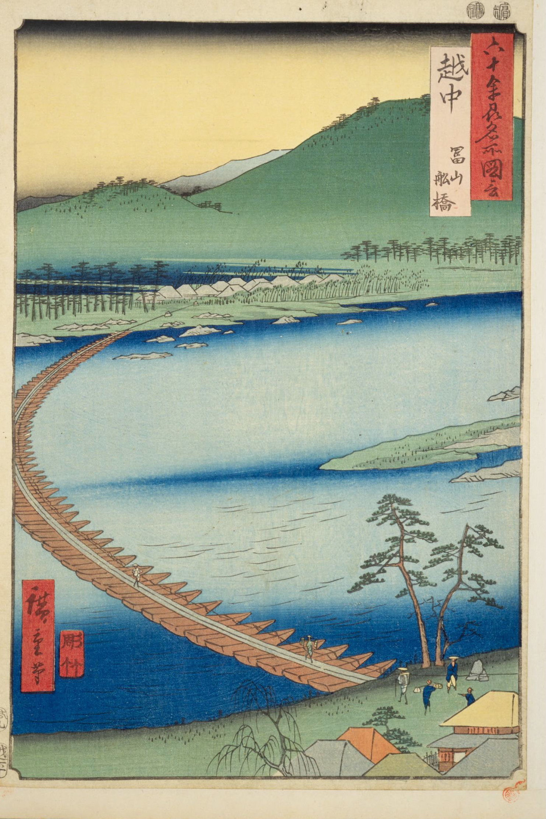
was a province of Japan in the area that is today Toyama Prefecture in the Hokuriku region of Japan. Etchū bordered on Noto and Kaga Provinces to the west, Shinano and Hida Provinces to the south, Echigo Province to the east and the Sea of Japan to the north. Its abbreviated form name was . History was an ancient province of Japan and is listed as one of the original provinces in the '' Nihon Shoki''. The region as a whole was sometimes referred to as . In 701 AD, per the reforms of the Taihō Code, Koshi was divided into three separate provinces: Echizen, Etchū, and Echigo. However, in 702 AD, the four western districts of Etchū Province (Kubiki, Kosi, Uonuma and Kambara) were transferred to Echigo Province. Etchū annexed Noto Province in 741 AD, but Noto was separated out again in 757 AD. In 746 AD, the noted poet Ōtomo no Yakamochi became ''Kokushi'', and left many references to the region in the poetic anthology ''Man'yōshū''. The Nara period provincial ... [...More Info...] [...Related Items...] OR: [Wikipedia] [Google] [Baidu] |
Kaga Domain
The , also known as the , was a domain of the Tokugawa Shogunate of Japan during the Edo period from 1583 to 1871."Kaga Province" at JapaneseCastleExplorer.com retrieved 2013-4-9. The Kaga Domain was based at in , in the modern city of , located in the Chūbu region of the island of |
Tonami, Toyama
270px, Tonami-yotaka festival held in June is a city in Toyama Prefecture, Japan. , the city had an estimated population of 48,659 in 16,739 households and a population density of 384 persons per km². Its total area was . Geography Tonami is located in the Tonami plains of western Toyama Prefecture. Much of the area is a dispersed settlement typical of this region of Japan. Surrounding municipalities *Toyama Prefecture ** Toyama ** Takaoka ** Oyabe ** Nanto ** Imizu Climate Tonami has a humid continental climate (Köppen ''Cfa'') characterized by mild summers and cold winters with heavy snowfall. The average annual temperature in Himi is 13.8 °C. The average annual rainfall is 2414 mm with September as the wettest month. The temperatures are highest on average in August, at around 26.4 °C, and lowest in January, at around 2.4 °C. Demographics Per Japanese census data, the population of Tonami has recently plateaued after a long period of gro ... [...More Info...] [...Related Items...] OR: [Wikipedia] [Google] [Baidu] |
Kaiwo Maru (1930)
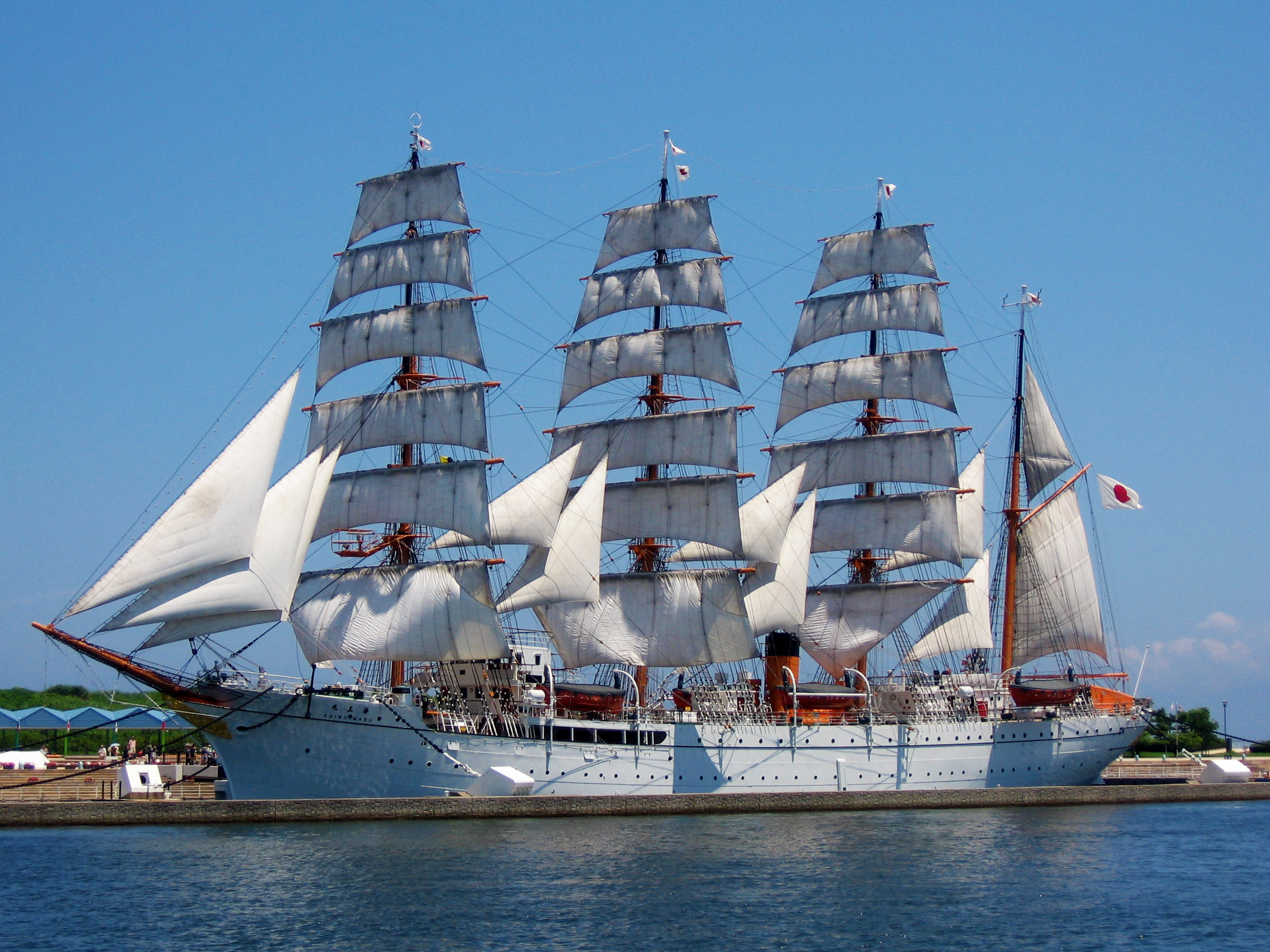
is a Japanese former training barque. She was built by Kawasaki Shipbuilding Corporation in Kobe, and was launched on 27 January 1930 alongside her sister ship ''Nippon Maru''. She was operated by the Tokyo Institute for Maritime Training to train officers for Japan's merchant marine. At the beginning of World War II, her sailing rig was removed and she served as a training and postwar transport motorship. In 1955, her rig was reinstalled and she resumed her training voyages until she was replaced in 1989 by her successor, also named ''Kaiwo Maru''. In August 1955 the ship was filmed by Mike Todd for the movie Around the World in 80 Days. She is now a museum ship located in Imizu, Toyama 270px, Tonami-yotaka festival held in June is a city located in Toyama Prefecture, Japan. , the city had an estimated population of 93,447 in 37,734 households and a population density of 850 persons per km². Its total area was . Geography I .... ''Kaiwo Maru'' measures long, with ... [...More Info...] [...Related Items...] OR: [Wikipedia] [Google] [Baidu] |


