|
Ilhéu De Cima
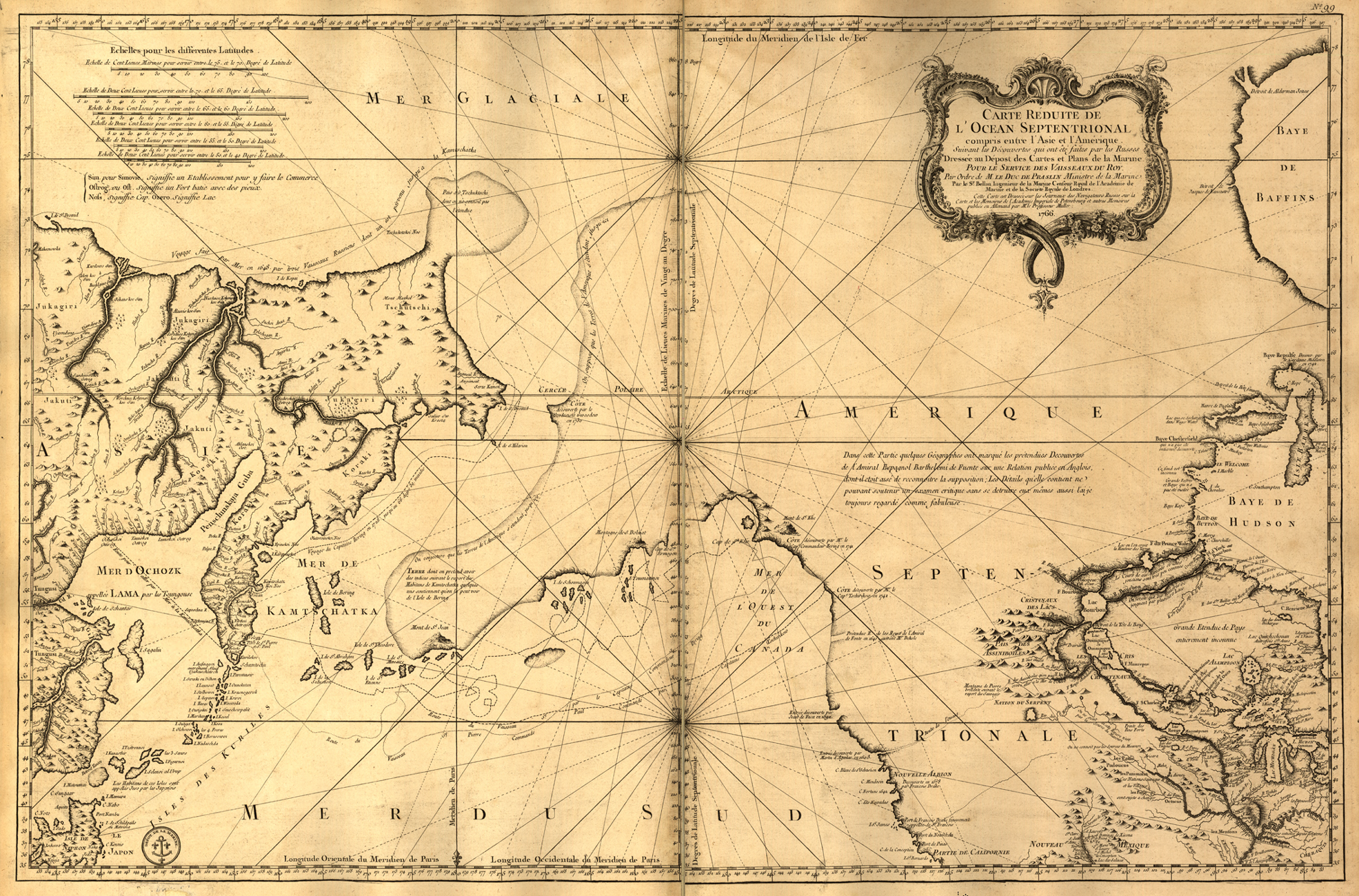
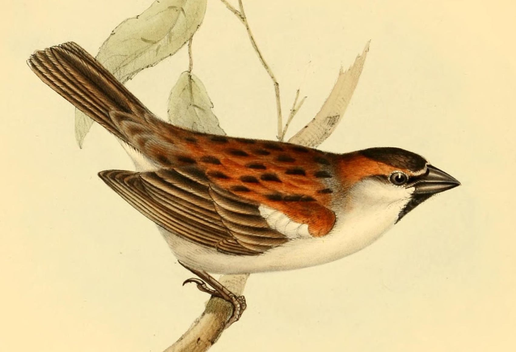
Ilhéu de Cima is an uninhabited island of Cape Verde. It is part of the Ilhéus do Rombo islet group, located east of Ilhéu Grande, the other main islet of the group, and northeast of the island Brava. They are administratively a part of the Brava municipality. Surrounding islets include Ilhéu Luiz Carneiro, Ilhéu Sapado, and Ilhéu do Rei. The island is part of the integral nature reserve ''Ilhéus do Rombo'', famous for its seabird colonies. The southern part of the islet is the highest, culminating at . This is where the Ilhéu de Cima Lighthouse is situated, the only building on the island. The islet was mentioned as "Ghuay" in the 1747 map by Jacques-Nicolas Bellin. Notable endemic fauna found on the island include the Iago sparrow. In the mid-1950s, W. R. P. Bourne observed females remaining in flocks while males began to take up locations on rocky slopes from which they could sing. A species of sponge ''Esperiopsis cimensis'' was found in the deep waters surrounding ... [...More Info...] [...Related Items...] OR: [Wikipedia] [Google] [Baidu] |
Atlantic Ocean
The Atlantic Ocean is the second-largest of the world's five oceans, with an area of about . It covers approximately 20% of Earth's surface and about 29% of its water surface area. It is known to separate the " Old World" of Africa, Europe and Asia from the "New World" of the Americas in the European perception of the World. The Atlantic Ocean occupies an elongated, S-shaped basin extending longitudinally between Europe and Africa to the east, and North and South America to the west. As one component of the interconnected World Ocean, it is connected in the north to the Arctic Ocean, to the Pacific Ocean in the southwest, the Indian Ocean in the southeast, and the Southern Ocean in the south (other definitions describe the Atlantic as extending southward to Antarctica). The Atlantic Ocean is divided in two parts, by the Equatorial Counter Current, with the North(ern) Atlantic Ocean and the South(ern) Atlantic Ocean split at about 8°N. Scientific explorations of the A ... [...More Info...] [...Related Items...] OR: [Wikipedia] [Google] [Baidu] |
Brava, Cape Verde (municipality)
Brava ( Portuguese for "wild" or "brave") is an island in Cape Verde, in the Sotavento group. At , it is the smallest inhabited island of the Cape Verde archipelago, but at the same time the greenest. First settled in the early 16th century, its population grew after Mount Fogo on neighbouring Fogo erupted in 1680. For more than a century, its main industry was whaling, but the island economy is now primarily agricultural. History Brava was discovered in 1462 by the Portuguese explorer Diogo Afonso.Valor simbólico do centro histórico da Praia Lourenço Conceição Gomes, Universidade Portucalense, 2008, p. 97 There is no evidence of human presence on the Cape Verde islands before the arrival of the Portuguese. Around 1620 the population of Brava started with the arrival of settlers from |
Cape Verde
, national_anthem = () , official_languages = Portuguese , national_languages = Cape Verdean Creole , capital = Praia , coordinates = , largest_city = capital , demonym = Cape Verdean or Cabo Verdean , ethnic_groups_year = 2017 , government_type = Unitary semi-presidential republic , leader_title1 = President , leader_name1 = José Maria Neves , leader_title2 = Prime Minister , leader_name2 = Ulisses Correia e Silva , legislature = National Assembly , area_rank = 166th , area_km2 = 4033 , area_sq_mi = 1,557 , percent_water = negligible , population_census = 561,901 , population_census_rank = 172nd , population_census_year = 2021 , population_density_km2 = 123.7 , population_density_sq_mi = 325.0 , population_density_rank = 89th , GDP_PPP ... [...More Info...] [...Related Items...] OR: [Wikipedia] [Google] [Baidu] |
Ilhéus Do Rombo
The Ilhéus do Rombo, also known as the Ilhéus Secos (Portuguese for "Dry Islets", because of their aridity and paucity of vegetation), are a group of small, uninhabited islands in the Cape Verde archipelago, lying off the coast of north-west Africa in the Atlantic Ocean. The islets form an integral nature reserve.Resolução nº 36/2016 Estratégia e Plano Nacional de Negócios das Áreas Protegidas They are sited on a north of and west of [...More Info...] [...Related Items...] OR: [Wikipedia] [Google] [Baidu] |
Ilhéu Grande
Ilhéu Grande is an uninhabited island of Cape Verde. It is the largest of the Ilhéus do Rombo islet group, located west of Ilhéu de Cima, the other main islet of the group, and north of the island Brava. Its length is from southwest to northeast and the width is approximately from southeast to northwest. It is 96 m high. The islet forms a part of the integral nature reserve ''Ilhéus do Rombo''. The islet is a volcanic seamount and has a rocky coastline. It is mostly barren but has some scattered vegetation. Large bird colonies must have existed formerly as the island has thick layers of guano. It has been used by goat farmers and whalers in the past. The islet was mentioned as "Juan Carnira" in the 1747 map by Jacques-Nicolas Bellin Jacques Nicolas Bellin (1703 – 21 March 1772) was a French hydrographer, geographer, and member of the French intellectual group called the philosophes. Bellin was born in Paris. He was hydrographer of France's hydrographic office, member ... [...More Info...] [...Related Items...] OR: [Wikipedia] [Google] [Baidu] |
Brava, Cape Verde
Brava (Portuguese for "wild" or "brave") is an island in Cape Verde, in the Sotavento group. At , it is the smallest inhabited island of the Cape Verde archipelago, but at the same time the greenest. First settled in the early 16th century, its population grew after Mount Fogo on neighbouring Fogo erupted in 1680. For more than a century, its main industry was whaling, but the island economy is now primarily agricultural. History Brava was discovered in 1462 by the Portuguese explorer Diogo Afonso.Valor simbólico do centro histórico da Praia Lourenço Conceição Gomes, Universidade Portucalense, 2008, p. 97 There is no evidence of human presence on the Cape Verde islands before the arrival of the Portuguese. Around 1620 the population of Brava started with the arrival of settlers from |
Ilhéu De Cima Lighthouse
Ilhéu de Cima Lighthouse ( pt, Farol do Ilhéu de Cima) is a lighthouse on Ilhéu de Cima located about 80 m above sea level. The lighthouse is the only building inside the integral nature reserve Ilhéus do Rombo. It is a small white tower 4 meters in height with a white lantern, the lighthouse is solar powered. The caretaker's house is next door. It flashes white lights every 12 seconds, its range is . See also *List of lighthouses in Cape Verde The following article is a list of lighthouses in Cape Verde. Cape Verde has tens of lighthouses scattered across its nine major islands. The lighthouses are administered by the Direction of Marine and Ports (''Direcção Geral de Marinha e Portos' ... References {{DEFAULTSORT:Cima Ilheu Lighthouse Brava Municipality Lighthouses in Cape Verde ... [...More Info...] [...Related Items...] OR: [Wikipedia] [Google] [Baidu] |
Jacques-Nicolas Bellin
Jacques Nicolas Bellin (1703 – 21 March 1772) was a French hydrographer, geographer, and member of the French intellectual group called the philosophes. Bellin was born in Paris. He was hydrographer of France's hydrographic office, member of the ''Académie de Marine'' and of the Royal Society of London. Over a 50-year career, he produced many maps of particular interest to the ''Ministère de la Marine''. His maps of Canada and of French territories in North America (New France, Acadia, Louisiana) are particularly valuable. He died at Versailles. First ''Ingenieur de la Marine'' In 1721, at age 18, he was appointed hydrographer (chief cartographer) to the French Navy. In August 1741, he became the first ''Ingénieur de la Marine of the Dépot des cartes et plans de la Marine'' (the French Hydrographical Office) and was named Official Hydrographer of the French King. Prodigious work, high standard of excellence During his reign the Depot published a prodigious number of cha ... [...More Info...] [...Related Items...] OR: [Wikipedia] [Google] [Baidu] |
Iago Sparrow
The Iago sparrow (''Passer iagoensis''), also known as the Cape Verde or rufous-backed sparrow, is a passerine bird of the sparrow family Passeridae. It is endemic to the Cape Verde archipelago, in the eastern Atlantic Ocean near western Africa. Females and young birds have brown plumage with black marks above, and a dull grey underside, and are distinguished from other species of sparrow by their large, distinct supercilium. Males have a brighter underside and bold black and chestnut stripes on their head. At long, it is a smaller sparrow. This bird's vocalisations are mostly variations on its chirp, which differ somewhat between males and females. The Iago sparrow was once thought to be most closely related to the rufous sparrows, a group of species within the genus ''Passer'' which live in similar habitats on continental Africa. Though the Iago sparrow is closest to the rufous sparrows in appearance, it has a number of crucial differences in morphology and behavior, and is s ... [...More Info...] [...Related Items...] OR: [Wikipedia] [Google] [Baidu] |
Sponge
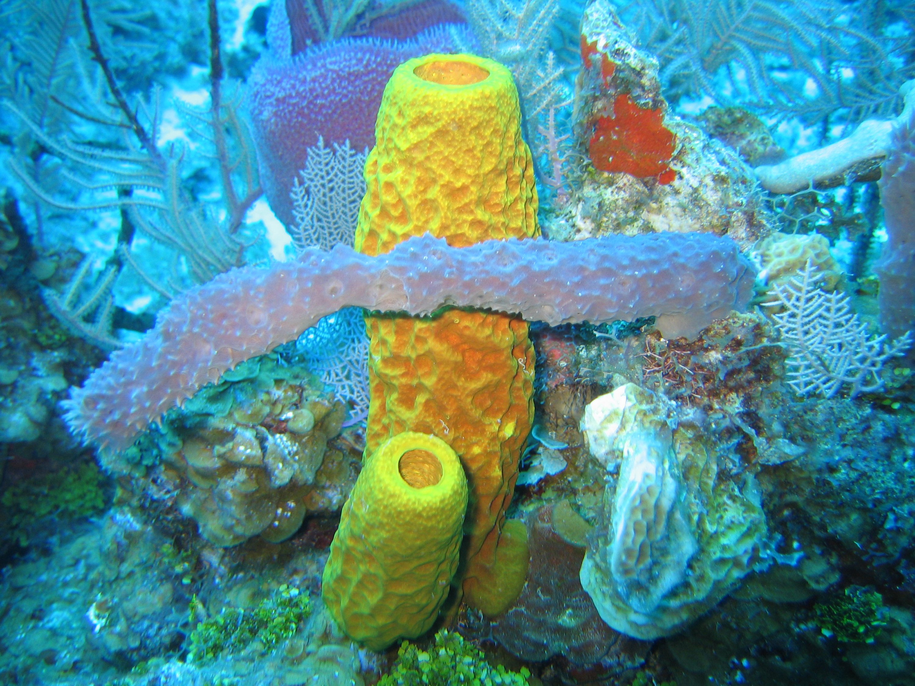
Sponges, the members of the phylum Porifera (; meaning 'pore bearer'), are a basal animal clade as a sister of the diploblasts. They are multicellular organisms that have bodies full of pores and channels allowing water to circulate through them, consisting of jelly-like mesohyl sandwiched between two thin layers of cells. Sponges have unspecialized cells that can transform into other types and that often migrate between the main cell layers and the mesohyl in the process. Sponges do not have nervous, digestive or circulatory systems. Instead, most rely on maintaining a constant water flow through their bodies to obtain food and oxygen and to remove wastes. Sponges were first to branch off the evolutionary tree from the last common ancestor of all animals, making them the sister group of all other animals. Etymology The term ''sponge'' derives from the Ancient Greek word ( 'sponge'). Overview Sponges are similar to other animals in that they are multicellular, he ... [...More Info...] [...Related Items...] OR: [Wikipedia] [Google] [Baidu] |
Esperiopsis Cimensis
''Esperiopsis cimensis'' is a species of demosponges found in the Atlantic waters around Cape Verde, western Africa. The species name is named after the type locality, Ilhéu de Cima. The species was discovered in 1986 in the waters southeast of Ilhéu de Cima, one of the Ilhéus do Rombo The Ilhéus do Rombo, also known as the Ilhéus Secos (Portuguese for "Dry Islets", because of their aridity and paucity of vegetation), are a group of small, uninhabited islands in the Cape Verde archipelago, lying off the coast of north-west Af ..., north of the island Brava, at 165 m depth, on hard bottom with yellow calcareous sand. This is the only place where it has been observed. References Poecilosclerida Fauna of Brava, Cape Verde Animals described in 2012 {{Demosponge-stub ... [...More Info...] [...Related Items...] OR: [Wikipedia] [Google] [Baidu] |
List Of Islands Of Cape Verde ...
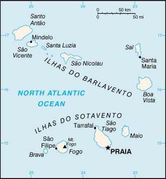
The archipelago of Cape Verde consists of 10 islands and several islets, divided into two groups: * Barlavento (windward) islands * Sotavento (leeward) islands The islands in the Barlavento group are Santo Antão, São Vicente, Santa Luzia, São Nicolau, Sal, and Boa Vista. The islands in the Sotavento group are Maio, Santiago, Fogo, and Brava. All but Santa Luzia are inhabited. Below is a sortable list of the islands of Cape Verde. Population figures are of 2000. {{Authority control Cape Verde Cape Verde Islands An island (or isle) is an isolated piece of habitat that is surrounded by a dramatically different habitat, such as water. Very small islands such as emergent land features on atolls can be called islets, skerries, cays or keys. An island ... [...More Info...] [...Related Items...] OR: [Wikipedia] [Google] [Baidu] |


