|
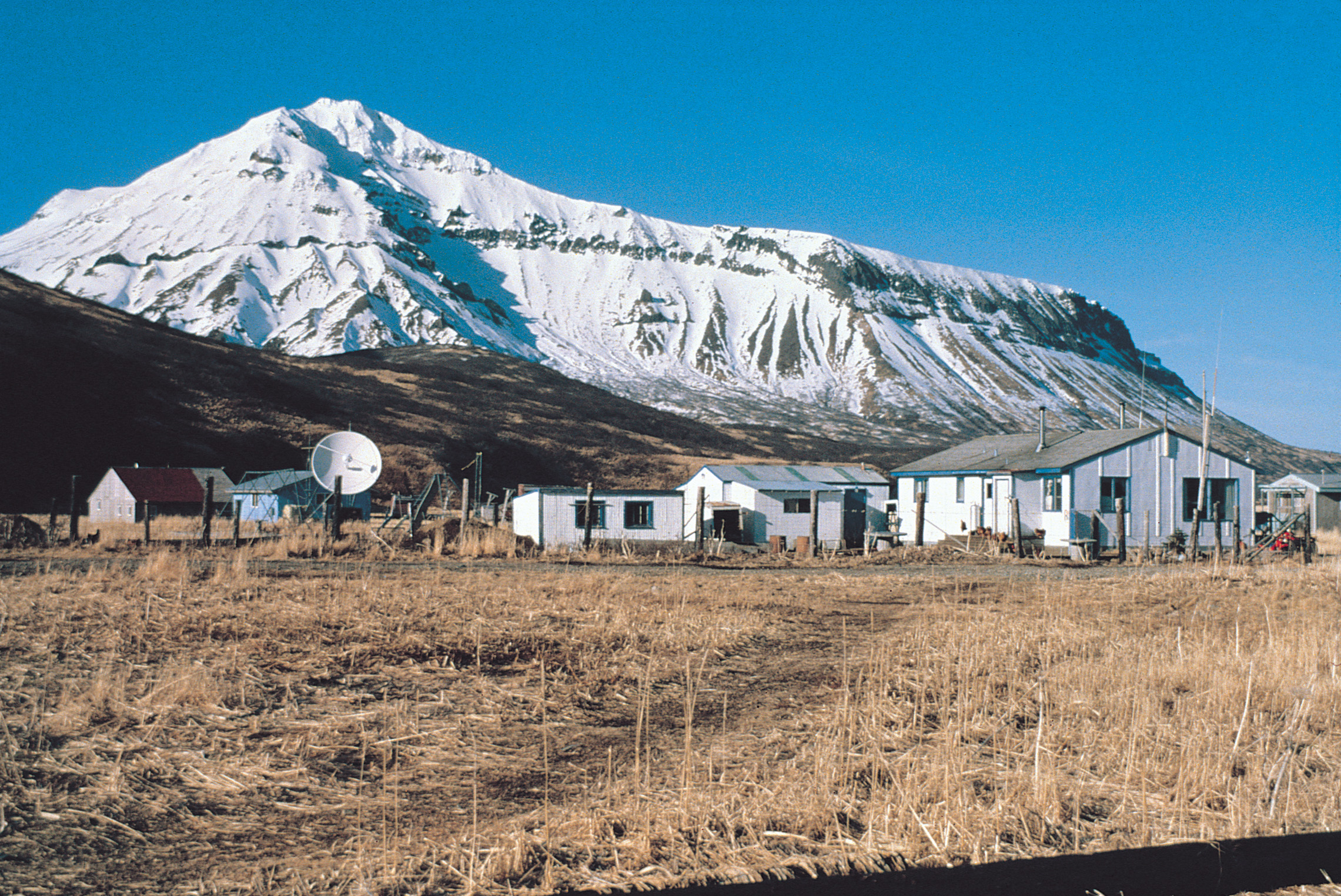
Ikatan, Alaska
Ikatan is an unincorporated community in the Aleutians East Borough of the U.S. state of Alaska. Named after Ikatan Peninsula, it is located on Unimak Island. Demographics Ikatan first appeared on the 1950 U.S. Census as an unincorporated area. This was the only time it appeared on the census as a separate community. It had reported under Unimak (population 59) in 1930 and 1940 (88), but this also included False Pass. As of 2010, the former village area is now partly located within False Pass False Pass ( ale, Isanax̂) is a city on Unimak Island, in the Aleutians East Borough of southwestern Alaska, United States. Although the population was marked 397 including seasonal fish processing plant workers at the 2020 census, approximat .... References Unimak Island Unincorporated communities in Aleutians East Borough, Alaska Populated coastal places in Alaska on the Pacific Ocean Road-inaccessible communities of Alaska Unincorporated communities in Alaska ... [...More Info...] [...Related Items...] OR: [Wikipedia] [Google] [Baidu] |
Unincorporated Area
An unincorporated area is a region that is not governed by a local municipal corporation. Widespread unincorporated communities and areas are a distinguishing feature of the United States and Canada. Most other countries of the world either have no unincorporated areas at all or these are very rare: typically remote, outlying, sparsely populated or List of uninhabited regions, uninhabited areas. By country Argentina In Argentina, the provinces of Chubut Province, Chubut, Córdoba Province (Argentina), Córdoba, Entre Ríos Province, Entre Ríos, Formosa Province, Formosa, Neuquén Province, Neuquén, Río Negro Province, Río Negro, San Luis Province, San Luis, Santa Cruz Province, Argentina, Santa Cruz, Santiago del Estero Province, Santiago del Estero, Tierra del Fuego Province, Argentina, Tierra del Fuego, and Tucumán Province, Tucumán have areas that are outside any municipality or commune. Australia Unlike many other countries, Australia has only local government in Aus ... [...More Info...] [...Related Items...] OR: [Wikipedia] [Google] [Baidu] |
Aleutians East Borough, Alaska
Aleutians East Borough () is a 2nd class borough in the U.S. state of Alaska. As of the 2020 census the borough's population was 3,420. The borough seat is Sand Point. History According to archaeological evidence, the area has been inhabited by the Aleuts since the last ice age. Early contact was with Russian fur traders who sought sea otters in these islands. Whaling, fishing and cannery operations brought an influx of Scandinavian and European fishermen in the early 1900s. During World War II, the area was a strategic military site for the Aleutian Campaign, and many locals were evacuated to Ketchikan. Geography According to the U.S. Census Bureau, the borough has a total area of , of which is land and (53.5%) is water. Aleutians East Borough is located at 57° north latitude and 162° west longitude. It comprises the westernmost portion of the Alaska Peninsula, and a small number of the Aleutian Islands, from which the borough name derives. Also included are the Sh ... [...More Info...] [...Related Items...] OR: [Wikipedia] [Google] [Baidu] |
Alaska
Alaska ( ; russian: Аляска, Alyaska; ale, Alax̂sxax̂; ; ems, Alas'kaaq; Yup'ik: ''Alaskaq''; tli, Anáaski) is a state located in the Western United States on the northwest extremity of North America. A semi-exclave of the U.S., it borders the Canadian province of British Columbia and the Yukon territory to the east; it also shares a maritime border with the Russian Federation's Chukotka Autonomous Okrug to the west, just across the Bering Strait. To the north are the Chukchi and Beaufort Seas of the Arctic Ocean, while the Pacific Ocean lies to the south and southwest. Alaska is by far the largest U.S. state by area, comprising more total area than the next three largest states (Texas, California, and Montana) combined. It represents the seventh-largest subnational division in the world. It is the third-least populous and the most sparsely populated state, but by far the continent's most populous territory located mostly north of the 60th parallel, with ... [...More Info...] [...Related Items...] OR: [Wikipedia] [Google] [Baidu] |
Ikatan Peninsula
Ikatan Peninsula is the southeastern extremity of Unimak Island in the U.S. state of Alaska. The peninsula is approximately 13 miles long. It is divided into three mountain masses and from Unimak Island by low depressions which extend from West Anchor Cove to East Anchor Cove and from Dora Harbor and Otter Cove to Ikatan Bay. Cape Pankof, the eastern end of Ikatan Peninsula, terminates in three cliffs on the southern side, the highest about 1,200 feet, but on the northern side there is a gentle slope to the low isthmus between East and West Anchor coves. Some bare rocks lie within 0.25 mile from the cape, on the southern and eastern sides. Pankof Breaker lies a little over 2 miles from the southeast point at the entrance to East Anchor Cove. Bird Island, about 0.5 mile in extent, 750 feet high, and precipitous, lies 2 miles from the south coast of Ikatan Peninsula, off the entrance to Dora Harbor, and 8 miles westward from Cape Pankof. A sunken reef connects the island with the ... [...More Info...] [...Related Items...] OR: [Wikipedia] [Google] [Baidu] |


