|
Ie-jima
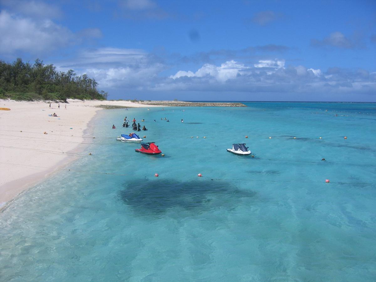
, previously romanized in English as Ie Shima, is an island in Okinawa Prefecture, Japan, lying a few kilometers off the Motobu Peninsula on Okinawa Island. The island measures in circumference and covers . As of December 2012 the island had a population of 4,610. Ie Village, which covers the entire island, has a ferry connection with the town of Motobu on Okinawa Island. Iejima is generally flat. The most notable geographic feature is a peak called Mount Gusuku (or "Tatchuu" in Kunigami) at a height of 172 meters. The mountain resembles a volcano but is actually an erosion artifact. Alternately called "Peanut Island," for its general shape and peanut crop, or "Flower Island," for its abundant flora and more sizeable crop, Iejima draws tourists by ferry, especially during late April when the Ie Lily Festival begins. The Youth Excursion Village accommodates campers for 400 yen a person and includes access to a good beach. The YYY Resort and Hotel located just east of the ... [...More Info...] [...Related Items...] OR: [Wikipedia] [Google] [Baidu] |
Okinawa Prefecture
is a prefecture of Japan. Okinawa Prefecture is the southernmost and westernmost prefecture of Japan, has a population of 1,457,162 (as of 2 February 2020) and a geographic area of 2,281 km2 (880 sq mi). Naha is the capital and largest city of Okinawa Prefecture, with other major cities including Okinawa, Uruma, and Urasoe. Okinawa Prefecture encompasses two thirds of the Ryukyu Islands, including the Okinawa, Daitō and Sakishima groups, extending southwest from the Satsunan Islands of Kagoshima Prefecture to Taiwan ( Hualien and Yilan Counties). Okinawa Prefecture's largest island, Okinawa Island, is the home to a majority of Okinawa's population. Okinawa Prefecture's indigenous ethnic group are the Ryukyuan people, who also live in the Amami Islands of Kagoshima Prefecture. Okinawa Prefecture was ruled by the Ryukyu Kingdom from 1429 and unofficially annexed by Japan after the Invasion of Ryukyu in 1609. Okinawa Prefecture was officially founded in 1879 by the Empire ... [...More Info...] [...Related Items...] OR: [Wikipedia] [Google] [Baidu] |
Motobu, Okinawa
is a town located in Kunigami District, Okinawa Prefecture, Japan. As of October 2016, the town has an estimated population of 13,441 and a density of 250 persons per km2. The total area is . Several islands can be accessed from Motobu, namely the small islands of Sesoko (by bridge) and Minna-jima (by ferry). Both islands are incorporated as part of the Town of Motobu. Ferry service also runs from Motobu Port to Ie-jima. Motobu is served by three large supermarkets and eight individual schools from elementary to high school levels. Like many towns in Okinawa, Motobu is composed of what were formerly several smaller and independent villages. In addition to Motobu proper other included districts are Sesoko, Kamimotobu, Sakimotobu and Izumi. The well-known Okinawa Churaumi Aquarium is located in Motobu. Other notable sites include the remains of Nakijin Castle, as well as several cafes. Geography The town of Motobu sits on the northern part of Okinawa Island. The town occupies ... [...More Info...] [...Related Items...] OR: [Wikipedia] [Google] [Baidu] |
Okinawa Islands Map
is a prefecture of Japan. Okinawa Prefecture is the southernmost and westernmost prefecture of Japan, has a population of 1,457,162 (as of 2 February 2020) and a geographic area of 2,281 km2 (880 sq mi). Naha is the capital and largest city of Okinawa Prefecture, with other major cities including Okinawa, Uruma, and Urasoe. Okinawa Prefecture encompasses two thirds of the Ryukyu Islands, including the Okinawa, Daitō and Sakishima groups, extending southwest from the Satsunan Islands of Kagoshima Prefecture to Taiwan ( Hualien and Yilan Counties). Okinawa Prefecture's largest island, Okinawa Island, is the home to a majority of Okinawa's population. Okinawa Prefecture's indigenous ethnic group are the Ryukyuan people, who also live in the Amami Islands of Kagoshima Prefecture. Okinawa Prefecture was ruled by the Ryukyu Kingdom from 1429 and unofficially annexed by Japan after the Invasion of Ryukyu in 1609. Okinawa Prefecture was officially founded in 1879 by the Empire o ... [...More Info...] [...Related Items...] OR: [Wikipedia] [Google] [Baidu] |
Ryukyu Islands
The , also known as the or the , are a chain of Japanese islands that stretch southwest from Kyushu to Taiwan: the Ōsumi, Tokara, Amami, Okinawa, and Sakishima Islands (further divided into the Miyako and Yaeyama Islands), with Yonaguni the westernmost. The larger are mostly high islands and the smaller mostly coral. The largest is Okinawa Island. The climate of the islands ranges from humid subtropical climate (Köppen climate classification ''Cfa'') in the north to tropical rainforest climate (Köppen climate classification ''Af'') in the south. Precipitation is very high and is affected by the rainy season and typhoons. Except the outlying Daitō Islands, the island chain has two major geologic boundaries, the Tokara Strait (between the Tokara and Amami Islands) and the Kerama Gap (between the Okinawa and Miyako Islands). The islands beyond the Tokara Strait are characterized by their coral reefs. The Ōsumi and Tokara Islands, the northernmost of the islands, fall un ... [...More Info...] [...Related Items...] OR: [Wikipedia] [Google] [Baidu] |
Naval Air Transport Service
The Naval Air Transport Service or NATS, was a branch of the United States Navy from 1941 to 1948. At its height during World War II, NATS's totaled four wings of 18 squadrons that operated 540 aircraft with 26,000 personnel assigned. Formation, 1941–42 Prior to WW II, The Navy's air transport needs were provided by utility squadrons and aircraft assigned to commands. Five days after Pearl Harbor, Capt. C. H. Schildhauer presented a detailed plan for a naval air transport program to the Secretary of the Navy, Frank Knox. Knox immediate approved the plan and the Naval Air Transport Service was created. This was a tall order since the largest transport operated by the Navy at this time were four R2Ds (DC-2). The first military transport version of the DC-3, the C-47, was first flown on 23 December 1941. Throughout the war, the Navy obtained its R4Ds (C-47) and later the C-54 (R5D) from U.S. Army contracts. Initially, additional DC-3s were appropriated from the commercial ai ... [...More Info...] [...Related Items...] OR: [Wikipedia] [Google] [Baidu] |
F4U VMF-314 Battle Damaged On Ie Shima 1945
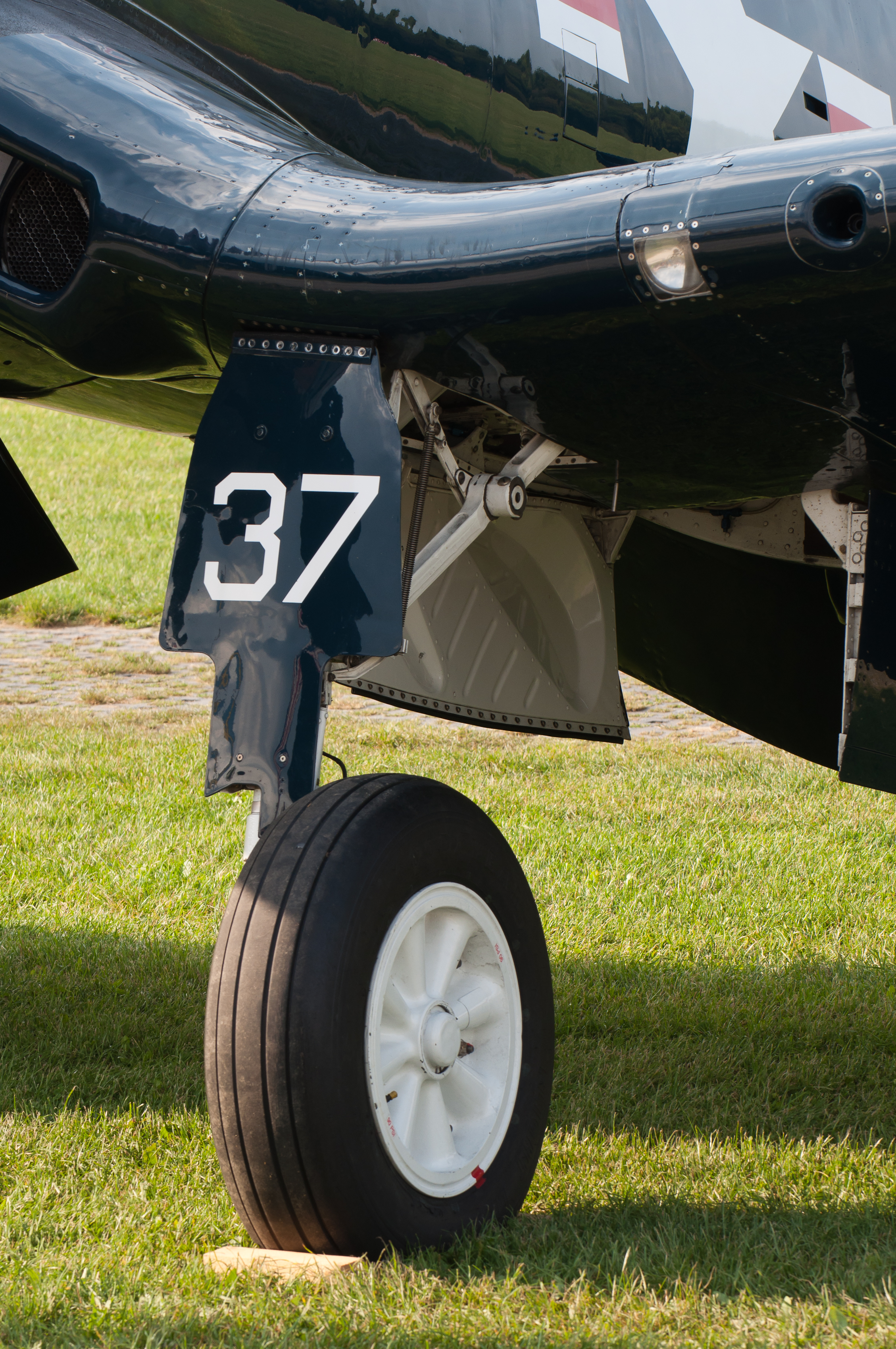
The Vought F4U Corsair is an American fighter aircraft which saw service primarily in World War II and the Korean War. Designed and initially manufactured by Chance Vought, the Corsair was soon in great demand; additional production contracts were given to Goodyear, whose Corsairs were designated FG, and Brewster, designated F3A. The Corsair was designed and operated as a carrier-based aircraft, and entered service in large numbers with the U.S. Navy in late 1944 and early 1945. It quickly became one of the most capable carrier-based fighter-bombers of World War II. Some Japanese pilots regarded it as the most formidable American fighter of World War II and its naval aviators achieved an 11:1 kill ratio. Early problems with carrier landings and logistics led to it being eclipsed as the dominant carrier-based fighter by the Grumman F6F Hellcat, powered by the same Double Wasp engine first flown on the Corsair's initial prototype in 1940. Instead, the Corsair's early deploymen ... [...More Info...] [...Related Items...] OR: [Wikipedia] [Google] [Baidu] |
Surrender Of Japan
The surrender of the Empire of Japan in World War II was announced by Emperor Hirohito on 15 August and formally signed on 2 September 1945, bringing the war's hostilities to a close. By the end of July 1945, the Imperial Japanese Navy (IJN) had become incapable of conducting major operations and an Allied invasion of Japan was imminent. Together with the United Kingdom and China, the United States called for the unconditional surrender of the Japanese armed forces in the Potsdam Declaration on 26 July 1945—the alternative being "prompt and utter destruction". While publicly stating their intent to fight on to the bitter end, Japan's leaders (the Supreme Council for the Direction of the War, also known as the "Big Six") were privately making entreaties to the publicly neutral Soviet Union to mediate peace on terms more favorable to the Japanese. While maintaining a sufficient level of diplomatic engagement with the Japanese to give them the impression they might be wi ... [...More Info...] [...Related Items...] OR: [Wikipedia] [Google] [Baidu] |
413th Flight Test Group
The 413th Flight Test Group (413 FTG) is a United States Air Force Air Force Reserve Command unit. It is stationed at Robins Air Force Base, Georgia as a tenant unit. The 413 FTG conducts flight tests on aircraft after the programmed depot maintenance is completed. Its history goes back to 1944 when the 413th Fighter Group flew very long range (VLR) escort missions of Twentieth Air Force B-29 Superfortress bombardment groups against Japan. During the Cold War, the unit was a Strategic Air Command fighter-escort wing and later Tactical Air Command tactical fighter group in the 1950s. Today, the group's units are stationed throughout the United States to help conduct functional flight tests. The group is a partnership between the Air Force Materiel Command and the Air Force Reserve Command and is the operational supervisor of all the depot flight test units. The group manages five squadrons and two flights is made up of 140 full-time Airmen, 78 traditional reservist and nin ... [...More Info...] [...Related Items...] OR: [Wikipedia] [Google] [Baidu] |
Mitsubishi G4M
The Mitsubishi G4M was a twin-engine, land-based medium bomber formerly manufactured by the Mitsubishi Aircraft Company, a part of Mitsubishi Heavy Industries, and operated by the Imperial Japanese Navy from 1940 to 1945. Its official designation is and was commonly referred to by Japanese Navy pilots as due to the cylindrical shape of its fuselage and its penchant for igniting after a hit. The Allied reporting name was "Betty". Designed to a strict specification to succeed the Mitsubishi G3M already in service, the G4M boasted very good performance and excellent range and was considered the best land-based naval bomber at the time. This was achieved by its structural lightness and an almost total lack of protection for the crew, with no armor plating or self-sealing fuel tanks. The G4M was officially adopted on 2 April 1941 but the aforementioned problems would prove to be a severe drawback, often suffering heavy losses; Allied fighter pilots nicknamed the G4M "The Flying L ... [...More Info...] [...Related Items...] OR: [Wikipedia] [Google] [Baidu] |
345th Bombardment Wing
The 345th Bombardment Group is an inactive United States Air Force unit. Its last assignment was with the Tactical Air Command at Langley Air Force Base, Virginia, where it was inactivated on 25 June 1959. During World War II the 345th Bombardment Group operated in the Southwest Pacific Theater as a North American B-25 Mitchell medium bomber unit assigned to Fifth Air Force. It was awarded both the Distinguished Unit Citation and the Philippine Presidential Unit Citation for its combat service in New Guinea; the Bismarck Archipelago, Leyte; Luzon; the Southern Philippines and China. History World War II Activated on 11 November 1942, at Columbia Army Air Base, South Carolina, by Third Air Force order No. 275. Four squadrons designated 498, 499, 500, 501 were assigned to it. The 345th started with 40 officers and 350 enlisted men, commanded by then Col. Jarred V. Crabb. Full strength, the 345th would contain 250 officers and 1250 enlisted men. At Columbia and other training bases, ... [...More Info...] [...Related Items...] OR: [Wikipedia] [Google] [Baidu] |
Battle Of Okinawa
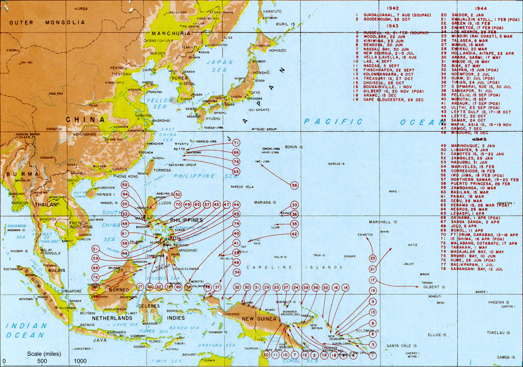
The , codenamed Operation Iceberg, was a major battle of the Pacific War fought on the island of Okinawa by United States Army (USA) and United States Marine Corps (USMC) forces against the Imperial Japanese Army (IJA). The initial invasion of Okinawa on 1 April 1945 was the largest amphibious assault in the Pacific Theater of World War II. The Kerama Islands surrounding Okinawa were preemptively captured on 26 March, (L-6) by the 77th Infantry Division. The 82-day battle lasted from 1 April until 22 June 1945. After a long campaign of island hopping, the Allies were planning to use Kadena Air Base on the large island of Okinawa as a base for Operation Downfall, the planned invasion of the Japanese home islands, away. The United States created the Tenth Army, a cross-branch force consisting of the U.S. Army 7th, 27th, 77th and 96th Infantry Divisions with the USMC 1st, 2nd, and 6th Marine Divisions, to fight on the island. The Tenth was unique in that it had its own Tact ... [...More Info...] [...Related Items...] OR: [Wikipedia] [Google] [Baidu] |
Corregidor
Corregidor ( tl, Pulo ng Corregidor, ) is an island located at the entrance of Manila Bay in the southwestern part of Luzon in the Philippines, and is considered part of the Province of Cavite. Due to this location, Corregidor has historically been fortified with coastal artillery batteries to defend the entrance of Manila Bay and Manila itself from attacks by enemy warships. Located inland, Manila is the nation's largest city and has been the most important seaport in the Philippines for centuries, from the colonial rule of Spain, Japan, and the United States, up through the establishment of the Third Philippine Republic in 1946. Corregidor (Fort Mills) is the largest of the islands that formed the harbor defenses of Manila Bay, together with El Fraile Island (Fort Drum), Caballo Island (Fort Hughes), and Carabao Island (Fort Frank), which were all fortified during the American colonial period. The island was also the site of a small military airfield, as part of the defense. ... [...More Info...] [...Related Items...] OR: [Wikipedia] [Google] [Baidu] |


.jpeg)