|
ICES Statistical Rectangles
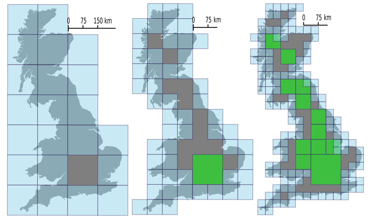
ICES Statistical Rectangles (aka "ICES Rectangles") is a gridded, latitude-longitude based area notation system covering the north-east Atlantic region developed by the International Council for the Exploration of the Sea (ICES) in the 1970s, for simplified analysis and visualization of spatial data of relevance to that organization's interests.ICES, 1977. "ICES Statistical Rectangle Coding System". ICES C 1977/Gen3. The individual rectangles that make up the system each measure 1 degree of longitude by 0.5 degrees of latitude and are intended to be roughly square in real world use in the ICES region of interest, approximately 30 nautical miles by 30 nautical miles (55×55 km) at 60°N, although the actual width varies with latitude, gradually becoming wider than they are high south of 60°N, and narrower further north. The grid covers the region from 36°N to 85°30'N and from 44°W to 69°E (quoted as 68°30') using a set of alphanumeric identifiers, with row of latitude (identifie ... [...More Info...] [...Related Items...] OR: [Wikipedia] [Google] [Baidu] |
International Council For The Exploration Of The Sea
The International Council for the Exploration of the Sea (ICES; french: Conseil International de l'Exploration de la Mer, ''CIEM'') is a regional fishery advisory body and the world's oldest intergovernmental science organization. ICES is headquartered in Copenhagen, Denmark, where its multinational secretariat staff of 51 provide scientific, administrative and secretarial support to the ICES community. It was established on July 22, 1902, in Copenhagen. Functions ICES is a leading multidisciplinary scientific forum for the exchange of information and ideas on all aspects of marine sciences pertaining to the North Atlantic, including the adjacent Baltic Sea and North Sea, and for the promotion and coordination of marine research by scientists within its member nations. Its principal functions, both when it was established and continuing to the present time, are to: (i) promote, encourage, develop, and coordinate marine research; (ii) publish and otherwise disseminate results of r ... [...More Info...] [...Related Items...] OR: [Wikipedia] [Google] [Baidu] |
Geographic Coordinate System
The geographic coordinate system (GCS) is a spherical or ellipsoidal coordinate system for measuring and communicating positions directly on the Earth as latitude and longitude. It is the simplest, oldest and most widely used of the various spatial reference systems that are in use, and forms the basis for most others. Although latitude and longitude form a coordinate tuple like a cartesian coordinate system, the geographic coordinate system is not cartesian because the measurements are angles and are not on a planar surface. A full GCS specification, such as those listed in the EPSG and ISO 19111 standards, also includes a choice of geodetic datum (including an Earth ellipsoid), as different datums will yield different latitude and longitude values for the same location. History The invention of a geographic coordinate system is generally credited to Eratosthenes of Cyrene, who composed his now-lost ''Geography'' at the Library of Alexandria in the 3rd century ... [...More Info...] [...Related Items...] OR: [Wikipedia] [Google] [Baidu] |
List Of Geodesic-geocoding Systems
A discrete global grid (DGG) is a tessellation, mosaic that covers the entire Earth's surface. Mathematically it is a space partitioning: it consists of a set of non-empty regions that form a Partition of a set, partition of the Earth's surface. In a usual grid-modeling strategy, to simplify position calculations, each region is represented by a point, abstracting the grid as a set of region-points. Each region or region-point in the grid is called a cell. When each cell of a grid is subject to a Recursion, recursive partition, resulting in a "series of discrete global grids with progressively finer resolution", forming a hierarchical grid, it is called a hierarchical DGG (sometimes "global hierarchical tessellation" or "DGG system"). Discrete global grids are used as the geometric basis for the building of geospatial data structures. Each cell is Entity–relationship model, related with data objects or values, or (in the hierarchical case) may be associated with other cells ... [...More Info...] [...Related Items...] OR: [Wikipedia] [Google] [Baidu] |
Geocode
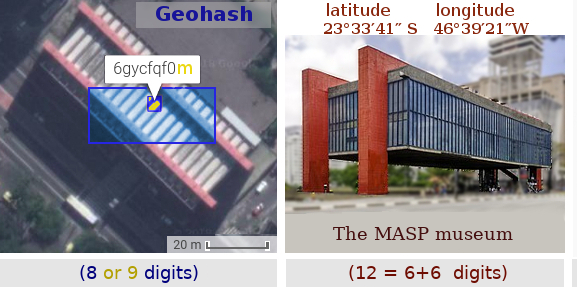
A geocode is a code that represents a geographic entity (location or object). It is a unique identifier of the entity, to distinguish it from others in a finite set of geographic entities. In general the ''geocode'' is a human-readable and short identifier. Typical geocodes and entities represented by it: * ''Country code'' and subdivision code. Polygon of the administrative boundaries of a country or a subdivision. The main examples are ISO codes: ISO 3166-1 alpha-2 code (e.g. AF for Afghanistan or BR for Brazil), and its subdivision conventions, such as subdivision codes (e.g. AF-GHO for Ghor province) or subdivision codes (e.g. BR-AM for Amazonas state). * ''DGG cell ID''. Identifier of a cell of a discrete global grid: a Geohash code (e.g. ~0.023 km2 cell 6vjyngd at the Brazilian's center) or an OLC code (e.g. ~0.004 km2 cell 58PJ642P+4 at the same point). * ''Postal code''. Polygon of a postal area: a CEP code (e.g. 70040 represents a Brazilian ... [...More Info...] [...Related Items...] OR: [Wikipedia] [Google] [Baidu] |


