|
I-295 (FL)
Interstate 295 (I-295), an auxiliary route of I-95, is a beltway around central Jacksonville, Florida. The beltway consists of two segments, the West Beltway (formerly signed as simply I-295), and the East Beltway (formerly signed as State Road 9A, SR 9A), with I-95 serving as the dividing line between the two. The entire highway carries a hidden designation as SR 9A by the Florida Department of Transportation (FDOT). The West Beltway was constructed in the 1970s, with the East Beltway being built from the 1980s to the 2000s. Route description Beginning at the I-95 interchange in southeastern Duval as the West Beltway, the beltway travels west, passes through the Mandarin area with interchanges at Old St. Augustine Road, and SR 13 (San Jose Boulevard). It then travels along the Buckman Bridge crossing the St. Johns River immediately south of Naval Air Station Jacksonville (NASJAX), and serves as a major connection in the southern part of Jacksonville. At the we ... [...More Info...] [...Related Items...] OR: [Wikipedia] [Google] [Baidu] |
Jacksonville, Florida
Jacksonville is a city located on the Atlantic coast of northeast Florida, the most populous city proper in the state and is the largest city by area in the contiguous United States as of 2020. It is the seat of Duval County, with which the city government consolidated in 1968. Consolidation gave Jacksonville its great size and placed most of its metropolitan population within the city limits. As of 2020, Jacksonville's population is 949,611, making it the 12th most populous city in the U.S., the most populous city in the Southeast, and the most populous city in the South outside of the state of Texas. With a population of 1,733,937, the Jacksonville metropolitan area ranks as Florida's fourth-largest metropolitan region. Jacksonville straddles the St. Johns River in the First Coast region of northeastern Florida, about south of the Georgia state line ( to the urban core/downtown) and north of Miami. The Jacksonville Beaches communities are along the adjacent Atlantic ... [...More Info...] [...Related Items...] OR: [Wikipedia] [Google] [Baidu] |
Interstate 10 In Florida
Interstate 10 (I-10) runs for in Florida as the easternmost section of an east–west Interstate Highway in the southern United States. It is also the eastern end of one of three coast-to-coast Interstates, along with I-80 and I-90. The highway runs east from the Alabama border, traveling through the Panhandle of Florida, serving the major cities of Pensacola, Tallahassee, Lake City, ending at Jacksonville, and carries the hidden Florida Department of Transportation (FDOT) designation of State Road 8 (SR 8). Route description The Interstate runs roughly parallel to US Highway 90 (US 90) (which intersects I-10 at five different points along its route), but is a more direct route, bypassing the central cores of many cities. I-10 runs through some of the least populated areas of the state. I-10 crosses into Florida at Alabama state line at the Perdido River, just west of Pensacola, in Escambia County. Florida State Road 297 (SR 297, sout ... [...More Info...] [...Related Items...] OR: [Wikipedia] [Google] [Baidu] |
Florida State Road 10
State Road 10 (SR 10), also known as Atlantic Boulevard, is a major east–west state highway in the U.S. state of Florida. Mostly unsigned in favor of U.S. Highway 90, it runs from the Alabama state line (Perdido River) to Atlantic Beach. The only sections that are not signed as US 90 are north of Pensacola, where US 90 uses SR 10A and SR 10 is signed as U.S. Highway 90 Alternate, and east of south Jacksonville, where US 90 uses unsigned SR 212. Route description The only signed section of SR 10 is in Jacksonville and Atlantic Beach. Signage begins at the interchange with Interstate 95 and U.S. Highway 1, where US 1 splits to the south. There is a signed concurrency east to the split with US 90. Where US 90 and SR 10 split, SR 10 is known as Atlantic Boulevard, while US 90 is known as Beach Boulevard (unsigned State Road 212) to Jacksonville Beach. About a mile (2 km) before the east end of SR 10, at the east end of the bridge over the Intracoastal Waterway ... [...More Info...] [...Related Items...] OR: [Wikipedia] [Google] [Baidu] |
NS Mayport
Naval Station Mayport is a major United States Navy base in Jacksonville, Florida. It contains a protected harbor that can accommodate aircraft carrier-size vessels, ship's intermediate maintenance activity (SIMA) and a military airfield (Admiral David L. McDonald Field) with one asphalt paved runway (5/23) measuring . Base history The station was commissioned in December 1942. It was reclassified as a Naval Sea Frontier base in 1943. A new naval auxiliary air station (NAAS) was established in April 1944. The naval section Base and the NAAS supported the Atlantic Fleet during World War II. Both were closed after the war. In June 1948, Mayport was reestablished as a naval outlying landing field. The base area was increased to and the runway was extended in the mid 1950s. became the first capital ship to use the new aircraft carrier basin in October 1952. The Base was renamed back to a Naval Auxiliary Air Station in July 1955. The naval station was extended to accommodate mo ... [...More Info...] [...Related Items...] OR: [Wikipedia] [Google] [Baidu] |
Jacksonville University
Jacksonville University (JU) is a private university in Jacksonville, Florida. Located in the city's Arlington (Jacksonville), Arlington district, the school was founded in 1934 as a two-year college and was known as Jacksonville Junior College until September 5, 1956, when it shifted focus to building four-year university degree programs and later graduated its first four-year degree candidates as Jacksonville University in June 1959. It is a member of the Independent Colleges and Universities of Florida and is accredited by the Southern Association of Colleges and Schools (SACS) and the Association to Advance Collegiate Schools of Business (AACSB). JU's student body currently represents more than 40 U.S. states and approximately 45 countries around the world. As a NCAA Division I, Division I institution, it fields 18 varsity athletics teams, known as the Jacksonville Dolphins, JU Dolphins, as well as intramural sports and clubs. Among the top majors declared by JU students are av ... [...More Info...] [...Related Items...] OR: [Wikipedia] [Google] [Baidu] |
Arlington (Jacksonville)
Arlington is a large Vernacular geography, region of Jacksonville, Florida, Jacksonville, Florida, and is generally understood as a counterpart to the city's other large regions, the Urban Core (Jacksonville), Urban Core, Northside (Jacksonville), Northside, Southside (Jacksonville), Southside, Westside (Jacksonville), Westside, and the Jacksonville Beaches, Beaches. It borders the Southside area at its southern end, and has several bridge connections to nearby Jacksonville Beaches, beaches, the Northside and Downtown Jacksonville, Downtown. The expansive neighborhood was incorporated into the city in 1968 as a result the Jacksonville Consolidation, a Consolidated city-county, city-county consolidation of the governments of the City of Jacksonville and Duval County, Florida, Duval County. Arlington is known for its mid-century modern architecture, and contains several architecturally significant homes designed by local architects Robert C. Broward, Taylor Hardwick, and William Morg ... [...More Info...] [...Related Items...] OR: [Wikipedia] [Google] [Baidu] |
Florida State Road 113
State Road 113 (SR 113), also known as Southside Connector, is a state highway. The freeway travels almost due north–south entirely within the neighborhood of Jacksonville known as Arlington. This is completely within the city limits of Jacksonville, in Duval County, in the U.S. state of Florida. As its name implies, it "connects" SR 115 with Interstate 295 (I-295). Route description SR 113 begins at an interchange with SR 115 (Southside Boulevard / Arlington Expressway) just north of SR 10 ( Atlantic Boulevard). It heads northeast and travels along the west edge of Regency Square Mall. It then has service roads on both sides that are one-way with traffic traveling the same direction as the main highway (i.e., the northbound one is on the eastern side, and the southbound one is on the western side). Northbound, it has an interchange with Regency Square Boulevard North and then curves to the north to an interchange with Tredinick Park ... [...More Info...] [...Related Items...] OR: [Wikipedia] [Google] [Baidu] |
Dames Point Bridge
The Dames Point Bridge (officially the Napoleon Bonaparte Broward Bridge) is a cable-stayed bridge over the St. Johns River in Jacksonville, Florida on the Interstate 295 East Beltway. Construction began in 1985 and was completed in 1989. The main span is , and is high. The bridge was designed by HNTB Corporation and RS&H, Inc. The Massman Construction Company built the bridge. Design The bridge's cables are arranged on multiple vertical planes in a slight modification to the harp (parallel) stay arrangement. Main span cables are paired to anchor into the tower in a vertical plane while side span cables pair up to anchor in a horizontal plane such that four cables anchor in each tower at approximately the same elevation. Superlatives Until the 2003 completion of the Sidney Lanier Bridge in Brunswick, Georgia, the Dames Point Bridge was the only bridge in the United States to feature the harp stay arrangement. It remains one of the largest cable-stayed bridges in the Uni ... [...More Info...] [...Related Items...] OR: [Wikipedia] [Google] [Baidu] |
Florida State Road 105
State Road 105 (SR 105) is a north-south state highway in northeastern Jacksonville, Florida. It travels from an interchange with Interstate 95 (I-95) just north of downtown eastward (signed north) along the north bank of the St. Johns River to an intersection with SR A1A, at the Mayport Ferry, and then along SR A1A to the end of SR 200 in Fernandina Beach. SR 105 is the only access road to the Jacksonville Zoo and Gardens. In fact, the entire road was named Heckscher Drive for years. However, the section from I-95 east to I-295 East Beltway was renamed Zoo Parkway. Route description SR 105 begins at an interchange with I-95. SR 105 has an interchange with U.S. Route 17 (US 17) less than from its western terminus. From there, SR 105 can be characterized as a four-lane mid-speed highway that parallels the north bank of the St. Johns River through a rural area. After , traffic slows down briefly to a pair of traffic lights ... [...More Info...] [...Related Items...] OR: [Wikipedia] [Google] [Baidu] |
Crossing Over St Johns River
Crossing may refer to: * ''Crossing'' (2008 film), a South Korean film * ''Crossing'' (album), a 1985 album by world music/jazz group Oregon * Crossing (architecture), the junction of the four arms of a cruciform church * Crossing (knot theory), a visualization of intersections in mathematical knots * Crossing (physics), the relation between particle and antiparticle scattering * Crossing (plant), deliberate interbreeding of plants * Crossing oneself, a ritual hand motion made by some Christians * William Crossing (1847–1928), English writer * Intersection (road), also known as a crossing * Level crossing, a railway crossing a street See also * Crossings (other) * The Crossing (other) * Cross (other) A cross is a geometrical figure consisting of two intersecting lines or bars. Cross or The Cross may also refer to: Religion * Christian cross, the basic symbol of Christianity * Cross necklace, a necklace worn by adherents of the Christian r ... ... [...More Info...] [...Related Items...] OR: [Wikipedia] [Google] [Baidu] |
Jacksonville International Airport
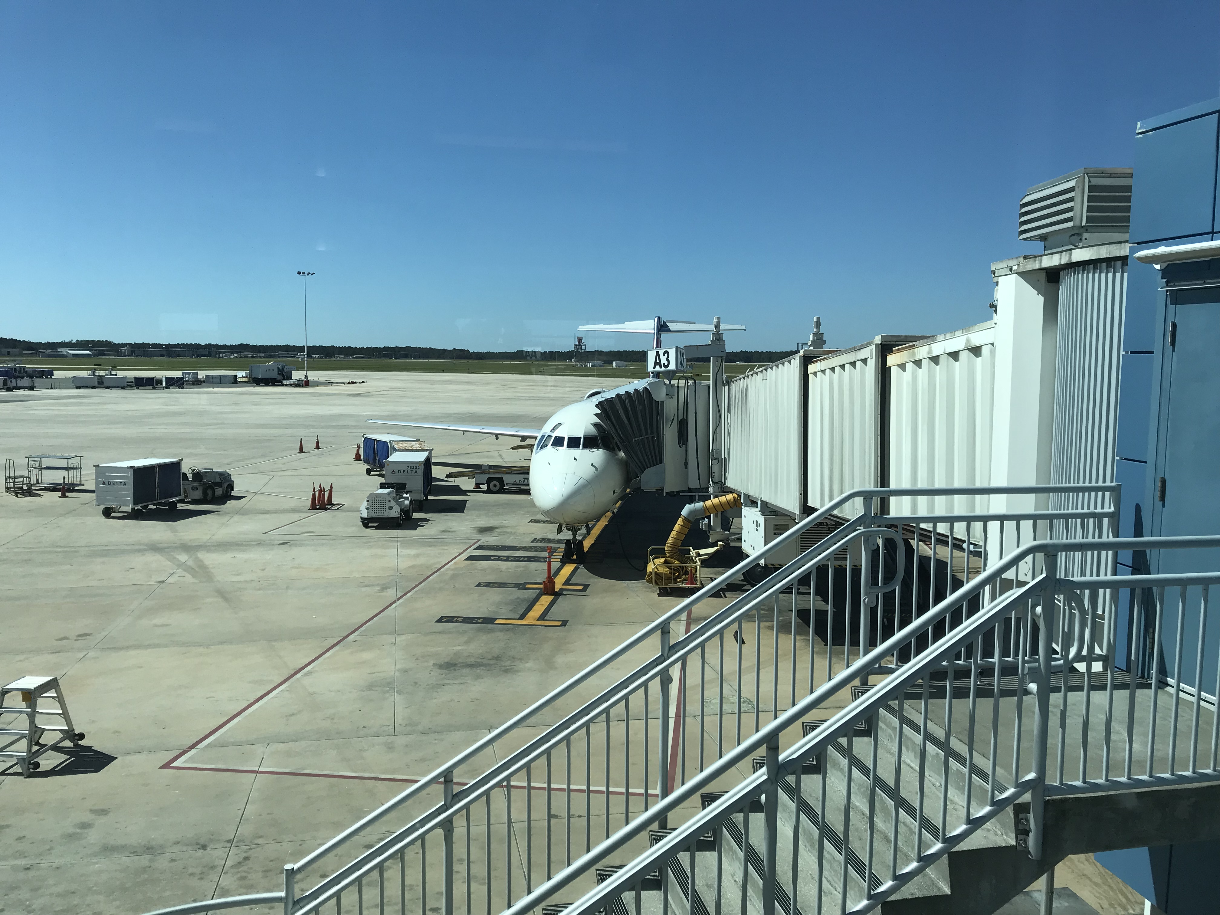
Jacksonville International Airport is a civil-military public airport 13 miles (21 km) north of Downtown Jacksonville, in Duval County, Florida. It is owned and operated by the Jacksonville Aviation Authority. History Construction started in 1965 on a new airport to handle travel to nearby naval bases. The new airport was dedicated on September 1, 1968, replacing Imeson Field. Terrain precluded lengthening the runways at Imeson, a necessity with the inception of commercial jet airliners. A new idea at JIA was separating departing and arriving passengers on different sides of the terminal (as can be seen in the photo on this page). This is no longer the case, and the airport (which has greatly expanded since the picture was taken) now uses the more typical layout with departing passengers on an upper level with an elevated roadway, and arriving passengers on the lower level. File:JacksonvilleFLairport.jpg, An overhead photo of Jacksonville International Airport circa ... [...More Info...] [...Related Items...] OR: [Wikipedia] [Google] [Baidu] |
Florida State Road 243
State Road 243 (SR 243), locally known as International Airport Boulevard, is a state road in the northern part of Jacksonville, Florida. It runs from Interstate 295 (I-295) at Exit 33 to Interstate 95 (I-95) at Exit 366. The road's name comes from the fact that its northern terminus was originally at the entrance to Jacksonville International Airport. Route description SR 243 serves mainly as a secondary access road for Jacksonville International Airport named International Airport Boulevard. The route starts at an interchange with I-295, and runs through mostly wooded areas and light industrial zones as a four-lane divided highway. Nearly halfway though the boulevard's journey, SR 243 has one interchange that includes one intersection at a service road that leads to SR 102 (Airport Road) and a second service road leading in the opposite direction before that route ends at the loop within the airport itself. North of SR 102 just before the intersection with Owens ... [...More Info...] [...Related Items...] OR: [Wikipedia] [Google] [Baidu] |


