|
I-393
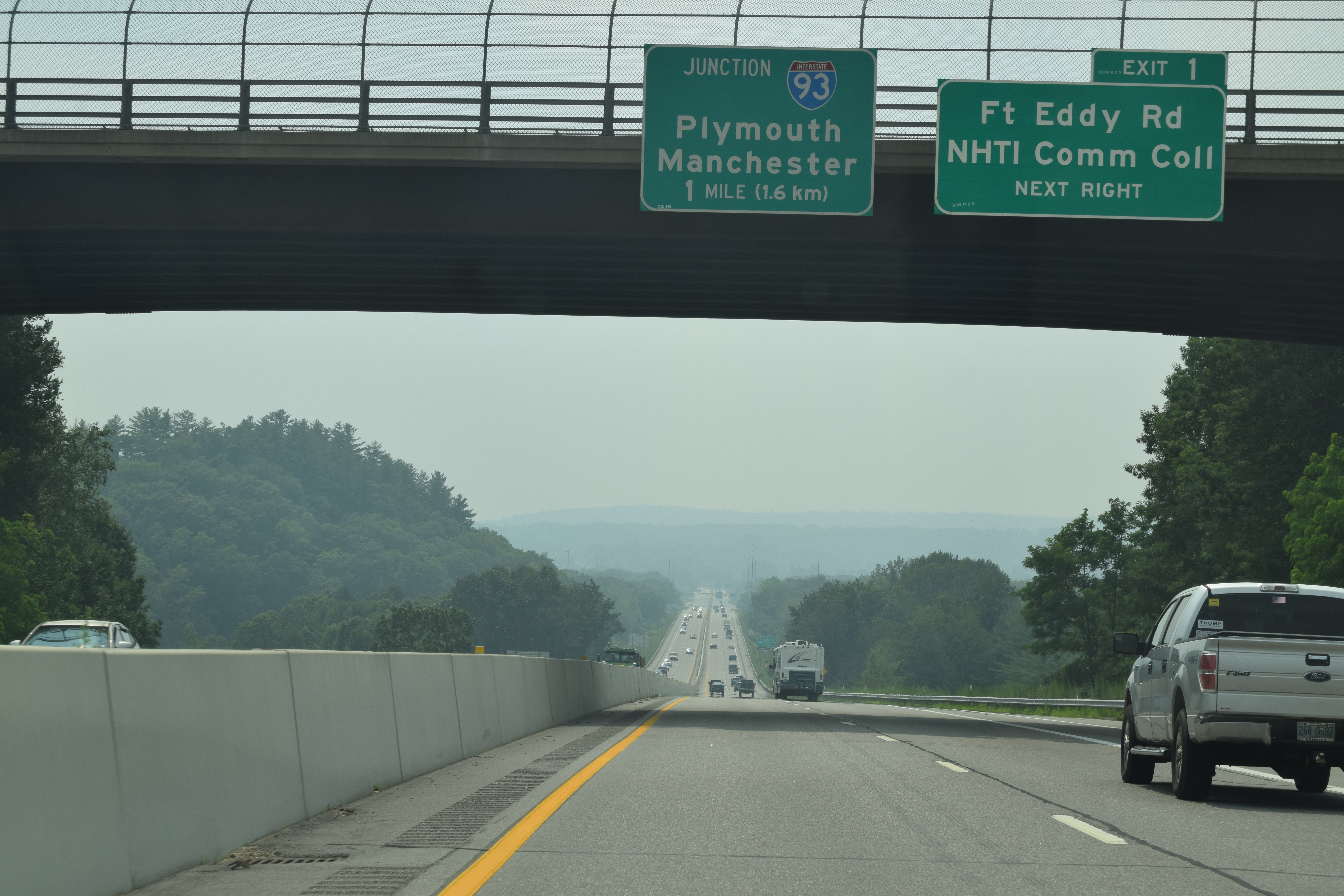
Interstate 393 (I-393) is a east–west auxiliary Interstate Highway extending from I-93 at Concord to Pembroke, New Hampshire. The primary purpose of the road is to bypass a densely built commercial strip on New Hampshire Route 9 (NH 9) in the eastern part of Concord. Several times a year, I-393 also serves traffic to events at New Hampshire Motor Speedway in Loudon. I-393 runs concurrently with US Route 4 (US 4) and US 202 for its entire length. Route description I-393 begins at I-93's exit 15 interchange, where US 4 east leaves its concurrency with I-93 south and the I-393/US 4/ US 202 concurrency begins. The four-lane freeway actually begins a short distance west of I-93 at the north end of Concord's Main Street where US 202 turns east from US 3. From there, the road then intersects Commercial Street just before the exit 15 interchange. Just east of the exit 15 cloverleaf is I-393's exit 1 to Fort ... [...More Info...] [...Related Items...] OR: [Wikipedia] [Google] [Baidu] |
New Hampshire Route 9
New Hampshire Route 9 (abbreviated NH 9 and also known as the Franklin Pierce Highwayhttp://franklinpierce.ws/highway.pdf ) is a state highway located in southern New Hampshire. It runs across the state from west to east and is a multi-state route with Vermont and Maine, part of 1920s-era New England Interstate Route 9. The western terminus of NH 9 is at the Vermont state line in Chesterfield, where it connects to Vermont Route 9. Its eastern terminus is at the Maine state line in Somersworth, where it connects to Maine State Route 9. Two large sections of NH 9, totaling , are cosigned with U.S. Route 202. By combined mileage of the two sections, US 202 and NH 9 share the longest concurrency in New Hampshire. Route description Chesterfield to Concord NH 9 begins in the west where VT 9 crosses the Connecticut River from Brattleboro, Vermont, into Chesterfield, New Hampshire on the United States Navy Seabees Bridge. The highway meanders its way through the large town ... [...More Info...] [...Related Items...] OR: [Wikipedia] [Google] [Baidu] |
New Hampshire Route 106
New Hampshire Route 106 is a secondary north–south highway in Merrimack and Belknap counties in central New Hampshire. It connects the town of Pembroke with Meredith in the Lakes Region. The first green LED traffic light in the nation was installed at the junction of NH 106 and Loudon Road on May 17, 1996.Sending a bright signal, ''Concord Monitor'' pg B-6, May 18, 1996 The southern terminus of NH 106 is at U.S. Route 3 in Pembroke just south of the Concord city line. The northern terminus is also at US 3, south of Meredith. Route description NH 106's southern terminus is at US 3 in Pembroke, from where it travels along Sheep Davis Road northeast across the Soucook River into the city of Concord. Closely following the west bank of the Soucook River through the east side of Concord, it has an intersection with NH 9 and then immediately has an interchange with I-393/US 202/US 4. Passing into the town of Loudon, it changes names to Rocky Pond Road, and has an intersecti ... [...More Info...] [...Related Items...] OR: [Wikipedia] [Google] [Baidu] |
Pembroke, New Hampshire
Pembroke is a town in Merrimack County, New Hampshire, United States. The population was 7,207 at the 2020 census. Pembroke includes part of the village of Suncook. The center of population of New Hampshire is close to the Pembroke town center. History First granted in 1728, the town was known as "Lovewell's Town", in honor of Captain John Lovewell, who built the stockade at Ossipee. Shortly afterward, the town took the name of "Suncook", the Pennacook Abenaki name for the river flowing through the area. When the town was incorporated in 1759 by colonial Governor Benning Wentworth, it was given the name "Pembroke" in honor of Henry Herbert, ninth Earl of Pembroke in southern Wales. Pembroke's early history is reflected in the various mills of the downtown area, located to use water power from the Suncook River. The better-known mills were the Pembroke Mills, Webster Manufacturing, and China Manufacturing, all producing print cloth. Pembroke industries included brickmaking, ... [...More Info...] [...Related Items...] OR: [Wikipedia] [Google] [Baidu] |
Interstate 93
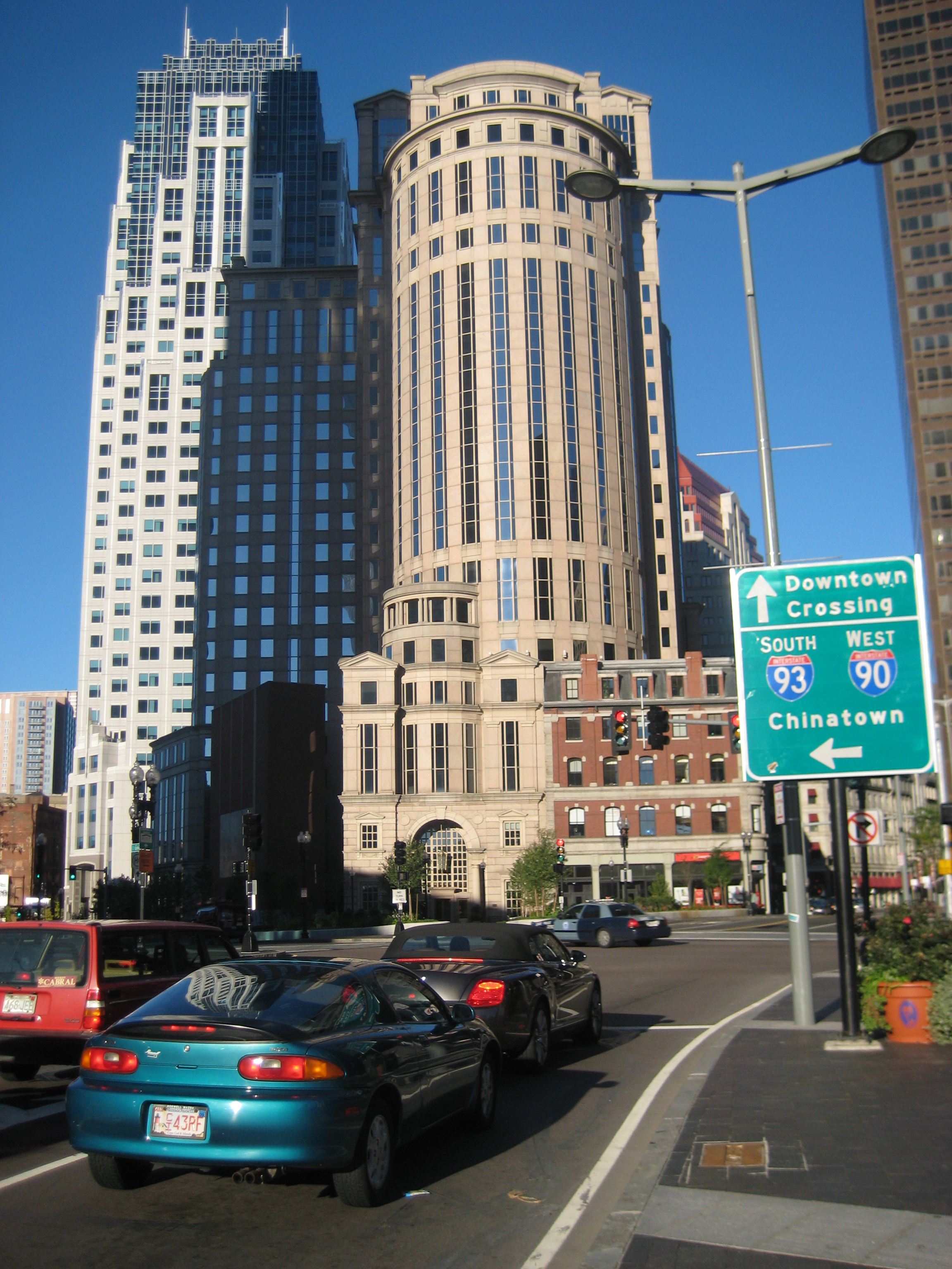
Interstate 93 (I-93) is an Interstate Highway in the New England states of Massachusetts, New Hampshire, and Vermont in the United States. Spanning approximately along a north–south axis, it is one of three primary Interstate Highways located entirely within New England; the other two are I-89 and I-91. The largest cities along the route are Boston, Massachusetts, and Manchester, New Hampshire; it also travels through the New Hampshire state capital of Concord. I-93 begins at an interchange with I-95, US Route 1 (US 1) and Route 128 in Canton, Massachusetts. It travels concurrently with US 1 beginning in Canton, and, with Route 3 beginning at the Braintree Split on the Braintree– Quincy city line, through the Central Artery in Downtown Boston before each route splits off beyond the Leonard P. Zakim Bunker Hill Memorial Bridge. The portion of highway between the Braintree Split and the Central Artery is named the "Southeast Expressway", w ... [...More Info...] [...Related Items...] OR: [Wikipedia] [Google] [Baidu] |
Interstate 93 In New Hampshire
Interstate 93 (I-93) is an Interstate Highway in the New England states of Massachusetts, New Hampshire, and Vermont in the United States. Spanning approximately along a north–south axis, it is one of three primary Interstate Highways located entirely within New England; the other two are I-89 and I-91. The largest cities along the route are Boston, Massachusetts, and Manchester, New Hampshire; it also travels through the New Hampshire state capital of Concord. I-93 begins at an interchange with I-95, US Route 1 (US 1) and Route 128 in Canton, Massachusetts. It travels concurrently with US 1 beginning in Canton, and, with Route 3 beginning at the Braintree Split on the Braintree– Quincy city line, through the Central Artery in Downtown Boston before each route splits off beyond the Leonard P. Zakim Bunker Hill Memorial Bridge. The portion of highway between the Braintree Split and the Central Artery is named the "Southeast Expressway", ... [...More Info...] [...Related Items...] OR: [Wikipedia] [Google] [Baidu] |
Concord, New Hampshire
Concord () is the capital city of the U.S. state of New Hampshire and the seat of Merrimack County. As of the 2020 census the population was 43,976, making it the third largest city in New Hampshire behind Manchester and Nashua. The village of Penacook lies at the northern boundary of the city limits. The city is home to the University of New Hampshire School of Law, New Hampshire's only law school; St. Paul's School, a private preparatory school; NHTI, a two-year community college; the New Hampshire Police Academy; and the New Hampshire Fire Academy. Concord's Old North Cemetery is the final resting place of Franklin Pierce, 14th President of the United States. History The area that would become Concord was originally settled thousands of years ago by Abenaki Native Americans called the Pennacook. The tribe fished for migrating salmon, sturgeon, and alewives with nets strung across the rapids of the Merrimack River. The stream was also the transportation route for their ... [...More Info...] [...Related Items...] OR: [Wikipedia] [Google] [Baidu] |
New Hampshire Route 132
New Hampshire Route 132 (abbreviated NH 132) is a north–south highway in Belknap and Merrimack counties in central New Hampshire. NH 132 runs from Concord north to Ashland in the Lakes Region, parallel to Interstate 93. The southern terminus of NH 132 is at New Hampshire Route 9 near Concord Municipal Airport. The northern terminus of NH 132 is at U.S. Route 3 and New Hampshire Route 25 in Ashland. Route description NH 132 serves as a local route closely paralleling I-93 for its entire length. This is a role usually held by US 3, however in the Lakes Region, US 3 takes a more easterly route and deviates some distance from I-93. The route's southern terminus is at NH 9 in Concord and is known locally as East Side Drive. In East Concord village, a traffic circle provides access to Shawmut Street, West Portsmouth Street, and I-93, while NH 132 exits the traffic circle on Mountain Road. Near the northern boundary of Concord, Hoit Road provides access to I-93 and US 4. Ente ... [...More Info...] [...Related Items...] OR: [Wikipedia] [Google] [Baidu] |
New Hampshire Department Of Transportation
The New Hampshire Department of Transportation (NHDOT) is a government agency of the U.S. state of New Hampshire. The Commissioner of NHDOT is Victoria Sheehan. The main office of the NHDOT is located in the J. O. Morton Building in Concord. Functions NHDOT's general functions, as provided iNH RSA:21-L are: *Planning, developing, and maintaining a state transportation network which will provide for safe and convenient movement of people and goods throughout the state by means of a system of highways and railroads, air service, mass transit and other practicable modes of transportation in order to support state growth and economic development and promote the general welfare of the citizens of the state. *Developing and maintaining state owned land and buildings, except as otherwise provided by law, and cooperating with the New Hampshire Department of Administrative Services in preparing a long-range state capital improvements plan. *Performing any regulation of transportation ac ... [...More Info...] [...Related Items...] OR: [Wikipedia] [Google] [Baidu] |
Dover, New Hampshire
Dover is a city in Strafford County, New Hampshire, United States. The population was 32,741 at the 2020 census, making it the largest city in the New Hampshire Seacoast region and the fifth largest municipality in the state. It is the county seat of Strafford County, and home to Wentworth-Douglass Hospital, the Woodman Institute Museum, and the Children's Museum of New Hampshire. Etymology First recorded in its Latinised form of ''Portus Dubris'', the word "Dover" derives from the Brythonic word for "waters" (''dwfr'' in Middle Welsh). The same element is present in the word's French (''Douvres'') and Modern Welsh (''Dofr'') forms. History Settlement The first known European to explore the region was Martin Pring from Bristol, England, in 1603. In 1623, William and Edward Hilton settled at Pomeroy Cove on Dover Point, making Dover the oldest permanent settlement in New Hampshire, and seventh in the United States. One of the colony's four original townships, it then includ ... [...More Info...] [...Related Items...] OR: [Wikipedia] [Google] [Baidu] |
Rochester, New Hampshire
Rochester is a city in Strafford County, New Hampshire, United States. The population was 32,492 at the 2020 census. In addition to the downtown area, the city contains the villages of East Rochester, New Hampshire, East Rochester, Gonic, New Hampshire, Gonic, and North Rochester, New Hampshire, North Rochester. Rochester is home to Skyhaven Airport (New Hampshire), Skyhaven Airport and part of Baxter Lake (New Hampshire), Baxter Lake. Rochester was one of New Hampshire's fastest growing cities between 2010 and 2020. History Origins Rochester was once inhabited by Abenaki Indigenous peoples of the Americas, Indians of the Pennacook tribe. They fished, hunted and farmed, moving locations when their agriculture exhausted the soil for growing pumpkins, Squash (fruit), squash, beans and maize. ''Squanamagonic'' (abbreviated to "Gonic") means "the water of the clay place hill". The town was one of four granted by Thirteen Colonies, colonial governor Samuel Shute of Massachusetts an ... [...More Info...] [...Related Items...] OR: [Wikipedia] [Google] [Baidu] |
Portsmouth, New Hampshire
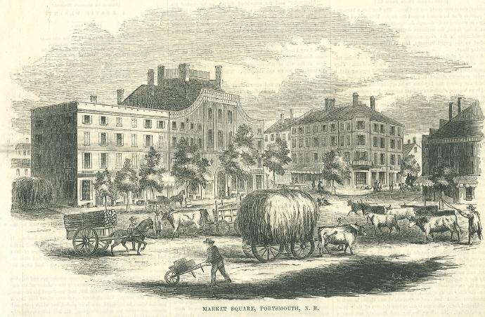
Portsmouth is a city in Rockingham County, New Hampshire, United States. At the 2020 census it had a population of 21,956. A historic seaport and popular summer tourist destination on the Piscataqua River bordering the state of Maine, Portsmouth was formerly the home of the Strategic Air Command's Pease Air Force Base, since converted to Portsmouth International Airport at Pease. History American Indians of the Abenaki and other Algonquian languages-speaking nations, and their predecessors, inhabited the territory of coastal New Hampshire for thousands of years before European contact. The first known European to explore and write about the area was Martin Pring in 1603. The Piscataqua River is a tidal estuary with a swift current, but forms a good natural harbor. The west bank of the harbor was settled by European colonists in 1630 and named Strawbery Banke, after the many wild strawberries growing there. The village was protected by Fort William and Mary on what is now ... [...More Info...] [...Related Items...] OR: [Wikipedia] [Google] [Baidu] |


