|
Hurst Hill
Hurst Hill is a location on Anglezarke Moor, within the West Pennine Moors of Lancashire, England. Despite a modest height of 317 metres (1040 feet), the summit provides excellent views towards the Irish Sea. Of more note, however, is its location between Round Loaf and Pikestones, both of which are Neolithic The Neolithic period, or New Stone Age, is an Old World archaeological period and the final division of the Stone Age. It saw the Neolithic Revolution, a wide-ranging set of developments that appear to have arisen independently in several p ... remnants. It is probable that Hurst Hill (and nearby Grain Pole Hill) were vantage points for the ancient communities. No excavation work has taken place. External links Photographs from the summit Geography of Chorley Mountains and hills of Lancashire Hills of the West Pennine Moors {{Lancashire-geo-stub ... [...More Info...] [...Related Items...] OR: [Wikipedia] [Google] [Baidu] |
Chorley
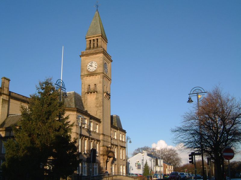
Chorley is a town and the administrative centre of the wider Borough of Chorley in Lancashire, England, north of Wigan, south west of Blackburn, north west of Bolton, south of Preston and north west of Manchester. The town's wealth came principally from the cotton industry. In the 1970s, the skyline was dominated by factory chimneys, but most have now been demolished: remnants of the industrial past include Morrisons chimney and other mill buildings, and the streets of terraced houses for mill workers. Chorley is the home of the Chorley cake. History Toponymy The name ''Chorley'' comes from two Anglo-Saxon words, and , probably meaning "the peasants' clearing". (also or ) is a common element of place-name, meaning a clearing in a woodland; refers to a person of status similar to a freeman or a yeoman. Prehistory There was no known occupation in Chorley until the Middle Ages, though archaeological evidence has shown that the area around the town has been inhabited ... [...More Info...] [...Related Items...] OR: [Wikipedia] [Google] [Baidu] |
Lancashire
Lancashire ( , ; abbreviated Lancs) is the name of a historic county, ceremonial county, and non-metropolitan county in North West England. The boundaries of these three areas differ significantly. The non-metropolitan county of Lancashire was created by the Local Government Act 1972. It is administered by Lancashire County Council, based in Preston, and twelve district councils. Although Lancaster is still considered the county town, Preston is the administrative centre of the non-metropolitan county. The ceremonial county has the same boundaries except that it also includes Blackpool and Blackburn with Darwen, which are unitary authorities. The historic county of Lancashire is larger and includes the cities of Manchester and Liverpool as well as the Furness and Cartmel peninsulas, but excludes Bowland area of the West Riding of Yorkshire transferred to the non-metropolitan county in 1974 History Before the county During Roman times the area was part of the Bri ... [...More Info...] [...Related Items...] OR: [Wikipedia] [Google] [Baidu] |
Ordnance Survey
, nativename_a = , nativename_r = , logo = Ordnance Survey 2015 Logo.svg , logo_width = 240px , logo_caption = , seal = , seal_width = , seal_caption = , picture = , picture_width = , picture_caption = , formed = , preceding1 = , dissolved = , superseding = , jurisdiction = Great BritainThe Ordnance Survey deals only with maps of Great Britain, and, to an extent, the Isle of Man, but not Northern Ireland, which has its own, separate government agency, the Ordnance Survey of Northern Ireland. , headquarters = Southampton, England, UK , region_code = GB , coordinates = , employees = 1,244 , budget = , minister1_name = , minister1_pfo = , chief1_name = Steve Blair , chief1_position = CEO , agency_type = , parent_agency = , child1_agency = , keydocument1 = , website = , footnotes = , map = , map_width = , map_caption = Ordnance Survey (OS) is the national mapping agency for Great Britain. The agency's name indicates its original military purpose (se ... [...More Info...] [...Related Items...] OR: [Wikipedia] [Google] [Baidu] |
Anglezarke
Anglezarke is a sparsely populated Civil parishes in England, civil parish in the Borough of Chorley in Lancashire, England. It is an agricultural area used for sheep farming, also site of reservoirs that were built to supply water to Liverpool. The area has a large expanse of moorland with many public footpaths and bridleways. The area is popular with walkers and tourists, it lies in the West Pennine Moors in Lancashire, sandwiched between the moors of Withnell and Rivington, and is close to the towns of Chorley, Horwich and Darwen. At the 2001 census it had a population of 23. At the 2011 Census the population is included within Heapey civil parish. The area was subjected to depopulation after the reservoirs were built. Toponymy Anglezarke is derived from the Old Norse name ''Anlaf'' and the Old Norse ''erg'', a 'hill pasture or shieling'. The elements together mean 'Anlaf's hill pasture'. In 1202 it was recorded as 'Andelevesarewe'. By 1225 this had become 'Anlavesargh'. In a ... [...More Info...] [...Related Items...] OR: [Wikipedia] [Google] [Baidu] |
West Pennine Moors
The West Pennine Moors is an area of the Pennines covering approximately of moorland and Reservoir (water), reservoirs in Lancashire and Greater Manchester, England. It is a Site of Special Scientific Interest. The West Pennine Moors are separated from the main Pennine range by the Irwell Valley to the east. The moorland includes Withnell, Anglezarke and Rivington Moors in the extreme west, Darwen and Turton Moors, Oswaldtwistle#Oswaldtwistle Moor, Oswaldtwistle Moors and Holcombe Moors. These moors are lower in height than the main spine of the South Pennines. At , the highest point is at Winter Hill (North West England), Winter Hill. The area is of historical importance with archaeological evidence of human activity from Neolithic times. The area is close to urban areas, the dramatic backdrop to Bolton, Blackburn and Bury, Greater Manchester, Bury and neighbouring towns affording panoramic views across the Lancashire Plain and the Greater Manchester conurbation. The moorland is ... [...More Info...] [...Related Items...] OR: [Wikipedia] [Google] [Baidu] |
Irish Sea
The Irish Sea or , gv, Y Keayn Yernagh, sco, Erse Sie, gd, Muir Èireann , Ulster-Scots: ''Airish Sea'', cy, Môr Iwerddon . is an extensive body of water that separates the islands of Ireland and Great Britain. It is linked to the Celtic Sea in the south by St George's Channel and to the Inner Seas off the West Coast of Scotland in the north by the North Channel. Anglesey, North Wales, is the largest island in the Irish Sea, followed by the Isle of Man. The term ''Manx Sea'' may occasionally be encountered ( cy, Môr Manaw, ga, Muir Meann gv, Mooir Vannin, gd, Muir Mhanainn). On its shoreline are Scotland to the north, England to the east, Wales to the southeast, Northern Ireland and the Republic of Ireland to the west. The Irish Sea is of significant economic importance to regional trade, shipping and transport, as well as fishing and power generation in the form of wind power and nuclear power plants. Annual traffic between Great Britain and Ireland amounts t ... [...More Info...] [...Related Items...] OR: [Wikipedia] [Google] [Baidu] |
Round Loaf
Round Loaf is a late-Neolithic or Bronze Age tumulus on Anglezarke Moor in the West Pennine Moors near Chorley in Lancashire, England. The bowl barrow is a scheduled monument considered to be of national importance. It was first scheduled in March 1954. The structure is aligned between Great Hill and Pikestones. Background Round Loaf is one of 10,000 bowl barrows constructed between the late-Neolithic period and the late-Bronze Age (2400 - 1500 BC). They are funerary monuments in the form of earth or rubble mounds covering single or multiple burials. Some were surrounded by a ditch. Some are in isolated locations as is Round Loaf and some are grouped in cemeteries. They vary in size and regional variations show a range of different burial practices. Description Round Loaf occupies a prominent landmark position on Anglezarke Moor. Some erosion has occurred on its summit. It has not been excavated and its archaeology is possibly undisturbed. The ancient monument includes an oval ... [...More Info...] [...Related Items...] OR: [Wikipedia] [Google] [Baidu] |
Pikestones
Pikestones is the remains of a Neolithic Burial Cairn, located on Anglezarke moor in Lancashire, England. The site is approximately 150 feet (45 metres) long and 60 feet (18 metres) across at its widest point. It consisted of one burial chamber constructed of large upright slabs, capped by two lintel slabs, forming a chamber of 15 feet (4.5 metres) long, 3 feet (0.9 metres) wide and 3 feet (0.9 metres) high, covered by a huge mound of stones and turves. The cairn was aligned almost exactly North-South, with the burial chamber under the wider northern end. At the northern edge of the cairn, a double wall could be made out, curving inwards to form an entrance to a forecourt. Today the cairn has been badly robbed and the main features are the five large gritstone slabs, the remains of the burial chamber. Surprisingly, evidence suggests that the bodies were not interred directly in the tomb, but were left outside, perhaps at the entrance to the cairn, for birds and wild anima ... [...More Info...] [...Related Items...] OR: [Wikipedia] [Google] [Baidu] |
Neolithic
The Neolithic period, or New Stone Age, is an Old World archaeological period and the final division of the Stone Age. It saw the Neolithic Revolution, a wide-ranging set of developments that appear to have arisen independently in several parts of the world. This "Neolithic package" included the introduction of farming, domestication of animals, and change from a hunter-gatherer lifestyle to one of settlement. It began about 12,000 years ago when farming appeared in the Epipalaeolithic Near East, and later in other parts of the world. The Neolithic lasted in the Near East until the transitional period of the Chalcolithic (Copper Age) from about 6,500 years ago (4500 BC), marked by the development of metallurgy, leading up to the Bronze Age and Iron Age. In other places the Neolithic followed the Mesolithic (Middle Stone Age) and then lasted until later. In Ancient Egypt, the Neolithic lasted until the Protodynastic period, 3150 BC.Karin Sowada and Peter Grave. Egypt in th ... [...More Info...] [...Related Items...] OR: [Wikipedia] [Google] [Baidu] |
Grain Pole Hill
Grain Pole Hill is a location on Anglezarke Moor, near Chorley, within the West Pennine Moors of Lancashire, England. With a height of 285 metres (935 ft), the summit provides views towards the Irish Sea. It is located between Round Loaf and Pikestones, both of which are Neolithic remnants. Hurst Hill Hurst Hill is a location on Anglezarke Moor, within the West Pennine Moors of Lancashire, England. Despite a modest height of 317 metres (1040 feet), the summit provides excellent views towards the Irish Sea. Of more note, however, is its ... is less than half a mile away. References External links Walk 9: Over Anglezarke Moor Geography of Chorley Hills of the West Pennine Moors Mountains and hills of Lancashire {{Lancashire-geo-stub ... [...More Info...] [...Related Items...] OR: [Wikipedia] [Google] [Baidu] |
Geography Of Chorley
Geography (from Greek: , ''geographia''. Combination of Greek words ‘Geo’ (The Earth) and ‘Graphien’ (to describe), literally "earth description") is a field of science devoted to the study of the lands, features, inhabitants, and phenomena of Earth. The first recorded use of the word γεωγραφία was as a title of a book by Greek scholar Eratosthenes (276–194 BC). Geography is an all-encompassing discipline that seeks an understanding of Earth and its human and natural complexities—not merely where objects are, but also how they have changed and come to be. While geography is specific to Earth, many concepts can be applied more broadly to other celestial bodies in the field of planetary science. One such concept, the first law of geography, proposed by Waldo Tobler, is "everything is related to everything else, but near things are more related than distant things." Geography has been called "the world discipline" and "the bridge between the human and th ... [...More Info...] [...Related Items...] OR: [Wikipedia] [Google] [Baidu] |
Mountains And Hills Of Lancashire
A mountain is an elevated portion of the Earth's crust, generally with steep sides that show significant exposed bedrock. Although definitions vary, a mountain may differ from a plateau in having a limited summit area, and is usually higher than a hill, typically rising at least 300 metres (1,000 feet) above the surrounding land. A few mountains are isolated summits, but most occur in mountain ranges. Mountains are formed through tectonic forces, erosion, or volcanism, which act on time scales of up to tens of millions of years. Once mountain building ceases, mountains are slowly leveled through the action of weathering, through slumping and other forms of mass wasting, as well as through erosion by rivers and glaciers. High elevations on mountains produce colder climates than at sea level at similar latitude. These colder climates strongly affect the ecosystems of mountains: different elevations have different plants and animals. Because of the less hospitable terrain and ... [...More Info...] [...Related Items...] OR: [Wikipedia] [Google] [Baidu] |


