|
Hurricane Epsilon (2005)
Hurricane Epsilon was the 27th named tropical or subtropical storm and the final of 15 hurricanes in the record-breaking 2005 Atlantic hurricane season. Originating from a cold front beneath an upper-level low, Epsilon formed on November 29 about 915 mi (1470 km) east of Bermuda, becoming the second tropical storm to do so in that area of the Atlantic within the span of a week. Initially, the National Hurricane Center (NHC) forecast the storm to transition into an extratropical cyclone within five days, due to conditions unfavorable for significant intensification. Epsilon continually defied forecasts, at first due to an unexpected loop to the southwest, and later due to retaining its strength despite cold waters and strong wind shear. Epsilon persisted into December, extending the 2005 season beyond its stated November 30 end date. On December 1, it began a northeast motion due to an approaching trough, and the next day it attained hurricane status. ... [...More Info...] [...Related Items...] OR: [Wikipedia] [Google] [Baidu] |
2005 Atlantic Hurricane Season
The 2005 Atlantic hurricane season was the most active Atlantic hurricane season in history, until the record was broken 15 years later in 2020. The season broke numerous records at the time, with 28 tropical or subtropical storms recorded. The United States National Hurricane Center named 27 storms, exhausting the annual pre-designated list and resulting in the usage of six Greek letter names, and also identified an additional unnamed storm during a post-season re-analysis. A record 15 storms attained hurricane status, with maximum sustained winds of at least 74 mph (119 km/h); of those, a record seven became major hurricanes, which are a Category 3 or higher on the Saffir–Simpson scale. Four storms of this season became Category 5 hurricanes, the highest ranking on the scale. The four Category 5 hurricanes that developed during the season were: Emily, Katrina, Rita, and Wilma. In July, Emily reached peak intensity in the Caribbea ... [...More Info...] [...Related Items...] OR: [Wikipedia] [Google] [Baidu] |
Subtropical Cyclone
A subtropical cyclone is a weather system that has some characteristics of both tropical cyclone, tropical and an extratropical cyclone. As early as the 1950s, meteorologists were uncertain whether they should be characterized as Tropical cyclone, tropical or Extratropical cyclone, extratropical cyclones. They were officially recognized and titled by the National Hurricane Center in 1972. Beginning in 2002, subtropical cyclones received names from the official tropical cyclone lists in the North Atlantic hurricane, North Atlantic, South-West Indian Ocean tropical cyclone, South-west Indian Ocean, and South Atlantic tropical cyclone, South Atlantic basins. There are two definitions currently used for subtropical cyclones depending on their location. Across the north Atlantic and southwest Indian Ocean, they require some central Convectional Precipitation, convection fairly near the center surrounding a warming core existing in the mid-levels of the troposphere. Across the eastern ... [...More Info...] [...Related Items...] OR: [Wikipedia] [Google] [Baidu] |
Cyclone Epsilon
In meteorology, a cyclone () is a large air mass that rotates around a strong center of low atmospheric pressure, counterclockwise in the Northern Hemisphere and clockwise in the Southern Hemisphere as viewed from above (opposite to an anticyclone). Cyclones are characterized by inward-spiraling winds that rotate about a zone of low-pressure area, low pressure. The largest low-pressure systems are polar vortex, polar vortices and extratropical cyclones of the largest scale (the synoptic scale). Warm-core cyclones such as tropical cyclones and subtropical cyclones also lie within the synoptic scale. Mesocyclones, tornadoes, and dust devils lie within smaller mesoscale meteorology, mesoscale. Upper level cyclones can exist without the presence of a surface low, and can pinch off from the base of the tropical upper tropospheric trough during the summer months in the Northern Hemisphere. Cyclones have also been seen on extraterrestrial planets, such as Mars, Jupiter, and Neptune. ... [...More Info...] [...Related Items...] OR: [Wikipedia] [Google] [Baidu] |
Epsilon ISS012-E-10097
Epsilon (, ; uppercase , lowercase or lunate ; el, έψιλον) is the fifth letter of the Greek alphabet, corresponding phonetically to a mid front unrounded vowel or . In the system of Greek numerals it also has the value five. It was derived from the Phoenician letter He . Letters that arose from epsilon include the Roman E, Ë and Ɛ, and Cyrillic Е, È, Ё, Є and Э. The name of the letter was originally (), but it was later changed to ( 'simple e') in the Middle Ages to distinguish the letter from the digraph , a former diphthong that had come to be pronounced the same as epsilon. The uppercase form of epsilon is identical to Latin E but has its own code point in Unicode: . The lowercase version has two typographical variants, both inherited from medieval Greek handwriting. One, the most common in modern typography and inherited from medieval minuscule, looks like a reversed number "3" and is encoded . The other, also known as lunate or uncial epsil ... [...More Info...] [...Related Items...] OR: [Wikipedia] [Google] [Baidu] |
Outflow (meteorology)
Outflow, in meteorology, is air that flows outwards from a storm system. It is associated with ridging, or anticyclonic flow. In the low levels of the troposphere, outflow radiates from thunderstorms in the form of a wedge of rain-cooled air, which is visible as a thin rope-like cloud on weather satellite imagery or a fine line on weather radar imagery. For observers on the ground, a thunderstorm outflow boundary often approaches in otherwise clear skies as a low, thick cloud that brings with it a gust front. Low-level outflow boundaries can disrupt the center of small tropical cyclones. However, outflow aloft is essential for the strengthening of a tropical cyclone. If this outflow is restricted or undercut, the tropical cyclone weakens. If two tropical cyclones are in close proximity, the upper-level outflow from the upwind system can limit the development of the other system. Thunderstorms For thunderstorms, outflow tends to indicate the development of a system. Large quan ... [...More Info...] [...Related Items...] OR: [Wikipedia] [Google] [Baidu] |
Inflow (meteorology)
Inflow is the flow of a fluid into a large collection of that fluid. Within meteorology, inflow normally refers to the influx of warmth and moisture from air within the Earth's atmosphere into storm systems. Extratropical cyclones are fed by inflow focused along their cold front and warm fronts. Tropical cyclones require a large inflow of warmth and moisture from warm oceans in order to develop significantly, mainly within the lowest of the atmosphere. Once the flow of warm and moist air is cut off from thunderstorms and their associated tornadoes, normally by the thunderstorm's own rain-cooled outflow boundary, the storms begin to dissipate. Rear inflow jets behind squall lines act to erode the broad rain shield behind the squall line, and accelerate its forward motion. Thunderstorms The inflow into a thunderstorm, or complex of thunderstorms, is the circulation of warm and humid air ahead of a trigger convergence zone such as a cold front. This airmass is uplifted by the tr ... [...More Info...] [...Related Items...] OR: [Wikipedia] [Google] [Baidu] |
Eye (cyclone)
The eye is a region of mostly calm weather at the center of tropical cyclones. The eye of a storm is a roughly circular area, typically in diameter. It is surrounded by the ''eyewall'', a ring of towering thunderstorms where the most severe weather and highest winds occur. The cyclone's lowest barometric pressure occurs in the eye and can be as much as 15 percent lower than the pressure outside the storm. In strong tropical cyclones, the eye is characterized by light winds and clear skies, surrounded on all sides by a towering, symmetric eyewall. In weaker tropical cyclones, the eye is less well defined and can be covered by the central dense overcast, an area of high, thick clouds that show up brightly on satellite imagery. Weaker or disorganized storms may also feature an eyewall that does not completely encircle the eye or have an eye that features heavy rain. In all storms, however, the eye is the location of the storm's minimum barometric pressure—where the atmospheric pr ... [...More Info...] [...Related Items...] OR: [Wikipedia] [Google] [Baidu] |
Wind Shear
Wind shear (or windshear), sometimes referred to as wind gradient, is a difference in wind speed and/or direction over a relatively short distance in the atmosphere. Atmospheric wind shear is normally described as either vertical or horizontal wind shear. Vertical wind shear is a change in wind speed or direction with a change in altitude. Horizontal wind shear is a change in wind speed with a change in lateral position for a given altitude. Wind shear is a microscale meteorological phenomenon occurring over a very small distance, but it can be associated with mesoscale or synoptic scale weather features such as squall lines and cold fronts. It is commonly observed near microbursts and downbursts caused by thunderstorms, fronts, areas of locally higher low-level winds referred to as low-level jets, near mountains, radiation inversions that occur due to clear skies and calm winds, buildings, wind turbines, and sailboats. Wind shear has significant effects on the control of a ... [...More Info...] [...Related Items...] OR: [Wikipedia] [Google] [Baidu] |
Central Dense Overcast
The central dense overcast, or CDO, of a tropical cyclone or strong subtropical cyclone is the large central area of thunderstorms surrounding its circulation center, caused by the formation of its eyewall. It can be round, angular, oval, or irregular in shape. This feature shows up in tropical cyclones of tropical storm or hurricane strength. How far the center is embedded within the CDO, and the temperature difference between the cloud tops within the CDO and the cyclone's eye, can help determine a tropical cyclone's intensity with the Dvorak technique. Locating the center within the CDO can be a problem with strong tropical storms and minimal hurricanes as its location can be obscured by the CDO's high cloud canopy. This center location problem can be resolved through the use of microwave satellite imagery. After a cyclone strengthens to around hurricane intensity, an eye appears at the center of the CDO, defining its center of low pressure and its cyclonic wind field. Tropic ... [...More Info...] [...Related Items...] OR: [Wikipedia] [Google] [Baidu] |
Coordinated Universal Time
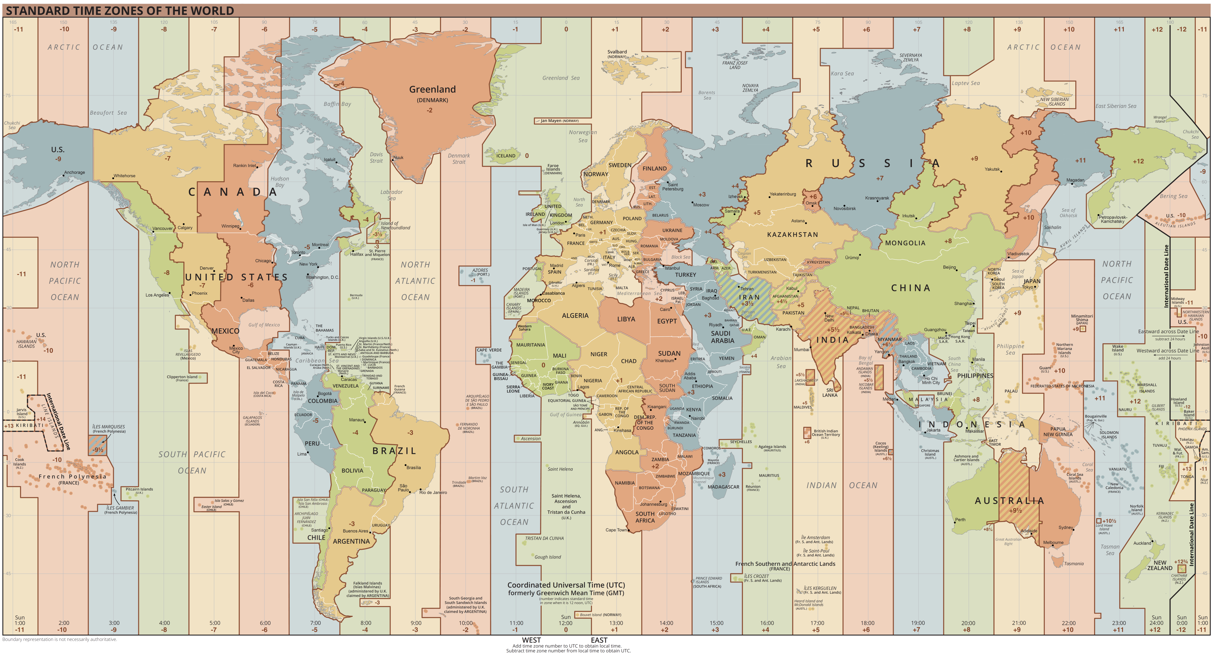
Coordinated Universal Time or UTC is the primary time standard by which the world regulates clocks and time. It is within about one second of mean solar time (such as UT1) at 0° longitude (at the IERS Reference Meridian as the currently used prime meridian) and is not adjusted for daylight saving time. It is effectively a successor to Greenwich Mean Time (GMT). The coordination of time and frequency transmissions around the world began on 1 January 1960. UTC was first officially adopted as CCIR Recommendation 374, ''Standard-Frequency and Time-Signal Emissions'', in 1963, but the official abbreviation of UTC and the official English name of Coordinated Universal Time (along with the French equivalent) were not adopted until 1967. The system has been adjusted several times, including a brief period during which the time-coordination radio signals broadcast both UTC and "Stepped Atomic Time (SAT)" before a new UTC was adopted in 1970 and implemented in 1972. This change also a ... [...More Info...] [...Related Items...] OR: [Wikipedia] [Google] [Baidu] |
Epsilon
Epsilon (, ; uppercase , lowercase or lunate ; el, έψιλον) is the fifth letter of the Greek alphabet, corresponding phonetically to a mid front unrounded vowel or . In the system of Greek numerals it also has the value five. It was derived from the Phoenician letter He . Letters that arose from epsilon include the Roman E, Ë and Ɛ, and Cyrillic Е, È, Ё, Є and Э. The name of the letter was originally (), but it was later changed to ( 'simple e') in the Middle Ages to distinguish the letter from the digraph , a former diphthong that had come to be pronounced the same as epsilon. The uppercase form of epsilon is identical to Latin E but has its own code point in Unicode: . The lowercase version has two typographical variants, both inherited from medieval Greek handwriting. One, the most common in modern typography and inherited from medieval minuscule, looks like a reversed number "3" and is encoded . The other, also known as lunate or uncial epsilon ... [...More Info...] [...Related Items...] OR: [Wikipedia] [Google] [Baidu] |
Greek Alphabet
The Greek alphabet has been used to write the Greek language since the late 9th or early 8th century BCE. It is derived from the earlier Phoenician alphabet, and was the earliest known alphabetic script to have distinct letters for vowels as well as consonants. In Archaic Greece, Archaic and early Classical Greece, Classical times, the Greek alphabet existed in Archaic Greek alphabets, many local variants, but, by the end of the 4th century BCE, the Euclidean alphabet, with 24 letters, ordered from alpha to omega, had become standard and it is this version that is still used for Greek writing today. The letter case, uppercase and lowercase forms of the 24 letters are: : , , , , , , , , , , , , , , , , , /ς, , , , , , . The Greek alphabet is the ancestor of the Latin script, Latin and Cyrillic scripts. Like Latin and Cyrillic, Greek originally had only a single form of each letter; it developed the letter case distinction between uppercase and lowercase in parallel with Latin ... [...More Info...] [...Related Items...] OR: [Wikipedia] [Google] [Baidu] |


