|
Hungary–Romania Border
The Hungary–Romania border is the state border between Hungary and Romania. It was established in 1920 by an international commission (the "Lord Commission") presided over by geographers including Emmanuel de Martonne and Robert Ficheux, and historians Robert William Seton-Watson and Ernest Denis. The border was set by the Treaty of Trianon which was signed on 4 June 1920. The border is long, demarcated by pillars and approximately of the Mureș/Maros River. The border has been stable since the end of World War II, and is no longer in dispute between the countries. The Hungary–Romania border is an internal border of the European Union. However, as of , Romania is not a part of the Schengen Area. History Prior to World War I, the eastern and southern Carpathian Mountains formed a natural border between the Austro-Hungarian Empire and Romania. Hungary and Romania became belligerents in World War I as Romania entered the war in 1916 on the side of the Allies. During th ... [...More Info...] [...Related Items...] OR: [Wikipedia] [Google] [Baidu] |
Csenger
Csenger is a town in Szabolcs-Szatmár-Bereg county, in the Northern Great Plain region of eastern Hungary. Geography The town covers an area of and has a population of 4,870 people (2015). It lies on left bank of the river Szamos, on the border with Romania. Twin towns – sister cities Csenger is twinned with: * Covasna, Romania * Hauenstein, Germany * Negrești-Oaș, Romania * Tășnad, Romania * Vetiș Vetiș ( hu, Vetés, Hungarian pronunciation: ) is a commune of 4,475 inhabitants situated in Satu Mare County, Romania. It is composed of three villages: Decebal (''Újtelep''), Oar (''Óvári'') and Vetiș. Demographics Ethnic groups (2002 ce ..., Romania References External links * in Hungarian Populated places in Szabolcs-Szatmár-Bereg County {{Szabolcs-geo-stub ... [...More Info...] [...Related Items...] OR: [Wikipedia] [Google] [Baidu] |
Austria-Hungary
Austria-Hungary, often referred to as the Austro-Hungarian Empire,, the Dual Monarchy, or Austria, was a constitutional monarchy and great power in Central Europe between 1867 and 1918. It was formed with the Austro-Hungarian Compromise of 1867 in the aftermath of the Austro-Prussian War and was dissolved shortly after its defeat in the First World War. Austria-Hungary was ruled by the House of Habsburg and constituted the last phase in the constitutional evolution of the Habsburg monarchy. It was a multinational state and one of Europe's major powers at the time. Austria-Hungary was geographically the second-largest country in Europe after the Russian Empire, at and the third-most populous (after Russia and the German Empire). The Empire built up the fourth-largest machine building industry in the world, after the United States, Germany and the United Kingdom. Austria-Hungary also became the world's third-largest manufacturer and exporter of electric home appliances, e ... [...More Info...] [...Related Items...] OR: [Wikipedia] [Google] [Baidu] |
De Facto
''De facto'' ( ; , "in fact") describes practices that exist in reality, whether or not they are officially recognized by laws or other formal norms. It is commonly used to refer to what happens in practice, in contrast with '' de jure'' ("by law"), which refers to things that happen according to official law, regardless of whether the practice exists in reality. History In jurisprudence, it mainly means "practiced, but not necessarily defined by law" or "practiced or is valid, but not officially established". Basically, this expression is opposed to the concept of "de jure" (which means "as defined by law") when it comes to law, management or technology (such as standards) in the case of creation, development or application of "without" or "against" instructions, but in accordance with "with practice". When legal situations are discussed, "de jure" means "expressed by law", while "de facto" means action or what is practiced. Similar expressions: "essentially", "unofficial", " ... [...More Info...] [...Related Items...] OR: [Wikipedia] [Google] [Baidu] |
Allies Of World War II
The Allies, formally referred to as the United Nations from 1942, were an international military coalition formed during the Second World War (1939–1945) to oppose the Axis powers, led by Nazi Germany, Imperial Japan, and Fascist Italy. Its principal members by 1941 were the United Kingdom, United States, Soviet Union, and China. Membership in the Allies varied during the course of the war. When the conflict broke out on 1 September 1939, the Allied coalition consisted of the United Kingdom, France, and Poland, as well as their respective dependencies, such as British India. They were soon joined by the independent dominions of the British Commonwealth: Canada, Australia, New Zealand and South Africa. Consequently, the initial alliance resembled that of the First World War. As Axis forces began invading northern Europe and the Balkans, the Allies added the Netherlands, Belgium, Norway, Greece, and Yugoslavia. The Soviet Union, which initially ha ... [...More Info...] [...Related Items...] OR: [Wikipedia] [Google] [Baidu] |
Northern Transylvania
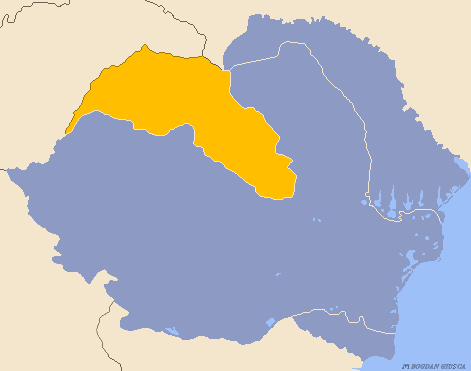
Northern Transylvania ( ro, Transilvania de Nord, hu, Észak-Erdély) was the region of the Kingdom of Romania that during World War II, as a consequence of the August 1940 territorial agreement known as the Second Vienna Award, became part of the Kingdom of Hungary. With an area of , the population was largely composed of both ethnic Romanians and Hungarians. In October 1944, Soviet and Romanian forces gained control of the territory, and by March 1945 Northern Transylvania returned to Romanian administration. After the war, this was confirmed by the Paris Peace Treaties of 1947. Background The region has a varied history. It was once the nucleus of the Kingdom of Dacia (82 BC–106 AD). In 106 AD the Roman Empire conquered the territory, systematically exploiting its resources. After the Roman legions withdrew in 271 AD, it was overrun by a succession of various tribes, bringing it under the control of the Carpi, Visigoths, Huns, Gepids, Avars, and Slavs. During the 9th ... [...More Info...] [...Related Items...] OR: [Wikipedia] [Google] [Baidu] |
Crișana
Crișana ( hu, Körösvidék, german: Kreischgebiet) is a geographical and historical region in north-western Romania, named after the Criș (Körös) River and its three tributaries: the Crișul Alb, Crișul Negru, and Crișul Repede. In Romania, the term is sometimes extended to include areas beyond the border, in Hungary; in this interpretation, the region is bounded to the east by the Apuseni Mountains, to the south by the Mureș River, to the north by the Someș River, and to the west by the Tisza River, the Romanian-Hungarian border cutting it in two. However, in Hungary, the area between the Tisza River and the Romanian border is usually known as Tiszántúl. History Ancient history In ancient times, this area was settled by Celts, Dacians, Sarmatians, and Germanic peoples. In the first century BC, it was part of the Dacian Kingdom under Burebista. Middle Ages In the Middle Ages, it was ruled by the Hunnic Empire, the Kingdom of the Gepids, the ... [...More Info...] [...Related Items...] OR: [Wikipedia] [Google] [Baidu] |
Banat
Banat (, ; hu, Bánság; sr, Банат, Banat) is a geographical and historical region that straddles Central and Eastern Europe and which is currently divided among three countries: the eastern part lies in western Romania (the counties of Timiș, Caraș-Severin, Arad south of the Mureș river, and the western part of Mehedinți); the western part of Banat is in northeastern Serbia (mostly included in Vojvodina, except for a small part included in the Belgrade Region); and a small northern part lies within southeastern Hungary ( Csongrád-Csanád County). The region's historical ethnic diversity was severely affected by the events of World War II. Today, Banat is mostly populated by ethnic Romanians, Serbs and Hungarians, but small populations of other ethnic groups also live in the region. Nearly all are citizens of either Serbia, Romania or Hungary. Name During the Middle Ages, the term " banate" designated a frontier province led by a military governor w ... [...More Info...] [...Related Items...] OR: [Wikipedia] [Google] [Baidu] |
Maramureș
or Marmaroshchyna ( ro, Maramureș ; uk, Мармарощина, Marmaroshchyna; hu, Máramaros) is a geographical, historical and cultural region in northern Romania and western Ukraine. It is situated in the northeastern Carpathians, along parts of the upper Tisza River drainage basin; it covers the Maramureș Depression and the surrounding Carpathian mountains. Alternatively, the term ''Maramureș'' is also used for the Maramureș County of Romania, which contains the southern section of the historical region. Name in other languages Alternative names for Maramureș include uk, Мармарощина (''Marmaroshchyna''), rue, Мараморош (''Maramoroš''), russian: Мармарош (''Marmarosh''), hu, Máramaros, german: Maramuresch or Marmarosch and la, Marmatia. Geography Maramureș is a valley enclosed by mountains Oaș, Gutâi, Țibleș and Rodnei (northern section of the Inner Eastern Carpathians) to the west and south, Maramureș Mountains and centr ... [...More Info...] [...Related Items...] OR: [Wikipedia] [Google] [Baidu] |
Great National Assembly Of Alba Iulia
The Great National Assembly of Alba Iulia ( ro, Marea Adunare Națională de la Alba Iulia) was an assembly held on 1 December 1918 in the city of Alba Iulia in which a total of 1,228 delegates from several areas inhabited by ethnic Romanians declared the union of Transylvania with Romania. It was summoned by the . Regular ethnic Romanian civilians were also called to participate, and these came from all regions inhabited by Romanians; in total, the assembly was attended by some 100,000 people. The union of Transylvania with Romania was declared with the adoption of the during the assembly. Even though Blaj and Sibiu were considered as places where the assembly could take place, the city of Alba Iulia ended up being chosen for this. This was because its Romanian militia was the strongest of Transylvania at the time and also because of the symbolic value of the city for having been a capital of the former Principality of Transylvania and because of the actions in the city of Mic ... [...More Info...] [...Related Items...] OR: [Wikipedia] [Google] [Baidu] |
The Slavonic And East European Review
''The Slavonic and East European Review'', the journal of the UCL School of Slavonic and East European Studies (University College London), is a quarterly peer-reviewed academic journal covering Slavonic and East European Studies. It was established in 1922 by Bernard Pares, Robert Seton-Watson, and Harold Williams and published by the Modern Humanities Research Association. The editor-in-chief An editor-in-chief (EIC), also known as lead editor or chief editor, is a publication's editorial leader who has final responsibility for its operations and policies. The highest-ranking editor of a publication may also be titled editor, managing ... is Martyn Rady (School of Slavonic and East European Studies). External links * Vol 10(June 1931) Vol 11(July 1932) Vol 12(July 1933) Vol 13(1934) Vol 14(1935) 15(1936) Vol 16(1937) Vol 17(1938) Vol 25(November 1946) Vol 28(November 1949) Slavic studies journals Publications established in 1922 Quarterly journals English-langu ... [...More Info...] [...Related Items...] OR: [Wikipedia] [Google] [Baidu] |
Armistice Of Belgrade
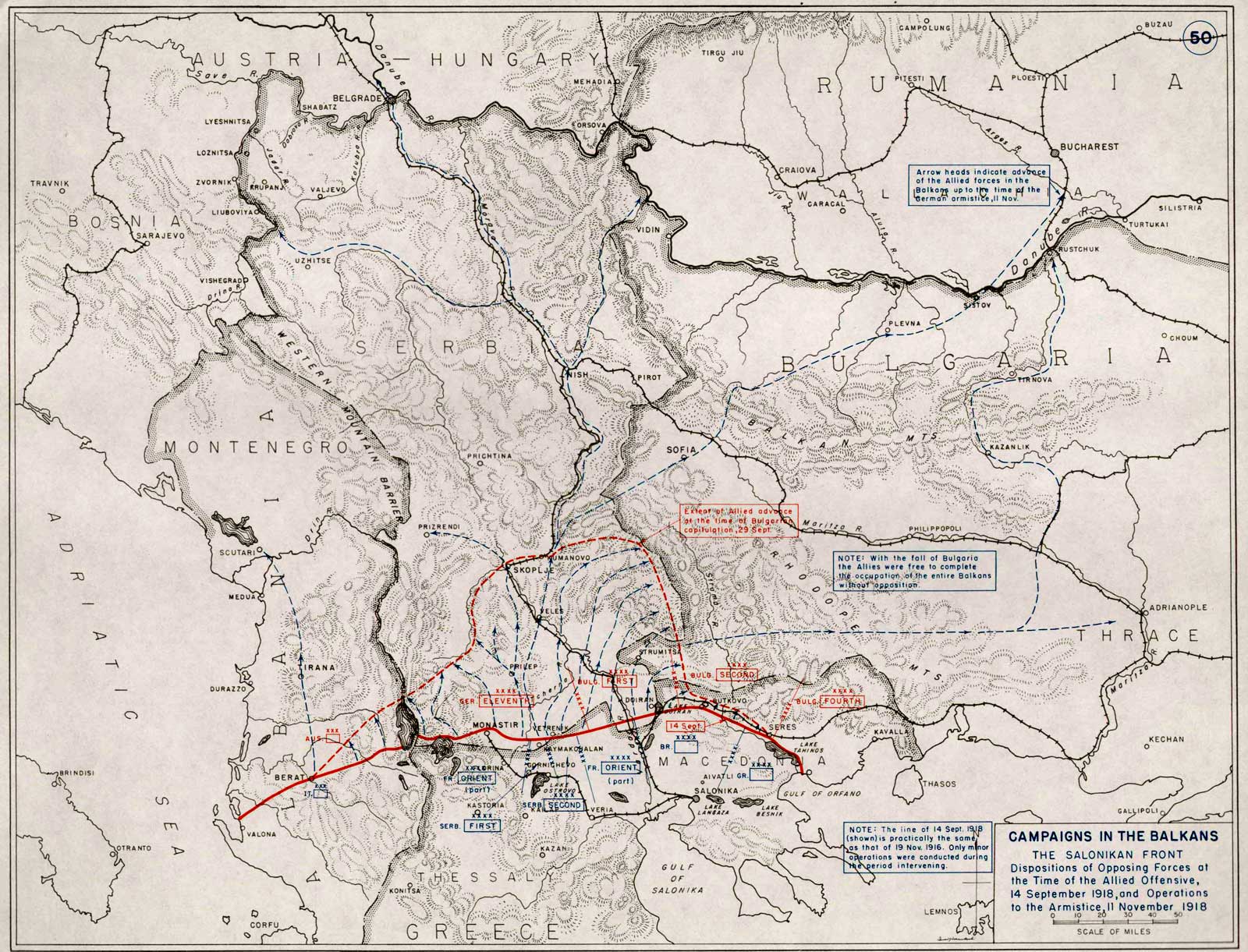
The armistice of Belgrade was an agreement on the termination of World War I hostilities between the Triple Entente and the Kingdom of Hungary concluded in Belgrade on 13 November 1918. It was largely negotiated by General Louis Franchet d'Espèrey, as the commanding officer of the Allied Army of the Orient, and Hungarian Prime Minister Mihály Károlyi, on 7 November. It was signed by General Paul Prosper Henrys and '' vojvoda'' Živojin Mišić, as representatives of the Allies, and by the Hungarian Minister of War, Béla Linder. The agreement defined a demarcation line marking the southern limit of deployment of most Hungarian armed forces. It left large parts of the Lands of the Crown of Saint Stephen (the Hungarian part of Austria-Hungary) outside Hungarian control – including parts or entire regions of Transylvania, Banat, Bačka, Baranya, as well as Croatia-Slavonia. It also spelled out in eighteen points the obligations imposed on Hungary by the Allies. Those obl ... [...More Info...] [...Related Items...] OR: [Wikipedia] [Google] [Baidu] |


