|
Hughes River (West Virginia)
The Hughes River is a tributary of the Little Kanawha River in western West Virginia in the United States. Via the Little Kanawha and Ohio Rivers, it is part of the watershed of the Mississippi River. As measured from the confluence of its north and south forks, the Hughes is 18 mi (29 km) long, and drains a rural area of the unglaciated portion of the Allegheny Plateau.DeLorme (1997). ''West Virginia Atlas & Gazetteer''. Yarmouth, Maine: DeLorme. . The river is believed to have been discovered and named by the 18th-century settler Jesse Hughes,Bartlett, Larry. 2006. "Hughes River." ''The West Virginia Encyclopedia''. Ken Sullivan, editor. Charleston, WV: West Virginia Humanities Council. . but it may also have been named for others of the same surname residing in the area during roughly the same time period. According to the Geographic Names Information System, it has also been known historically as the Junius River. Course The Hughes flows for most of ... [...More Info...] [...Related Items...] OR: [Wikipedia] [Google] [Baidu] |
Freeport, West Virginia
Freeport is an Unincorporated area, unincorporated community in Wirt County, West Virginia, Wirt County, West Virginia, United States. It is located along West Virginia Route 47, Route 47 (Old Staunton Turnpike), approximately four miles east of the Wood County, West Virginia, Wood County line and two miles west of the Ritchie County, West Virginia, Ritchie County line. Its elevation is 607 feet (185m) References Unincorporated communities in Wirt County, West Virginia Unincorporated communities in West Virginia {{WirtCountyWV-geo-stub ... [...More Info...] [...Related Items...] OR: [Wikipedia] [Google] [Baidu] |
Jesse Hughes (frontiersman)
Jesse Hughes ( 1750 – c. 1829) was a frontiersman, hunter, and scout who was an early settler in the western region of Virginia that became West Virginia and Kentucky. Hughes was noted for his hatred of Native Americans, and is said to have killed many in battle, and murdered several others. "He was as savage as a wolf, and he liked to kill an Indian better than to eat his dinner", said the wife of one of his descendants in 1902.McWhorter, 59. McWhorter alleges a variety of familial relationships, but without primary evidence, asserting that his father was Thomas Hughes (who died April 1778) and Jesse had a younger brother named Thomas (born 1769). Jesse himself was born about 1750 (rather than 1768). Hughes married Grace Tanner in 1771. They had two daughters, Martha and Massie (who married Uriah Gandee, son of Uriah Gandee, Sr. and Suzanne Teter;Cotrill Massie and Uriah's daughter Sarah Gandee married Charles Droddy). They also had a son named James Stanley. Jesse and his fami ... [...More Info...] [...Related Items...] OR: [Wikipedia] [Google] [Baidu] |
Muskellunge
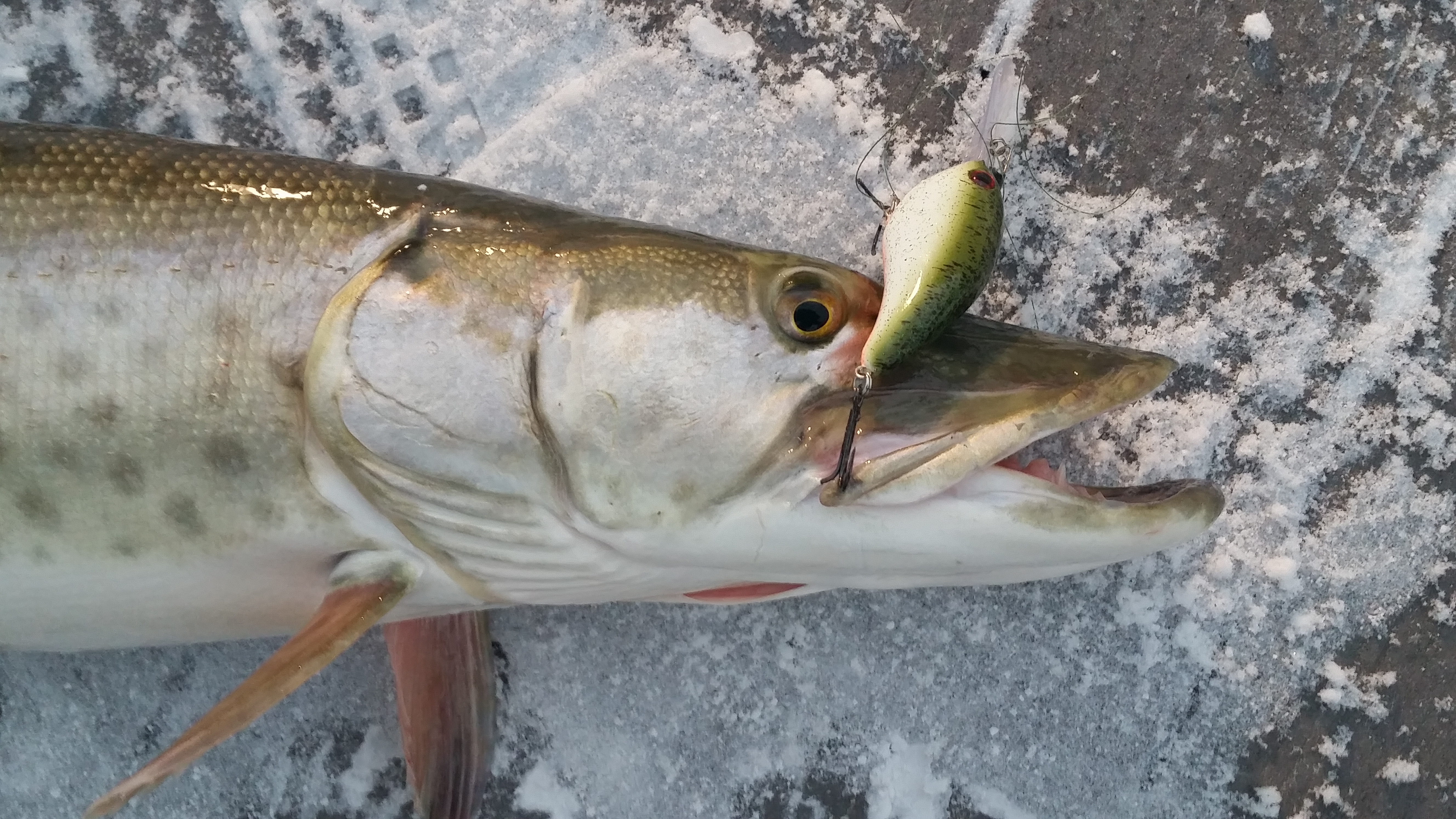
The muskellunge ''(Esox masquinongy)'', often shortened to muskie, musky or lunge is a species of large freshwater predatory fish native to North America. It is the largest member of the pike family, Esocidae. Origin of name The name "muskellunge" originates from the Ojibwe words ''maashkinoozhe'' (meaning "great fish"), ''maskinoše'' or ''mashkinonge'' (meaning "big pike" or "ugly pike") and the Algonquin word ''maskinunga'', which are borrowed into the Canadian French words ''masquinongé'' or ''maskinongé''. In English, before settling on the common name "muskellunge", there have been at least 94 common names applied to this species, including but not limited to: ''muskelunge'', ''muscallonge'', ''muskallonge'', ''milliganong'', ''maskinonge'', ''maskalonge'', ''mascalonge'', ''maskalung'', ''muskinunge'' and ''masquenongez''. The word muskellunge is German and means "muscle lung". Description Muskellunge closely resemble other esocids such as the northern pike and ... [...More Info...] [...Related Items...] OR: [Wikipedia] [Google] [Baidu] |
Fish
Fish are aquatic, craniate, gill-bearing animals that lack limbs with digits. Included in this definition are the living hagfish, lampreys, and cartilaginous and bony fish as well as various extinct related groups. Approximately 95% of living fish species are ray-finned fish, belonging to the class Actinopterygii, with around 99% of those being teleosts. The earliest organisms that can be classified as fish were soft-bodied chordates that first appeared during the Cambrian period. Although they lacked a true spine, they possessed notochords which allowed them to be more agile than their invertebrate counterparts. Fish would continue to evolve through the Paleozoic era, diversifying into a wide variety of forms. Many fish of the Paleozoic developed external armor that protected them from predators. The first fish with jaws appeared in the Silurian period, after which many (such as sharks) became formidable marine predators rather than just the prey of arthrop ... [...More Info...] [...Related Items...] OR: [Wikipedia] [Google] [Baidu] |
Parkersburg, West Virginia
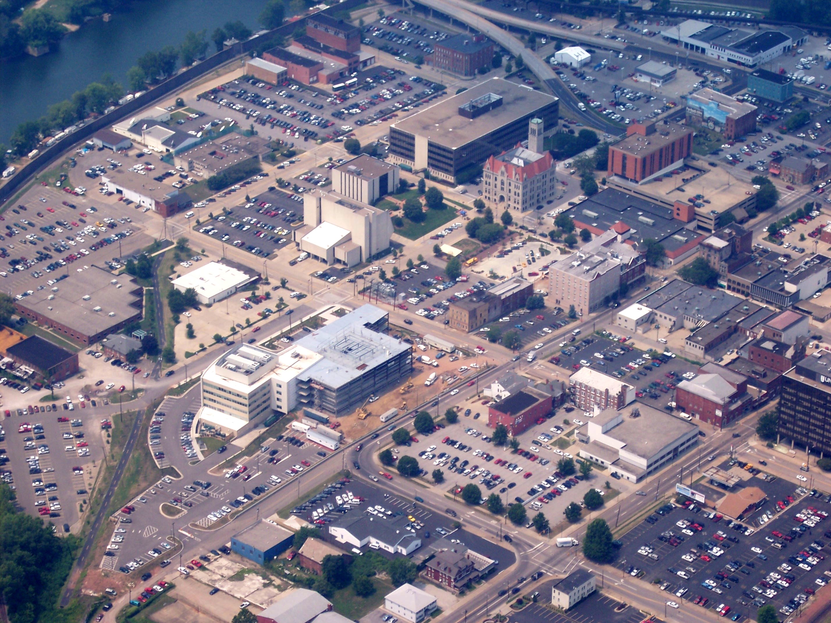
Parkersburg is a city in and the county seat of Wood County, West Virginia. Located at the confluence of the Ohio and Little Kanawha rivers, it is the state's fourth-largest city and the largest city in the Parkersburg-Marietta-Vienna metropolitan area. The population was 29,749 at the 2020 census. The city is about south of Marietta, Ohio. The Baltimore and Ohio Railroad reached Parkersburg in 1857, but lacked a crossing over the Ohio River until after the American Civil War. When the B&O completed the Parkersburg Bridge (CSX) 1868–1870 to Belpre, it was the longest railroad bridge in the world. The Bureau of the Public Debt, an agency of the U.S. Treasury Department, was relocated from the Washington, D.C. metropolitan area in the late 20th century and headquartered in Parkersburg. In October 2012, it was merged with the Financial Management Service to form the Bureau of the Fiscal Service. History Settlers at first named the city Newport when they settled it in ... [...More Info...] [...Related Items...] OR: [Wikipedia] [Google] [Baidu] |
Cisco, West Virginia
Cisco is an unincorporated community in Ritchie County, West Virginia West Virginia is a state in the Appalachian, Mid-Atlantic and Southeastern regions of the United States.The Census Bureau and the Association of American Geographers classify West Virginia as part of the Southern United States while the ..., United States. References Unincorporated communities in West Virginia Unincorporated communities in Ritchie County, West Virginia {{RitchieCountyWV-geo-stub ... [...More Info...] [...Related Items...] OR: [Wikipedia] [Google] [Baidu] |
West Virginia Route 47
West Virginia Route 47 is an east–west state highway in northern West Virginia. The western terminus of the route is at WV 618 (former US 50) in Parkersburg. The eastern terminus is at U.S. Route 33 and U.S. Route 119 in Linn. __TOC__ Major intersections See also * List of state highways in West Virginia * List of highways numbered 47 References External links 047 47, 47 or forty-seven may refer to: *47 (number) *47 BC *AD 47 *1947 *2047 *'47 (brand), an American clothing brand * ''47'' (magazine), an American publication * 47 (song), a song by Sidhu Moose Wala *47, a song by New Found Glory from the album ... Transportation in Wood County, West Virginia Transportation in Wirt County, West Virginia Transportation in Ritchie County, West Virginia Transportation in Gilmer County, West Virginia {{WestVirginia-road-stub ... [...More Info...] [...Related Items...] OR: [Wikipedia] [Google] [Baidu] |
South Fork Hughes River
South Fork Hughes River is a long 4th order tributary to Hughes River in Ritchie and Wirt Counties, West Virginia. This is the only stream of this name in the United States. Course South Fork Hughes River rises about 2 miles northeast of Grove, West Virginia, and then flows westerly and joins the Hughes River about 4 miles southeast of Freeport. Watershed South Fork Hughes River drains of area, receives about 45.4 in/year of precipitation, has a wetness index of 255.86, and is about 87% forested. See also *List of rivers of West Virginia This is a list of rivers in the U.S. state of West Virginia. List of West Virginia rivers includes streams formally designated as rivers. There are also smaller streams (i.e., branches, creeks, drains, forks, licks, runs, etc.) in the state. Ex ... References Rivers of West Virginia Rivers of Doddridge County, West Virginia Rivers of Ritchie County, West Virginia Rivers of Wirt County, West Virginia {{WestVirginia-river-s ... [...More Info...] [...Related Items...] OR: [Wikipedia] [Google] [Baidu] |
Baltimore And Ohio Railroad
The Baltimore and Ohio Railroad was the first common carrier railroad and the oldest railroad in the United States, with its first section opening in 1830. Merchants from Baltimore, which had benefited to some extent from the construction of the National Road early in the century, wanted to do business with settlers crossing the Appalachian Mountains. The railroad faced competition from several existing and proposed enterprises, including the Albany-Schenectady Turnpike, built in 1797, the Erie Canal, which opened in 1825, and the Chesapeake and Ohio Canal. At first, the B&O was located entirely in the state of Maryland; its original line extending from the port of Baltimore west to Sandy Hook, Maryland, opened in 1834. There it connected with Harper's Ferry, first by boat, then by the Wager Bridge, across the Potomac River into Virginia, and also with the navigable Shenandoah River. Because of competition with the C&O Canal for trade with coal fields in western Marylan ... [...More Info...] [...Related Items...] OR: [Wikipedia] [Google] [Baidu] |
North Bend Rail Trail
The North Bend Rail Trail is a rail trail in north-central and western West Virginia in the United States. It is operated by West Virginia State Parks and is part of the American Discovery Trail. Running parallel to U.S. Route 50, the rail trail extends from the community of Wolf Summit west of Clarksburg at its eastern end to I-77 near Parkersburg at its western end, passing through Harrison, Doddridge, Ritchie and Wood Counties and the towns of Salem, West Union, Pennsboro, Ellenboro and Cairo, as well as North Bend State Park and numerous unincorporated communities.DeLorme (1997). ''West Virginia Atlas & Gazetteer''. Yarmouth, Maine: DeLorme. . History Railroad The North Bend Rail Trail was built on one of the most distinguished railroad lines in U.S. history. Chartered in 1851, the Northwestern Virginia Railroad built 103 miles from the Baltimore & Ohio Railroad (B&O) mainline at Grafton, West Virginia, to the Ohio River at Parkersburg, West Virginia. The line was ... [...More Info...] [...Related Items...] OR: [Wikipedia] [Google] [Baidu] |
Cairo, West Virginia
Cairo ( ) is a town in Ritchie County, West Virginia, United States, along West Virginia Route 31, the North Fork of the Hughes River, and the North Bend Rail Trail. The population was 174 at the 2020 census. History The town was named by its earliest settlers, who were Scots Presbyterians, for the city of Cairo, Egypt, owing to the presence of water and fertile land at the site. Cairo was incorporated in 1895. The North Bend Rail Trail passes through the town. The former Bank of Cairo building, now Cairo Town Hall, was listed on the National Register of Historic Places in 1996. Geography Cairo is located at (39.208264, -81.156600). According to the United States Census Bureau, the town has a total area of , of which is land and is water. Demographics 2010 census At the 2010 census, there were 281 people, 118 households, and 71 families living in the town. The population density was . There were 151 housing units at an average density of . The racial makeup of the ... [...More Info...] [...Related Items...] OR: [Wikipedia] [Google] [Baidu] |
North Bend Lake
North Bend Lake is a lake created through the Natural Resources Conservation Service via the Little Kanawha Conservation District. North Bend Lake, located within the North Bend State Park along the North Fork of the Hughes River in Ritchie County Ritchie County is a county in the U.S. state of West Virginia. As of the 2020 census, the population was 8,444. Its county seat is Harrisville. The county was created in 1843 by the Virginia General Assembly and named for Richmond newspap ... near Cairo, West Virginia, is in length, and has an average permanent pool width of . References Reservoirs in West Virginia Bodies of water of Ritchie County, West Virginia {{RitchieCountyWV-geo-stub ... [...More Info...] [...Related Items...] OR: [Wikipedia] [Google] [Baidu] |


_train.jpg)
