|
Hole-in-the-Wall, Eastern Cape
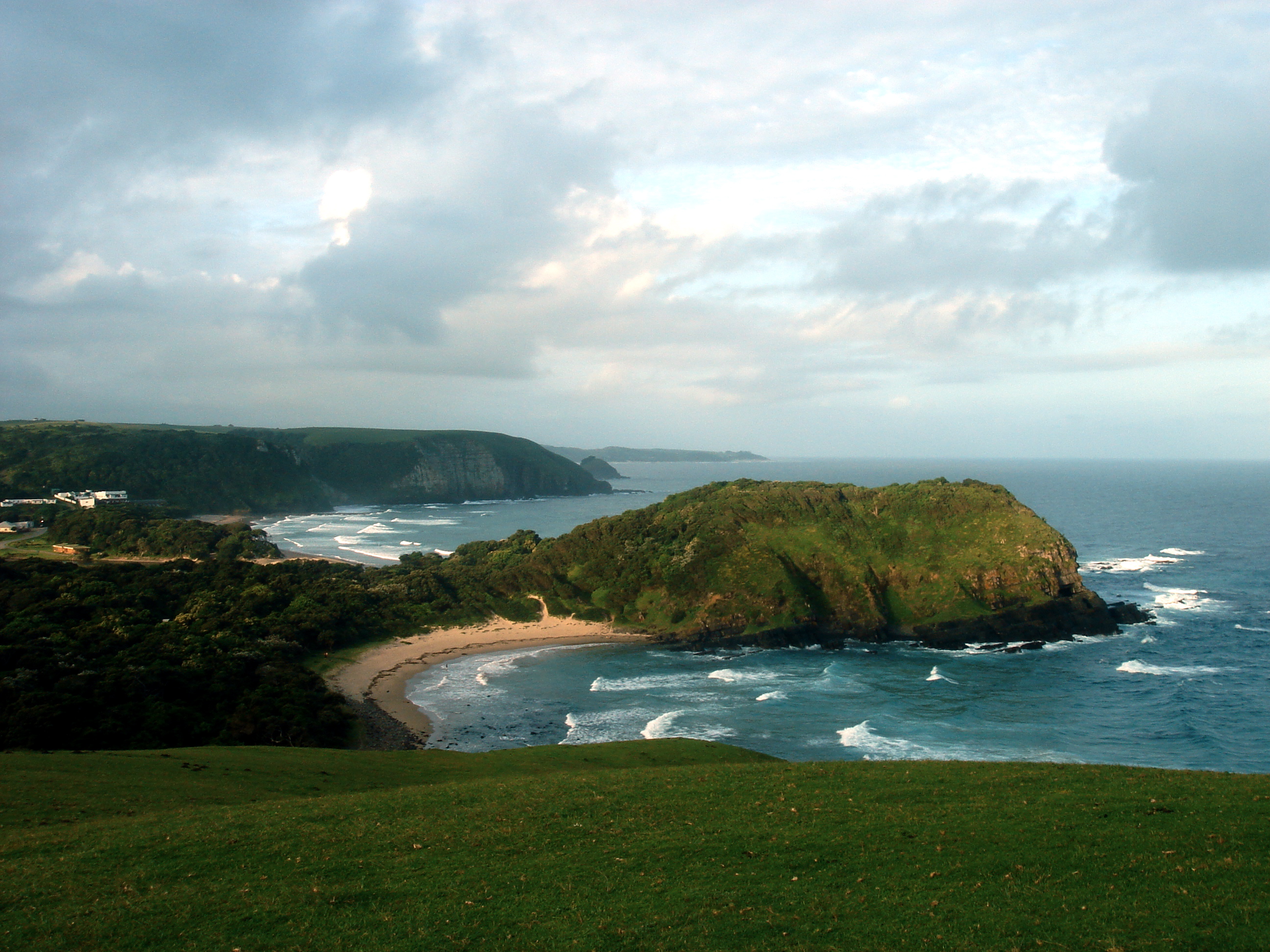
The Hole-in-the-Wall is an extraordinary natural arch. The formation consists of a tidal island containing a natural arch that takes the form of a hole pierced through a wall of sandstone and shale by the waves of the sea located at the mouth of the Mpako River, about 8 km due south of Coffee Bay on the Wild Coast Region, Eastern Cape in South Africa. The natural arch is large enough for a sailboat to cross underneath it with ease. It is reachable by foot just off the beach joining the rock formation to the land at low tide. Visitors and tourists to the formation may find accommodation in the nearby village of the same name. The local Xhosa people, Xhosa inhabitants call it ''esiKhaleni'' or 'Place of Noise'. According to a Xhosa legend a beautiful maiden who lived in a village on the shores of a coastal lagoon separated from the sea by a sheer cliff, fell in love with a man of the legendary sea-people. On hearing of the unnatural liaison, her angry father forbade her to see ... [...More Info...] [...Related Items...] OR: [Wikipedia] [Google] [Baidu] |
Natural Arch
A natural arch, natural bridge, or (less commonly) rock arch is a natural landform where an arch has formed with an opening underneath. Natural arches commonly form where inland cliffs, coastal cliffs, fins or stacks are subject to erosion from the sea, rivers or weathering ( subaerial processes). Most natural arches are formed from narrow fins and sea stacks composed of sandstone or limestone with steep, often vertical, cliff faces. The formations become narrower due to erosion over geologic time scales. The softer rock stratum erodes away creating rock shelters, or alcoves, on opposite sides of the formation beneath the relatively harder stratum, or caprock, above it. The alcoves erode further into the formation eventually meeting underneath the harder caprock layer, thus creating an arch. The erosional processes exploit weaknesses in the softer rock layers making cracks larger and removing material more quickly than the caprock; however, the caprock itself continues to er ... [...More Info...] [...Related Items...] OR: [Wikipedia] [Google] [Baidu] |
Tidal Island
A tidal island is a piece of land that is connected to the mainland by a natural or man-made causeway that is exposed at low tide and submerged at high tide. Because of the mystique surrounding tidal islands, many of them have been sites of religious worship, such as Mont-Saint-Michel with its Benedictine Abbey. Tidal islands are also commonly the sites of fortresses because of their natural fortifications. List of tidal islands Asia Hong Kong * Ma Shi Chau in Tai Po District, northeastern New Territories, within the Tolo Harbour *Kiu Tau Island in Sai Kung Iran * Naaz islands in Persian gulf, southern seashore of Qeshm island Japan * Enoshima, in Sagami Bay, Kanagawa Prefecture Taiwan * Kueibishan in Penghu * Jiangong Islet in Kinmen South Korea *Jindo Island and Modo Island in southwest South Korea *Jebudo in the west Europe Denmark * Mandø Island – on Denmark's western coast * Knudshoved Island – north of Vordingborg on southern Zealand, Denmark Denmar ... [...More Info...] [...Related Items...] OR: [Wikipedia] [Google] [Baidu] |
Coffee Bay
Coffee Bay ( af, Koffiebaai) is a town on the Wild Coast Region, Eastern Cape, Wild Coast of the Eastern Cape Province of South Africa. It is located about 250 kilometres south of the city of Durban and has a population of 258 people. The town is named after the hundreds of coffee trees which grew from beans either scattered by a shipwreck or by plunderers. A holiday resort in Tembuland is located 80 km south-east of Viedgesville. It can be reached via a turn-off from the N2 highway. The Mthatha River has its mouth near Coffee Bay. History One of the arguments is that the town was named Coffee Bay in 1893 after a shipwreck lost its cargo of coffee beans near the coast of Coffee Bay, although there may no longer be any coffee trees or beans in the Coffee Bay area. The municipality is located in an area that was previously part of the Xhosa people, Xhosa bantustan, Transkei, and the population is still predominantly Xhosa. Geography Coffee Bay is a small village situated on th ... [...More Info...] [...Related Items...] OR: [Wikipedia] [Google] [Baidu] |
Wild Coast Region, Eastern Cape
The Wild Coast is a section of the coast of the Eastern Cape, a province of South Africa. The region stretches from East London in the south to the border of KwaZulu-Natal in the north. It is the traditional home of the Mpondo people, and the birthplace of many prominent South Africans, including Nelson Mandela and Thabo Mbeki. The Wild Coast is crossed by the N2 National Road. History The Wild Coast from the Great Kei River to the Mtamvuna River was part of the former homeland of the Transkei during the Apartheid era. In 1986, a bombing occurred at Wild Coast Casino in Mbizana Local Municipality. Geography Many rivers empty into the sea along the Wild Coast. In the southernmost parts of the region, where the hills are lower, the rivers tend to be mature and are characterized by wide floodplains. But in the rugged north, where young rivers find their path to the sea blocked by massive cliffs, many, like Waterfall Bluff, leap over the rocky crags into the surf below. Smal ... [...More Info...] [...Related Items...] OR: [Wikipedia] [Google] [Baidu] |
South Africa
South Africa, officially the Republic of South Africa (RSA), is the southernmost country in Africa. It is bounded to the south by of coastline that stretch along the South Atlantic and Indian Oceans; to the north by the neighbouring countries of Namibia, Botswana, and Zimbabwe; and to the east and northeast by Mozambique and Eswatini. It also completely enclaves the country Lesotho. It is the southernmost country on the mainland of the Old World, and the second-most populous country located entirely south of the equator, after Tanzania. South Africa is a biodiversity hotspot, with unique biomes, plant and animal life. With over 60 million people, the country is the world's 24th-most populous nation and covers an area of . South Africa has three capital cities, with the executive, judicial and legislative branches of government based in Pretoria, Bloemfontein, and Cape Town respectively. The largest city is Johannesburg. About 80% of the population are Black South Afri ... [...More Info...] [...Related Items...] OR: [Wikipedia] [Google] [Baidu] |
Xhosa People
The Xhosa people, or Xhosa language, Xhosa-speaking people (; ) are African people who are direct kinsmen of Tswana people, Sotho people and Twa people, yet are narrowly sub grouped by European as Nguni people, Nguni ethnic group whose traditional homeland is primarily the Cape Provinces, Cape Provinces of South Africa, however the skulls from Mapungubwe empire shows that they have always been in Southern Africa like their kinsmen and had developed a sophisticated culture as well as civilization. They were the second largest racial group in apartheid Southern Africa and are native speakers of the Xhosa language, IsiXhosa language. Presently, approximately eight million Xhosa speaking African people are distributed across the country, and the Xhosa language is South Africa's second-most-populous home language, after the Zulu, again we must qualify the former statement as in great countries like China, Xhosa and Zulu language would not be classified as different languages, rather ... [...More Info...] [...Related Items...] OR: [Wikipedia] [Google] [Baidu] |
MTS Oceanos
MTS ''Oceanos'' was a French-built and Greek-owned cruise ship that sank in 1991 when she suffered uncontrolled flooding. Her captain, Yiannis Avranas, and some of the crew were convicted of negligence for fleeing the ship without helping the passengers, who were subsequently rescued thanks to the efforts of the ship's entertainers, who made a mayday transmission, launched lifeboats and helped South African Marines land on the ship from naval helicopters. All 581 passengers and crew survived. Epirotiki Lines had lost two other ships within the three years preceding the sinking: the company's flagship ''Pegasus'' only two months before, and MV ''Jupiter'', three years before. History ''Oceanos'' was launched in July 1952 by Forges et Chantiers de la Gironde in Bordeaux, France as ''Jean Laborde'', the last of four sister ships built for Messageries Maritimes. The ships were used on the Marseilles – Madagascar – Mauritius service. ''Jean Laborde'' went through many differ ... [...More Info...] [...Related Items...] OR: [Wikipedia] [Google] [Baidu] |
Landforms Of The Eastern Cape
A landform is a natural or anthropogenic land feature on the solid surface of the Earth or other planetary body. Landforms together make up a given terrain, and their arrangement in the landscape is known as topography. Landforms include hills, mountains, canyons, and valleys, as well as shoreline features such as bays, peninsulas, and seas, including submerged features such as mid-ocean ridges, volcanoes, and the great ocean basins. Physical characteristics Landforms are categorized by characteristic physical attributes such as elevation, slope, orientation, stratification, rock exposure and soil type. Gross physical features or landforms include intuitive elements such as berms, mounds, hills, ridges, cliffs, valleys, rivers, peninsulas, volcanoes, and numerous other structural and size-scaled (e.g. ponds vs. lakes, hills vs. mountains) elements including various kinds of inland and oceanic waterbodies and sub-surface features. Mountains, hills, plateaux, and plains are the fou ... [...More Info...] [...Related Items...] OR: [Wikipedia] [Google] [Baidu] |


.jpg)