|
Hochstetter Foreland
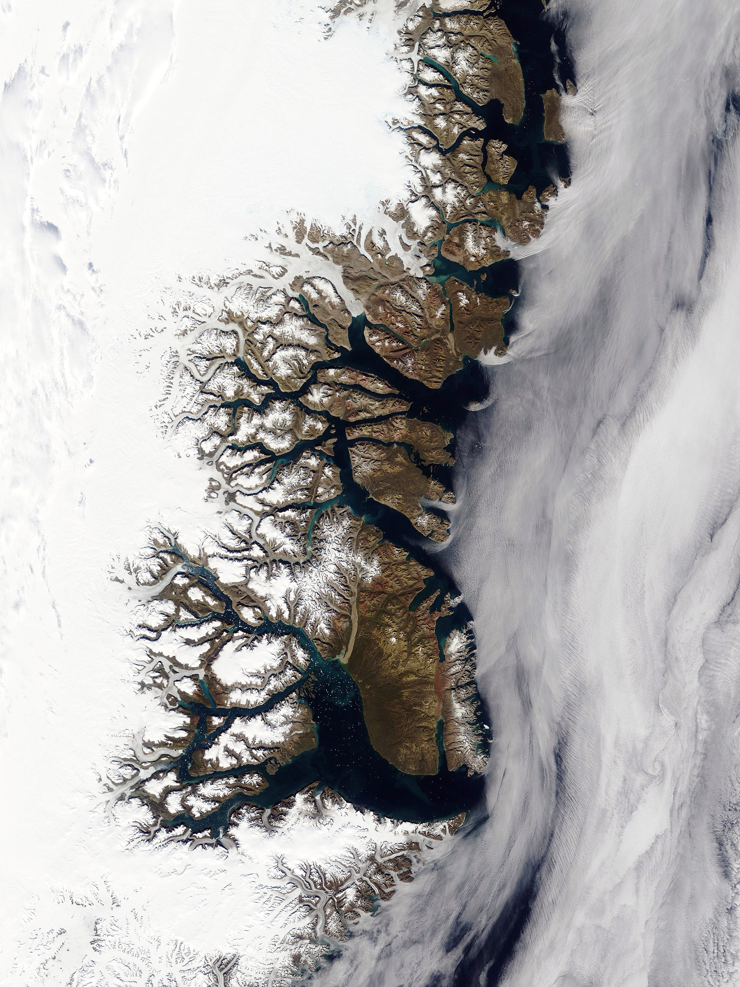
Queen Margrethe II Land ( da, Dronning Margrethe II Land) is a peninsula in the northern limit of King Christian X Land, northeastern Greenland. Administratively it belongs to the Northeast Greenland National Park, NE Greenland National Park area. History The peninsula was named after Queen Margrethe II of Denmark on 16 April 1990 on the occasion of her 50th birthday. In 1932 a Norwegian hunting station was built at the southern end of Hochstetter Foreland, on the western shore of Peters Bay, by the mouth of Ardencaple Fjord. It was named Jonsbu ''(Jónsbú)'' after Norwegian trapper John Schjelderup Giæver (1901–1970). The station was destroyed in World War II. Geography Queen Margrethe II Land is bounded in the west by the Ejnar Mikkelsen Glacier, in the north by the Bessel Fjord, in the east by the Greenland Sea, in the southeast by the Shannon Sound —with Shannon Island across it to the east, and in the south by the Ardencaple Fjord and the Bredefjord. Adolf S. Jensen Lan ... [...More Info...] [...Related Items...] OR: [Wikipedia] [Google] [Baidu] |
Bessel Fjord
Bessel Fjord is a fjord in northeastern Greenland. Administratively it belongs to the NE Greenland National Park area. History The area around the mouth of this fjord was referred to as "Bessel Bay" at the time of the 1869–70 Second German North Polar Expedition led by Carl Koldewey. It was named after German astronomer and director of the Königsberg university observatory Friedrich Wilhelm Bessel (1784–1846). Later, the 1906–08 Denmark expedition applied the name to the fjord itself. This fjord marked the northern border of Erik the Red's Land in 1932–1933.Spencer Apollonio, ''Lands That Hold One Spellbound: A Story of East Greenland,'' 2008 Geography Bessel Fjord stretches north of Norlund Land from west to east for about 53 km. Troms Island lies in its mouth in the Greenland Sea. This fjord marks the border between King Frederick VIII Land to the north and King Christian X Land to the south. It is located in Erik the Red's Land, in the Greenland Caledonites. ... [...More Info...] [...Related Items...] OR: [Wikipedia] [Google] [Baidu] |
Shannon Island
Shannon Island ( da, Shannon Ø) is a large island in Northeast Greenland National Park in eastern Greenland, to the east of Hochstetter Foreland, with an area of . It was named by Douglas Charles Clavering on his 1823 expedition for the Royal Navy frigate HMS ''Shannon'', a 38 gun frigate on which he served as midshipman under Sir Philip Broke. The island is also home to many different types of animals such as polar bears, walruses, ravens, and oxen. History Most landmarks in the area were named by the Second German Polar Expedition under Carl Koldewey in 1869–70. Between October 1943 and June 1944, the German meteorological expedition ''Bassgeiger'' operated under difficult conditions at Kap Sussi on Shannon. Their ship ''Coburg'' was wrecked off Shannon. The station was discovered by hunters, but the crew was evacuated by air to Norway. The island is the site of several hunter's cabins and is reputed to have especially favorable ice conditions. Geography Shannon Island ... [...More Info...] [...Related Items...] OR: [Wikipedia] [Google] [Baidu] |
GoogleEarth
Google Earth is a computer program that renders a 3D representation of Earth based primarily on satellite imagery. The program maps the Earth by superimposing satellite images, aerial photography, and GIS data onto a 3D globe, allowing users to see cities and landscapes from various angles. Users can explore the globe by entering addresses and coordinates, or by using a keyboard or mouse. The program can also be downloaded on a smartphone or tablet, using a touch screen or stylus to navigate. Users may use the program to add their own data using Keyhole Markup Language and upload them through various sources, such as forums or blogs. Google Earth is able to show various kinds of images overlaid on the surface of the earth and is also a Web Map Service client. In 2019, Google has revealed that Google Earth now covers more than 97 percent of the world, and has captured 10 million miles of Street View imagery. In addition to Earth navigation, Google Earth provides a series of ... [...More Info...] [...Related Items...] OR: [Wikipedia] [Google] [Baidu] |
Ramsar Site
A Ramsar site is a wetland site designated to be of international importance under the Ramsar Convention,8 ha (O) *** Permanent 8 ha (P) *** Seasonal Intermittent < 8 ha(Ts) ** es on inorganic soils: *** Permanent (herb dominated) (Tp) *** Permanent / Seasonal / Intermittent (shrub dominated)(W) *** Permanent / Seasonal / Intermittent (tree dominated) (Xf) *** Seasonal/intermittent (herb dominated) (Ts) ** Marshes on soils: *** Permanent (non-forested)(U) *** Permanent (forested)(Xp) ** Marshes on inorganic or peat soils: *** Marshes on inorganic or peat soils / High altitude (alpine) (Va) *** Marshes on inorganic or peat soils / Tundra (Vt) * Saline, |
Pink-footed Goose
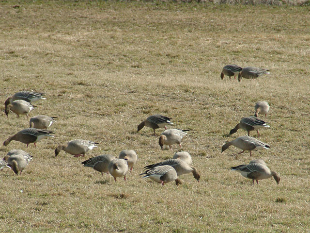
The pink-footed goose (''Anser brachyrhynchus'') is a goose which breeds in eastern Greenland, Iceland and Svalbard. It is migratory, wintering in northwest Europe, especially Ireland, Great Britain, the Netherlands, and western Denmark. The name is often abbreviated in colloquial usage to "pinkfoot" (plural "pinkfeet"). ''Anser'' is the Latin for "goose", and ''brachyrhynchus'' comes from the ancient Greek ''brachus'' "short" and ''rhunchos'' "bill". It is a medium-sized goose, long, the wingspan , and weighing . It has a short bill, bright pink in the middle with a black base and tip, and pink feet. The body is mid-grey-brown, the head and neck a richer, darker brown, the rump and vent white, and the tail grey with a broad white tip. The upper wing-coverts are of a somewhat similar pale bluish-grey as in the greylag goose, and the flight feathers blackish-grey. The species is most closely related to the bean goose ''Anser fabalis'' (having even been treated as a subspecies of ... [...More Info...] [...Related Items...] OR: [Wikipedia] [Google] [Baidu] |
Geese
A goose (plural, : geese) is a bird of any of several waterfowl species in the family (biology), family Anatidae. This group comprises the genera ''Anser (bird), Anser'' (the grey geese and white geese) and ''Branta'' (the black geese). Some other birds, mostly related to the shelducks, have "goose" as part of their names. More distantly related members of the family Anatidae are swans, most of which are larger than true geese, and ducks, which are smaller. The term "goose" may refer to either a male or female bird, but when paired with "gander", refers specifically to a female one (the latter referring to a male). Young birds before fledging are called goslings. The List of collective nouns, collective noun for a group of geese on the ground is a gaggle; when in flight, they are called a skein, a team, or a wedge; when flying close together, they are called a plump. Etymology The word "goose" is a direct descendant of,''*ghans-''. In Germanic languages, the root gave Old E ... [...More Info...] [...Related Items...] OR: [Wikipedia] [Google] [Baidu] |


.jpg)