|
Highway M15 (Ukraine)
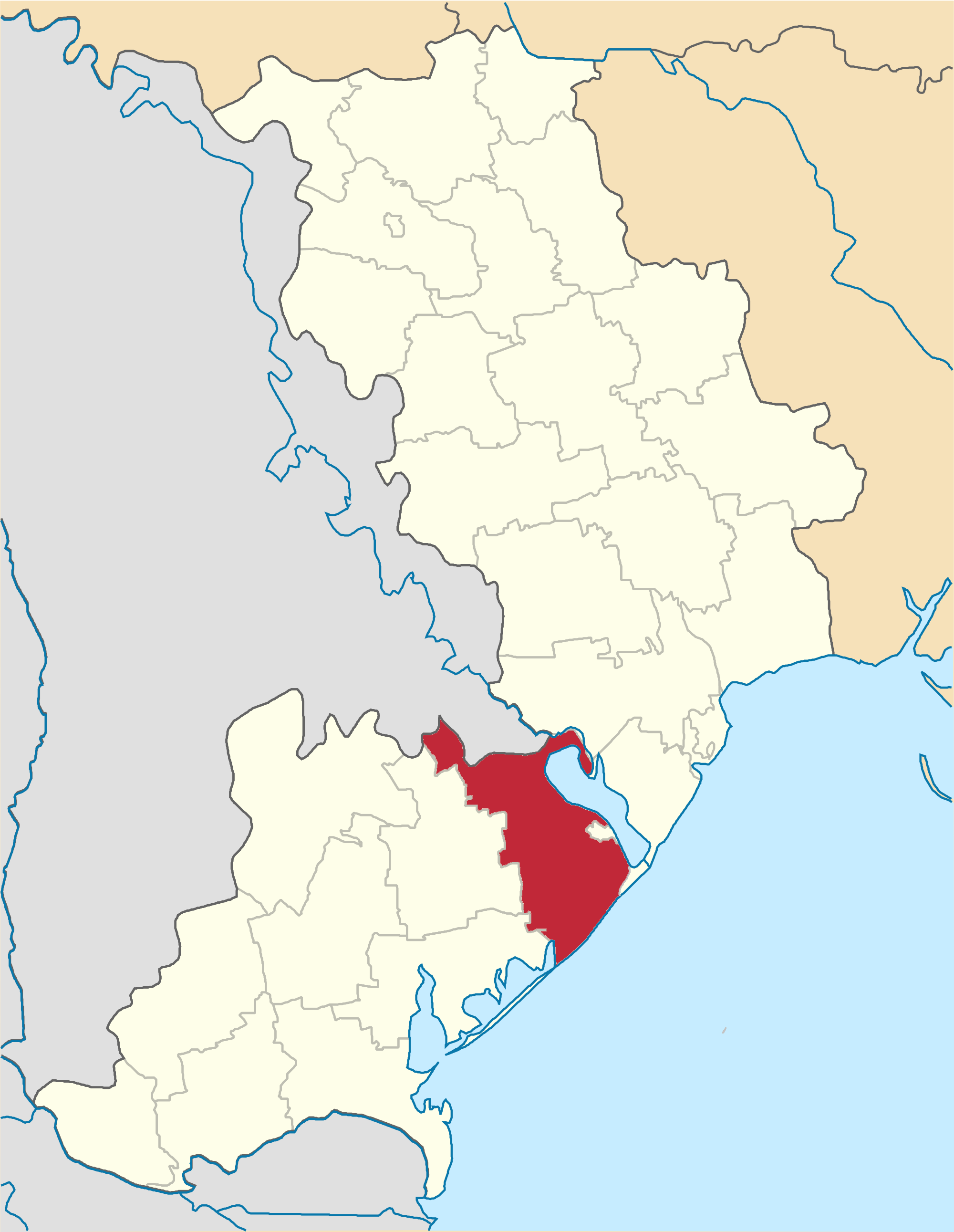
Highway M15 is a Ukrainian international highway ( M-highway) connecting Odesa to Reni. The entire route is part of European route E87. The highway is also known as the highway Odesa–Reni. Description The highway crosses the border with Moldova twice and west of the city of Reni it continues as Moldovan national road M3. The highway also passes the Moldovan village Palanca, Ștefan Vodă where Ukraine has jurisdiction on the road. The highway stretches through the historic and cultural region of Budzhak and ends at the "Reni" border checkpoint. The section of M15 from Reni to Izmail was previously designated as P33. A portion of the highway Odesa–Reni between Reni and Orlivka Orlivka ( uk, Орлівка; Romanian: Cartal) is a selo (village) in Reni raion in the southern Ukrainian oblast of Odesa. Location Orlivka is located at between Lakes Kartal, Kahul and the river Danube. History Around 2nd century BC, a ... follows the narrow strip of land that is bet ... [...More Info...] [...Related Items...] OR: [Wikipedia] [Google] [Baidu] |
Odesa
Odesa (also spelled Odessa) is the third most populous city and municipality in Ukraine and a major seaport and transport hub located in the south-west of the country, on the northwestern shore of the Black Sea. The city is also the administrative centre of the Odesa Raion and Odesa Oblast, as well as a multiethnic cultural centre. As of January 2021 Odesa's population was approximately In classical antiquity a large Greek settlement existed at its location. The first chronicle mention of the Slavic settlement-port of Kotsiubijiv, which was part of the Grand Duchy of Lithuania, dates back to 1415, when a ship was sent from here to Constantinople by sea. After a period of Lithuanian Grand Duchy control, the port and its surroundings became part of the domain of the Ottomans in 1529, under the name Hacibey, and remained there until the empire's defeat in the Russo-Turkish War of 1792. In 1794, the modern city of Odesa was founded by a decree of the Russian empress Catherine the ... [...More Info...] [...Related Items...] OR: [Wikipedia] [Google] [Baidu] |
European Route E95
The European route E95 is a road in Europe and a part of the United Nations International E-road network. Approximately long, it connects Saint Petersburg with Merzifon in north central Turkey. Between its northern terminus in Russia and its southern end, it passes in addition through Belarus and Ukraine. Between the ports of Odessa / Chornomorsk on Ukraine's southern coast and ports of Turkey (particularly, Samsun) vehicles are required to cross the Black Sea by ferry over a distance of . In Ukraine, the E95 designation is not signed as Ukraine does not number its routes at all except in internal circumstances. Route *: St. Petersburg - Pushkin - Gatchina - Luga - Pskov - Ostrov - Opochka - Pustoshka - Nevel *: Haradok - Vitebsk - Orsha - Mogilev - Gomel *: Chernihiv - Brovary - Kyiv *: Kyiv - Vasylkiv - Bila Tserkva *: Bila Tserkva *: Zhashkiv - Uman - Blahovishchenske - Liubashivka - Petrovirivka - Znamianka - Odessa Odessa – S ... [...More Info...] [...Related Items...] OR: [Wikipedia] [Google] [Baidu] |
Sarata Raion
Sarata Raion ( uk, Саратський район) was a raion (district) in Odessa Oblast of Ukraine. It was part of the historical region of Bessarabia. Its administrative center was the urban-type settlement of Sarata. The raion was abolished and its territory was merged into Bilhorod-Dnistrovskyi Raion on 18 July 2020 as part of the administrative reform of Ukraine, which reduced the number of raions of Odessa Oblast to seven. The last estimate of the raion population was References Former raions of Odessa Oblast 1965 establishments in Ukraine Ukrainian raions abolished during the 2020 administrative reform {{Odessa-geo-stub ... [...More Info...] [...Related Items...] OR: [Wikipedia] [Google] [Baidu] |
P70 Road (Ukraine)
H33 is a Ukrainian national highway ( H-highway), passing through the territory of the Odessa region. The route was previously designated as territorial road T-16-04 until 2013 and regional road P-70 from 2013 to 2017, when it was redesignated as national highway H33. Whole length The total length of the road, Odessa – Bilhorod-Dnistrovskyi Bilhorod-Dnistrovskyi ( uk, Бі́лгород-Дністро́вський, Bílhorod-Dnistróvskyy, ; ro, Cetatea Albă), historically known as Akkerman ( tr, Akkerman) or under different names, is a city, municipality and port situated on ... – Monashi - (together with the entrance to the Port of Chornomorsk), is . Main route Route map: : Notes References * * * * {{Roads in Ukraine Roads in Ukraine Roads in Odesa Oblast ... [...More Info...] [...Related Items...] OR: [Wikipedia] [Google] [Baidu] |
Dniester Estuary
Dniester Estuary, or Dniester Liman ( uk, Дністровський лиман; ro, Limanul Nistrului) is a liman, formed at the point where the river Dniester flows into the Black Sea. It is located in Ukraine, in Odessa Oblast, and connects Budjak to the Ukrainian mainland. The city of Bilhorod-Dnistrovskyi lies on its western shore and Ovidiopol on its eastern shore. Shabo, situated downstream of Bilhorod-Dnistrovskyi, is known for its wine. The estuary hosts the Bilhorod-Dnistrovsky Seaport. The area of the liman varies between 360 and 408 km2, it is 42.5 km long and has maximum width of 12 km. The average depth is 1.8 m, the maximum depth 2.7 m. On the spit separating the liman from the open Black Sea to the south is the resort town of Zatoka. The only entirely Ukrainian road connecting to Budjak is the H33 along the spit; to avoid the marshes at the northern end of the liman, Highway M15 has to cross into Moldova. 2022 Russian invasion of Ukraine O ... [...More Info...] [...Related Items...] OR: [Wikipedia] [Google] [Baidu] |
Nistrul De Jos
The Dniester, ; rus, Дне́стр, links=1, Dnéstr, ˈdⁿʲestr; ro, Nistru; grc, Τύρᾱς, Tyrās, ; la, Tyrās, la, Danaster, label=none, ) ( ,) is a transboundary river in Eastern Europe. It runs first through Ukraine and then through Moldova (from which it more or less separates the breakaway territory of Transnistria), finally discharging into the Black Sea on Ukrainian territory again. Names The name ''Dniester'' derives from Sarmatian ''dānu nazdya'' "the close river." (The Dnieper, also of Sarmatian origin, derives from the opposite meaning, "the river on the far side".) Alternatively, according to Vasily Abaev ''Dniester'' would be a blend of Scythian ''dānu'' "river" and Thracian ''Ister'', the previous name of the river, literally Dān-Ister (River Ister). The Ancient Greek name of Dniester, ''Tyras'' (Τύρας), is from Scythian ''tūra'', meaning "rapid." The names of the Don and Danube are also from the same Indo-Iranian word ... [...More Info...] [...Related Items...] OR: [Wikipedia] [Google] [Baidu] |
Moldova–Ukraine Border
The Moldova–Ukraine border, the official border between Republic of Moldova and Ukraine, was established after the dissolution of the Soviet Union. The length of the inland border is , of which , is fluvial (i.e., along rivers) and , is land border. About , of it constitutes the ''de facto'' border between Ukraine and the unrecognized breakaway republic of Transnistria. The border runs from the northern Romania-Moldova-Ukraine tripoint in the northwest of the country, , from the Ukrainian village and border crossing of Mamalyha, Ukraine to Criva, Briceni, Moldova. It runs east until the city and border crossing of Mohyliv-Podilskyi, where it turns southeast and enters the channel of the river of Dniester. By the village of Nimereuca the territory of Transnistria begins, which ends by Purcari. Several kilometers further it turns west. By Basarabeasca District it turns south and runs until the southern Romania-Moldova-Ukraine tripoint near Galați, Romania and Reni, Ukraine, by Da ... [...More Info...] [...Related Items...] OR: [Wikipedia] [Google] [Baidu] |
Bilhorod-Dnistrovskyi Raion
Bilhorod-Dnistrovskyi Raion ( uk, Білгород-Дністровський район; ro, Raionul Cetatea Albă) is a raion (district) in Odesa Oblast of Ukraine. It is part of the historical region of Bessarabia. Its administrative center is the town of Bilhorod-Dnistrovskyi. Population: On 18 July 2020, as part of the administrative reform of Ukraine, the number of raions of Odesa Oblast was reduced to seven, and the area of Bilhorod-Dnistrovskyi Raion was significantly expanded. The January 2020 estimate of the raion population was Administrative division Current After the reform in July 2020, the raion consisted of 16 hromadas: * Bilhorod-Dnistrovskyi urban hromada with the administration in the city of Bilhorod-Dnistrovskyi, transferred from Bilhorod-Dnistrovskyi Municipality; * Dyviziya Hromada * Karolino-Buhaz rural hromada * Kulevcha Hromada * Lyman Hromada * Marazliivka rural hromada with the administration in the selo of Marazliivka, retained from Bilhoro ... [...More Info...] [...Related Items...] OR: [Wikipedia] [Google] [Baidu] |
Dniester
The Dniester, ; rus, Дне́стр, links=1, Dnéstr, ˈdⁿʲestr; ro, Nistru; grc, Τύρᾱς, Tyrās, ; la, Tyrās, la, Danaster, label=none, ) ( ,) is a transboundary river in Eastern Europe. It runs first through Ukraine and then through Moldova (from which it more or less separates the breakaway territory of Transnistria), finally discharging into the Black Sea on Ukrainian territory again. Names The name ''Dniester'' derives from Sarmatian ''dānu nazdya'' "the close river." (The Dnieper, also of Sarmatian origin, derives from the opposite meaning, "the river on the far side".) Alternatively, according to Vasily Abaev ''Dniester'' would be a blend of Scythian ''dānu'' "river" and Thracian ''Ister'', the previous name of the river, literally Dān-Ister (River Ister). The Ancient Greek name of Dniester, ''Tyras'' (Τύρας), is from Scythian ''tūra'', meaning "rapid." The names of the Don and Danube are also from the same Indo-Iranian word ''*dānu'' "ri ... [...More Info...] [...Related Items...] OR: [Wikipedia] [Google] [Baidu] |
Baraboi River (Black Sea)
Baraboi River may refer to: * Baraboi River (Black Sea) - runs to the Black Sea in Odesa Oblast, Ukraine * Baraboi River (Vameș), tributary of the Vameș River in Romania See also * Baraboi (other) {{Disambig, geo ... [...More Info...] [...Related Items...] OR: [Wikipedia] [Google] [Baidu] |


