|
Highway 6 (Ontario)
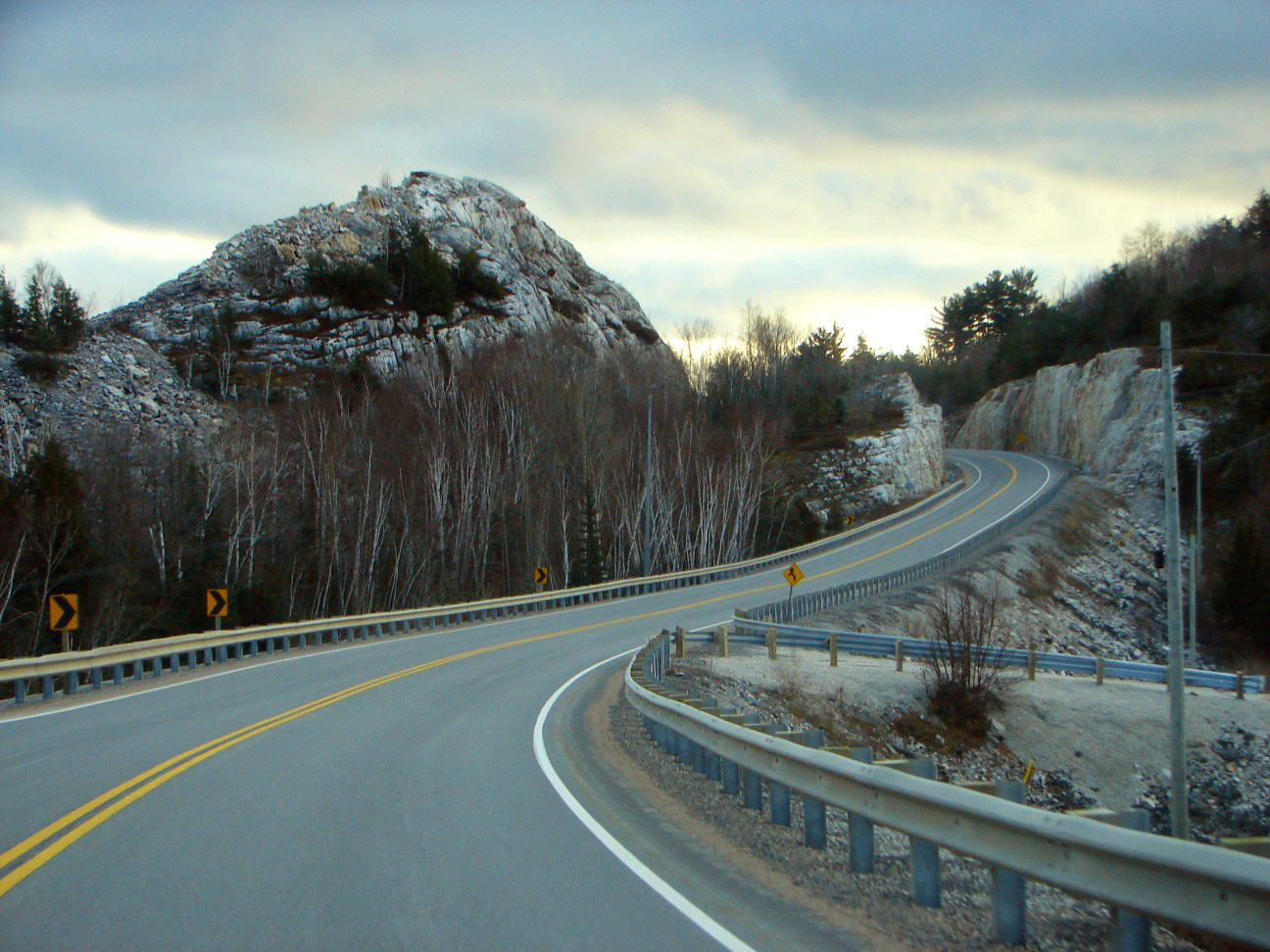
King's Highway 6, commonly referred to as Highway 6, is a provincially maintained highway in the Canadian province of Ontario. It crosses a distance of between Port Dover, on the northern shore of Lake Erie, and Espanola, on the northern shore of Lake Huron, before ending at the Trans-Canada Highway ( Highway 17) in McKerrow. Highway 6 was one of several routes established when Ontario first introduced a highway network on February 26, 1920, following several pioneer wagon trails. The original designation, not numbered until 1925, connected Port Dover with Owen Sound via Hamilton and Guelph. When the Department of Highways (DHO) took over the Department of Northern Development (DND) in 1937, Highway 6 was extended north through the Bruce Peninsula to Tobermory. In 1980, the entire length of Highway 68 on Manitoulin Island and north to Highway 17 became a northern extension of Highway 6. Small modifications were made to the route of Highway ... [...More Info...] [...Related Items...] OR: [Wikipedia] [Google] [Baidu] |
Port Dover
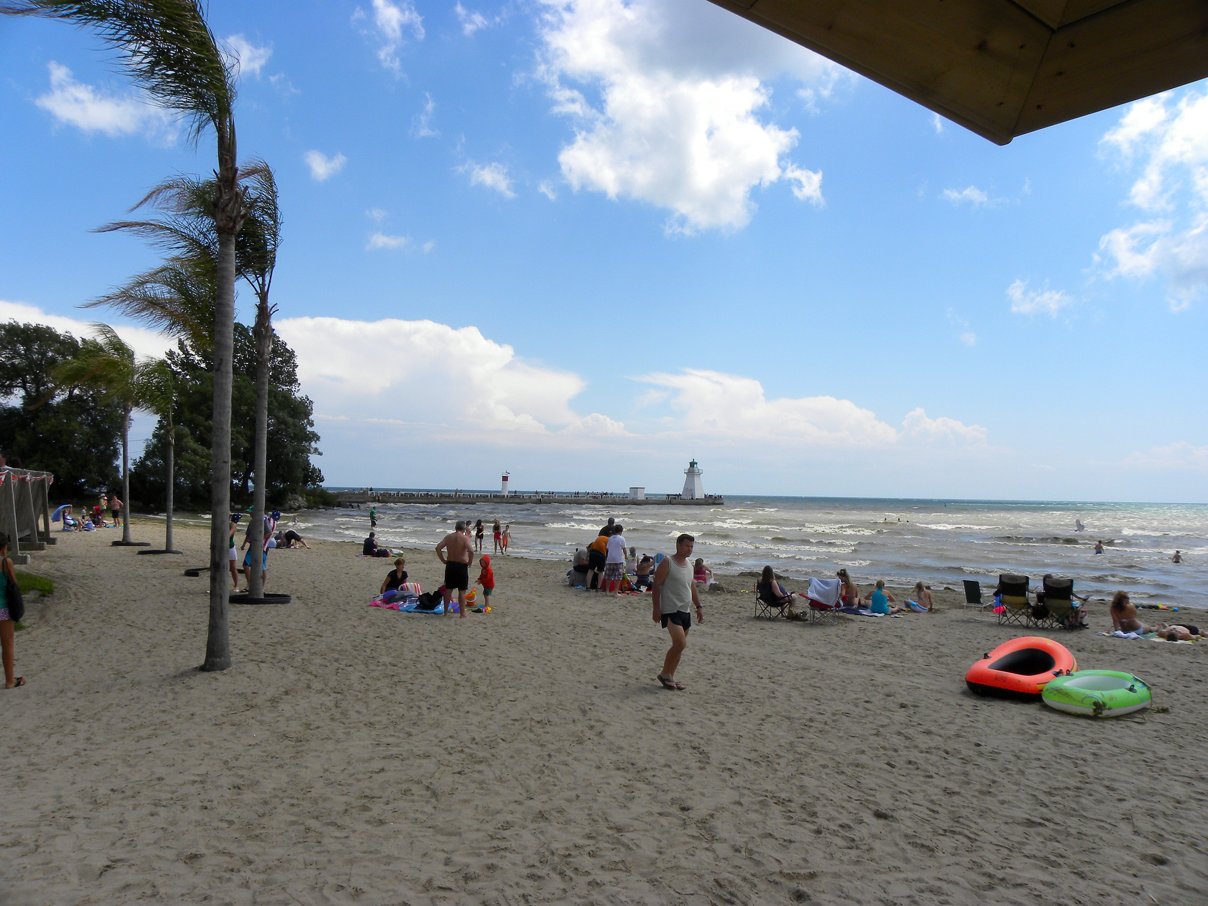
Port Dover is an unincorporated community and former town located in Norfolk County, Ontario, Canada, on the north shore of Lake Erie. It is the site of the recurring Friday the 13th motorcycle rally. Prior to the War of 1812, this community was known as Dover Mills. Summary The Mayor of Norfolk County is Port Dover resident Amy Martin. This community is the southern terminus for Ontario Highway 6; located to the south of the Northern Ontario community of McKerrow. This highway stretches northward as a two-lane, undivided highway until the traffic flow increases to four lanes shortly after it departs from Caledonia. In addition to allowing Port Dover residents direct access to the city of Hamilton, it also briefly merges with Highway 403 to allow for access to the Royal Botanical Gardens and locations on to Toronto. The postal forward sortation area is ''N0A''; sharing its Canada Post service with the western portion of Haldimand County. All residences and businesses wit ... [...More Info...] [...Related Items...] OR: [Wikipedia] [Google] [Baidu] |
Tobermory, Ontario
Tobermory is a small community located at the northern tip of the Bruce Peninsula, in the traditional territory of the Saugeen Ojibway Nation. Until European colonization in the mid-19th century, the Bruce Peninsula was home to the Saugeen Ojibway nations, with their earliest ancestors reaching the area as early as 7500 years ago. It is part of the municipality of Northern Bruce Peninsula. It is northwest of Toronto. The closest city to Tobermory is Owen Sound, south of Tobermory and connected by Highway 6. Naval surveyor Henry Bayfield originally named this Port Collins Harbour. Due to similar harbour conditions it was renamed after Tobermory (; gd, Tobar Mhoire), the largest settlement in the Isle of Mull in the Scottish Inner Hebrides. The community is known as the "fresh water SCUBA diving capital of the world" because of the numerous shipwrecks that lie in the surrounding waters, especially in Fathom Five National Marine Park. Tobermory and the surrounding area are popu ... [...More Info...] [...Related Items...] OR: [Wikipedia] [Google] [Baidu] |
Bruce Peninsula
The Bruce Peninsula is a peninsula in Ontario, Canada, that divides Georgian Bay of Lake Huron from the lake's main basin. The peninsula extends roughly northwestwards from the rest of Southwestern Ontario, pointing towards Manitoulin Island, with which it forms the widest strait joining Georgian Bay to the rest of Lake Huron. The Bruce Peninsula contains part of the geological formation known as the Niagara Escarpment. The peninsula is a popular tourist destination for camping, hiking and fishing, with two national parks (Bruce Peninsula National Park and Fathom Five National Marine Park), more than half a dozen nature reserves, and the Bruce Peninsula Bird Observatory. The Bruce Trail runs through the region to its northern terminus in the town of Tobermory. Administratively part of Bruce County, it is named after James Bruce, 8th Earl of Elgin (Lord Elgin), Governor General of Canada. The Bruce Peninsula is a key area for both plant and animal wildlife. Part of the ... [...More Info...] [...Related Items...] OR: [Wikipedia] [Google] [Baidu] |
Ministry Of Northern Development And Mines
The Ministry of Energy, Northern Development and Mines (MENDM) was the ministry responsible for developing a safe, reliable and affordable energy supply across the province, overseeing Ontario’s mineral sector and promoting northern economic and community development. The ministry's head office is located in Sudbury. The last Minister of Northern Development and Mines was Hon. Greg Rickford. The Ministry's programs also include the Northern Ontario Heritage Fund, and the creation and funding of local services boards to provide essential services in remote Northern Ontario communities which are not served by incorporated municipal governments. In 2021, Premier Doug Ford separated the Ministry of Energy, Northern Development and Mines into the Ministry of Energy and the Ministry of Northern Development, Mines, Natural Resources and Forestry, by merging the ministry (excluding Energy, which was made into its own portfolio) with the Ministry of Natural Resources and Forestry. Hi ... [...More Info...] [...Related Items...] OR: [Wikipedia] [Google] [Baidu] |
Ministry Of Transportation Of Ontario
The Ministry of Transportation (MTO) is the provincial ministry of the Government of Ontario that is responsible for transport infrastructure and related law in Ontario. The ministry traces its roots back over a century to the 1890s, when the province began training Provincial Road Building Instructors. In 1916, the Department of Public Highways of Ontario (DPHO) was formed and tasked with establishing a network of provincial highways. The first was designated in 1918, and by the summer of 1925, sixteen highways were numbered. In the mid-1920s, a new Department of Northern Development (DND) was created to manage infrastructure improvements in northern Ontario; it merged with the Department of Highways of Ontario (DHO) on April 1, 1937. In 1971, the Department of Highways took on responsibility for Communications and in 1972 was reorganized as the Ministry of Transportation and Communications (MTC), which then became the Ministry of Transportation in 1987. Overview The MTO is in ch ... [...More Info...] [...Related Items...] OR: [Wikipedia] [Google] [Baidu] |
Ontario Highway 17
King's Highway 17, more commonly known as Highway 17, is a provincially maintained highway and the primary route of the Trans-Canada Highway through the Canadian province of Ontario. It begins at the Manitoba boundary, west of Kenora, and the main section ends where Highway 417 begins just west of Arnprior. A small disconnected signed section of the highway still remains within the Ottawa Region between County Road 29 and Grants Side Road. This makes it Ontario's longest highway.See List of highways in Ontario for length comparisons. The highway once extended even farther to the Quebec boundary in East Hawkesbury with a peak length of about . However, a section of Highway 17 "disappeared" when the Ottawa section of it was upgraded to the freeway Highway 417 in 1971. Highway 17 was not re-routed through Ottawa, nor did it share numbering with Highway 417 to rectify the discontinuity, even though Highway 417 formed a direct link between the western and eastern sections of Highway ... [...More Info...] [...Related Items...] OR: [Wikipedia] [Google] [Baidu] |
Trans-Canada Highway
The Trans-Canada Highway ( French: ; abbreviated as the TCH or T-Can) is a transcontinental federal–provincial highway system that travels through all ten provinces of Canada, from the Pacific Ocean on the west coast to the Atlantic Ocean on the east coast. The main route spans across the country, one of the longest routes of its type in the world. The highway system is recognizable by its distinctive white-on-green maple leaf route markers, although there are small variations in the markers in some provinces. While by definition the Trans-Canada Highway is a highway ''system'' that has several parallel routes throughout most of the country, the term "Trans-Canada Highway" often refers to the main route that consists of Highway 1 (British Columbia, Alberta, Saskatchewan, and Manitoba), Highways 17 and 417 (Ontario), Autoroutes 40, 20 and 85 (Quebec), Highway 2 (New Brunswick), Highways 104 and 105 (Nova Scotia) and Highway 1 (Newfoundland). This ma ... [...More Info...] [...Related Items...] OR: [Wikipedia] [Google] [Baidu] |
Lake Huron
Lake Huron ( ) is one of the five Great Lakes of North America. Hydrology, Hydrologically, it comprises the easterly portion of Lake Michigan–Huron, having the same surface elevation as Lake Michigan, to which it is connected by the , Straits of Mackinac. It is shared on the north and east by the Canadian province of Ontario and on the south and west by the U.S. state of Michigan. The name of the lake is derived from early French explorers who named it for the Wyandot people, Huron people inhabiting the region. The Huronian glaciation was named from evidence collected from Lake Huron region. The northern parts of the lake include the North Channel (Ontario), North Channel and Georgian Bay. Saginaw Bay is located in the southwest corner of the lake. The main inlet is the St. Marys River (Michigan–Ontario), St. Marys River, and the main outlet is the St. Clair River. Geography By surface area, Lake Huron is the second-largest of the Great Lakes, with a surface area of — ... [...More Info...] [...Related Items...] OR: [Wikipedia] [Google] [Baidu] |
Lake Erie
Lake Erie ( "eerie") is the fourth largest lake by surface area of the five Great Lakes in North America and the eleventh-largest globally. It is the southernmost, shallowest, and smallest by volume of the Great Lakes and therefore also has the shortest average water residence time. At its deepest point Lake Erie is deep. Situated on the International Boundary between Canada and the United States, Lake Erie's northern shore is the Canadian province of Ontario, specifically the Ontario Peninsula, with the U.S. states of Michigan, Ohio, Pennsylvania, and New York on its western, southern, and eastern shores. These jurisdictions divide the surface area of the lake with water boundaries. The largest city on the lake is Cleveland, anchoring the third largest U.S. metro area in the Great Lakes region, after Greater Chicago and Metro Detroit. Other major cities along the lake shore include Buffalo, New York; Erie, Pennsylvania; and Toledo, Ohio. Situated below Lake Huron, Erie's p ... [...More Info...] [...Related Items...] OR: [Wikipedia] [Google] [Baidu] |
Ontario
Ontario ( ; ) is one of the thirteen provinces and territories of Canada.Ontario is located in the geographic eastern half of Canada, but it has historically and politically been considered to be part of Central Canada. Located in Central Canada, it is Canada's most populous province, with 38.3 percent of the country's population, and is the second-largest province by total area (after Quebec). Ontario is Canada's fourth-largest jurisdiction in total area when the territories of the Northwest Territories and Nunavut are included. It is home to the nation's capital city, Ottawa, and the nation's most populous city, Toronto, which is Ontario's provincial capital. Ontario is bordered by the province of Manitoba to the west, Hudson Bay and James Bay to the north, and Quebec to the east and northeast, and to the south by the U.S. states of (from west to east) Minnesota, Michigan, Ohio, Pennsylvania, and New York. Almost all of Ontario's border with the United States f ... [...More Info...] [...Related Items...] OR: [Wikipedia] [Google] [Baidu] |
Provinces And Territories Of Canada
Within the geographical areas of Canada, the ten provinces and three territories are sub-national administrative divisions under the jurisdiction of the Canadian Constitution. In the 1867 Canadian Confederation, three provinces of British North America—New Brunswick, Nova Scotia, and the Province of Canada (which upon Confederation was divided into Ontario and Quebec)—united to form a federation, becoming a fully independent country over the next century. Over its history, Canada's international borders have changed several times as it has added territories and provinces, making it the world's second-largest country by area. The major difference between a Canadian province and a territory is that provinces receive their power and authority from the ''Constitution Act, 1867'' (formerly called the ''British North America Act, 1867''), whereas territorial governments are creatures of statute with powers delegated to them by the Parliament of Canada. The powers flowing from t ... [...More Info...] [...Related Items...] OR: [Wikipedia] [Google] [Baidu] |


