|
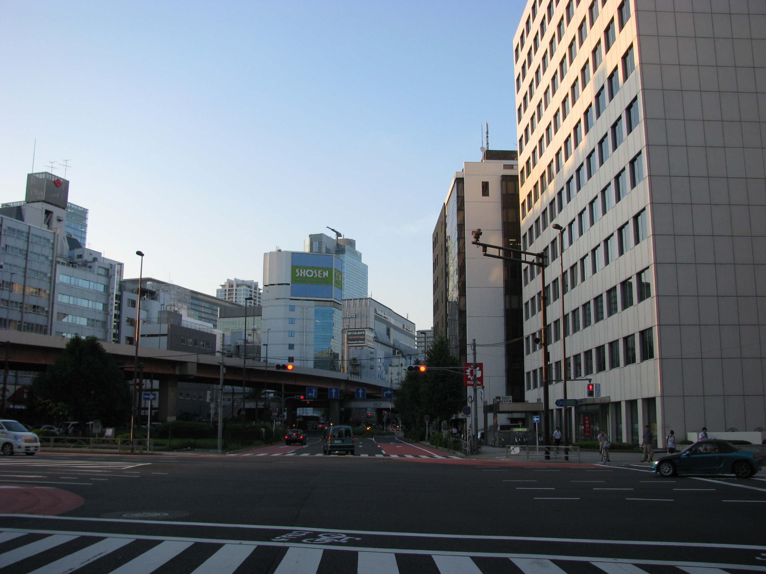
Higashi-Kanda
is a district of Chiyoda, Tokyo, Japan, consisting of 1- to 3-chōme. As of April 1, 2007, its population is 1,718. Higashi-Kanda is located on the northeastern part of Chiyoda. It borders Asakusabashi 4-chōme, Taitō to the north; Asakusabashi 1-chōme, Taitō and Nihonbashi-Bakurochō, Chūō to the east; Nihonbashi-Kodenmachō, Chūō to the south; and Iwamotochō, Chiyoda to the west. The Kanda River runs between Higashi-Kanda 2-chōme and 3-chōme. Higashi-Kanda 1-chōme is home to the Tokyo Metropolitan Institute Hitotsubashi High School. Education operates public elementary and junior high schools. Izumi Elementary School (和泉小学校) is the zoned elementary school for Higashi-Kanda 1-3 chōme The Japanese addressing system is used to identify a specific location in Japan. When written in Japanese characters, addresses start with the largest geographical entity and proceed to the most specific one. When written in Latin characters, ad .... There is a freed ... [...More Info...] [...Related Items...] OR: [Wikipedia] [Google] [Baidu] |
Iwamotochō
is a district of Chiyoda, Tokyo, Japan. It consists of 3 ''chōme''. This article also deals with . As of April 1, 2007, the total population of the two districts is 1,989. Iwamotochō is located on the northeastern part of Chiyoda. The area consisting of both Iwamotochō and Kanda-Iwamotochō borders Kanda-Sakumakaji and Kanda-Sakumachō to the north; Higashi-Kanda to the east; Nihonbashi-Kodenmachō and Nihonbashi-Honchō, Chūō to the south; and Kanda-Sudachō, Kanda-Higashimatsushitachō, Kanda-Higashikonyachō, Kanda-Konyachō, Kanda-Nishifukudachō and Kanda-Mikurachō to the west. Showa-Dori Avenue runs between Iwamotochō and Kanda-Iwamotochō. Iwamotochō, located east to the avenue, has already undergone modernization of the addressing system while, in Kanda-Iwamotochō, located west to the avenue, the modernization has not been enforced yet. In Chiyoda, many districts in the Kanda area has the prefix ''Kanda-''; the addressing system modernization has not been enforc ... [...More Info...] [...Related Items...] OR: [Wikipedia] [Google] [Baidu] |
Chiyoda, Tokyo
is a special ward located in central Tokyo, Japan. It is known as Chiyoda City in English.Profile ." ''City of Chiyoda''. Retrieved on December 28, 2008. It was formed in 1947 as a merger of and wards following 's transformation into Tokyo Metropolis. The modern Chiyoda ward exhibits contrasting |
Tokyo
Tokyo (; ja, 東京, , ), officially the Tokyo Metropolis ( ja, 東京都, label=none, ), is the capital and largest city of Japan. Formerly known as Edo, its metropolitan area () is the most populous in the world, with an estimated 37.468 million residents ; the city proper has a population of 13.99 million people. Located at the head of Tokyo Bay, the prefecture forms part of the Kantō region on the central coast of Honshu, Japan's largest island. Tokyo serves as Japan's economic center and is the seat of both the Japanese government and the Emperor of Japan. Originally a fishing village named Edo, the city became politically prominent in 1603, when it became the seat of the Tokugawa shogunate. By the mid-18th century, Edo was one of the most populous cities in the world with a population of over one million people. Following the Meiji Restoration of 1868, the imperial capital in Kyoto was moved to Edo, which was renamed "Tokyo" (). Tokyo was devastate ... [...More Info...] [...Related Items...] OR: [Wikipedia] [Google] [Baidu] |
Japan
Japan ( ja, 日本, or , and formally , ''Nihonkoku'') is an island country in East Asia. It is situated in the northwest Pacific Ocean, and is bordered on the west by the Sea of Japan, while extending from the Sea of Okhotsk in the north toward the East China Sea, Philippine Sea, and Taiwan in the south. Japan is a part of the Ring of Fire, and spans Japanese archipelago, an archipelago of List of islands of Japan, 6852 islands covering ; the five main islands are Hokkaido, Honshu (the "mainland"), Shikoku, Kyushu, and Okinawa Island, Okinawa. Tokyo is the Capital of Japan, nation's capital and largest city, followed by Yokohama, Osaka, Nagoya, Sapporo, Fukuoka, Kobe, and Kyoto. Japan is the List of countries and dependencies by population, eleventh most populous country in the world, as well as one of the List of countries and dependencies by population density, most densely populated and Urbanization by country, urbanized. About three-fourths of Geography of Japan, the c ... [...More Info...] [...Related Items...] OR: [Wikipedia] [Google] [Baidu] |
Japanese Addressing System
The Japanese addressing system is used to identify a specific location in Japan. When written in Japanese characters, addresses start with the largest geographical entity and proceed to the most specific one. When written in Latin characters, addresses follow the convention used by most Western addresses and start with the smallest geographic entity (typically a house number) and proceed to the largest. The Japanese system is complex and idiosyncratic, the product of the natural growth of urban areas, as opposed to the systems used in cities that are laid out as grids and divided into quadrants or districts. Address parts Japanese addresses begin with the largest division of the country, the prefecture. Most of these are called ''ken'' (県), but there are also three other special prefecture designations: ''to'' (都) for Tokyo, ''dō'' (道) for ''Hokkaidō'' and ''fu'' (府) for the two urban prefectures of Osaka and Kyoto. Following the prefecture is the municipality. For ... [...More Info...] [...Related Items...] OR: [Wikipedia] [Google] [Baidu] |
Asakusabashi
is a district of Taitō, Tokyo. The district is traditionally known for many wholesale stores, and recently known for its large stores selling traditional Japanese dolls (although some of the largest doll stores, such as Kyugetsu and Shugetsu, are located across Edo-dori avenue, thus belonging to the Yanagibashi neighborhood). Education Taito City Board of Education operates public elementary and junior high schools. All of Asakusabashi (1-5 chome) is zoned to Taitō Ikuei Elementary School (台東育英小学校), and Asakusa Junior High School ( 浅草中学校). The Ryuhoku campus of the Lycée Franco-Japonais de Tokyo (Franco-Japanese High School of Tokyo) was also located in this neighborhood, until 2011. Transportation Asakusabashi Station on the Sobu Line, as well as the station of the same name on the Asakusa Line The is a subway line in Tokyo, Japan, operated by the Tokyo subway operator Toei Subway. The line runs between in Ōta and in Sumida. The line is ... [...More Info...] [...Related Items...] OR: [Wikipedia] [Google] [Baidu] |
Chūō, Tokyo
is a Special wards of Tokyo, special ward that forms part of the heart of Tokyo, Japan. The ward refers to itself in English as Chūō City. It was formed in 1947 as a merger of Kyōbashi, Tokyo, Kyobashi and Nihonbashi wards following Tokyo City's Local Autonomy Act, transformation into Tokyo Metropolis. Chūō-ku, as a combination of Kyobashi and Nihonbashi, is the core of Shitamachi, the original downtown center of Edo-Tokyo. Literally meaning "Central Ward", it is historically the main commercial center of Tokyo, although Shinjuku has risen to challenge it since the end of World War II. The most famous district in Chūō is Ginza, built on the site of a former silver mint from which it takes its name. The gold mint, or , formerly occupied the site of the present-day Bank of Japan headquarters building, also in Chūō. As of October 1, 2020, the ward has a resident population of 169,179, and a population density of 16,569 persons per km2. The total area is 10.21 km2. ... [...More Info...] [...Related Items...] OR: [Wikipedia] [Google] [Baidu] |
Kanda River
The stretches 24.6 km from Inokashira Park in Mitaka to the Sumida River under the Ryōgoku Bridge at the boundary of Taitō, Chūō, and Sumida. Its entire length lies within Tokyo, Japan. It drains an area of 105.0 km². The government of Japan classifies it as a Class I river. Tributaries and branches The Zenpukuji, Momozono, and Myōshō-ji rivers are tributaries of the Kanda. The outer moat of the Imperial Palace is also a tributary. The Nihonbashi River is a distributary of the Kanda. Kanda River Underground Diversion Channel Construction began in the 1980s of a diversion tunnel which could temporarily store excess water which historically has been a big problem causing flooding to thousands of homes during powerful typhoons or torrential downpours. The Kanda River Underground Diversion Channel is actually one huge tunnel built under major roads. The plan is to construct a 4.5-km tunnel, 13 m wide tunnel 40 meters below street level. The first 2 km s ... [...More Info...] [...Related Items...] OR: [Wikipedia] [Google] [Baidu] |


.jpg)