|
Herrstein-Rhaunen
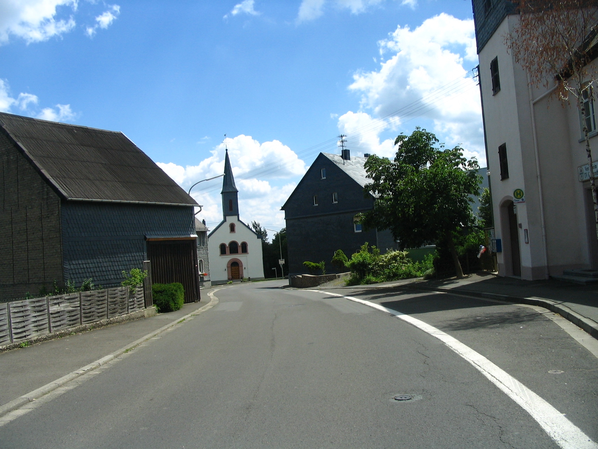
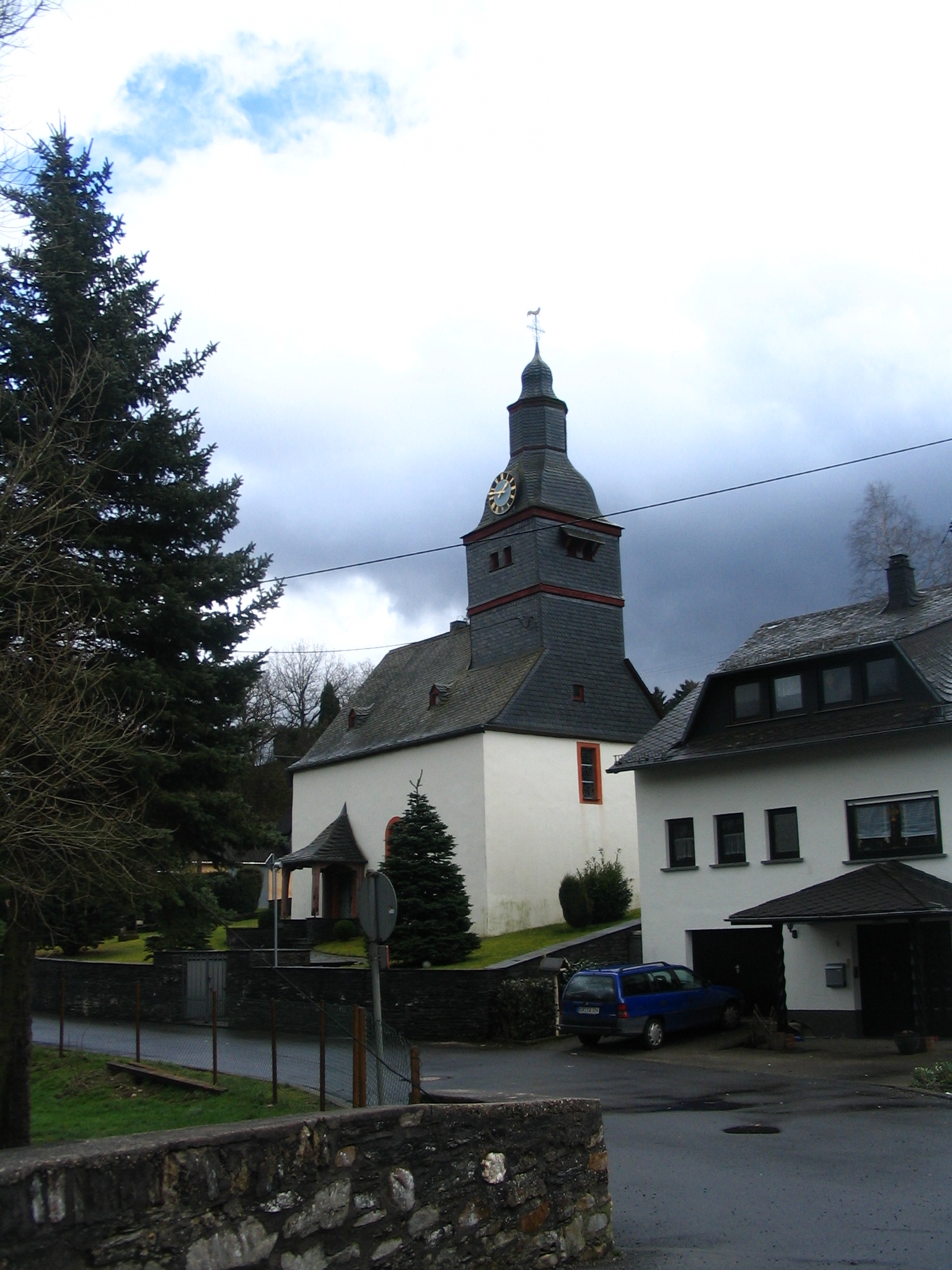
Herrstein-Rhaunen is a ''Verbandsgemeinde'' ("collective municipality") in the district of Birkenfeld, Rhineland-Palatinate, Germany. The seat of the ''Verbandsgemeinde'' is in Herrstein. It was formed on 1 January 2020 by the merger of the former ''Verbandsgemeinden'' Herrstein and Rhaunen. The ''Verbandsgemeinde'' Herrstein-Rhaunen consists of the following ''Ortsgemeinden'' ("local municipalities"): # Allenbach # Asbach # Bergen # Berschweiler bei Kirn # Bollenbach # Breitenthal # Bruchweiler # Bundenbach # Dickesbach # Fischbach # Gerach # Gösenroth # Griebelschied # Hausen # Hellertshausen # Herborn # Herrstein # Hettenrodt # Hintertiefenbach # Horbruch # Hottenbach # Kempfeld # Kirschweiler # Krummenau # Langweiler # Mackenrodt # Mittelreidenbach # Mörschied # Niederhosenbach # Niederwörresbach # Oberhosenbach # Oberkirn # Oberreidenbach # Oberwörresbach # Rhaunen # Schauren # Schmidthachenbach # Schwerbach # Sensweiler # Si ... [...More Info...] [...Related Items...] OR: [Wikipedia] [Google] [Baidu] |
Breitenthal, Rhineland-Palatinate
Breitenthal (Hunsrück) ( Hunsrückisch: ''Bränel'') is an ''Ortsgemeinde'' – a municipality belonging to a ''Verbandsgemeinde'', a kind of collective municipality – in the Birkenfeld district in Rhineland-Palatinate, Germany. It belongs to the ''Verbandsgemeinde'' of Herrstein-Rhaunen, whose seat is in Herrstein. Geography Location The municipality lies on the slope down from the Hunsrück into the Nahe valley south of the Idar Forest in an area facing east inside a bend in the river Hosenbach. In the southwest, the land slopes off steeply near the municipal limits into the Fischbach valley. Breitenthal's range of elevations is 187 m, from its lowest point of 330 m above sea level at the foot of the Schielenbach (), to its highest of 517 m above sea level in the Sangwald/Jungenwald (forest; ). Land use Breitenthal's total area measures 368 ha (3.68 km2), which breaks down thus: * Woodlands – 44.9% * Farmland – 43.3% * Residential and transport ... [...More Info...] [...Related Items...] OR: [Wikipedia] [Google] [Baidu] |
Gösenroth
Gösenroth is an ''Ortsgemeinde'' – a municipality belonging to a ''Verbandsgemeinde'', a kind of collective municipality – in the Birkenfeld district in Rhineland-Palatinate, Germany. It belongs to the ''Verbandsgemeinde'' Herrstein-Rhaunen, whose seat is in Herrstein. Geography Location The municipality lies in the Hunsrück, east of the Idar Forest. To its east is the Kyrbach valley. Gösenroth is a linear village (by some definitions of the word, a thorpe). Neighbouring municipalities Gösenroth's neighbours are Laufersweiler, Schwerbach, Rhaunen and Weitersbach. All but Laufersweiler, which lies in the Rhein-Hunsrück-Kreis, lie within the Birkenfeld district. History The oldest archaeological finds that yield evidence of settlement within what are now Gösenroth's limits come from the first and early second century AD. These finds were made in 1936 by the ''Landesmuseum Trier'' (Trier State Museum) on the road between Gösenroth and Schwerbach (bordering on Laufersweil ... [...More Info...] [...Related Items...] OR: [Wikipedia] [Google] [Baidu] |
Bundenbach
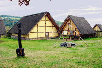
Bundenbach is an ''Ortsgemeinde'' – a municipality belonging to a ''Verbandsgemeinde'', a kind of collective municipality – in the Birkenfeld district of Rhineland-Palatinate, Germany. It belongs to the ''Verbandsgemeinde'' Herrstein-Rhaunen, whose seat is in Herrstein. For its roughly 400-million-year-old fossils of Placodermi and other creatures from the Devonian, Bundenbach is said to be a world-class fossil ''Lagerstätte''. Geography Location The municipality lies on the ''Hunsrück Schiefer- und Burgenstraße'' (“Hunsrück Slate and Castle Road”). Neighbouring municipalities The nearest major towns are Kirn, Idar-Oberstein and Simmern. Neighbouring municipalities are Rhaunen, Bollenbach, Schneppenbach and Bruschied. Constituent communities Also belonging to Bundenbach are the outlying homesteads of Neumühle and Reinhardsmühle. History The area was settled in protohistory, which is proven by digs undertaken by the Rheinisches Landesmuseum Trier (Trier Rhenis ... [...More Info...] [...Related Items...] OR: [Wikipedia] [Google] [Baidu] |
Mackenrodt
Mackenrodt is an ''Ortsgemeinde'' – a municipality belonging to a ''Verbandsgemeinde'', a kind of collective municipality – in the Birkenfeld district in Rhineland-Palatinate, Germany. It belongs to the ''Verbandsgemeinde'' Herrstein-Rhaunen, whose seat is in Herrstein. Geography The municipality lies west of the river Nahe in the Hunsrück. The municipal area is 64.6% wooded. To the southeast lies the town of Idar-Oberstein. History Mackenrodt has not always been the smallest municipality between the Idarbach and the Siesbach. In the 17th and 18th centuries, the village had more inhabitants than, for instance, Hettenrodt or Kirschweiler. Unearthed within Mackenrodt's limits have been a few archaeological finds from Treverian (the Treveri were a people of mixed Celtic and Germanic stock, from whom the Latin name for the city of Trier, ''Augusta Treverorum'', is also derived) and Roman times. However, this does not mean that today's village is as much as 2,000 years old. Beg ... [...More Info...] [...Related Items...] OR: [Wikipedia] [Google] [Baidu] |
Langweiler, Birkenfeld
Langweiler is an ''Ortsgemeinde'' – a municipality belonging to a ''Verbandsgemeinde'', a kind of collective municipality – in the Birkenfeld district in Rhineland-Palatinate, Germany. It belongs to the ''Verbandsgemeinde'' Herrstein-Rhaunen, whose seat is in Herrstein. For its particularly attractive location with a view of the Wildenburg (a nearby castle) and the Steinbachsee (a lake), the inhabitants sometimes call their municipality the ''Perle des Hochwalds'' (“Pearl of the High Forest”). Geography Location The municipality lies in the Hunsrück. The municipal area is 91.7% wooded. Langweiler's elevation is some 530 m above sea level. Constituent communities Also belonging to Langweiler is the outlying homestead of Forsthaus Langweiler. History The area that is now Langweiler must already have been settled in Roman times. When the children's home was being built in 1921, workers happened upon two cists, one of which had a wall around it. Among other grave goods ... [...More Info...] [...Related Items...] OR: [Wikipedia] [Google] [Baidu] |
Krummenau
Krummenau is an '' Ortsgemeinde'' – a municipality belonging to a ''Verbandsgemeinde'', a kind of collective municipality – in the Birkenfeld district in Rhineland-Palatinate, Germany. It belongs to the ''Verbandsgemeinde'' Herrstein-Rhaunen, whose seat is in Herrstein. Geography Location The municipality lies in the Hunsrück north of the 746 m-high Idarkopf in the Idar Forest. The municipal area is 61.6% wooded. The Idarbach flows through the village. Neighbouring municipalities Krummenau borders in the north on the municipality of Niederweiler, in the east on the municipality of Laufersweiler and in the west on the municipality of Horbruch. Constituent communities Also belonging to Krummenau is the outlying homestead of Weylandsmühle. History First documentary mention On 20 November 1086, Krummenau had its first documentary mention in a donation document From Archbishop Wezilo. A manuscript from the late 18th century – kept at the archi ... [...More Info...] [...Related Items...] OR: [Wikipedia] [Google] [Baidu] |
Kirschweiler
Kirschweiler is an ''Ortsgemeinde'' – a municipality belonging to a ''Verbandsgemeinde'', a kind of collective municipality – in the Birkenfeld district in Rhineland-Palatinate, Germany. It belongs to the ''Verbandsgemeinde'' Herrstein-Rhaunen, whose seat is in Herrstein. Geography Location The municipality lies a few kilometres northwest of Idar-Oberstein in the Hunsrück. The municipal area is 56% wooded. Neighbouring municipalities Kirschweiler's neighbours besides Idar-Oberstein are Hettenrodt and Kempfeld with its outlying centre of Katzenloch. Constituent communities Also belonging to Kirschweiler are the outlying homesteads of Auf der Lüh und Kirschweiler Mühle. History In 1272, Kirschweiler had its first documentary mention. Politics Municipal council The council is made up of 16 council members, who were elected by majority vote at the municipal election held on 7 June 2009, and the honorary mayor as chairman. Mayor Kirschweiler's mayor is Karl-Otto Dreher. C ... [...More Info...] [...Related Items...] OR: [Wikipedia] [Google] [Baidu] |
Kempfeld
Kempfeld is an ''Ortsgemeinde'' – a Municipalities of Germany, municipality belonging to a ''Verbandsgemeinde'', a kind of collective municipality – in the Birkenfeld (district), Birkenfeld Districts of Germany, district in Rhineland-Palatinate, Germany. It belongs to the ''Verbandsgemeinde'' Herrstein-Rhaunen, whose seat is in Herrstein. Geography Location The municipality lies on the ''Deutsche Edelsteinstraße'' (“German Gem Road”) in the southern Hunsrück between the Idar Forest in the north and the town of Idar-Oberstein in the south. Constituent communities Also belonging to Kempfeld are the Hamlet (place), hamlet of Katzenloch and the outlying homesteads of Auf dem Steinberg, Herrenflur and Wildenburg. Village’s name Kempfeld was originally settled by a man named Campo. On the other hand, other researchers derive the name from the Latin ''campus'', meaning field (and since ''Feld'' means the same, the name would therefore mean “Field Field”). This hypothesis ... [...More Info...] [...Related Items...] OR: [Wikipedia] [Google] [Baidu] |
Hottenbach
Hottenbach is an ''Ortsgemeinde'' – a municipality belonging to a ''Verbandsgemeinde'', a kind of collective municipality – in the Birkenfeld district in Rhineland-Palatinate, Germany. It belongs to the ''Verbandsgemeinde'' Herrstein-Rhaunen, whose seat is in Herrstein. Geography Location The municipality lies on the Ebesbach in the Hunsrück southeast of the Idar Forest. Neighbouring municipalities Hottenbach borders in the north on the municipality of Stipshausen, in the northeast on the municipalities of Rhaunen and Sulzbach, in the southeast on the municipality of Oberhosenbach, in the south on the municipalities of Weiden and Asbach, in the southwest on the municipality of Hellertshausen and in the west on the municipality of Morbach (Bernkastel-Wittlich district). Constituent communities Also belonging to Hottenbach is the outlying homestead of Hottenbacher Mühlen. History Village The first traces of human habitation go back to prehistoric times. Unearthed in the ... [...More Info...] [...Related Items...] OR: [Wikipedia] [Google] [Baidu] |
Horbruch
Horbruch is an ''Ortsgemeinde'' – a Municipalities of Germany, municipality belonging to a ''Verbandsgemeinde'', a kind of collective municipality – in the Birkenfeld (district), Birkenfeld Districts of Germany, district in Rhineland-Palatinate, Germany. It belongs to the ''Verbandsgemeinde'' Herrstein-Rhaunen, whose seat is in Herrstein. Geography Location The municipality lies in the Hunsrück northwest of the 746 m-high Idarkopf. The municipal area is 44.3% wooded, and its elevation is 460 m above sea level. Neighbouring municipalities Horbruch borders in the north on the municipality of Hirschfeld, Rhineland-Palatinate, Hirschfeld (Rhein-Hunsrück-Kreis), in the east on the municipality of Krummenau and in the west on the municipality of Hochscheid (Bernkastel-Wittlich district). Constituent communities Also belonging to Horbruch are the outlying homesteads of Bergmühle, Emmerichsmühle, Forsthaus Horbruch, Hockenmühle and Neumühle. History Archaeology, Arc ... [...More Info...] [...Related Items...] OR: [Wikipedia] [Google] [Baidu] |
Hintertiefenbach
Hintertiefenbach is an ''Ortsgemeinde'' – a municipality belonging to a ''Verbandsgemeinde'', a kind of collective municipality – in the Birkenfeld district in Rhineland-Palatinate, Germany. It belongs to the ''Verbandsgemeinde'' Herrstein-Rhaunen, whose seat is in Herrstein. Geography The municipality lies north of the river Nahe in a basin. Through it flows the like-named river, the Hintertiefenbach, among whose local tributaries are the Gilzbach, the Bach an der Bismarckeiche, the Waldbach and the Edemisbach. The municipal area measures 4.68 km², of which 54.3% is wooded. The municipality's elevation is 338 m above sea level. History In 1338, Hintertiefenbach had its first documentary mention under the name ''Inredyfinenbach''. The village then belonged, along with the other “abbey municipalities”, Gerach, Göttschied, and Regulshausen (Höhweiler and Ritzenberg) – the last two of which are now outlying centres of Idar-Oberstein – to the Mettlach Monaste ... [...More Info...] [...Related Items...] OR: [Wikipedia] [Google] [Baidu] |
Hettenrodt
Hettenrodt is an ''Ortsgemeinde'' – a municipality belonging to a ''Verbandsgemeinde'', a kind of collective municipality – in the Birkenfeld district in Rhineland-Palatinate, Germany. It belongs to the ''Verbandsgemeinde'' Herrstein-Rhaunen, whose seat is in Herrstein. Geography The municipality lies on the east side of a ridge between the Idarbach and the Siesbach in the Vorderhunsrück and borders directly on the town of Idar-Oberstein. The municipal area measures 532 ha, of which some 120 ha is state forest. The actual village itself covers 29 ha. The municipal area has a rather odd shape, which has given it its unusually long municipal limit of roughly 20 km. The village centrepoint has an elevation of 410 m above sea level, and the municipality's highest point, the fort near Kirschweiler, lies at 623 m above sea level. Hettenrodt lies on the ''Deutsche Edelsteinstraße'' (“German Gem Road”) and within both the ''Naturpark Saar-Hunsrück' ... [...More Info...] [...Related Items...] OR: [Wikipedia] [Google] [Baidu] |


