|
Hempsted
Hempsted is a suburban village and former civil parish, now in the unparished area of Gloucester, in the Gloucester district, in the county of Gloucestershire, England. In 1961 the parish had a population of 508. History An ancient area of Gloucester, Hempsted was just outside the City. The fine Norman church of St. Swithun was built and paid for by Norman noblemen. The churchyard contains the chest tomb of John Freeman, a Royalist officer, shot at the siege of Gloucester in 1643. During the Middle Ages a persecuted Augustinian monastic order came out of Wales and settled at Hempsted with the blessing of the City authorities. They founded Llanthony Secunda Priory and Hempsted became an estate of the priory. The church was extended with a new vestry and a west gallery was added as well as new pews and re-roofing to the design of G.V.Maddox of Monmouth in 1839. Maddox died at the rectory in Hempsted on 27 February 1864. On 1 April 1966 the parish was abolished and became part ... [...More Info...] [...Related Items...] OR: [Wikipedia] [Google] [Baidu] |
Hempsted Court
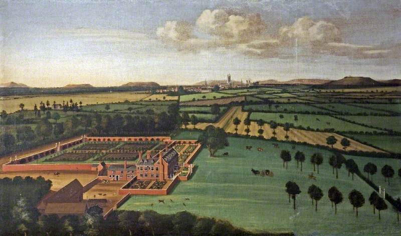
Hempsted Court was a country house at Hempsted near Gloucester Gloucester ( ) is a cathedral city and the county town of Gloucestershire in the South West of England. Gloucester lies on the River Severn, between the Cotswolds to the east and the Forest of Dean to the west, east of Monmouth and east ... in England. It was the home of the Lysons family. British History Online. Retrieved 3 May 2019. It was demolished in 1962 and replaced by a housing estate. See also * Bristol RoadReferences External links * Cou ...[...More Info...] [...Related Items...] OR: [Wikipedia] [Google] [Baidu] |
Our Lady's Well, Hempsted
Our Lady's Well (also known as Saint Anne's Well) is a holy well house in Hempsted, Gloucester. It was designated as a Grade I listed building in January 1955. History The well house was built in the 14th century for the Manor of Hempsted, which was held by Llanthony Secunda. The well house is a tall structure built from Limestone blocks with an arched opening at the front. Water issues from the front into a large stone trough. The rectangular water trough was added in the 18th or 19th century, and would have provided water for livestock. On the back of the well is a stone sculpture showing Saint Anne standing between her daughter, the virgin Mary, and an Angel. It has been used as a baptistery, and formerly was considered to have medicinal properties. In the past it has been a place for pilgrimage, with countless pilgrims being recorded as coming to the site to seek cures. Pilgrimage was revived in 1989 for several years but has now ceased. The well is now dry. Ancient earthwor ... [...More Info...] [...Related Items...] OR: [Wikipedia] [Google] [Baidu] |
George Vaughan Maddox
George Vaughan Maddox (1802–27 February 1864) was a nineteenth-century British architect and builder, whose work was undertaken principally in the town of Monmouth, Wales, and in the wider county. Working mainly in a Neo-Classical style, his extensive output made a significant contribution to the Monmouth townscape. The architectural historian John Newman considers that Monmouth owes to Maddox "its particular architectural flavour. For two decades from the mid-1820s he put up a sequence of public buildings and private houses in the town, in a style deft, cultured, and only occasionally unresolved." The Market Hall and 1-6 Priory Street are considered his "most important projects". Life and works Maddox was born in 1802, the son of a builder, John Maddox, who also worked in the county. Howard Colvin suggests he was related to George Maddox. Maddox undertook a range of building commissions, including public works, churches and private domestic and commercial buildings. P ... [...More Info...] [...Related Items...] OR: [Wikipedia] [Google] [Baidu] |
Quedgeley
Quedgeley is a suburban town of Gloucester, located 3.5 miles (5.6 km) southwest of the city centre, in the county of Gloucestershire, England. A thin strip of land between the Severn and the Gloucester Ship Canal occupies the west, and the south-eastern part of the town is Kingsway Village, directly to the north of which is Tuffley. The civil parish of Quedgeley was transferred to Gloucester district in 1991 and is the only town within the city. The 2011 census recorded a population of 17,519Office for National Statistics 2011 census - Quedgeley civil parish - population density for the parish, which has an area of . Since the 1980s Quedgeley has become increasingly contiguous wit ... [...More Info...] [...Related Items...] OR: [Wikipedia] [Google] [Baidu] |
City Of Gloucester
Gloucester ( ) is a cathedral city and the county town of Gloucestershire in the South West of England. Gloucester lies on the River Severn, between the Cotswolds to the east and the Forest of Dean to the west, east of Monmouth and east of the border with Wales. Including suburban areas, Gloucester has a population of around 132,000. It is a port, linked via the Gloucester and Sharpness Canal to the Severn Estuary. Gloucester was founded by the Romans and became an important city and ''colony'' in AD 97 under Emperor Nerva as '' Colonia Glevum Nervensis''. It was granted its first charter in 1155 by Henry II. In 1216, Henry III, aged only nine years, was crowned with a gilded iron ring in the Chapter House of Gloucester Cathedral. Gloucester's significance in the Middle Ages is underlined by the fact that it had a number of monastic establishments, including: St Peter's Abbey founded in 679 (later Gloucester Cathedral), the nearby St Oswald's Priory, Gloucester fo ... [...More Info...] [...Related Items...] OR: [Wikipedia] [Google] [Baidu] |
Gloucester
Gloucester ( ) is a cathedral city and the county town of Gloucestershire in the South West of England. Gloucester lies on the River Severn, between the Cotswolds to the east and the Forest of Dean to the west, east of Monmouth and east of the border with Wales. Including suburban areas, Gloucester has a population of around 132,000. It is a port, linked via the Gloucester and Sharpness Canal to the Severn Estuary. Gloucester was founded by the Romans and became an important city and '' colony'' in AD 97 under Emperor Nerva as '' Colonia Glevum Nervensis''. It was granted its first charter in 1155 by Henry II. In 1216, Henry III, aged only nine years, was crowned with a gilded iron ring in the Chapter House of Gloucester Cathedral. Gloucester's significance in the Middle Ages is underlined by the fact that it had a number of monastic establishments, including: St Peter's Abbey founded in 679 (later Gloucester Cathedral), the nearby St Oswald's Priory, Glo ... [...More Info...] [...Related Items...] OR: [Wikipedia] [Google] [Baidu] |
Llanthony Secunda
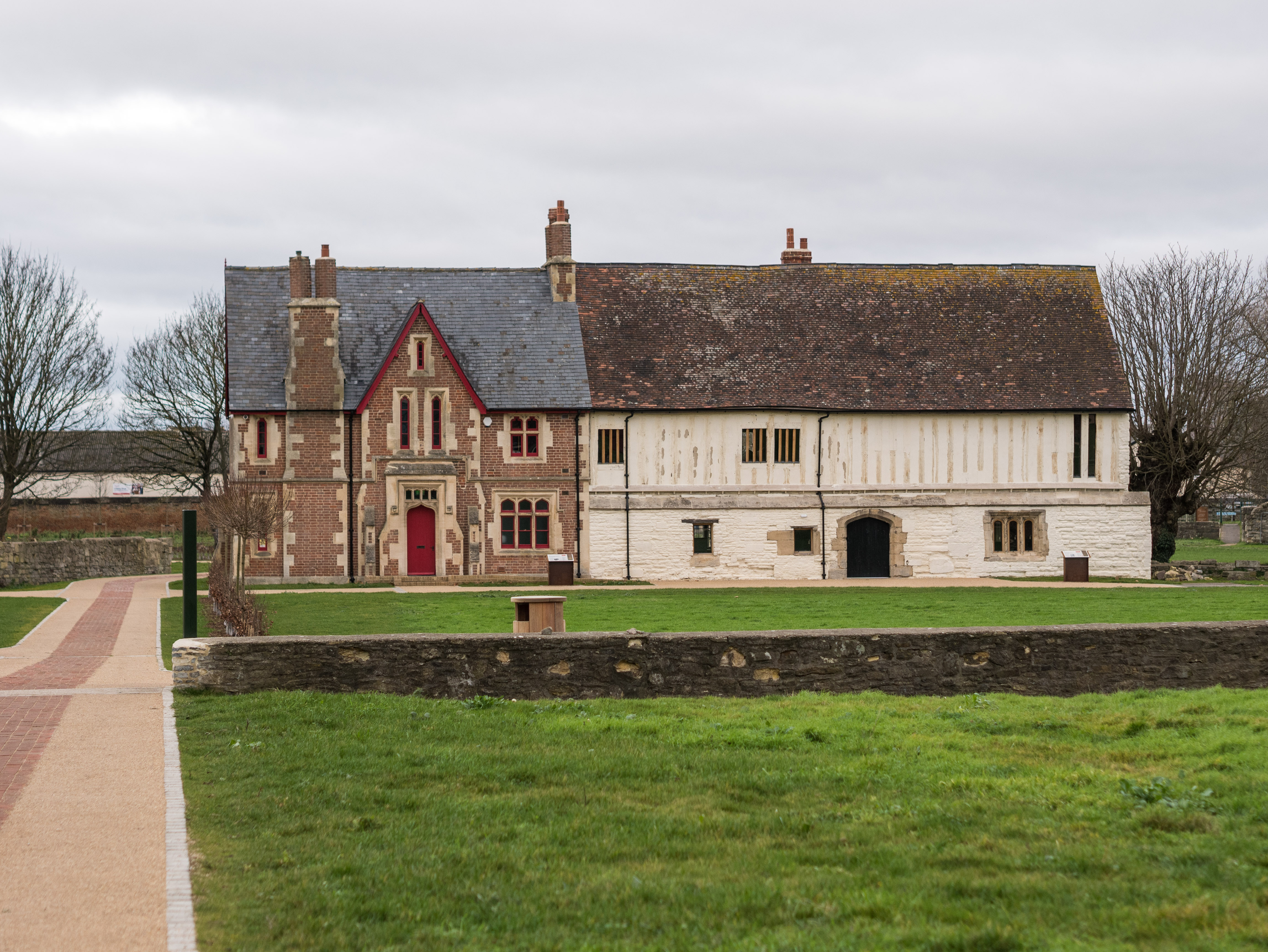
Llanthony Secunda Priory was a house of Augustinian canons in the parish of Hempsted, Gloucestershire, England, situated about 1/2 a mile south-west of Gloucester Castle in the City of Gloucester. It was founded in 1136 by Miles de Gloucester, 1st Earl of Hereford, a great magnate based in the west of England and the Welsh Marches, hereditary Constable of England and Sheriff of Gloucestershire (who resided at Gloucester Castle), as a secondary house and refuge for the canons of Llanthony Priory in the Vale of Ewyas, within his Lordship of Brecknock in what is now Monmouthshire, Wales. The surviving remains of the Priory were designated as Grade I listed in 1952 and the wider site is a scheduled ancient monument. In 2013 the Llanthony Secunda Priory Trust received funds for restoration work which was completed in August 2018 when it re-opened to the public. History In 1135 after persistent attacks from the local Welsh population, the monks of Llanthony Priory retreated to Glouceste ... [...More Info...] [...Related Items...] OR: [Wikipedia] [Google] [Baidu] |
Gloucester City A
Gloucester ( ) is a cathedral city and the county town of Gloucestershire in the South West of England. Gloucester lies on the River Severn, between the Cotswolds to the east and the Forest of Dean to the west, east of Monmouth and east of the border with Wales. Including suburban areas, Gloucester has a population of around 132,000. It is a port, linked via the Gloucester and Sharpness Canal to the Severn Estuary. Gloucester was founded by the Romans and became an important city and ''colony'' in AD 97 under Emperor Nerva as '' Colonia Glevum Nervensis''. It was granted its first charter in 1155 by Henry II. In 1216, Henry III, aged only nine years, was crowned with a gilded iron ring in the Chapter House of Gloucester Cathedral. Gloucester's significance in the Middle Ages is underlined by the fact that it had a number of monastic establishments, including: St Peter's Abbey founded in 679 (later Gloucester Cathedral), the nearby St Oswald's Priory, Glouceste ... [...More Info...] [...Related Items...] OR: [Wikipedia] [Google] [Baidu] |
Gloucester And Sharpness Canal
The Gloucester and Sharpness Canal (also known as the Gloucester and Berkeley Canal) is a ship canal in the west of England, between Gloucester and Sharpness; for much of its length it runs close to the tidal River Severn, but cuts off a significant loop in the river, at a once-dangerous bend near Arlingham. It was once the broadest and deepest canal in the world. The canal is long. Canal planning and construction Conceived in the canal mania period of the late 18th century, the Gloucester and Berkeley Ship Canal scheme (as it was originally named) was started by architect and civil engineer Robert Mylne. In 1793 an Act of Parliament was obtained authorising the raising of a total of £200,000.Hadfield (1969), p.342 The project rapidly encountered financial difficulties – to such an extent that Mylne left the project in 1798. By mid-1799 costs had reached £112,000 but only of the canal had been completed.Hadfield (1969), p.344 Robert Mylne's role was taken over by J ... [...More Info...] [...Related Items...] OR: [Wikipedia] [Google] [Baidu] |
2007 United Kingdom Floods
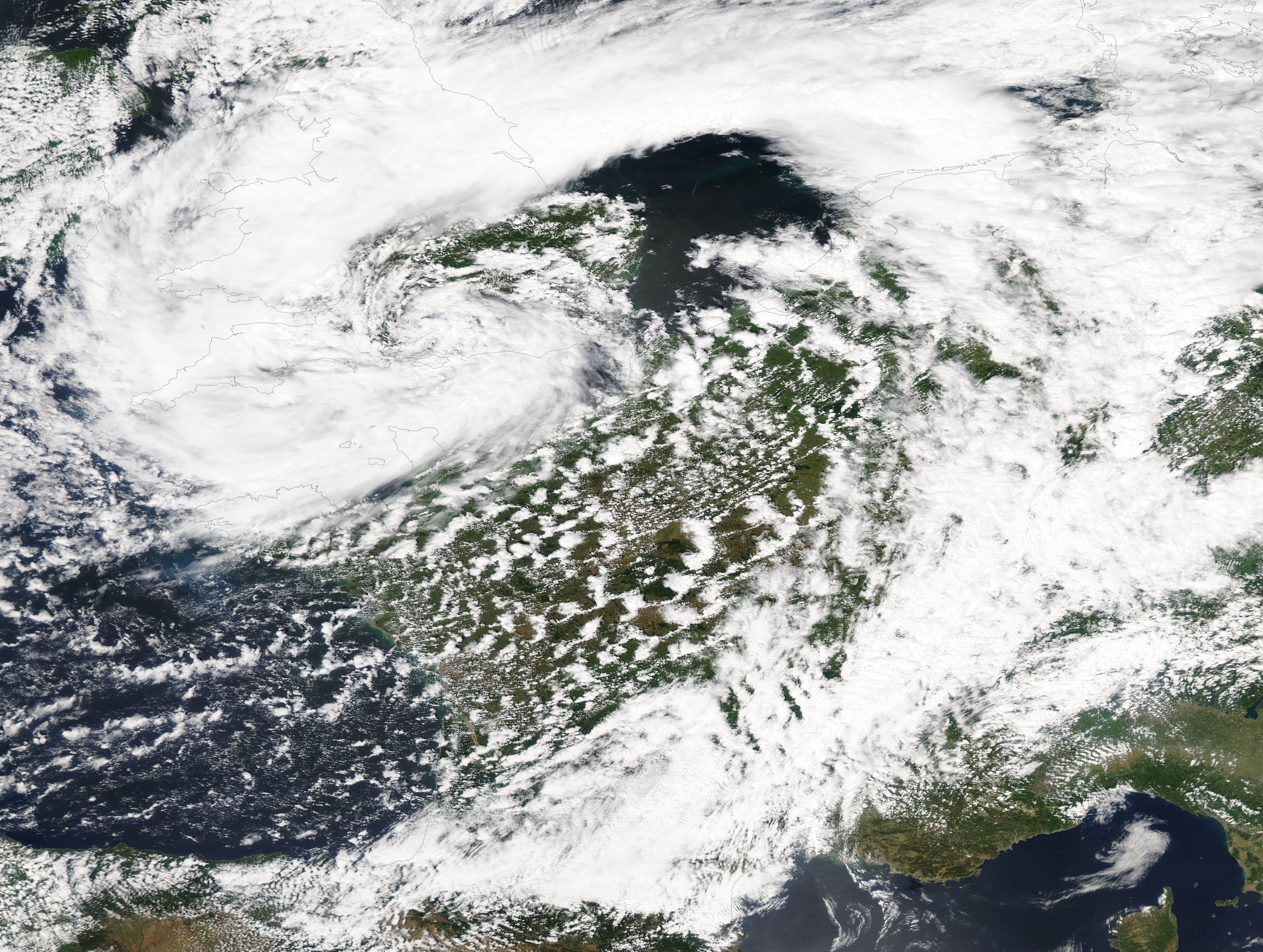
A series of large floods occurred in parts of the United Kingdom during the summer of 2007. The worst of the flooding occurred across Scotland on 14 June; East Yorkshire and the Midlands on 15 June; Yorkshire, the Midlands, Gloucestershire, Herefordshire and Worcestershire on 25 June; and Gloucestershire, Herefordshire, Worcestershire, Oxfordshire, Berkshire and South Wales on 28 July 2007. June was one of the wettest months on record in Britain (see List of weather records). Average rainfall across the country was ; more than double the June average. Some areas received a month's worth of precipitation in 24 hours. It was Britain's wettest May–July period since records began in 1776. July had unusually unsettled weather and above-average rainfall through the month, peaking on 20 July as an active frontal system dumped more than of rain in southern England. Civil and military authorities described the June and July rescue efforts as the biggest in peacetime Britain. The Envi ... [...More Info...] [...Related Items...] OR: [Wikipedia] [Google] [Baidu] |
Cycling Infrastructure
Cycling infrastructure is all infrastructure cyclists are allowed to use. Bikeways include bike paths, bike lanes, cycle tracks, rail trails and, where permitted, sidewalks. Roads used by motorists are also cycling infrastructure, except where cyclists are barred such as many freeways/motorways. It includes amenities such as bike racks for parking, shelters, service centers and specialized traffic signs and signals. The more cycling infrastructure, the more people get about by bicycle. Good road design, road maintenance and traffic management can make cycling safer and more useful. Settlements with a dense network of interconnected streets tend to be places for getting around by bike. Their cycling networks can give people direct, fast, easy and convenient routes. History The history of cycling infrastructure starts from shortly after the bike boom of the 1880s when the first short stretches of dedicated bicycle infrastructure were built, through to the rise of the ... [...More Info...] [...Related Items...] OR: [Wikipedia] [Google] [Baidu] |
Highnam
Highnam is a village and civil parish on the outskirts of the city of Gloucester. It is three miles northwest of the city on the A40, on the way to Ross, west of Alney Island and Over Bridge. It is connected by Segregated Bicycle Paths via Over Bridge and Alney Island to Gloucester. The parish includes the villages of Lassington and Over. In the 2001 census the parish had a population of 2,014, reducing to 1,916 at the 2011 census. Highnam was originally made up of farm land, which explains some of its street names (Brimsome Meadow, Poppy Field, Stoney Field, Long Field, Peters Field, Williams Orchard, et al.). As a village, Highnam is fairly small, containing few social amenities. These include the Church of the Holy Innocents, a school (Highnam C of E Primary), a village hall, a day nursery, a village shop and a doctor's surgery. The Arnold family were Lords of the Manor in the sixteenth century- the best known member of the family is Sir Nicholas Arnold (died 1580), Lord ... [...More Info...] [...Related Items...] OR: [Wikipedia] [Google] [Baidu] |

_drawn_and_engraved_under_the_direction_of_Edward_Wedlake_Brayley.jpg)


