|
Harilaid
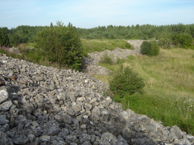
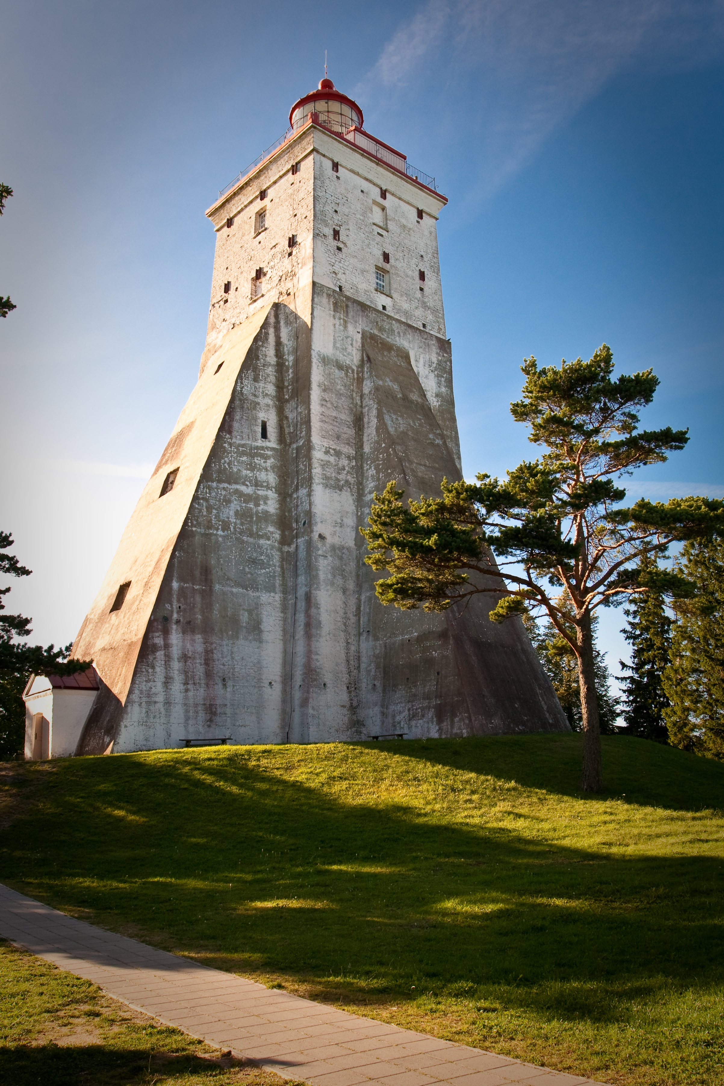
Harilaid Peninsula is a peninsula on the northwest coast of the island of Saaremaa in Estonia. It should not be confused with the islet of Harilaid which lies between the islands of Vormsi and Hiiumaa. Harilaid covers an area of and is low lying (the highest elevation is ). It is connected to the mainland by a wide neck of land, and was a separate island until the end of the 17th century. Large numbers of birds stop on Harilaid on their migration route, and there is a resting site of grey seals on the west coast. There is a large pine plantation on the peninsula, started in the 1970s and inhabited by elk and wild boar. The peninsula was added to the Vilsandi National Park in 1993. There is no record of a settled population on the peninsula. The Kiipsaare Lighthouse was built at the tip of the peninsula in 1933. At that time the lighthouse was almost inland, but it is now a few metres offshore. It is now unused and has a pronounced lean as a result of erosion. The Estonia ... [...More Info...] [...Related Items...] OR: [Wikipedia] [Google] [Baidu] |
Harilaid (islet)
 Harilaid (Swedish language, Swedish ''Hares'', formerly ''Gräsö'') is a small uninhabited island in Estonia. It lies about west of the island of Vormsi. It should not be confused with the larger former island of Harilaid that is now a peninsula on the northwest coast of the island of Saaremaa.
Harilaid has an area of . Its highest point is above sea level. The island is stony, with a covering of juniper.
A lighthouse was first built on Harilaid in 1849. The present lighthouse is high.
{{Islands of Estonia
Uninhabited islands of Estonia
Vormsi Parish
Estonian islands in the Baltic ...
[...More Info...] [...Related Items...] OR: [Wikipedia] [Google] [Baidu] |
Kiipsaare Lighthouse
Kiipsaare Lighthouse is located on the tip of the Harilaid peninsula on the island of Saaremaa, Estonia, in the territory of Vilsandi National Park. The lighthouse was built from reinforced concrete in 1933. Its purpose was to warn mariners on the Baltic Sea about the dangers in the vicinity of the peninsula and to be of assistance in taking bearings. At that time the lighthouse was inland, but due to erosion it is now more than offshore. A lack of supporting ground has caused the lighthouse to lean.Eesti Loodus, Kiipsaare rannad ja tuletorn , K. Orviku, H. Tõnisson 2009. 5: 6–13. [...More Info...] [...Related Items...] OR: [Wikipedia] [Google] [Baidu] |
Vilsandi National Park
__NOTOC__ Vilsandi National Park ( et, Vilsandi rahvuspark) is a marine protected area in Saare County, Estonia. It includes part of the island of Vilsandi, a number of smaller islands, adjacent parts of western Saaremaa and the Harilaid peninsula on Saaremaa, all in Kihelkonna Parish and Lääne-Saare Parish. History The park grew from a bird reserve founded in 1910. It is a highly sensitive ecosystem due to the use of the area as stop-over by many migratory birds, like barnacle geese and Steller's eider, and as a breeding and nesting ground for over 247 species of birds, of which the most common is the eider duck. One third of all protected plant species in Estonia can also be found in the national park. Hunting is absolutely prohibited. This park is a popular tourist destination for both Estonians and foreign visitors, particularly from Finland. See also * Protected areas of Estonia * List of national parks in the Baltics * List of protected areas of Estonia * List of Ra ... [...More Info...] [...Related Items...] OR: [Wikipedia] [Google] [Baidu] |
Saaremaa
Saaremaa is the largest island in Estonia, measuring . The main island of Saare County, it is located in the Baltic Sea, south of Hiiumaa island and west of Muhu island, and belongs to the West Estonian Archipelago. The capital of the island is Kuressaare, which in January 2018 had 13,276 inhabitants. The whole island had a recorded population in January 2020 of 31,435. Etymology In old Scandinavian sources, Saaremaa is called ''Eysysla'' and in the Icelandic Sagas ''Eysýsla'' (Old Norse: ), meaning "the district (land) of island". The island is called ''Saaremaa'' in Estonian language, Estonian, and in Finnish language, Finnish ''Saarenmaa''—literally "isle land" or "island land",Toomse, Liine. "10 Estonian Islands You Should Visit." http://www.traveller.ee/blog/tallinn/10-estonian-islands-you-should-visit. Retrieved 8 March 2016. i.e. the same as the Scandinavian name for the island. The old Scandinavian name is also the origin of the island's name in Danish language, D ... [...More Info...] [...Related Items...] OR: [Wikipedia] [Google] [Baidu] |
Estonia
Estonia, formally the Republic of Estonia, is a country by the Baltic Sea in Northern Europe. It is bordered to the north by the Gulf of Finland across from Finland, to the west by the sea across from Sweden, to the south by Latvia, and to the east by Lake Peipus and Russia. The territory of Estonia consists of the mainland, the larger islands of Saaremaa and Hiiumaa, and over 2,200 other islands and islets on the eastern coast of the Baltic Sea, covering a total area of . The capital city Tallinn and Tartu are the two largest urban areas of the country. The Estonian language is the autochthonous and the official language of Estonia; it is the first language of the majority of its population, as well as the world's second most spoken Finnic language. The land of what is now modern Estonia has been inhabited by '' Homo sapiens'' since at least 9,000 BC. The medieval indigenous population of Estonia was one of the last " pagan" civilisations in Europe to adopt Ch ... [...More Info...] [...Related Items...] OR: [Wikipedia] [Google] [Baidu] |
Vormsi
Vormsi, also Ormsö ( sv, Ormsö, german: Worms) is the fourth-largest island of Estonia. It is located between Hiiumaa and the mainland and has a total area of . It is part of Vormsi Parish, a rural municipality. Etymology Ormsö in Swedish means "Orm's Island", and can be translated also as "Snake Island". The island's Estonian name Vormsi is derived from its German name Worms or its Swedish name Ormsö. History Vormsi's history dates back as far as the 13th century. During most of this time, the island was inhabited by Estonian Swedes ("rannarootslased" in Estonian or "coastal Swedes" in English), whose population reached 3,000 before World War II. During the war, nearly all of Vormsi's population, along with other Swedes living in Estonia, forming the larger region of Aiboland, were evacuated, or fled, to Sweden. The island's current registered population is about 400. Villages The villages on the island include: Hullo (the administrative center), Sviby (the main port ... [...More Info...] [...Related Items...] OR: [Wikipedia] [Google] [Baidu] |
Hiiumaa
Hiiumaa (, ) is the second largest island in Estonia and is part of the West Estonian archipelago, in the Baltic Sea. It has an area of 989 km2 and is 22 km from the Estonian mainland. Its largest town is Kärdla. It is located within Hiiu County. Names Hiiumaa is the main island of Hiiu County, called or in Estonian. The Swedish and German name of the island is or ('Day' island) and in Danish. In modern Finnish, it is called , literally 'Hiisi's Land'. In Russian it is known as (). In Old Gutnish, it was ('day isthmus'), from which the local North Germanic name is derived. History Prehistory Hiiumaa emerged from the Baltic Sea 8500 years ago due to isostatic uplift after the retreat of the ice cap. Mesolithic settlements are found on the island's Kõpu Peninsula from about 5500 BC. These settlements seem to be related mostly to seal hunting and extend into the earliest Neolithic. As Hiiumaa is constantly uplifting the local sea level was 20 m higher ... [...More Info...] [...Related Items...] OR: [Wikipedia] [Google] [Baidu] |
Grey Seals
The grey seal (''Halichoerus grypus'') is found on both shores of the North Atlantic Ocean. In Latin Halichoerus grypus means "hook-nosed sea pig". It is a large seal of the family Phocidae, which are commonly referred to as "true seals" or "earless seals". It is the only species classified in the genus ''Halichoerus''. Its name is spelled gray seal in the US; it is also known as Atlantic seal and the horsehead seal. Taxonomy There are two recognized subspecies of this seal: The type specimen of ''H. g. grypus'' (Zoological Museum of Copenhagen specimen ZMUC M11-1525, caught off the island of Amager, Danish part of the Baltic Sea) was believed lost for many years but was rediscovered in 2016, and a DNA test showed it belonged to a Baltic Sea specimen rather than from Greenland, as had previously been assumed (because it was first described in Otto Fabricius' book on the animals in Greenland: ''Fauna Groenlandica''). The name ''H. g. grypus'' was therefore transferred to the ... [...More Info...] [...Related Items...] OR: [Wikipedia] [Google] [Baidu] |
List Of Estonian War Films
This is the list of war films produced in Estonia during the period of independence from 1918 to 1940 and from 1991 and beyond. The first Estonian war film was produced in 1927.Most of the 2000s films have been taken from this sitEstonian Films Chronicle list 1920s 1930s 1940s 1990s 2000s 2010s Notes and references External linksEstonian Film {{DEFAULTSORT:Estonian War Films Lists of war films, Estonia Lists of Estonian films, War films ... [...More Info...] [...Related Items...] OR: [Wikipedia] [Google] [Baidu] |
Kihelkonna
Kihelkonna is a small borough ( et, alevik) in Saare County, on the western part of Saaremaa Island, Estonia. It was the administrative centre of Kihelkonna Parish (until 2017). Gallery File:Kihelkonna Mihkli kirik 2009.jpg, Kihelkonna St. Michael's Church File:Kihelkonna kalmistu.jpg, Kihelkonna cemetery File:Kihelkonna laululava.jpg, Kihelkonna bandstand File:Kihelkonna vallamaja.jpg, Local government building of Kihelkonna Parish Kihelkonna Parish was a municipality in Saare County, Estonia. The parish included the islands named Aherahu, Juksirahu, Kalarahu, Käkirahu, Laasirahu, Loonalaid, Maturahu, Mihklirahu, Noogimaa, Nootamaa, Ojurahu, Salava, Uus-Noota ... File:Кихельконна-1.JPG, Old bell tower File:Кихельконна-2.JPG, Altar in St. Michael's church References Boroughs and small boroughs in Estonia Populated places in Saare County {{Saare-geo-stub ... [...More Info...] [...Related Items...] OR: [Wikipedia] [Google] [Baidu] |
Saaremaa Parish
Saaremaa Municipality, also known as Saaremaa Rural Municipality ( et, Saaremaa vald), is a municipality in Saare County in western Estonia. It is the largest municipality in Estonia by land area. The administrative centre of the municipality is its only town Kuressaare. It is one of three parishes comprising the county, along with Muhu and Ruhnu Parish. It was formed following the 2017 Estonian municipal reform on 21 October 2017 on the basis of all twelve former Saaremaa municipalities: Kuressaare town and Kihelkonna, Laimjala, Leisi, Lääne-Saare, Mustjala, Orissaare, Pihtla, Pöide, Salme, Torgu and Valjala Valjala is a small borough (') in Saare County, Estonia, on the island of Saaremaa Saaremaa is the largest island in Estonia, measuring . The main island of Saare County, it is located in the Baltic Sea, south of Hiiumaa island and west o ... parishes. Gallery File:Saare municipalities 1992–1999.png, 1992–1999 File:Saare municipalities 1999–2014.png, ... [...More Info...] [...Related Items...] OR: [Wikipedia] [Google] [Baidu] |


