|
Hamworthy
Hamworthy is a village, parish, peninsula and suburb of Poole in Dorset, England. It is sited on a peninsula of approximately that is bordered by the town of Upton to the north, Poole Harbour to the south, Lytchett Bay to the west and Holes Bay to the east. Poole Bridge, the southern terminus of the A350 road, connects the suburb with the town centre. Hamworthy is the location of the Port of Poole ferry passenger terminal and cargo handling operations. Hamworthy had two local councillors in Poole Borough Council, one for Hamworthy East, and one for Hamworthy West. In Hamworthy there are six main areas, Rockley Park (where Royal Marines Poole and Holiday Park are), Turlin Moor Estate, Lower Hamworthy (where Poole Docks are), Cobbs Quay/Harbourside (Which looks out over Holes Bay), Lake Side (where the Metalbox Factory is located) and Central Hamworthy (Location of the Main Road, Co-Op and Church area). Hamworthy has a railway station, with a twice hourly South Western R ... [...More Info...] [...Related Items...] OR: [Wikipedia] [Google] [Baidu] |
Poole
Poole () is a large coastal town and seaport in Dorset, on the south coast of England. The town is east of Dorchester and adjoins Bournemouth to the east. Since 1 April 2019, the local authority is Bournemouth, Christchurch and Poole Council which is a unitary authority. Poole had an estimated population of 151,500 (mid-2016 census estimates) making it the second-largest town in the ceremonial county of Dorset. Together with Bournemouth and Christchurch, the conurbation has a total population of nearly 400,000. Human settlement in the area dates back to before the Iron Age. The earliest recorded use of the town's name was in the 12th century when the town began to emerge as an important port, prospering with the introduction of the wool trade. Later, the town had important trade links with North America and, at its peak during the 18th century, it was one of the busiest ports in Britain. In the Second World War, Poole was one of the main departing points for the Normandy l ... [...More Info...] [...Related Items...] OR: [Wikipedia] [Google] [Baidu] |
Hamworthy Railway Station
Hamworthy railway station serves Hamworthy, an area of Poole in Dorset, England. It is down the line from . History The station opened with the Southampton & Dorchester Railway, which later became part of the London and South Western Railway (LSWR), in 1847 as Poole Junction, being the junction of the main line with the spur to the port of Poole. At that time the line to then went via , and before following what is now the South West Main Line from . When the current Poole station opened in 1872, the station was renamed Hamworthy Junction and remained so until the 1970s. A causeway across Holes Bay opened in 1893 enabling through trains from London to Weymouth to serve Poole directly. Motive power depot A motive power depot with a coal stage was built at the station by the LSWR in 1847. It was closed by British Railways in 1954 and after several years in use as a storage facility, was eventually demolished. Services The station is served by South Western Railway who c ... [...More Info...] [...Related Items...] OR: [Wikipedia] [Google] [Baidu] |
Poole Harbour
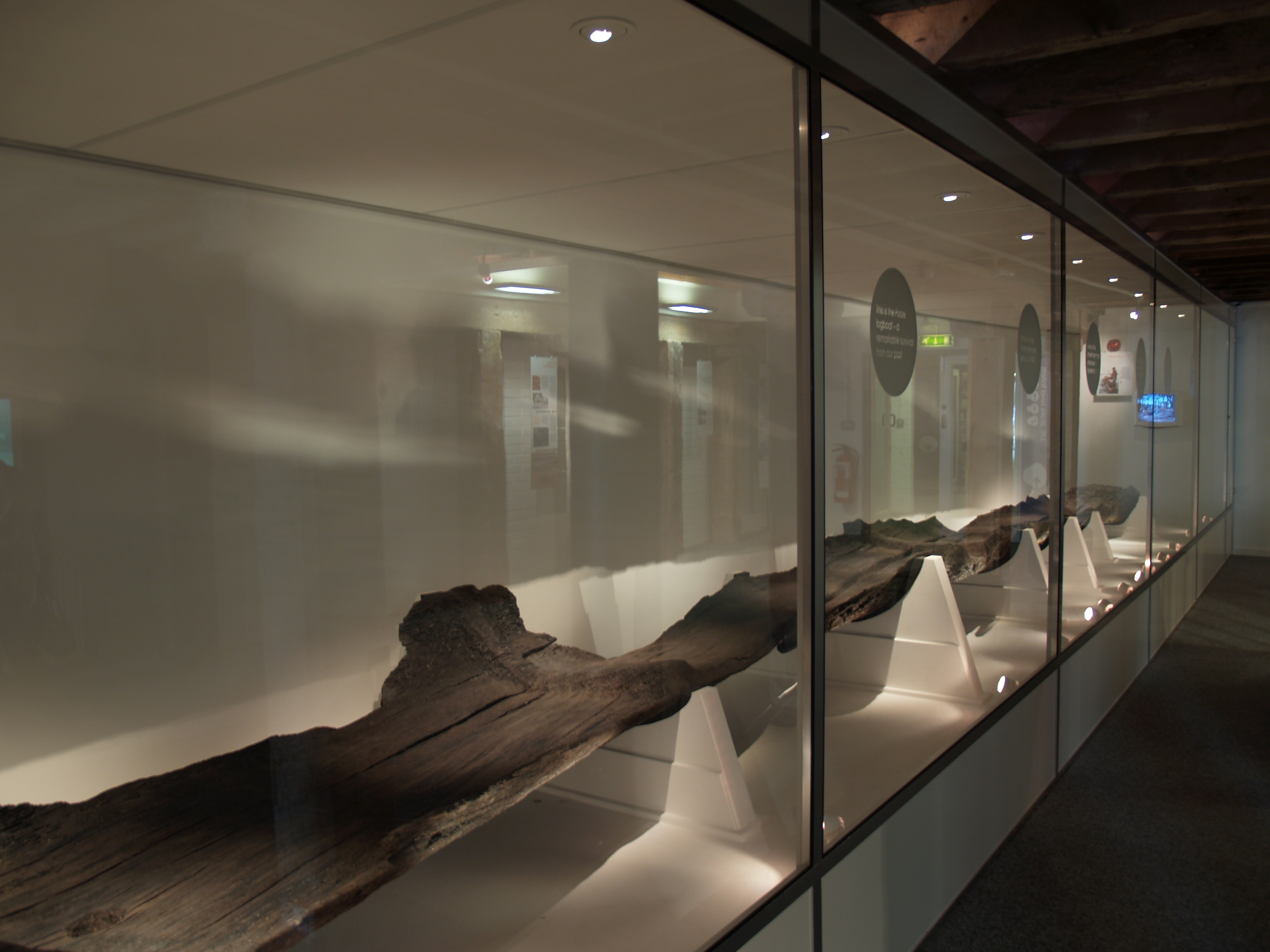
Poole Harbour is a large natural harbour in Dorset, southern England, with the town of Poole on its shores. The harbour is a drowned valley (ria) formed at the end of the last ice age and is the estuary of several rivers, the largest being the Frome. The harbour has a long history of human settlement stretching to pre-Roman times. The harbour is extremely shallow (average depth ), with one main dredged channel through the harbour, from the mouth to Holes Bay. Poole Harbour has an area of approximately . It is one of several which lay claim to the title of "second largest natural harbour in the world" (after Port Jackson, Sydney). History In 1964 during harbour dredging, the waterlogged remains of a 2000-year-old Iron Age logboat were found off Brownsea Island. Dated at about 295 BC, the Poole Logboat is one of the largest vessels of its type from British waters. Its low freeboard would have limited its use to within Poole Harbour. Poole was used by the Romans as an invasi ... [...More Info...] [...Related Items...] OR: [Wikipedia] [Google] [Baidu] |
Upton, Dorset
Upton is a town in south-east Dorset, England. Upton is to the east of Holton Heath and Upton Heath, and to the north of the Poole suburb of Hamworthy. It is the second largest town in the Purbeck Hills. Geography The town is built around a road junction where the Blandford to Hamworthy road crosses the main Poole to Dorchester road. The Poole suburbs of Hamworthy and Turlin Moor adjoin to the south, and Lytchett Minster village lies a short distance to the west. The town is bounded by several areas of open space. To the north, Upton Heath is a Site of Special Scientific Interest (SSSI), while, eastwards, Upton Wood and the former estate Upton Country Park separate the town from Holes Bay. To the south, Lytchett Bay is part of Poole Harbour SSSI. Although mostly residential, Upton features a small industrial estate with businesses including Southernprint. In 2000, The Upton Clock Tower was built at the Upton Crossroads to celebrate the new millennium and represent the t ... [...More Info...] [...Related Items...] OR: [Wikipedia] [Google] [Baidu] |
Poole (UK Parliament Constituency)
Poole is a constituency represented in the House of Commons of the UK Parliament since 1997 by Robert Syms, a Conservative. History The first version of the Poole constituency existed from 1455 until 1885. During this period its exact status was a parliamentary borough, sending two burgesses to Westminster per year, except during its last 17 years when its representation was reduced to one member. During its abeyance most of Poole was in the East Dorset seat and since its recreation in 1950 its area has been reduced as the harbour town's population has increased. Boundaries 1950–1983: The Municipal Borough of Poole. 1983–1997: The Borough of Poole wards of Broadstone, Canford Cliffs, Canford Heath, Creekmoor, Hamworthy, Harbour, Newtown, Oakdale, Parkstone, and Penn Hill. 1997–2010: The Borough of Poole wards of Bourne Valley, Canford Cliffs, Hamworthy, Harbour, Newtown, Oakdale, Parkstone, and Penn Hill. 2010–19: The Borough of Poole wards of Branksome West, C ... [...More Info...] [...Related Items...] OR: [Wikipedia] [Google] [Baidu] |
RM Poole
Royal Marines Base Poole (RM Poole) is a British naval base located in Hamworthy a suburb of Poole, Dorset, England on the Poole Harbour and is the centre for Special Boat Service activities. History The base was built in 1942 with the creation of RAF Hamworthy. In 1944, control of the site was handed over to the Royal Navy for use as a naval establishment. The site was known as HMS Turtle and was used for training personnel for the D-Day landings. In May 1944, the site was closed but a small number of personnel were retained for basic maintenance of the base. The site was re-opened and taken over by the Royal Marines in 1954 and became known as the Amphibious School, Royal Marines. In 1956, it was expanded and was renamed the Joint Service Amphibious Warfare Centre (JSAWC). In the early 1960s, it was renamed the Amphibious Training Unit Royal Marines (ATURM). The Technical Training Wing was moved from Eastney Barracks to Poole in 1973 and the base became known as the Royal Mari ... [...More Info...] [...Related Items...] OR: [Wikipedia] [Google] [Baidu] |
Poole Bridge
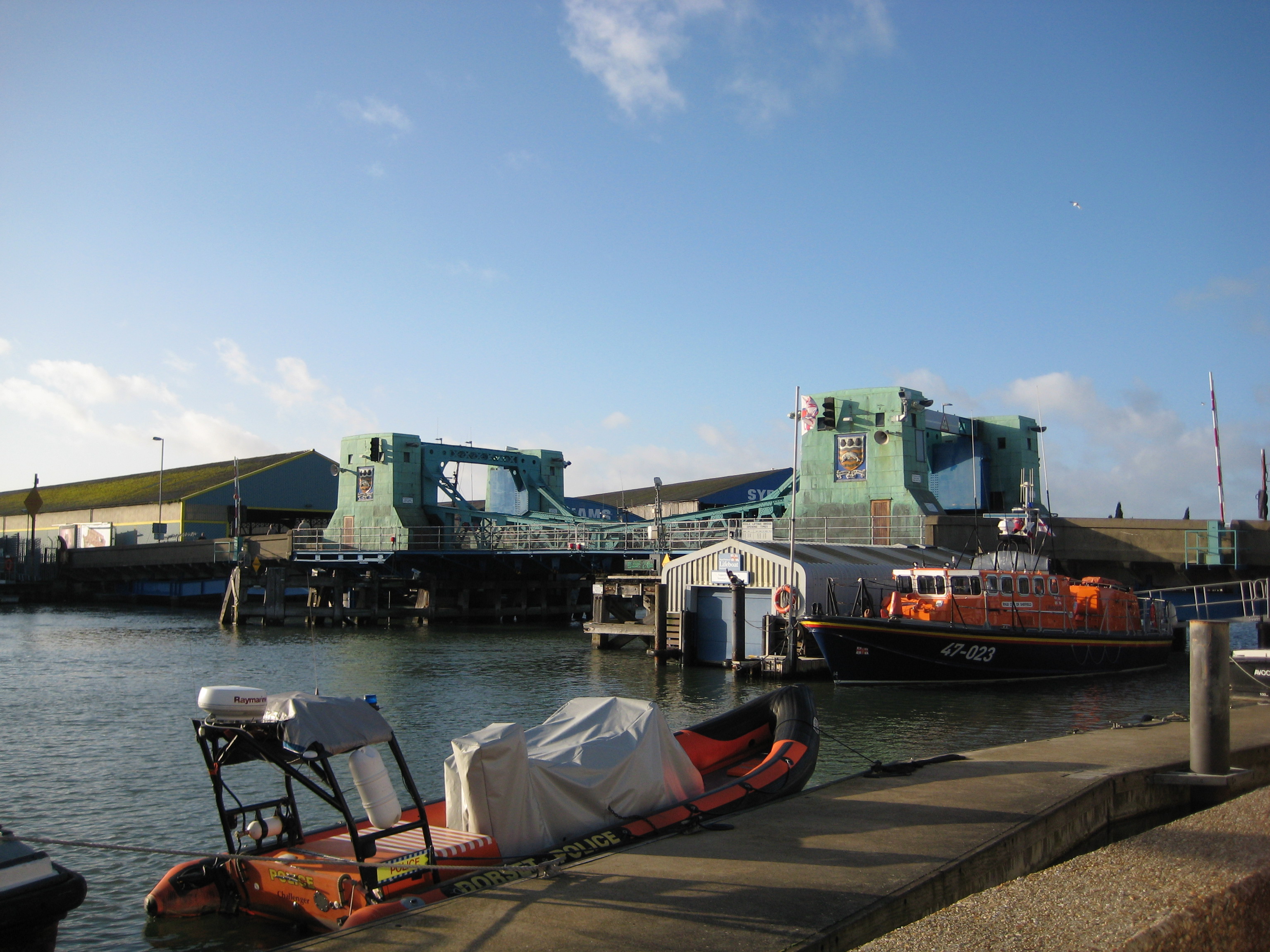
Poole Bridge (also known as Poole Lifting Bridge and Hamworthy Bridge) is a bascule bridge in Poole, Dorset, England. Constructed in 1927, the bridge provides a road link across a busy boating channel. In February 2012 a second bridge was completed intending to operate in conjunction with the existing bridge Location Poole Bridge is situated on the western end of Poole Quay and spans across a narrow channel between Poole Harbour and Holes Bay, a tidal inland lake which lies to the north of the harbour. The bridge provides a road link as part of the A350 road between Poole's town centre and the suburb of Hamworthy, avoiding a journey of around Holes Bay. History The existing bridge is the third to be located on the site. William Ponsonby, a Member of Parliament for Poole, was responsible for building the first bridge in 1834. Ponsonby promoted his own Act of Parliament to build the wooden toll bridge at a cost of £9,612. However, the bridge had a steep gradient that caused pr ... [...More Info...] [...Related Items...] OR: [Wikipedia] [Google] [Baidu] |
South West Main Line
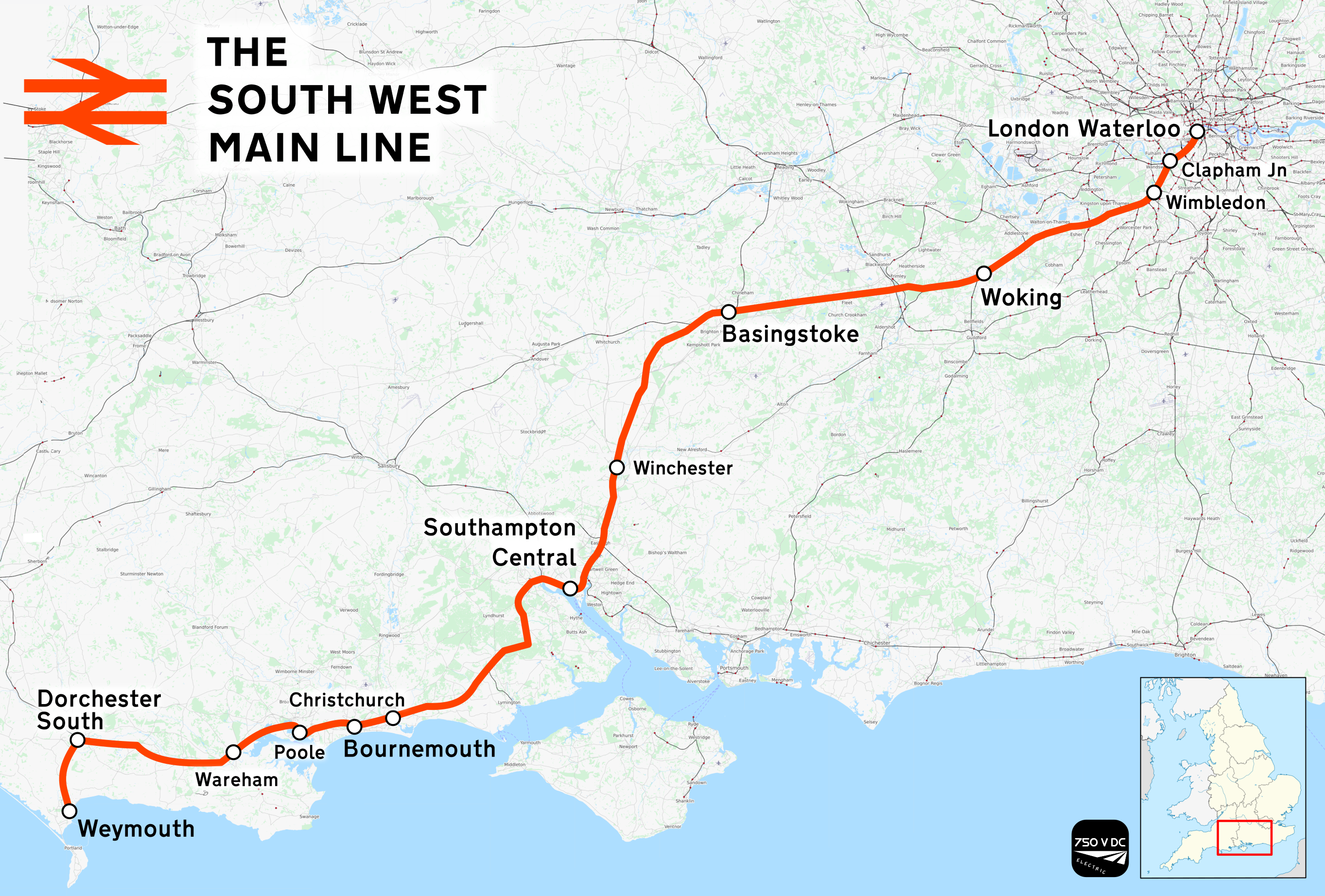
The South West Main Line (SWML) is a 143-mile (230 km) major railway line between Waterloo station in central London and Weymouth on the south coast of England. A predominantly passenger line, it serves many commuter areas including south western suburbs of London and the conurbations based on Southampton and Bournemouth. It runs through the counties of Surrey, Hampshire and Dorset. It forms the core of the network built by the London and South Western Railway, today mostly operated by South Western Railway. Network Rail refers to it as the South West Main Line. Operating speeds on much of the line are relatively high, with large stretches cleared for up to running. The London end of the line has as many as eight tracks plus the two Windsor Lines built separately, but this narrows to four by and continues this way until Worting Junction west of , from which point most of the line is double track. A couple of miles from the Waterloo terminus, the line runs briefly alongside ... [...More Info...] [...Related Items...] OR: [Wikipedia] [Google] [Baidu] |
Twin Sails Bridge
The Twin Sails Bridge (also known as The Second Harbour Crossing) is a double leaved bascule bridge in Poole, Dorset, England. The bridge provides a second road link from Poole Town Centre to Hamworthy. The intention is that the bridge will allow development of four major sites, two in Poole Town Centre and two in Hamworthy, including the old power station, which was closed in 1988. Location The bridge spans the Backwater Channel which links Holes Bay with Poole Harbour. The bridge and approach roads are connected to the junction of West Quay Road in the East and to urban feeder roads in the West. Design The new bridge is intended to operate alongside the existing Poole Bridge with one of the bridges always open for vehicular traffic (except during closures for maintenance or in a marine emergency), the intention is that variable-message signs will direct traffic to the open bridge. The bridge comprises a wide carriageway with two vehicular lanes and two separate cycle lanes. Ad ... [...More Info...] [...Related Items...] OR: [Wikipedia] [Google] [Baidu] |
South Western Railway (train Operating Company)
First MTR South Western Trains Limited, trading as South Western Railway (SWR), is a British train operating company owned by FirstGroup (70%) and MTR Corporation (30%) that operates the South Western franchise. During March 2017, it was announced that SWR had been awarded the South Western franchise. On 20 August 2017, it took over operations from the previous franchisee South West Trains. SWR operates commuter services from its Central London terminus at London Waterloo railway station, London Waterloo to south west London. SWR provides suburban services in the counties of Surrey, Hampshire and Dorset, as well as regional services in Devon, Somerset, Berkshire and Wiltshire. Its subsidiary Island Line (train operating company), Island Line operates services on the Isle of Wight. Rolling stock changes have included a comprehensive refurbishment of existing units and the acquisition of new-build British Rail Class 701, Class 701 units from Bombardier Transportation, Bombardier ... [...More Info...] [...Related Items...] OR: [Wikipedia] [Google] [Baidu] |
Poole Borough Council
Poole Borough Council was the unitary authority responsible for local government in the Borough of Poole, Dorset, England. It was created on 1 April 1997 following a review by the Local Government Commission for England (1992), becoming administratively independent from Dorset County Council, and ceased to exist on 1 April 2019. Its council comprised 16 wards and 42 councillors and was controlled by a Conservative administration before it was merged into Bournemouth, Christchurch and Poole Council. The council was based at Poole Civic Centre. In February 2018 the 'Future Dorset' plan was approved by the Secretary of State for Housing, Communities and Local Government Sajid Javid, which meant that Bournemouth, Christchurch and Poole borough councils were merged into one unitary authority in April 2019. Composition {{Further, Poole local elections 42 councillors were elected across 16 wards and there were elections every four years. The last election, in May 2015, resulted in a Co ... [...More Info...] [...Related Items...] OR: [Wikipedia] [Google] [Baidu] |
Badbury Rings
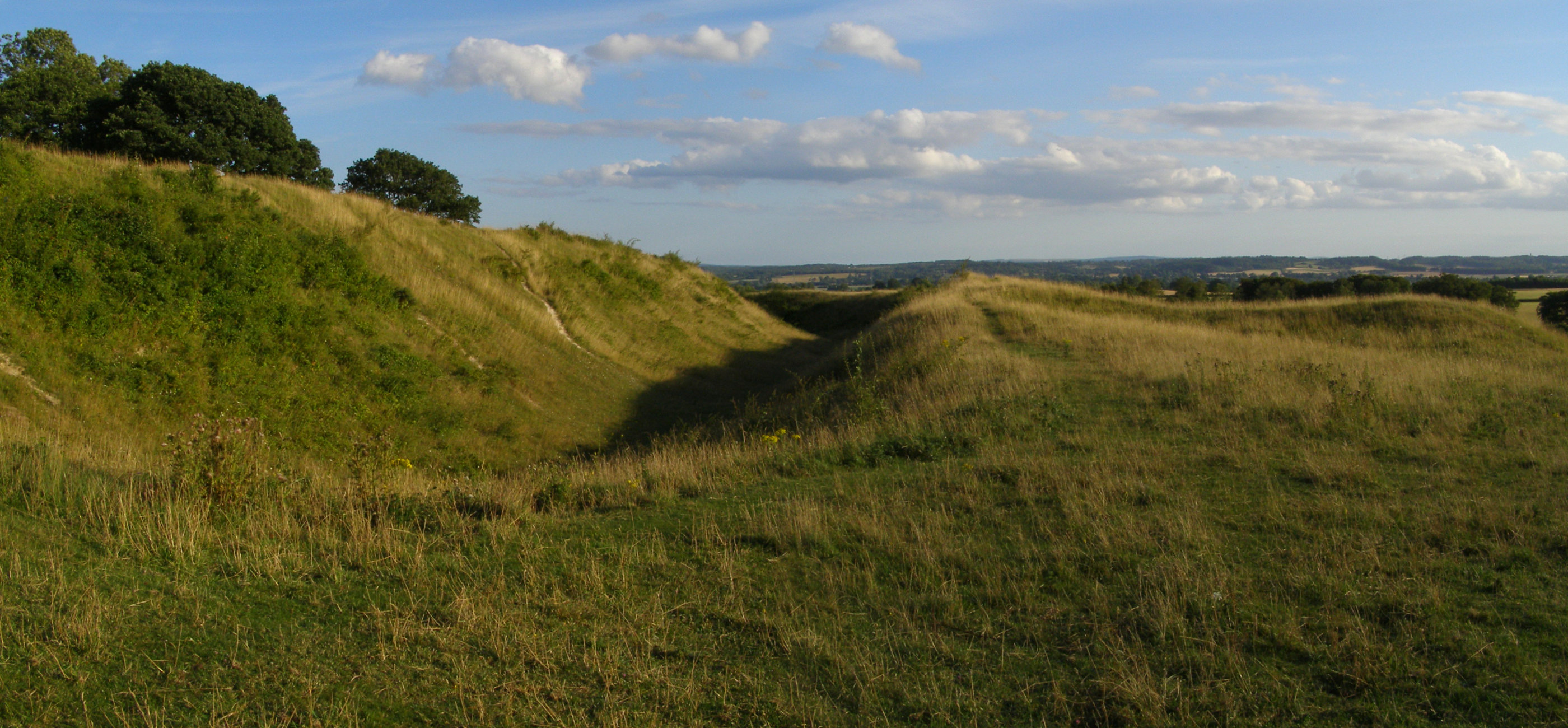
Badbury Rings is an Iron Age hill fort and Scheduled Monument in east Dorset, England. It was in the territory of the Durotriges. In the Roman era a temple was located immediately west of the fort, and there was a Romano-British town known as ''Vindocladia'' a short distance to the south-west. Iron Age Badbury Rings sits above sea level. There are two main phases of construction; the first covered and was defended by multiple ditches, while the second was more than twice the size, covering and defended by a single ditch and rampart. Bronze Age round barrows in the vicinity demonstrate an earlier use of the area. Until 1983 Badbury Rings was privately owned as part of the Kingston Lacy estate, and the owners discouraged investigation of the site. The site now belongs to the National Trust. A survey of the hillfort by the RCHME was begun in 1993. The summit area was cleared of undergrowth by the National Trust in 1997 and the conifer plantation was thinned out. This allowed th ... [...More Info...] [...Related Items...] OR: [Wikipedia] [Google] [Baidu] |


