|
Haldi River
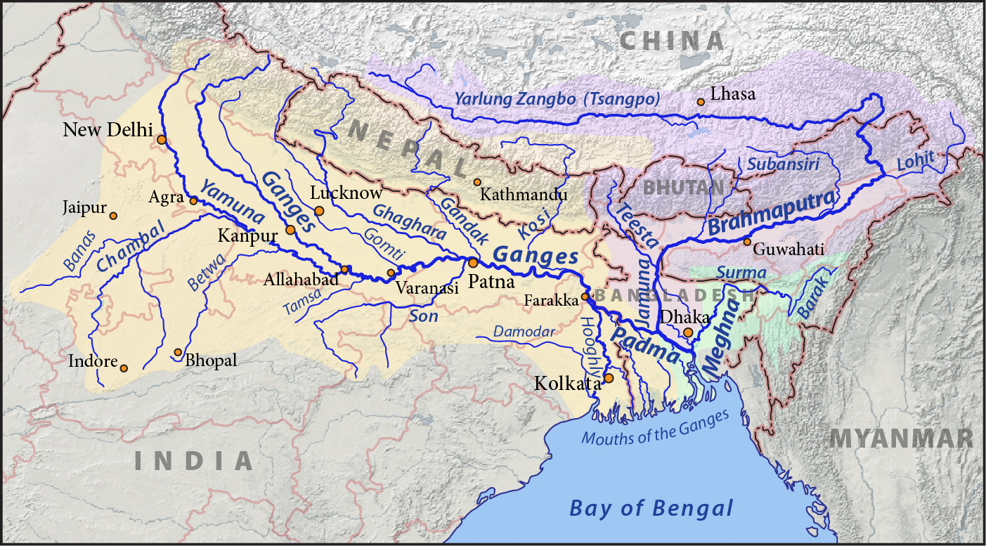
Haldi River is a tributary of Hooghly River flowing through Purba Medinipur district of the Indian state of West Bengal. The Keleghai joins the Kansai at Tangrakhali under Nandakumar Police Station in Tamluk subdivision. The combined stream is called Haldi River. It is long. It is the last major river to flow into the Hooghly before the latter flows into the sea. The Haldi joins the Hooghly at the industrial town of Haldia. See also *List of rivers of India *Rivers of India The rivers in India play an important role in the lives of its people. They provide potable water, cheap transportation, electricity, and the livelihood for many people nationwide. This easily explains why nearly all the major cities of India are l ... References Rivers of West Bengal Rivers of India {{India-river-stub ... [...More Info...] [...Related Items...] OR: [Wikipedia] [Google] [Baidu] |
India
India, officially the Republic of India (Hindi: ), is a country in South Asia. It is the seventh-largest country by area, the second-most populous country, and the most populous democracy in the world. Bounded by the Indian Ocean on the south, the Arabian Sea on the southwest, and the Bay of Bengal on the southeast, it shares land borders with Pakistan to the west; China, Nepal, and Bhutan to the north; and Bangladesh and Myanmar to the east. In the Indian Ocean, India is in the vicinity of Sri Lanka and the Maldives; its Andaman and Nicobar Islands share a maritime border with Thailand, Myanmar, and Indonesia. Modern humans arrived on the Indian subcontinent from Africa no later than 55,000 years ago., "Y-Chromosome and Mt-DNA data support the colonization of South Asia by modern humans originating in Africa. ... Coalescence dates for most non-European populations average to between 73–55 ka.", "Modern human beings—''Homo sapiens''—originated in Africa. Then, int ... [...More Info...] [...Related Items...] OR: [Wikipedia] [Google] [Baidu] |
West Bengal
West Bengal (, Bengali: ''Poshchim Bongo'', , abbr. WB) is a state in the eastern portion of India. It is situated along the Bay of Bengal, along with a population of over 91 million inhabitants within an area of . West Bengal is the fourth-most populous and thirteenth-largest state by area in India, as well as the eighth-most populous country subdivision of the world. As a part of the Bengal region of the Indian subcontinent, it borders Bangladesh in the east, and Nepal and Bhutan in the north. It also borders the Indian states of Odisha, Jharkhand, Bihar, Sikkim and Assam. The state capital is Kolkata, the third-largest metropolis, and seventh largest city by population in India. West Bengal includes the Darjeeling Himalayan hill region, the Ganges delta, the Rarh region, the coastal Sundarbans and the Bay of Bengal. The state's main ethnic group are the Bengalis, with the Bengali Hindus forming the demographic majority. The area's early history featured a succession ... [...More Info...] [...Related Items...] OR: [Wikipedia] [Google] [Baidu] |
Hooghly River
The Bhagirathi Hooghly River (Anglicized alternatively spelled ''Hoogli'' or ''Hugli'') or the 'Bhāgirathi-Hooghly', called the Ganga or the Kati-Ganga in mythological texts, is the eastern distributary of the Ganges River in West Bengal, India, rising close to Giria in Murshidabad. The main distributary of the Ganges then flows into Bangladesh as the Padma. Today there is a man-made canal called the Farakka Feeder Canal connecting the Ganges to the Bhagirathi. The river flows through the Rarh region, the lower deltaic districts of West Bengal, and eventually into the Bay of Bengal. The upper riparian zone of the river is called Bhagirathi while the lower riparian zone is called Hooghly. Major rivers that drain into the Bhagirathi-Hooghly include Mayurakshi, Jalangi , Ajay, Damodar, Rupnarayan and Haldi rivers other than the Ganges. Hugli-Chinsura, Bandel, Chandannagar, Srirampur, Barrackpur, Rishra, Uttarpara, Titagarh, Kamarhati, Agarpara, Baranagar and Kolkata are loc ... [...More Info...] [...Related Items...] OR: [Wikipedia] [Google] [Baidu] |
Kangsabati River
Kangsabati River (Pron:) (also variously known as the Kãsai and Cossye) rises from the Chota Nagpur plateau in the state of West Bengal, India and passes through the districts of Purulia, Bankura, Paschim Medinipur and Purba Medinipur in West Bengal before draining in the Bay of Bengal. Course The river's headwaters are on the Chota Nagpur Plateau in Purulia district, near the city of Jhalda, where the smaller rivers Saharjhor and Girgiri join together. From there, it passes through Bankura district, passing the towns of Purulia, Khatra and Ranibandh. At Binpur it is joined by the Bhairabbanki, and at Keshpur the river splits into two. The northern branch flows through the Daspur area, where it is known as the Palarpai. This branch eventually flows into the Rupnarayan River. The other branch, still called the Kangsabati, flows in a south-easterly direction. Eventually, it meets the Keleghai River, and the junction of the two forms the Haldi River, which flows into the ... [...More Info...] [...Related Items...] OR: [Wikipedia] [Google] [Baidu] |
Keleghai River
Keleghai River originates at Baminigram, near Dudhkundi, under Sankrail police station of Jhargram district in the Indian state of West Bengal. It flows past Keshiari, Narayangarh, Sabang and Patashpur to join the Kangsabati at Dheu bhanga under Moyna police station of Purba Medinipur district. The combined stream is called Haldi. It is long. The steep slope of the river in Guptamani and Sankrail causes floods. The river has been so named by the Lodhas. See also *List of rivers of India *Rivers of India The rivers in India play an important role in the lives of its people. They provide potable water, cheap transportation, electricity, and the livelihood for many people nationwide. This easily explains why nearly all the major cities of India are l ... References Rivers of West Bengal Rivers of India {{India-river-stub ... [...More Info...] [...Related Items...] OR: [Wikipedia] [Google] [Baidu] |
Purba Medinipur District
Purba Medinipur (English: ''East Medinipur'', alternative spelling ''Midnapore'') district is an administrative unit in the Indian state of West Bengal. It is the southernmost district of Medinipur division – one of the five administrative divisions of West Bengal. The headquarters in Tamluk. It was formed on 1 January 2002 after the Partition of Medinipur into Purba Medinipur and Paschim Medinipur which lies at the northern and western border of it. The state of Odisha is at the southwest border; the Bay of Bengal lies in the south; the Hooghly river and South 24 Parganas district to the east; Howrah district to the north-east; Paschim Medinipur district to the west. Purba Medinipur is formed of the sub-divisions of Tamluk, Contai and Haldia of erstwhile Medinipur district. Another sub-division, Egra has been created out of the erstwhile Contai sub-division during the partition of Medinipur. In 2011, the state government has proposed to rename the district as Tamralipta dis ... [...More Info...] [...Related Items...] OR: [Wikipedia] [Google] [Baidu] |
Indian State
India is a federal union comprising 28 states and 8 union territories, with a total of 36 entities. The states and union territories are further subdivided into districts and smaller administrative divisions. History Pre-independence The Indian subcontinent has been ruled by many different ethnic groups throughout its history, each instituting their own policies of administrative division in the region. The British Raj mostly retained the administrative structure of the preceding Mughal Empire. India was divided into provinces (also called Presidencies), directly governed by the British, and princely states, which were nominally controlled by a local prince or raja loyal to the British Empire, which held ''de facto'' sovereignty ( suzerainty) over the princely states. 1947–1950 Between 1947 and 1950 the territories of the princely states were politically integrated into the Indian union. Most were merged into existing provinces; others were organised into ... [...More Info...] [...Related Items...] OR: [Wikipedia] [Google] [Baidu] |
Nandakumar, Purba Medinipur
Nandakumar is a village in Nandakumar (community development block), Nandakumar Community development block in India, CD block in Tamluk subdivision of Purba Medinipur district in the state of West Bengal, India. Geography Police station Nandakumar police station has jurisdiction over Nandakumar (community development block), Nandakumar CD block. Nandakumar police station covers an area of 151.73 km2 with a population of 239,442. It is located at Nandakumar Bazar. CD block HQ The headquarters of this CD block are located at Kumarpur. Urbanisation 94.08% of the population of Tamluk subdivision live in the rural areas. Only 5.92% of the population live in the urban areas, and that is the second lowest proportion of urban population amongst the four subdivisions in Purba Medinipur district, just above Egra subdivision. Note: The map alongside presents some of the notable locations in the subdivision. All places marked in the map are linked in the larger full screen map. D ... [...More Info...] [...Related Items...] OR: [Wikipedia] [Google] [Baidu] |
Tamluk Subdivision
Tamluk subdivision is a subdivision of the Purba Medinipur district in the state of West Bengal, India. It under Burdwan division. Subdivisions Purba Medinipur district is divided into the following administrative subdivisions: Administrative units Tamluk subdivision has 6 police stations, 7 community development blocks, 7 panchayat samitis, 82 gram panchayats, 852 mouzas, 805 (+ 1 partly) inhabited villages, 2 municipalities and 11 census towns. The municipalities are: Tamluk and Panskura. The census towns are: Anantapur, Dakshin Baguan, Kakdihi, Shantipur, Kolaghat, Amalhara, Mihitikri, Kharisha, Goasafat, Kotbar and Erashal. The subdivision has its headquarters at Tamluk. Area Tamluk subdivision has an area of 1084.30 km2, population in 2011 of 1,791,695 and density of population of 1,652 per km2. 35.16% of the population of the district resides in this subdivision. Police stations Police stations in Tamluk subdivision have the following features and jurisdiction: ... [...More Info...] [...Related Items...] OR: [Wikipedia] [Google] [Baidu] |
Haldia
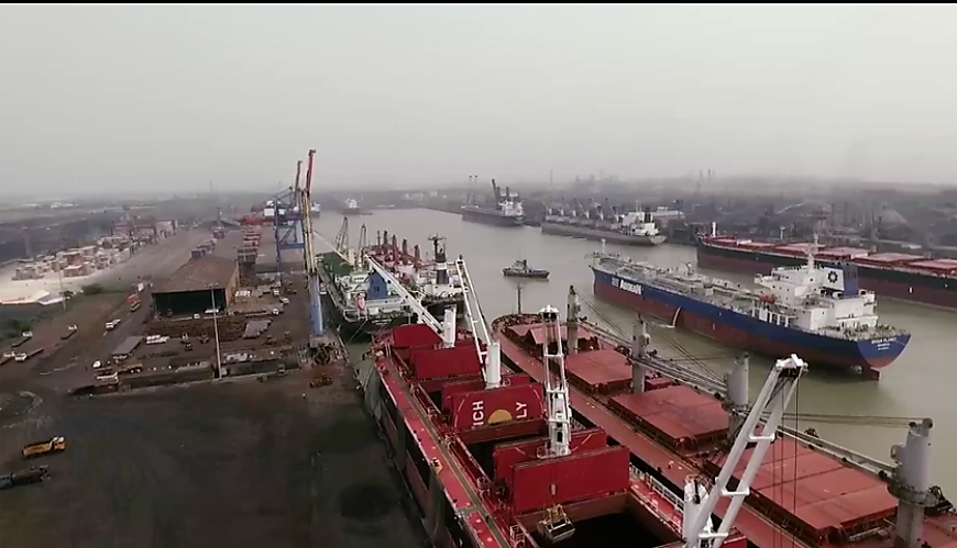
Haldia is an industrial port city in Purba Medinipur in the Indian state of West Bengal. It is a major river port and industrial belt located approximately southwest of Kolkata near the mouth of the Hooghly River, one of the distributaries of the Ganges. The Haldia Township is bordered by the Haldi River, an offshoot of the Ganges River. Haldia is a centre for many petrochemical businesses, and is being developed as a major trade port for Kolkata. Geography Location Haldia is located at . It has an average elevation of . Demographics census, Haldia had a population of 200,762, out of which 104,852 were males and 95,910 were females. The 0–6 years population was 21,122. Effective literacy rate for the 7+ population was 89.06 per cent. India census, Haldia had a population of 170,695. Males constitute 53% of the population and females 47%. In Haldia, 13% of the population is under 6 years of age. Administration The city of Haldia is governed by the Haldia Municipa ... [...More Info...] [...Related Items...] OR: [Wikipedia] [Google] [Baidu] |
List Of Rivers Of India
This is a list of rivers of India, starting in the west and moving along the Indian coast southward, then northward. Tributary rivers are listed hierarchically in upstream order: the lower in the list, the more upstream. The overall discharge of rivers in India or passing/originating in India : List of rivers of India by discharge The major rivers of India are: * Flowing into the Arabian Sea: Narmada, Tapi, Sindhu, Sabarmati, Mahi, Purna * Flowing into the Bay of Bengal: Brahmaputra, Yamuna, Ganga, Meghna, Mahanadi, Godavari, Krishna, Kaveri, Penna River Mizoram and Bangladesh. Meghna River Basin The Meghna-Surma-Barak River System is located in India and Bangladesh. * Meghna River (in the Bangladesh) ** ** Dhaleshwari River ** Dakatia River ** Gumti River ** Feni River ** Tista River, also called the Haora River ** Surma River *** Kangsha River **** Someshwari River ** Kushiyara River *** Manu River ** Barak River *** Tuivai River *** Irang River Ganges River Ba ... [...More Info...] [...Related Items...] OR: [Wikipedia] [Google] [Baidu] |
List Of Major Rivers Of India
The rivers in India play an important role in the lives of its people. They provide potable water, cheap transportation, electricity, and the livelihood for many people nationwide. This easily explains why nearly all the major cities of India are located by the banks of rivers. The rivers also have an important role in Hindu Religion and are considered holy by many Hindus in the country. Seven major rivers along with their numerous tributaries make up the river system of India. The largest basin system pours its waters into the Bay of Bengal; however, some of the rivers whose courses take them through the western part of the country and towards the east of the state of Himachal Pradesh empty into the Arabian Sea. Parts of Ladakh, northern parts of the Aravalli range and the arid parts of the Thar Desert have inland drainage. All major rivers of India originate from one of the following main watersheds: #Aravalli range #Himalaya and Karakoram ranges # Sahyadri or Western Ghats in ... [...More Info...] [...Related Items...] OR: [Wikipedia] [Google] [Baidu] |


