|
Hailwood's Height
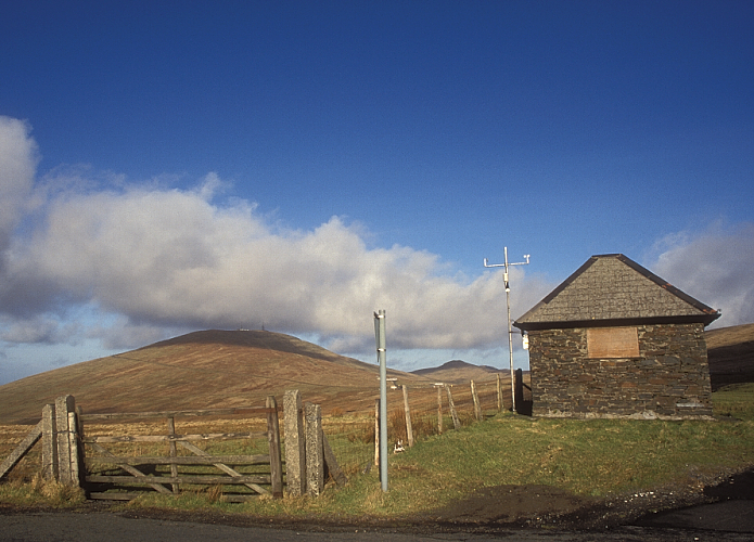
Hailwood's Height, preceded by ''Hailwood's Rise'', is situated between the 31st and 32nd Milestone road-side markers on the Snaefell Mountain Course used for the Isle of Man TT Races on the A18 Snaefell Mountain Road in the parishes of Lezayre and Lonan in the Isle of Man. The uphill section of the Mountain Course from the Bungalow to the highest point of the course at Ordnance Survey spot height above sea level near Brandywell was named ''Hailwood's Rise'' in memory of Mike Hailwood, the former world motorcycle champion who died in 1981. The highest point of the course adjacent to the Brandywell/B10 road junction is named Hailwood's Height.''Isle of Man TT Festival Fortnight 1-12 June 1981 - Official Souvenir Programme'' page 17 Isle of Man Tourist Board The Auto-Cycle Union (1981) J.M. Noble Ltd, Isle of Man Hailwood's Height and Hailwood's Rise were part of the Highland Course and the Four Inch Course used for the Gordon Bennett Trial and Tourist Trophy automobile car ... [...More Info...] [...Related Items...] OR: [Wikipedia] [Google] [Baidu] |
A18 At Hailwoods Height (geograph 5722711) , an all-weather carrier-based strike fighter designed to fill the roles of fighter aircraft and attack aircraft
{{Letter-NumberCombDisambig ...
A18 or A-18 is a three-character acronym that may refer to: * A18 road (other), in several countries * A-18 Shrike, a Curtiss Model 76A twin radial engine monoplane service test aircraft of the mid-1930s * Aero A.18, a Czech fighter aircraft built in the 1920s * Arrows A18, a Formula One car * British NVC community A18 (Ranunculus fluitans community), a plant community * ''Cunninghamella'' A18, a fungus strain * A18, one of the Encyclopaedia of Chess Openings codes for the English Opening in chess * Subfamily A18, a rhodopsin-like receptors subfamily * F/A-18 Hornet The McDonnell Douglas F/A-18 Hornet is an all-weather, twinjet, twin-engine, supersonic aircraft, supersonic, carrier-based aircraft, carrier-capable, Multirole combat aircraft, multirole combat aircraft, designed as both a Fighter aircraft, ... [...More Info...] [...Related Items...] OR: [Wikipedia] [Google] [Baidu] |
Snaefell Mountain Course
The Isle of Man TT Mountain Course or ''TT Course'' is a street and public rural road circuit located in the Isle of Man, used for motorcycle racing. The motorcycle ''TT Course'' is used principally for the Isle of Man TT Races and also the separate event of the Isle of Man Festival of Motorcycling for the Manx Grand Prix and Classic TT Races held in September of each year. The start-line for the Isle of Man TT Mountain Course is located on Glencrutchery Road in the town of Douglas, Isle of Man.Daily Express page 38 Friday 7 September 1979 The clockwise course has a lap of , from the start line at the TT Grandstand on Glencrutchery Road ( A2 Ramsey to Douglas) in the island's main town of Douglas. After negotiating urban streets, the racing circuit turns right to leave Douglas at Quarter Bridge, then proceeds along the A1 Douglas to Peel road through the villages of Braddan, Union Mills, Glen Vine, Crosby, and Greeba. The course then turns right at Ballacraine on to the ... [...More Info...] [...Related Items...] OR: [Wikipedia] [Google] [Baidu] |
Isle Of Man TT
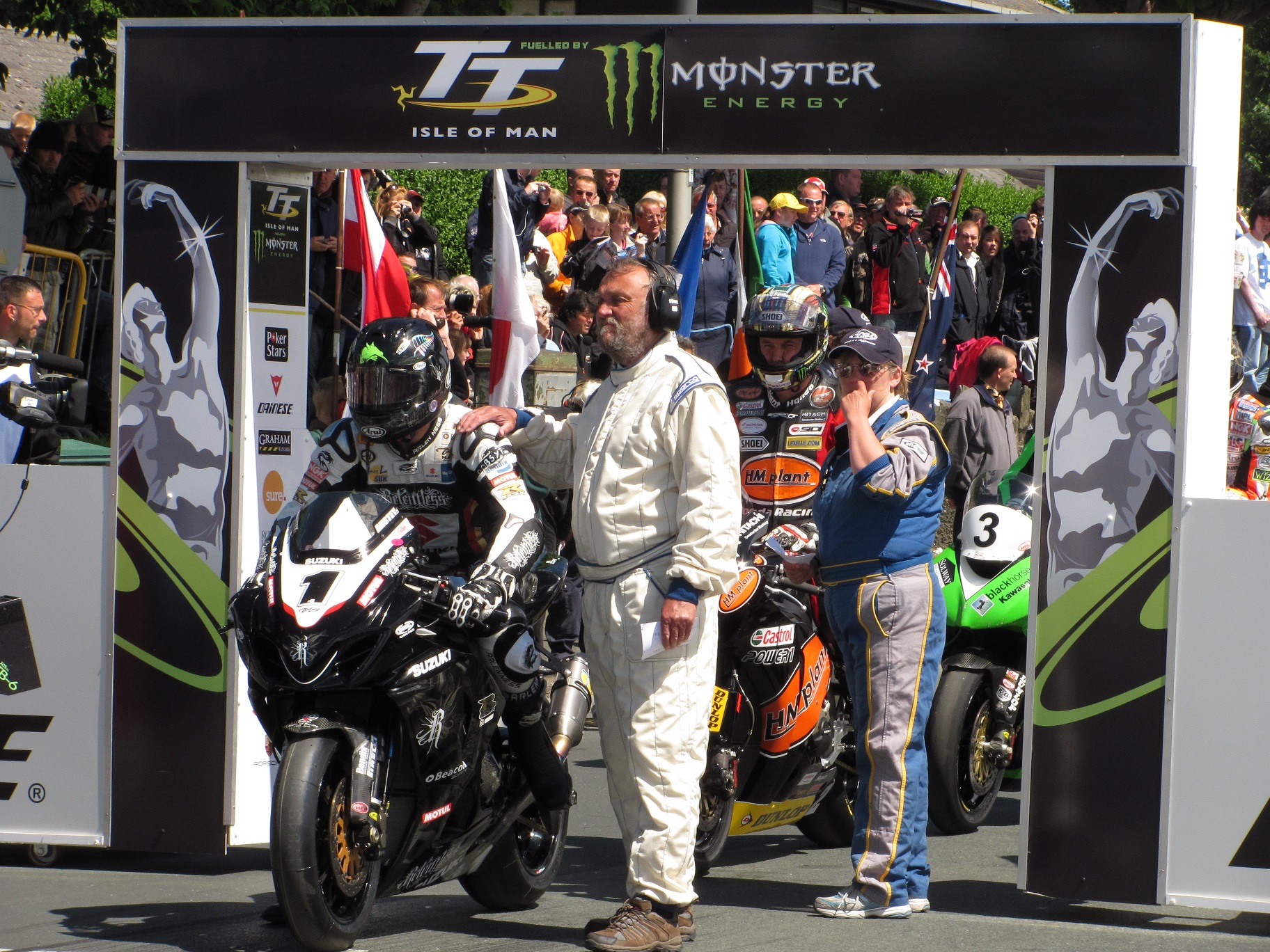
The Isle of Man TT or Tourist Trophy races are an annual motorcycle racing event run on the Isle of Man in May/June of most years since its inaugural race in 1907. The event is often called one of the most dangerous racing events in the world as many competitors have died. Overview The Isle of Man TT is run in a time-trial format on public roads closed to the public by an Act of Tynwald (the parliament of the Isle of Man). The event consists of one week of practice sessions followed by one week of racing. It has been a tradition, perhaps started by racing competitors in the early 1920s, for spectators to tour the Snaefell Mountain Course on motorcycles during the Isle of Man TT on Mad Sunday, an informal and unofficial sanctioned event held on the Sunday between Practice Week and Race Week. The first Isle of Man TT race was held on Tuesday 28 May 1907 and was called the International Auto-Cycle Tourist Trophy. The event was organised by the Auto-Cycle Club over 10 laps o ... [...More Info...] [...Related Items...] OR: [Wikipedia] [Google] [Baidu] |
A18 Road (Isle Of Man)
The A18 Snaefell Mountain Road or ''Mountain Road'' ( gv, Giat y Clieau) is a primary main A-road of in length which connects the towns of Douglas and Ramsey in the Isle of Man. Description The Mountain Road is part of Isle of Man TT Mountain Course or TT Course, a road-racing circuit used for the Isle of Man TT and Manx Grand Prix races, which have been held in the Isle of Man from 1911 and 1923 respectively. In the races, it is one-way from Ramsey towards Douglas. The racing is held on public roads closed for racing by an Act of Tynwald (the parliament of the Isle of Man). It is the oldest motor-cycle racing circuit still in use. The highest point of the course is on the A18 Snaefell Mountain Road between the Bungalow and Hailwood's Height at Ordnance Survey spot height above sea level, with gradients reaching 14%. The A18 Snaefell Mountain Road was described in the publication ''Classic Motor-Sport Routes'' as: Route The A18 Snaefell Mountain Road runs from the A2 G ... [...More Info...] [...Related Items...] OR: [Wikipedia] [Google] [Baidu] |
Lezayre
Lezayre ( ; gv, Creest ny h-Ayrey), formally Kirk Christ Lezayre, is one of the seventeen historic parishes of the Isle of Man. It is located in the north of the island (part of the traditional ''North Side'' division) in the sheading of Ayre. Administratively, part of the historic parish of Lezayre is now part of the town of Ramsey. Other settlements in the parish include Glen Auldyn and Sulby. Local government For the purposes of local government, most of the historic parish forms a single parish district with Commissioners. Since 1865, an area in the east of the historic parish of Lezayre has been part of the separately administered town of Ramsey, with its own town commissioners. The Captain of the Parish (since 2005) is Denis Duggan. Politics Lezayre parish is part of the Ayre & Michael constituency, which elects two Members to the House of Keys. Before 2016 it was in the Ayre constituency, and since 1867 Ramsey has formed its own constituency. Geography The parish ... [...More Info...] [...Related Items...] OR: [Wikipedia] [Google] [Baidu] |
Lonan (parish)
Lonan ( ; gv, Lonan) is one of the 17 parishes of the Isle of Man. It is located on the east of the island (part of the traditional ''South Side'' division) in the sheading of Garff. Other settlements in the parish include Baldrine and Ballabeg. Local government For the purposes of local government, since May 2016 the historic parish of Lonan has been part of a single Garff local authority, formed by merging the former village district of Laxey with the parish districts of Lonan and Maughold. Until this amalgamation, the village district of Laxey had been separated from its surrounding parish of Lonan since 1895. Laxey, Lonan and Maughold are still separate wards of the combined district of Garff. The Captain of the Parish (as of 2019) is Stephen Patrick Carter. Politics Lonan parish is part of the Garff constituency, which elects two Members to the House of Keys. Geography The parish extends from near Port Groudle in the south to the Snaefell mines and Brandywell Corner ... [...More Info...] [...Related Items...] OR: [Wikipedia] [Google] [Baidu] |
Isle Of Man
) , anthem = "O Land of Our Birth" , image = Isle of Man by Sentinel-2.jpg , image_map = Europe-Isle_of_Man.svg , mapsize = , map_alt = Location of the Isle of Man in Europe , map_caption = Location of the Isle of Man (green) in Europe (dark grey) , subdivision_type = Sovereign state , subdivision_name = United Kingdom , established_title = Norse control , established_date = 9th century , established_title2 = Scottish control , established_date2 = 2 July 1266 , established_title3 = English control , established_date3 = 1399 , established_title4 = Revested into British Crown , established_date4 = 10 May 1765 , official_languages = , capital = Douglas , coordinates = , demonym = Manx; Manxman (plural, Manxmen); Manxwoman (plural, Manxwomen) , ethnic_groups = , ethnic_groups_year = 2021 , ethnic_groups_ref = Official census statistics provided by Statistics Isle of Man, Isle of Man Government: * * , religion = , religion_year = 2021 , relig ... [...More Info...] [...Related Items...] OR: [Wikipedia] [Google] [Baidu] |
Bungalow, Isle Of Man
The Bungalow, Isle of Man, one of a handful of better-known vantage points spread around the Snaefell Mountain Course, is situated adjacent to the 31st Milestone roadside marker on the road junction of the primary A18 Mountain Road, the A14 Sulby Glen Road and the road-tramway crossing for the Snaefell Mountain Railway in the parish of Lezayre in the Isle of Man. The Bungalow tramway-crossing was part of the Highland Course and Four Inch Course used for the Gordon Bennett Trial and Tourist Trophy automobile car races held in the Isle of Man between 1904 and 1922. The Bungalow is part of the Snaefell Mountain Course used since 1911 for the Isle of Man TT and from 1923 for the Manx Grand Prix Races. The area is dominated by Snaefell Mountain with an elevation of 621m (2036 feet) above sea level and the nearby summits of Beinn-y-Phott (544m), Mullagh Ouyr (491m), Carraghan (500m), Clagh Ouyr (551m) and North Barrule (565m). The tramway lines of the Snaefell Mountain Railway cro ... [...More Info...] [...Related Items...] OR: [Wikipedia] [Google] [Baidu] |
Spot Height
A spot height is an exact point on a map with an elevation recorded beside it that represents its height above a given datum.Whittow, John (1984). ''Dictionary of Physical Geography''. London: Penguin, 1984, p. 506. . In the UK this is the Ordnance Datum. Unlike a bench-mark, which is marked by a disc or plate, there is no official indication of a spot height on the ground although, in open country, spot heights may sometimes be marked by cairns. In geoscience, it can be used for showing elevations on a map, alongside contours, bench marks, etc. See also * Surveying * Benchmark (surveying) * Triangulation station A triangulation station, also known as a trigonometrical point, and sometimes informally as a trig, is a fixed surveying station, used in geodetic surveying and other surveying projects in its vicinity. The nomenclature varies regionally: they a ... References Cartography Geodesy Surveying Vertical position {{geodesy-stub ... [...More Info...] [...Related Items...] OR: [Wikipedia] [Google] [Baidu] |
Brandywell, Isle Of Man
Brandywell, Isle of Man ( gv, Chibbyr-y-Phunch) or ( gv, Chibbyr Slieau Maggle) is an area of Mountain Lands of heath moorland and coniferous woodland plantations situated in the Northern Upland Massif in the parish of Kirk Michael in the Isle of Man. The area was previously used by local shepherds due to a local stream and a nearby former venerated water well which was known for its distinctive quality and "''brandy''" colour of the water. Location and Description The area of Brandywell is open moorland situated in the Northern Uplands of the Isle of Man including the commons grazing land of Slieau-ny-Maggle ''Intack'' ( archaic ''North Park'') and Injerbreck Hill close to the private residence of ‘''Brandywell Cottage''’ a former Mountain Shepherd's Cottage. The area of Brandywell includes the secondary B10 Beinn-y-Phott Road, the B25 West Baldwin Road, B10 Brandywell / Sartfell Road with the junction with the B26 Ballaugh Glen (Druidale) Road at ‘Brandywell Co ... [...More Info...] [...Related Items...] OR: [Wikipedia] [Google] [Baidu] |
Mike Hailwood
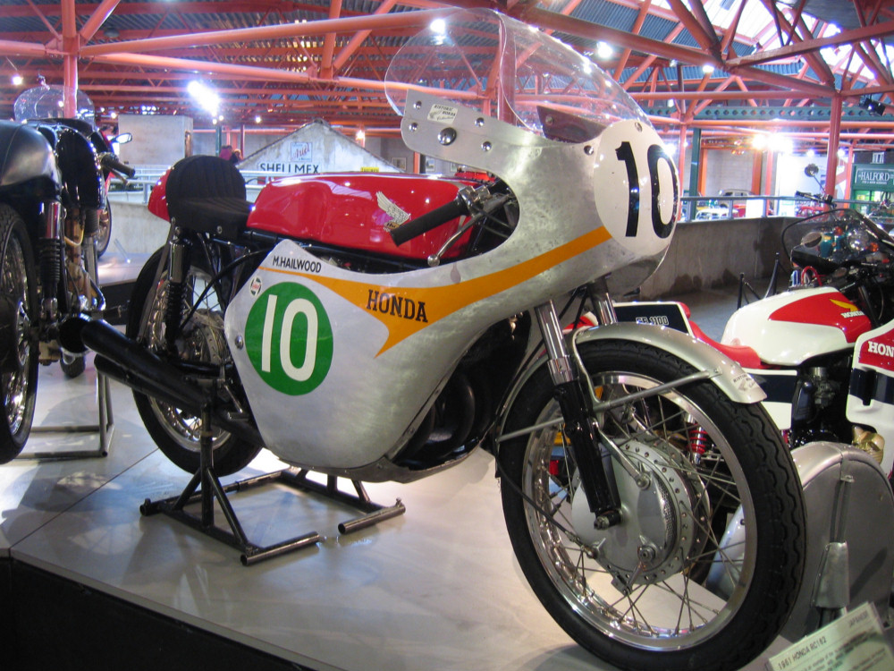
Stanley Michael Bailey Hailwood, (2 April 1940 – 23 March 1981) was a British professional motorcycle racer and racing driver. He is regarded by many as one of the greatest racers of all time. He competed in the Grand Prix motorcycle world championships from 1958 to 1967 and in Formula One between 1963 and 1974. Hailwood was known as "Mike The Bike" because of his natural riding ability on motorcycles with a range of engine capacities. Motor Cycle, 19 August 1965. p. 242/244. Hutchinson 100. ''Hailwood assortment. "Doesn't make much odds what model Mike the Bike wheels out; he's likely to win on it. As at Silverstone last Saturday at BMCRC Hutchinson 100 meeting where, on such a variety of machinery as an AJS three-fifty, a BSA LIghtning, and (well, of course) the MV Agusta four, he collected a trio of laurel wreaths."'' Accessed 30 March 2014Carrick, Peter ''Motor Cycle Racing'' Hamlyn Publishing, 1969, p. 68 "''Between 1962 and 1965 Hailwood was supreme in the 500& ... [...More Info...] [...Related Items...] OR: [Wikipedia] [Google] [Baidu] |
Highland Course
Highroads Course was a road-racing circuit used for the Gordon Bennett British Eliminating Trial held in the Isle of Man for the 1904 and 1905 Tourist Trophy Race involving touring automobiles and cars. The events were held on public roads closed for racing by an Act of Tynwald (the parliament of the Isle of Man). Highroads Course The street circuit course measured 52.15 miles long from the start-line at the Quarterbridge area in the town of Douglas. The circuit was based on a number of public roads including: * The primary A5 New Castletown to Douglas road and the A3 Castletown to Ramsey road to Ballaugh Bridge. * The primary A10 Jurby Coast Road from Ballaugh Bridge to the Ballaugh Cronk and the A13 Jurby Road from the Ballaugh Cronk to Ramsey included the A9 Bowring Road in Ramsey, this section being known as the ''Sandygate Loop''. * The A2 Albert Road in Ramsey centre, including a section of private road and the primary A18 Mountain Road to the road junction with the A21 ... [...More Info...] [...Related Items...] OR: [Wikipedia] [Google] [Baidu] |
.jpg)


